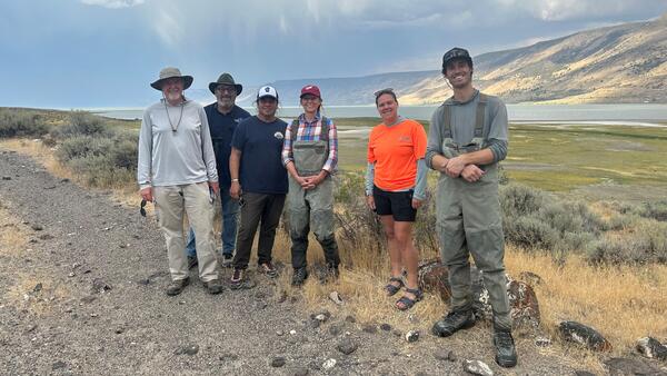
Christine Rumsey
Christine is a valuable member of the Utah Water Science staff.
Science and Products
Quantifying Nutrient Mass and Internal Cycling in Great Salt Lake
The Great Salt Lake (GSL) is an indispensable economic and ecological resource. It provides critical habitat and food for millions of migratory birds, and generates nearly $200 million per year from recreational activities and the brine shrimp harvest industry (Bioeconomics, 2012). These uses, habitat and aquaculture, rely on a balanced supply of nutrients in the Great Salt Lake to support...
General Information, Facts, News, Publications and Partners
The western part of the conterminous United States is often thought of as being a desert without any large bodies of water. In the desert area of western Utah, however, lies Great Salt Lake, which in 1986, at its highest level, covered approximately 2,300 square miles and contained 30 million acre-feet of water (an acre-foot is the amount of water necessary to cover 1 acre of land with water 1...
Salinity
Studies of Sources and Transport of Dissolved Solids (Salt) in the Colorado River Basin using the Spatially Referenced Regressions on Watershed Attributes (SPARROW) Model The Upper Colorado River Basin (UCRB) encompasses about 112,000 mi2 and discharges more than 6 million tons of dissolved solids (salt) annually to the lower Colorado River Basin. It has been estimated that between 32 and 45...
Baseflow
The Colorado River has been identified as the most overallocated river in the world. Considering predicted future imbalances between water supply and demand and the growing recognition that base flow (a proxy for groundwater discharge to streams) is critical for sustaining flow in streams and rivers, there is a need to develop methods to better quantify present-day base flow across large regions...
Great Salt Lake - Fifty years of change through satellite images
The completion of the Railroad Causeway in 1959 divided the Great Salt Lake in half. Because all of the freshwater inflows enter the southern part of the lake, the north arm became much more saline than the south; well defined in the satellite images. Several years of greater than normal precipitation resulted in a large increase in the lake’s area during the early 1980's and the creation of a new...
Vertical water-quality profiles collected at Great Salt Lake monitoring sites, Utah, 1995–2022
This U.S. Geological Survey (USGS) Data Release provides vertical water-quality profiles collected at Great Salt Lake, Utah monitoring sites during 1995–2000 and 2011–2022. Data were collected using an In-Situ Multi-Parameter TROLL 9500, In-Situ AquaTROLL 500, In-Situ AquaTROLL 600, or YSI EXO2 Multiparameter Sonde. Recorded parameters include water temperature, specific conductance, dissolved oxy
Data supporting a spatiotemporal trend analysis of specific conductivity, streamflow, and landscape attributes of selected sub-basins within the Delaware River watershed, 1980 to 2018
This data release makes available three data tables supporting a spatiotemporal analysis of riverine conductivity and streamflow trends within the Delaware River Basin. The listed datasets include baseflow and total flow time series for selected gaged basins, watershed attributes, water quality information and trend analysis results.
SPARROW model input datasets and predictions of total dissolved loads in streams of the Upper Colorado River Basin watershed
This data release contains bootstrap values of mean-annual total dissolved solids (TDS) loads predicted by a SPARROW model for individual stream reaches in the Upper Colorado River Basin watershed in the predict.txt file. Also included are the input variables required to execute the model, including dissolved solids sources, landscape characteristics, and calibration data from water quality monito
SPARROW model inputs and simulated future baseflow for streams of the Upper Colorado River Basin
The U.S. Geological Survey's (USGS) SPAtially Referenced Regression On Watershed attributes (SPARROW) model was used to estimate baseflow changes from historical (1984 - 2012) to thirty-year periods centered around 2030, 2050, and 2080 under warm/wet, median, and hot/dry climatic conditions. SPARROW is a spatially explicit hybrid statistical and process-based model that estimates mean baseflow ove
Baseflow estimation and hydroclimatic data input details for the Upper Rio Grande, 1980 to 2015
Understanding how changing climatic conditions affect streamflow volume and timing is critical for effective water management. In the Rio Grande Basin of the southwest U.S., decreasing snowpack, increasing minimum temperatures, and decreasing streamflow have been observed in recent decades, but the effects of hydroclimatic changes on baseflow, or groundwater discharge to streams, have not been inv
Filter Total Items: 13
Low flows from drought and water use reduced total dissolved solids fluxes in the Lower Colorado River Basin between 1976 to 2008
Study area:We evaluated the Virgin, Verde, Salt, and Gila Rivers in the Lower Colorado River Basin. The watersheds have extents in Arizona, Utah, New Mexico, US and Sonora, MX.Study focus:We calculated trends in total dissolved solids (TDS) concentrations and fluxes with the Weighted Regressions on Time, Discharge and Season model. The modeling framework leverages daily streamflow and discrete wat
Authors
Annie L. Putman, Hannah Erin Mcilwain, Christine Rumsey, Thomas M. Marston
Integrated science strategy for assessing and monitoring water availability and migratory birds for terminal lakes across the Great Basin, United States
Executive SummaryIn 2022, the U.S. Geological Survey (USGS) established the Saline Lake Ecosystems Integrated Water Availability Assessment (IWAAs) to monitor and assess the hydrology of terminal lakes in the Great Basin and the migratory birds and other wildlife dependent on those habitats. Scientists from across the USGS (with specialties in water quantity, water quality, limnology, avian biolog
Authors
Rebecca J. Frus, Cameron L. Aldridge, Michael L. Casazza, Collin A. Eagles-Smith, Garth Herring, Scott A. Hynek, Daniel K. Jones, Susan K Kemp, Thomas M. Marston, Christopher M. Morris, Ramon C. Naranjo, Cee Nell, David R. O'Leary, Cory T. Overton, Bryce A. Pulver, Brian E. Reichert, Christine A. Rumsey, Rudy Schuster, Cassandra D. Smith
A review of current capabilities and science gaps in water supply data, modeling, and trends for water availability assessments in the Upper Colorado River Basin
The Colorado River is a critical water resource in the southwestern United States, supplying drinking water for 40 million people in the region and water for irrigation of 2.2 million hectares of land. Extended drought in the Upper Colorado River Basin (UCOL) and the prospect of a warmer climate in the future pose water availability challenges for those charged with managing the river. Limited wat
Authors
Fred D. Tillman, Natalie K. Day, Matthew P. Miller, Olivia L. Miller, Christine Rumsey, Daniel Wise, Patrick C. Longley, Morgan C. McDonnell
Spatial patterns and seasonal timing of increasing riverine specific conductance from 1998 to 2018 suggest legacy contamination in the Delaware River Basin
Increasing salinization of freshwater threatens water supplies that support a range of human and ecological uses. The latest assessments of Delaware River Basin (DRB) surface-water-quality changes indicate widespread salinization has occurred in recent decades, which may lead to meaningful degradation in water quality. To better understand how and when salinity transport occurs and implications fo
Authors
Christine Rumsey, John C. Hammond, Jennifer C. Murphy, Megan E. Shoda, Alex M. Soroka
Upper Rio Grande Basin water-resource status and trends: Focus area study review and synthesis
The Upper Rio Grande Basin (URGB) is a critical international water resource under pressure from a myriad of climatic, ecological, infrastructural, water-use, and legal constraints. The objective of this study is to provide a comprehensive assessment of the spatial distribution and temporal trends of selected water-budget components (snow processes, evapotranspiration (ET), streamflow processes, a
Authors
Kyle R. Douglas-Mankin, Christine Rumsey, Graham A. Sexstone, Tamara I. Ivahnenko, Natalie Houston, Shaleene Chavarria, Gabriel B. Senay, Linzy K. Foster, Jonathan V. Thomas, Allison K. Flickinger, Amy E. Galanter, C. David Moeser, Toby L. Welborn, Diana E. Pedraza, Patrick M. Lambert, Michael Scott Johnson
How will baseflow respond to climate change in the Upper Colorado River Basin?
Baseflow is critical to sustaining streamflow in the Upper Colorado River Basin. Therefore, effective water resources management requires estimates of baseflow response to climatic changes. This study provides the first estimates of projected baseflow changes from historical (1984 – 2012) to thirty-year periods centered around 2030, 2050, and 2080 under warm/wet, median, and hot/dry climatic condi
Authors
Olivia L. Miller, Matthew P. Miller, Patrick C. Longley, Jay R. Alder, Lindsay A. Bearup, Tom Pruitt, Daniel Jones, Annie L. Putman, Christine Rumsey, Tim S. McKinney
Substantial declines in salinity observed across the Upper Colorado River Basin during the 20th century, 1929 to 2019
Salinity in the Colorado River Basin causes an estimated $300 to $400 million per year in economic damages in the U.S. To inform and improve salinity‐control efforts, this study quantifies long‐term trends in salinity (dissolved solids) across the Upper Colorado River Basin (UCRB), including time periods prior to the construction of large dams and preceding the implementation of salinity‐control p
Authors
Christine Rumsey, Olivia L. Miller, Robert Hirsch, Thomas M. Marston, David Susong
Relating hydroclimatic change to streamflow, baseflow, and hydrologic partitioning in the Upper Rio Grande Basin, 1980 to 2015
Understanding how changing climatic conditions affect streamflow volume and timing is critical for effective water management. In the Rio Grande Basin of the southwest U.S., decreasing snowpack, increasing minimum temperatures, and decreasing streamflow have been observed in recent decades, but the effects of hydroclimatic changes on baseflow, or groundwater discharge to streams, have not been inv
Authors
Christine Rumsey, Matthew P. Miller, Graham A. Sexstone
The role of baseflow in dissolved solids delivery to streams in the Upper Colorado River Basin
Salinity has a major effect on water users in the Colorado River Basin, estimated to cause almost $300 million per year in economic damages. The Colorado River Basin Salinity Control Program implements and manages projects to reduce salinity loads, investing millions of dollars per year in irrigation upgrades, canal projects, and other mitigation strategies. To inform and improve mitigation effort
Authors
Christine Rumsey, Matthew P. Miller, Gregory E. Schwarz, Robert M. Hirsch, David D. Susong
Enhanced and updated spatially referenced statistical assessment of dissolved-solids load sources and transport in streams of the Upper Colorado River Basin
Approximately 6.4 million tons of dissolved solids are discharged from the Upper Colorado River Basin (UCRB) to the Lower Colorado River Basin each year. This results in substantial economic damages, and tens of millions of dollars are spent annually on salinity control projects designed to reduce salinity loads in surface waters of the UCRB. Dissolved solids in surface water and groundwater have
Authors
Matthew P. Miller, Susan G. Buto, Patrick M. Lambert, Christine A. Rumsey
Analyses of infrequent (quasi-decadal) large groundwater recharge events in the northern Great Basin: Their importance for groundwater availability, use, and management
There has been a considerable amount of research linking climatic variability to hydrologic responses in the western United States. Although much effort has been spent to assess and predict changes in surface water resources, little has been done to understand how climatic events and changes affect groundwater resources. This study focuses on characterizing and quantifying the effects of large, mu
Authors
Melissa D. Masbruch, Christine Rumsey, Subhrendu Gangopadhyay, David D. Susong, Tom Pruitt
The importance of base flow in sustaining surface water flow in the Upper Colorado River Basin
The Colorado River has been identified as the most overallocated river in the world. Considering predicted future imbalances between water supply and demand and the growing recognition that base flow (a proxy for groundwater discharge to streams) is critical for sustaining flow in streams and rivers, there is a need to develop methods to better quantify present-day base flow across large regions.
Authors
Matthew P. Miller, Susan G. Buto, David D. Susong, Christine Rumsey