Current research focuses on landslide hazards in Alaska, specifically on tsunamigenic landslides in Prince William Sound. Past research includes post-wildfire debris flow hazards in the western United States, the geomorphology of alluvial and debris-flow fans and talus deposits in arid and alpine environments, and the assessment of aquatic, riparian and wetland ecosystem health and function.
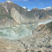
I am a Research Physical Scientist in the Alaska Volcano Observatory in Anchorage, Alaska, where I currently lead a project related to landslide hazards in Prince William Sound. This project is currently aimed at improving our understanding of the tsunamigenic potential and corresponding risk associated with large rock slope failures in recently deglaciated fiords.
Prior to moving to Alaska in the fall of 2021, I worked at the Geologic Hazards Science Center in Golden, Colorado, where I studied post-fire debris flows. This research focused on advancing our understanding of the topographic, geologic, hydrologic, and meteorological conditions that influence the location, timing, and magnitude of post-fire debris flows for the purpose of improving hazard assessment and early warning.
Before starting my career at the U.S. Geological Survey, I was a Physical Scientist at the U.S. Forest Service in Golden, Colorado, where I focused on developing protocols for assessing the health and function of aquatic, riparian, and wetland ecosystems of the Rocky Mountains.
Professional Experience
2007 - Present: Research Physical Scientist, U.S. Geological Survey, Golden CO and Anchorage AK
2001 - 2007: Physical Scientist, U.S. Forest Service, Golden CO
Education and Certifications
Ph.D. in Earth Sciences, University of Memphis, Memphis TN, 2006.
MSc. in Geography, University of Memphis, Memphis TN, 2000.
BA in Geography, State University of New York - College at Geneseo, Geneseo NY, 1998.
Affiliations and Memberships*
Fellow, Geological Society of America (2020)
E.B. Burwell Jr. Award, Geological Society of America Environmental and Engineering Geology Division (2019)
Honor Award for Superior Service, U.S. Department of Interior (2016)
Meritorious Service Award, Environmental and Engineering Geology Division of the Geological Society of America (2015)
Best Paper Award in Landslides, International Landslide Consortium (2013)
Science and Products
Advancing Post-Fire Debris Flow Hazard Science with a Field Deployable Mapping Tool
Barry Arm, Alaska Landslide and Tsunami Monitoring
How Often Do Rainstorms Cause Debris Flows in Burned Areas of the Southwestern U.S.?
Debris-Flow Forecasts Before Wildfires
Emergency Assessment of Post-Fire Debris-Flow Hazards
Rainfall and Landslides in Southern California
Exploiting high-resolution topography for advancing the understanding of mass and energy transfer across landscapes: Opportunities, challenges, and needs
Inventory of Large Slope Instabilities, Prince William Sound, Alaska
Hydrologic monitoring data in steep, landslide-prone terrain, Sitka, Alaska, USA
Simulated inundation extent and depth in Harriman Fjord and Barry Arm, western Prince William Sound, Alaska, resulting from the hypothetical rapid motion of landslides into Barry Arm Fjord, Prince William Sound, Alaska
Simulated inundation extent and depth at Whittier, Alaska resulting from the hypothetical rapid motion of landslides into Barry Arm Fjord, Prince William Sound, Alaska
Select model results from simulations of hypothetical rapid failures of landslides into Barry Arm, Prince William Sound, Alaska
Gridded estimates of postfire debris flow frequency and magnitude for southern California
Data supporting an analysis of the recurrence interval of post-fire debris-flow generating rainfall in the southwestern United States
Kinematic evolution of a large paraglacial landslide in the Barry Arm fjord of Alaska
Simulating debris flow and levee formation in the 2D shallow flow model D-Claw: Channelized and unconfined flow
New model of the Barry Arm landslide in Alaska reveals potential tsunami wave heights of 2 meters, values much lower than previously estimated
Multi-model comparison of computed debris flow runout for the 9 January 2018 Montecito, California post-wildfire event
Preliminary assessment of the wave generating potential from landslides at Barry Arm, Prince William Sound, Alaska
Movement of sediment through a burned landscape: Sediment volume observations and model comparisons in the San Gabriel Mountains, California, USA
Postwildfire soil‐hydraulic recovery and the persistence of debris flow hazards
Forecasting the frequency and magnitude of postfire debris flows across southern California
Time since burning and rainfall characteristics impact post-fire debris flow initiation and magnitude
The recurrence interval of post-fire debris-flow generating rainfall in the southwestern United States
Landslides after wildfire: Initiation, magnitude, and mobility
Predicting the floods that follow the flames
Science and Products
- Science
Advancing Post-Fire Debris Flow Hazard Science with a Field Deployable Mapping Tool
Mapping the occurrence of post-fire flooding and debris flow is crucial for 1) integrating observations into models used to define rainfall thresholds for early warning, 2) understanding patterns of inundation, and 3) improving models for predictive hazard assessment. Despite the critical role mapping plays in post-fire hazard assessment and early warning, there has not been a standardized approaBarry Arm, Alaska Landslide and Tsunami Monitoring
A large steep slope in the Barry Arm fjord 30 miles (50 kilometers) northeast of Whittier, Alaska has the potential to fall into the water and generate a tsunami that could have devastating local effects on those who live, work, and recreate in and around Whittier and in northern Prince William Sound.How Often Do Rainstorms Cause Debris Flows in Burned Areas of the Southwestern U.S.?
Debris flows, sometimes referred to as mudslides, mudflows, lahars, or debris avalanches, are common types of fast-moving landslides. They usually start on steep hillsides as a result of shallow landslides, or from runoff and erosion that liquefy and accelerate to speeds in excess of 35 mi/h. The consistency of debris flows ranges from thin, watery to thick, rocky mud that can carry large items...Debris-Flow Forecasts Before Wildfires
Release Date: OCTOBER 15, 2018 USGS scientists have been pursuing a way to assess debris-flow hazards before a fire occurs.Emergency Assessment of Post-Fire Debris-Flow Hazards
Estimates of the probability and volume of debris flows that may be produced by a storm in a recently burned area, using a model with characteristics related to basin shape, burn severity, soil properties, and rainfall. Wildfire can significantly alter the hydrologic response of a watershed to the extent that even modest rainstorms can produce dangerous flash floods and debris flows. The USGS...Rainfall and Landslides in Southern California
A summary of recent and past landslides and debris flows caused by rainfall in Southern California.Exploiting high-resolution topography for advancing the understanding of mass and energy transfer across landscapes: Opportunities, challenges, and needs
One of the grand challenges of Earth Surface Science and Natural Resource Management lies in the prediction of mass and energy transfer for large watersheds and landscapes. High resolution topography (lidar) datasets show potential to significantly advance our understanding of hydrologic and geomorphic processes controlling mass and energy transfer because they represent features at the appropriat - Data
Inventory of Large Slope Instabilities, Prince William Sound, Alaska
Steep glacial and paraglacial landscapes often exhibit evidence of gravitationally-driven slope deformation. In recently deglaciated coastal environments, catastrophic failures of these bedrock instabilities as rapid landslides have the potential to generate tsunamis that may pose hazards for communities, infrastructure, mariners, and important natural and cultural resources. We present a first inHydrologic monitoring data in steep, landslide-prone terrain, Sitka, Alaska, USA
This data release includes time-series data and qualitative descriptions from a monitoring station on a steep, landslide-prone slope above the City of Sitka, Alaska. On August 18, 2015, heavy rainfall triggered around 60 landslides in and around Sitka. These landslides moved downslope rapidly; several were damaging, and one demolished a home on South Kramer Avenue and killed three people. On SepteSimulated inundation extent and depth in Harriman Fjord and Barry Arm, western Prince William Sound, Alaska, resulting from the hypothetical rapid motion of landslides into Barry Arm Fjord, Prince William Sound, Alaska
Summary This data release contains postprocessed model output from a simulation of hypothetical rapid motion of landslides, subsequent wave generation, and wave propagation. A simulated displacement wave was generated by rapid motion of unstable material into Barry Arm fjord. We consider the wave propagation in Harriman Fjord and Barry Arm, western Prince William Sound (area of interest and placeSimulated inundation extent and depth at Whittier, Alaska resulting from the hypothetical rapid motion of landslides into Barry Arm Fjord, Prince William Sound, Alaska
This data release contains postprocessed model output from simulations of hypothetical rapid motion of landslides, subsequent wave generation, and wave propagation. A modeled tsunami wave was generated by rapid motion of unstable material into Barry Arm Fjord. This wave propagated through Prince William Sound and then into Passage Canal east of Whittier. Here we consider only the largest wave-geneSelect model results from simulations of hypothetical rapid failures of landslides into Barry Arm, Prince William Sound, Alaska
This data release contains model output from simulations presented in the associated Open-File Report (Barnhart and others, 2021). In this report, we present model results from four simulations (scenarios C-290, NC-290, C-689, NC-689, Table 1) of hypothetical rapid movement of landslides into adjacent fjord water at Barry Arm, Alaska using the D-Claw model (George and Iverson, 2014; Iverson and GeGridded estimates of postfire debris flow frequency and magnitude for southern California
This data release contains gridded estimates of postfire debris flow probability and magnitude for six different rainfall and wildfire scenarios in southern California. The scenarios represent the present and possible future precipitation and fire regimes for the region. The results are provided for 1 km2 cells across the study area. The data release accompanies the journal article Kean, J.W. andData supporting an analysis of the recurrence interval of post-fire debris-flow generating rainfall in the southwestern United States
This data release supports the analysis of the recurrence interval of post-fire debris-flow generating rainfall in the southwestern United States. We define the recurrence interval of the peak 15-, 30-, and 60-minute rainfall intensities for 316 observations of post-fire debris-flow occurrence in 18 burn areas, 5 U.S. states, and 7 climate types. These data support the analysis described in Staley - Publications
Filter Total Items: 49
Kinematic evolution of a large paraglacial landslide in the Barry Arm fjord of Alaska
Our warming climate is adversely affecting cryospheric landscapes via glacial retreat, permafrost degradation, and associated slope destabilization. In Prince William Sound, Alaska, the rapid retreat of Barry Glacier has destabilized the slopes flanking the glacier, resulting in numerous landslides. The largest of these landslides (∼500 Mm3 in volume) is more than 2 km wide and has the potential tAuthorsLauren N. Schaefer, Jeffrey A. Coe, Katreen Wikstrom Jones, Brian D. Collins, Dennis M. Staley, Michael E. West, Ezgi Karasozen, Charles Prentice-James Miles, Gabriel J. Wolken, Ronald P. Daanan, Kelli Wadsworth BaxstromSimulating debris flow and levee formation in the 2D shallow flow model D-Claw: Channelized and unconfined flow
Debris flow runout poses a hazard to life and infrastructure. The expansion of human population into mountainous areas and onto alluvial fans increases the need to predict and mitigate debris flow runout hazards. Debris flows on unconfined alluvial fans can exhibit spontaneous self-channelization through levee formation that reduces lateral spreading and extends runout distances compared to unchanAuthorsRyan P. Jones, Francis K. Rengers, Katherine R. Barnhart, David L. George, Dennis M. Staley, Jason W. KeanNew model of the Barry Arm landslide in Alaska reveals potential tsunami wave heights of 2 meters, values much lower than previously estimated
The retreat of Barry Glacier has contributed to the destabilization of slopes in Barry Arm, creating the possibility that a landslide could rapidly enter the fjord and trigger a tsunami.The U.S. Geological Survey (USGS) recently released a report documenting potential tsunami wave heights in the event of a large, fast-moving landslide at the Barry Arm fiord near Prince William Sound, Alaska (BarnhAuthorsMarísa A. Macías, Katherine R. Barnhart, Dennis M. StaleyMulti-model comparison of computed debris flow runout for the 9 January 2018 Montecito, California post-wildfire event
Hazard assessment for post-wildfire debris flows, which are common in the steep terrain of the western United States, has focused on the susceptibility of upstream basins to generate debris flows. However, reducing public exposure to this hazard also requires an assessment of hazards in downstream areas that might be inundated during debris flow runout. Debris flow runout models are widely availabAuthorsKatherine R. Barnhart, Ryan P. Jones, David L. George, Brian W. McArdell, Francis K. Rengers, Dennis M. Staley, Jason W. KeanPreliminary assessment of the wave generating potential from landslides at Barry Arm, Prince William Sound, Alaska
We simulated the concurrent rapid motion of landslides on an unstable slope at Barry Arm, Alaska. Movement of landslides into the adjacent fjord displaced fjord water and generated a tsunami, which propagated out of Barry Arm. Rather than assuming an initial sea surface height, velocity, and location for the tsunami, we generated the tsunami directly using a model capable of simulating the dynamicAuthorsKatherine R. Barnhart, Ryan P. Jones, David L. George, Jeffrey A. Coe, Dennis M. StaleyMovement of sediment through a burned landscape: Sediment volume observations and model comparisons in the San Gabriel Mountains, California, USA
Post-wildfire changes to hydrologic and geomorphic systems can lead to widespread sediment redistribution. Understanding how sediment moves through a watershed is crucial for assessing hazards, developing debris flow inundation models, engineering sediment retention solutions, and quantifying the role that disturbances play in landscape evolution. In this study, we used terrestrial and airborne liAuthorsFrancis K. Rengers, Luke A. McGuire, Jason W. Kean, Dennis M. Staley, Mariana Dobre, Peter R. Robichaud, Tyson SwetnamPostwildfire soil‐hydraulic recovery and the persistence of debris flow hazards
Deadly and destructive debris flows often follow wildfire, but understanding of changes in the hazard potential with time since fire is poor. We develop a simulation‐based framework to quantify changes in the hydrologic triggering conditions for debris flows as postwildfire infiltration properties evolve through time. Our approach produces time‐varying rainfall intensity‐duration thresholds for ruAuthorsMatthew A. Thomas, Francis K. Rengers, Jason W. Kean, Luke A. McGuire, Dennis M. Staley, Katherine R. Barnhart, Brian A. EbelForecasting the frequency and magnitude of postfire debris flows across southern California
Southern California has a long history of damaging debris flows after wildfire. Despite recurrent loss, forecasts of the frequency and magnitude of postfire debris flows are not available for the region like they are for earthquakes. Instead, debris flow hazards are typically assessed in a reactive manner after wildfires. Such assessments are crucial for evaluating debris flow risk by postfire emeAuthorsJason W. Kean, Dennis M. StaleyTime since burning and rainfall characteristics impact post-fire debris flow initiation and magnitude
The extreme heat from wildfire alters soil properties and incinerates vegetation, leading to changes in infiltration capacity, ground cover, soil erodibility, and rainfall interception. These changes promote elevated rates of runoff and sediment transport that increase the likelihood of runoff-generated debris flows. Debris flows are most common in the year immediately following wildfire, but tempAuthorsLuke A. McGuire, Francis K. Rengers, Nina S. Oakley, Jason W. Kean, Dennis M. Staley, Hui Tang, Marian de Orla-Barile, Ann M. YoubergThe recurrence interval of post-fire debris-flow generating rainfall in the southwestern United States
In the southwestern United States, post-fire debris flows commonly initiate during short bursts of intense rainfall. To date, the frequency of the rainfall rates has not been quantified. Here, we combine an existing database of debris-flow occurrences and corresponding peak storm intensities with a geospatial library of rainfall recurrence interval (RI) information and climate type to determine thAuthorsDennis M. Staley, Jason W. Kean, Francis K. RengersLandslides after wildfire: Initiation, magnitude, and mobility
In the semiarid Southwestern USA, wildfires are commonly followed by runoff-generated debris flows because wildfires remove vegetation and ground cover, which reduces soil infiltration capacity and increases soil erodibility. At a study site in Southern California, we initially observed runoff-generated debris flows in the first year following fire. However, at the same site three years after theAuthorsFrancis K. Rengers, Luke McGuire, Nina S. Oakley, Jason W. Kean, Dennis M. Staley, Hui TangPredicting the floods that follow the flames
No abstract available.AuthorsJonathan J Gourley, Humberto Vergara, Ami Arthur, Robert A III Clark, Dennis M. Staley, John Fulton, Laura A. Hempel, David C. Goodrich, Katherine Rowden, Peter R. Robichaud - News
*Disclaimer: Listing outside positions with professional scientific organizations on this Staff Profile are for informational purposes only and do not constitute an endorsement of those professional scientific organizations or their activities by the USGS, Department of the Interior, or U.S. Government