
Africa
Nile River, Egypt
Green farmland marks a distinct boundary between the Nile floodplain and the surrounding harsh desert
Richat Structure in the Maur Adrar Desert, Mauritania
Formed when a volcanic dome hardened and gradually eroded, exposing the onion-like layers of rock
Okavango Delta, Botswana
Okavango River spreads across the parched landscape to become the lush Okavango Delta
Namib-Naukluft National Park, western Namibia
Tallest sand dunes in the world cover the Namib Desert
Science in Support of Natural Resource Sustainability, Economic Development and Good Governance.
The USGS has a long history of cooperative science with partners in Africa, most notably geologic mapping and mineral resources assessment programs in Libya (1954-1962), Liberia (1970s and 1980s), Morocco (1998-2005), Madagascar (2003-2006), and Mauritania (2006-2008, 2011-2013). The USGS also had a long-term science diplomacy partnership with UNESCO (1993-2019), the Reduction of Earthquake Loss in the Extended Mediterranean Region (RELEMR) program which brought Arab and Israeli seismologists and earthquake engineers together to better understand and mitigate earthquake hazards in the Middle East and North Africa region.
Currently, the USGS has cooperative agreements in-force with institutions in Algeria, Angola, Botswana, Cameroon, the Democratic Republic of the Congo, Djibouti, Ethiopia, Gabon, Mali, Morocco, Namibia, South Africa and Zambia, and have active projects in Angola, Kenya, Ethiopia and Niger.
Following are short descriptions and links to recent and on-going USGS cooperative science projects and other activities in and related to Africa, associated with Water Resources, Energy and Mineral Resources, Natural Hazards, and Earth Observation / Land Change Analysis.
Water Resources
(Supporting Water, Food Security, Climate Resilience)
Kenya and Ethiopia Groundwater Assessments
This project, begun in 2016, uses satellite remote sensing and subsurface data to identify areas of increased potential for groundwater development in arid lands.


Energy and Mineral Resources
(Supporting Transparency, Good Governance, and Economic Development)
Angola Mineral Resource Assessment
The USGS established an MOU with the Angola Geological Institute (IGEO) in November 2023 and initiated a project to evaluate Angola’s critical mineral resources in October 2024. This project will compile, analyze, and interpret newly acquire geologic, geochemical and geophysical data and spectroscopic data to produce prospectivity maps for selected critical mineral deposit types.
Southern Africa Critical Mineral Resources
From 2021-2023 the USGS conducted two separate projects evaluating 1) the REE potential of eastern Botswana and 2) the artisanal and small-scale mining of cobalt in the Copperbelt region of the DRC and Zambia.

Documenting Resource, Production and Impact of Conflict Minerals and ASM Activity
The USGS has had a long-standing engagement with US government interagency partners to document the nature and scope of conflict mineral production in Africa and the role that artisanal and small-scale mining plays in these activities. While initially focused on conflict diamonds in support of the Kimberly Process, this work now is being applied to other conflict and critical mineral commodities such as gold, tin, tantalum, tungsten, and cobalt.


Global Oil and Gas Assessments
The USGS assesses potential for undiscovered conventional and unconventional oil and gas resources in priority geologic provinces throughout the World. In Africa, the most recent assessments include those for,
Postsalt Reservoirs of the West-Central Coastal Province of Africa, 2022
Presalt Reservoirs of the West-Central Coastal Province of Africa, 2022
Offshore East Africa and the Seychelles, 2022
Offshore Salt Basin Area of Morocco, 2021
Senegal Basin Province of Northwest Africa, 2021
Sirte and Pelagian Basin Provinces of Libya, Tunisia, Malta, and Italy, 2019
Shale-Oil Resources of the Sirte Basin Province, Libya, 2019
Grand Erg/Ahnet Province, Algeria, 2018
Reggane Basin Province, Algeria, 2018
Tindouf Basin Province, North Africa, 2018
Mineral Commodity Information and Supply Chain Studies
The USGS National Minerals Information Center (NMIC) produces annual Mineral Industry Surveys for African countries that are designed to provide timely statistical data on mineral commodities in each country. These can be accessed from the Minerals Yearbook Volume III: Area Reports-International-Africa and the Middle East. Each report includes sections on government policies and programs, environmental issues, trade and production data, industry structure and ownership, commodity sector developments, infrastructure, and a summary outlook.
The USGS NMIC also conducts special studies on materials flow and mineral supply chain analysis. These have included Africa-focused projects that have documented Africa’s energy and mineral industries and related infrastructure, energy-critical mineral supply potential, as well as critical mineral production and the roles played by external actors and the artisanal mining sector.
Natural Hazards
(Supporting Disaster Risk Reduction)
Volcanic Hazards
The USGS Volcano Disaster Assistance Program (VDAP) has helped build capacity at volcano observatories and responded to volcanic events in Africa. These have included programs at the Karthala Volcano Observatory in the Comoros, at the Goma Volcano Observatory in the eastern DRC, and a monitoring program in Equatorial Guinea for Pico Basile volcano.

Earthquake Hazard
The USGS Earthquake Hazards assistance Team (EDAT) responded to the September 2023 Morocco Earthquake by immediately sharing aftershock advisories and forecasts with Moroccan partners. EDAT also supported efforts to document the source characteristics of this significant damaging earthquake, to better understand how an enigmatic region of active surface faulting, and low seismicity produced significant damage and loss of life.
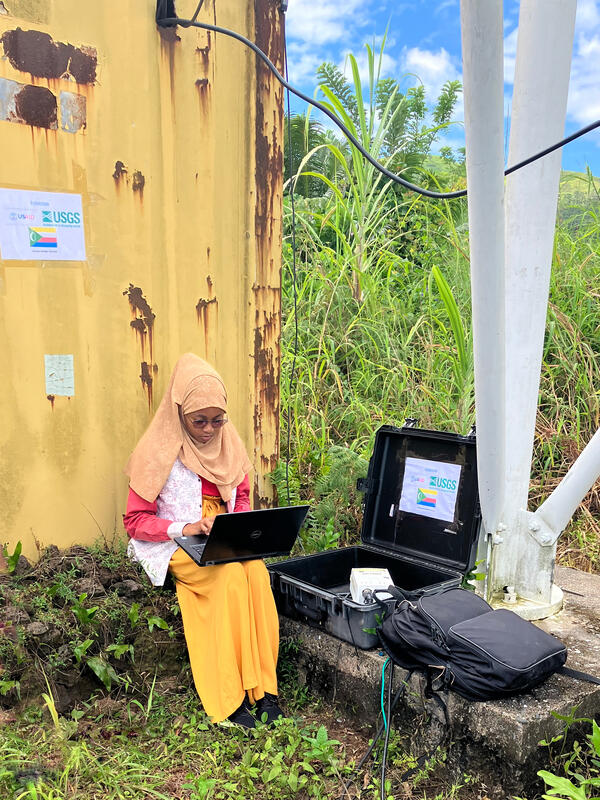
Global Seismographic Network (GSN)
Formed in partnership among the USGS, the National Science Foundation (NSF) and EarthScope, the GSN provides near-uniform, worldwide monitoring of the Earth, with approximately 150 modern seismic stations distributed globally. GSN stations are operated by the USGS Albuquerque Seismological Laboratory, EarthScope, and other affiliate organizations.
Data from the GSN are archived at the IRIS Data Management Center.
Within Africa, GSN stations are located in Botswana, Cabo Verde, Côte d'Ivoire, Ethiopia, Kenya, Madagascar, Namibia, Seychelles, South Africa, Uganda, and Zambia.


Earth Observation / Land Change Analysis
(Supporting Water, Food Security, Climate Resilience)
Famine Early Warning System – FEWS NET
USGS has had a long-term partnership with other US government agencies (NOAA, USDA, NASA) and NGOs to provide advance projections on drought and flood-related food shortages. The USGS provides expertise and training in satellite data acquisition, processing and interpretation with international partners in the Sahel and sub-Saharan regions of Africa.
USGS FEWS NET Data Portal
The USGS FEWS NET Data Portal provides access to geo-spatial data, satellite image products, and derived data products in support of FEWS NET drought monitoring efforts throughout the world. This portal is provided by the USGS FEWS NET Project, part of the Early Warning Focus Area at the USGS Earth Resources Observation and Science (EROS) Center.
Land Cover Dynamics in West Africa, the Sahel and Malawi
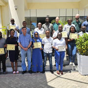
The USGS uses its 50+ years of Landsat satellite and other earth observation imagery to document changes on the landscape through time. In West Africa, the Sahel and Malawi, the USGS has worked with numerous international partner agencies to build local capacity to use and interpret this data. This work supports the monitoring of regional land use patterns and change, deforestation, desertification, and threats to biodiversity.
EROS in Action - Landscapes of West Africa
Gray Tappan and Francis Dwomoh discuss Landsat's contribution to the studies they have conducted regarding landscape changes in West Africa.