Rangeland managers need information on the current vegetation condition and how the landscape has changed through time. To address this need, scientists from the USGS and Bureau of Land Management (BLM) developed the Rangeland Condition Monitoring Assessment and Projection (RCMAP) project. These data classify western U.S.
Videos
Core Science Systems videos.
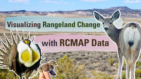 Thumbnail for "Visualizing Rangeland Change with RCMAP Data" Video
Rangeland managers need information on the current vegetation condition and how the landscape has changed through time. To address this need, scientists from the USGS and Bureau of Land Management (BLM) developed the Rangeland Condition Monitoring Assessment and Projection (RCMAP) project. These data classify western U.S.
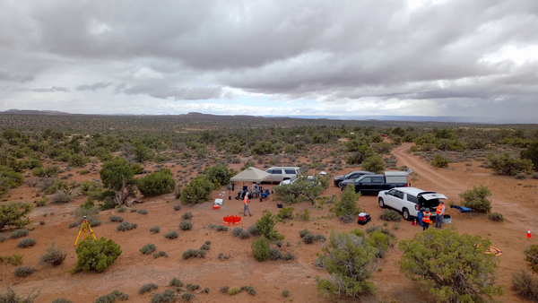 Overhead view taken by drone of a USGS fieldwork site in Moab with multiple cars and a tent shelter
B-Roll: Field and drone remote sensing operations near Moab, Utah – May 2025
B-Roll: Field and drone remote sensing operations near Moab, Utah – May 2025In May 2025, the U.S. Geological Survey (USGS) National Uncrewed Systems Office (NUSO) collected uncrewed aircraft system (UAS, also known as drone) data to support a collaborative field campaign led by Sasha Reed of the Southwest Biological Science Center (SBSC) and Miguel Villarreal of the Western Geographic Science Center (WGSC) near Moab, Utah.
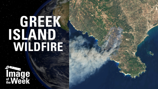 Thumbnail for "Greek Island Wildfire (Image of the Week)" video
Greek firefighters battled a wildfire on the Greek island of Zakynthos in August 2025, one of many late summer fires in the Ionian Islands. Landsat 8 captured smoke, ash, burn scar, and thermal perimeter activity on August 12 in natural color and false color infrared.
Greek firefighters battled a wildfire on the Greek island of Zakynthos in August 2025, one of many late summer fires in the Ionian Islands. Landsat 8 captured smoke, ash, burn scar, and thermal perimeter activity on August 12 in natural color and false color infrared.
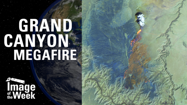
Multiple Landsat passes have captured the growth of the Dragon Bravo Fire in Kaibab National Forest near the North Rim of the Grand Canyon in Arizona.
On July 13, it destroyed the historic Grand Canyon Lodge. Dozens of other buildings have also been destroyed. As of August 15, the fire is 56% contained.
 FY26 3DNTM Data Collaboration Announcement Informational Webinar Thumbnail
FY26 3DNTM Data Collaboration Announcement Informational Webinar
FY26 3DNTM Data Collaboration Announcement Informational WebinarThe informational webinar for the Federal fiscal year (FY) 2026 3D National Topography Model (3DNTM) Data Collaboration Announcement was held on Wednesday, August 6, 2025 at 1pm ET. The USGS provided an overview of the application process followed by a Q&A session.
More Information:
Steve Aichele, the National Geospatial Program Hydrography Management and Planning Lead, announced publication of the Holston River, TN hydrologic unit 10 (0601010403) in the 3D Hydrography Program web map services and provided update on HydroAdd planned release of the Beta version (August 2025) and version 1.0 (September 2025).
Steve Aichele, the National Geospatial Program Hydrography Management and Planning Lead, announced publication of the Holston River, TN hydrologic unit 10 (0601010403) in the 3D Hydrography Program web map services and provided update on HydroAdd planned release of the Beta version (August 2025) and version 1.0 (September 2025).
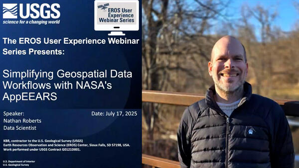 A man's portrait, of him standing outdoors in front of leafless trees, side by side with a title slide
Simplifying Geospatial Data Workflows with NASA's AppEEARS
Simplifying Geospatial Data Workflows with NASA's AppEEARSThis video is a recording of a previous webinar entitled: “Simplifying Geospatial Data Workflows with NASA's AppEEARS”. This webinar was recorded on July 17, 2025.
Simplifying Geospatial Data Workflows with NASA's AppEEARS
Simplifying Geospatial Data Workflows with NASA's AppEEARSThis video is a recording of a previous webinar entitled: “Simplifying Geospatial Data Workflows with NASA's AppEEARS”. This webinar was recorded on July 17, 2025.
 Thumbnail Image for video: "Record-Breaking Flooding in Australia (Image of the Week)"
Record-Breaking Flooding in Australia (Image of the Week)
Record-Breaking Flooding in Australia (Image of the Week)In May 2025, record rainfall in Australia's New South Wales created major flooding along the coast. In Taree, a mid-North Coast city, the Manning River reached a height of 6.4m on May 21st. The previous record of six meters was set back in 1929. The torrential rains have left almost 800 properties and counting uninhabitable in New South Wales.
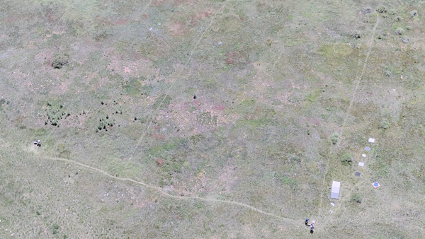 Aerial photo looking down at a field with drone operator and reference objects used for calibration of payload instruments
B-Roll: 2025 UAS radiometric calibration and validation research in Golden, Colorado
B-Roll: 2025 UAS radiometric calibration and validation research in Golden, ColoradoCalibration and validation (cal/val) are essential steps to ensure that remotely sensed data are reliable for scientific use. Radiometric cal/val involves converting digital image pixel values to meaningful units and assessing their accuracy.
 Thumbnail for Image of the Week video, "Great Lakes Shipping Season Begins"
Great Lakes Shipping Season Begins (Image of the Week)
Great Lakes Shipping Season Begins (Image of the Week)The St. Marys River between Michigan and Ontario is typically frozen January through March. The US Army Corp of Engineers performs maintenance on regulated access channels (the Soo Locks) during the coldest months.
 April 22, 2025 USGS Hydrography Community Call Thumbnail
April 22, 2025 USGS Hydrography Community Call: 3D Hydrography Program Announcements and "Updating historical flow permanence classifications with probabilistic continuous-value estimates” Presentation
April 22, 2025 USGS Hydrography Community Call: 3D Hydrography Program Announcements and "Updating historical flow permanence classifications with probabilistic continuous-value estimates” PresentationSteve Aichele, the National Geospatial Program Hydrography Management and Planning Lead, announced release of the Elevation Derived Hydrography Specification 2024 Revision A3 and updates on the following:
April 22, 2025 USGS Hydrography Community Call: 3D Hydrography Program Announcements and "Updating historical flow permanence classifications with probabilistic continuous-value estimates” Presentation
April 22, 2025 USGS Hydrography Community Call: 3D Hydrography Program Announcements and "Updating historical flow permanence classifications with probabilistic continuous-value estimates” PresentationApril 22, 2025 USGS Hydrography Community Call: 3D Hydrography Program Announcements and "Updating historical flow permanence classifications with probabilistic continuous-value estimates” Presentation
April 22, 2025 USGS Hydrography Community Call: 3D Hydrography Program Announcements and "Updating historical flow permanence classifications with probabilistic continuous-value estimates” PresentationSteve Aichele, the National Geospatial Program Hydrography Management and Planning Lead, announced release of the Elevation Derived Hydrography Specification 2024 Revision A3 and updates on the following:
 The EROS User Experience Webinar Series Presents: An Introduction to Landsat Data Access and Processing in the Cloud!
An Introduction to Landsat Data Access and Processing in the Cloud
An Introduction to Landsat Data Access and Processing in the CloudThis video is a recording of a previous webinar entitled: “An Introduction to Landsat Data Access and Processing in the Cloud!.” This webinar was recorded on April 17, 2025.
 An illustration containing satellite imagery of an iceberg and a title and graphic element
The world’s largest iceberg floats freely in the Southern Ocean.
Iceberg A23a is a 1,500 square mile ice mass larger than the state of Rhode Island. A23a weighs approximately 1 trillion tons and measures around 1,300 feet thick.
The world’s largest iceberg floats freely in the Southern Ocean.
Iceberg A23a is a 1,500 square mile ice mass larger than the state of Rhode Island. A23a weighs approximately 1 trillion tons and measures around 1,300 feet thick.
 January 28 2025 Hydrography Community Call Thumbnail
January 28, 2025 USGS Hydrography Community Call: 3D Hydrography Program Announcements and “HydroAdd3D Sneak Peak”
January 28, 2025 USGS Hydrography Community Call: 3D Hydrography Program Announcements and “HydroAdd3D Sneak Peak”Steve Aichele, the National Geospatial Program Hydrography Management and Planning Lead, announced release of updated Elevation Derived Hydrography Specifications and publication of the following products and services:
The USGS EROS Landsat archive recently reached a milestone of 12 million Landsat Collection 2 Level-1 products. These are available for download at no charge. The image representing this milestone displays a sprawling desert landscape and contains a multitude of agricultural, geological, and urban features.
The USGS EROS Landsat archive recently reached a milestone of 12 million Landsat Collection 2 Level-1 products. These are available for download at no charge. The image representing this milestone displays a sprawling desert landscape and contains a multitude of agricultural, geological, and urban features.
 Thumbnail reads: 1 Hour of Earth from Above, Relaxing Landsat Satellite Imagery
1 HOUR Relaxing Satellite Imagery (Sleep Music, Landsat, Concentrate, Meditation)
1 HOUR Relaxing Satellite Imagery (Sleep Music, Landsat, Concentrate, Meditation)Landsat satellites capture images of the Earth’s surface. While the sensors aboard Landsat capture a wide range of scientifically useful wavelengths, this collection reveals natural color imagery in the red, green and blue parts of the visible spectrum, as if viewed by the naked eye from 438 miles above the surface.
 December 2024 USGS Hydrography Community Call: Delivering and Using 3D Hydrography Program (3DHP) Data Thumbnail
December 2024 USGS Hydrography Community Call: Delivering and Using 3D Hydrography Program (3DHP) Data
December 2024 USGS Hydrography Community Call: Delivering and Using 3D Hydrography Program (3DHP) DataThe 3D Hydrography Program (3DHP) database will initially be populated with the National Hydrography Dataset (NHD) features, mapped to the new data model. The NHD-source features will be replaced with hydrography derived from the 3D Elevation Program (3DEP) lidar and IfSAR data as it becomes available.
A large, round lake in Quebec, Canada, highlights the geography of an ancient impact crater.
In the late Triassic Period, a 3 mile wide meteorite struck northern Pangea at over 30,000 miles per hour.
The resulting crater is now 214 million years old, but the dramatic circular lake visible in 2024 Landsat imagery is a surprisingly recent feature.
 The 3D Hydrography Program at one year – what was accomplished in FY24, what is planned for FY25? thumbnail
The 3D Hydrography Program at one year – what was accomplished in FY24, what is planned for FY25?
The 3D Hydrography Program at one year – what was accomplished in FY24, what is planned for FY25?Federal Fiscal Year 2024 was the first full operational year for the 3D Hydrography Program. We made significant progress in a number of areas, publishing final versions of legacy products, and developing processes for the new program. This presentation will provide an overview of what was accomplished in FY24 and what is planned for FY25.
 Thumbnail Image with photos on the right, and video title on the left, The New Annual NLCD Database
The New Annual (1985-2023) National Land Cover Database: Improving on a 30-Year Legacy
The New Annual (1985-2023) National Land Cover Database: Improving on a 30-Year LegacyThis video is a recording of a previous webinar entitled: “The New Annual (1985-2023) National Land Cover Database: Improving on a 30-year Legacy.” This webinar was recorded on October 24, 2024 at the USGS EROS.
 Illustration of a forest scene with a river running through, a bird prominent in front and a fish tail above the water
The Klamath River, flowing from the high desert interior of Oregon and through the redwood forests of California, once produced large runs of salmon and trout. However, the construction of hydroelectric dams, beginning in 1918, blocked fish migration, encroached on Indigenous culture, and impacted water quality.
The Klamath River, flowing from the high desert interior of Oregon and through the redwood forests of California, once produced large runs of salmon and trout. However, the construction of hydroelectric dams, beginning in 1918, blocked fish migration, encroached on Indigenous culture, and impacted water quality.


