U.S. flag

An official website of the United States government

Wetlands

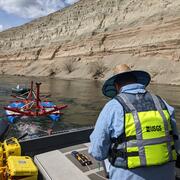
Filter Total Items: 19

Linking Selenium Sources to Ecosystems: Local and Global Perspectives

The sources, biogeochemistry, and ecotoxicology of selenium (Se) combine to produce a widespread potential for ecological risk such as deformities in birds and fish. Linking the understanding of source characteristics to a mechanistic, biodynamic dietary model of Se exposure on an ecosystem-scale improves the prediction of Se effects and its potential remediation.
Linking Selenium Sources to Ecosystems: Local and Global Perspectives

Linking Selenium Sources to Ecosystems: Local and Global Perspectives

The sources, biogeochemistry, and ecotoxicology of selenium (Se) combine to produce a widespread potential for ecological risk such as deformities in birds and fish. Linking the understanding of source characteristics to a mechanistic, biodynamic dietary model of Se exposure on an ecosystem-scale improves the prediction of Se effects and its potential remediation.
Learn More

Historical Flooding

The USGS provides practical, unbiased information about the Nation's rivers and streams that is crucial in mitigating hazards associated with floods. This site provides information about the USGS activities, data, and services provided during regional high-flow events, such as hurricanes or multi-state flooding events. The USGS response to these events is typically managed by the National Flood...
Historical Flooding

Historical Flooding

The USGS provides practical, unbiased information about the Nation's rivers and streams that is crucial in mitigating hazards associated with floods. This site provides information about the USGS activities, data, and services provided during regional high-flow events, such as hurricanes or multi-state flooding events. The USGS response to these events is typically managed by the National Flood...
Learn More

National Field Manual for the Collection of Water-Quality Data (NFM)

The National Field Manual for the Collection of Water-Quality Data (NFM) provides documented methods and protocols for USGS field personnel who collect water-quality data. The NFM provides detailed, comprehensive, and citable procedures for sampling water resources, processing samples for analysis of water quality, measuring field parameters, and specialized procedures.
National Field Manual for the Collection of Water-Quality Data (NFM)

National Field Manual for the Collection of Water-Quality Data (NFM)

The National Field Manual for the Collection of Water-Quality Data (NFM) provides documented methods and protocols for USGS field personnel who collect water-quality data. The NFM provides detailed, comprehensive, and citable procedures for sampling water resources, processing samples for analysis of water quality, measuring field parameters, and specialized procedures.
Learn More

Linking Selenium Sources to Ecosystems: Irrigation

Adverse effects of selenium (Se) on fish and waterfowl in wetlands receiving agricultural drainage occurred in the 1980s in the San Joaquin Valley of California. The identified mechanisms of Se enrichment helped resolve Se toxicity problems associated with irrigated agriculture in the arid West. Bioaccumulation of Se in ancient marine sediments is postulated as a primary pathway in source rocks.
Linking Selenium Sources to Ecosystems: Irrigation

Linking Selenium Sources to Ecosystems: Irrigation

Adverse effects of selenium (Se) on fish and waterfowl in wetlands receiving agricultural drainage occurred in the 1980s in the San Joaquin Valley of California. The identified mechanisms of Se enrichment helped resolve Se toxicity problems associated with irrigated agriculture in the arid West. Bioaccumulation of Se in ancient marine sediments is postulated as a primary pathway in source rocks.
Learn More

Urban Waters Federal Partnership—Middle Rio Grande (Albuquerque, N. Mex.)

The Valle de Oro National Wildlife Refuge, just 7 miles south of downtown Albuquerque on the Rio Grande, will reconnect people, especially young people, with nature in this highly populated area. The USGS is gathering data that will help gauge the success of habitat restoration efforts.
Urban Waters Federal Partnership—Middle Rio Grande (Albuquerque, N. Mex.)

Urban Waters Federal Partnership—Middle Rio Grande (Albuquerque, N. Mex.)

The Valle de Oro National Wildlife Refuge, just 7 miles south of downtown Albuquerque on the Rio Grande, will reconnect people, especially young people, with nature in this highly populated area. The USGS is gathering data that will help gauge the success of habitat restoration efforts.
Learn More

Thermal Imaging Cameras for Studying Groundwater/Surface-Water Exchange

USGS scientists are using high-resolution handheld and airborne thermal imaging cameras in groundwater/surface-water exchange studies and other investigations where surface temperature contrasts indicate various hydrological processes. These cameras are used to quickly locate and characterize thermal (temperature) anomalies along streams, lakes, wetlands, estuaries, and across the landscape...
Thermal Imaging Cameras for Studying Groundwater/Surface-Water Exchange

Thermal Imaging Cameras for Studying Groundwater/Surface-Water Exchange

USGS scientists are using high-resolution handheld and airborne thermal imaging cameras in groundwater/surface-water exchange studies and other investigations where surface temperature contrasts indicate various hydrological processes. These cameras are used to quickly locate and characterize thermal (temperature) anomalies along streams, lakes, wetlands, estuaries, and across the landscape...
Learn More

Geophysics for USGS Groundwater/Surface Water Exchange Studies

Locating and quantifying exchanges of groundwater and surface water, along with characterizing geologic structure, is essential to water-resource managers and hydrologists for the development of effective water-resource policy, protection, and management. The USGS conducts applied research to evaluate the use of new or emerging hydrogeophysical tools and methods to improve our understanding of...
Geophysics for USGS Groundwater/Surface Water Exchange Studies

Geophysics for USGS Groundwater/Surface Water Exchange Studies

Locating and quantifying exchanges of groundwater and surface water, along with characterizing geologic structure, is essential to water-resource managers and hydrologists for the development of effective water-resource policy, protection, and management. The USGS conducts applied research to evaluate the use of new or emerging hydrogeophysical tools and methods to improve our understanding of...
Learn More
Was this page helpful?