U.S. flag

An official website of the United States government

Images

Hawaiian Volcano Observatory images of eruptive activity, field work, and more.

Filter Total Items: 3970
Color photograph of UAS pilot and UAS in air
July 17, 2025 — UAS pilot lands UAS after flight over Halema‘uma‘u

A USGS Hawaiian Volcano Observatory pilot guides a UAS (uncrewed aircraft systems) to the landing pad after an observational flight over the eruptive vents in Halemaʻumaʻu.

Color photograph of volcanic landscape
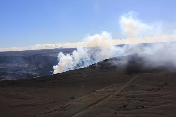
July 17, 2025 — Tephra hill southwest of Halema‘uma‘u eruption, Mauna Loa in background

The tephra mound on the crater rim southwest of the active vents in Halemaʻumaʻu is nearly 100 feet (30 m) tall after 28 episodes of lava fountaining since December 23, 2024. The profile of the tephra mound nearly mirrors that of Mauna Loa, outlined behind it. USGS photo by K. Mulliken. 

The tephra mound on the crater rim southwest of the active vents in Halemaʻumaʻu is nearly 100 feet (30 m) tall after 28 episodes of lava fountaining since December 23, 2024. The profile of the tephra mound nearly mirrors that of Mauna Loa, outlined behind it. USGS photo by K. Mulliken. 

Color photograph of volcanic vent degassing
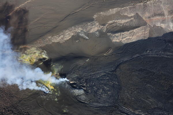
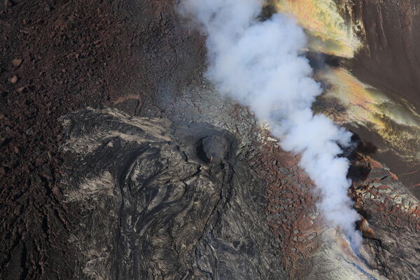
July 17, 2025 — UAS view into north vent

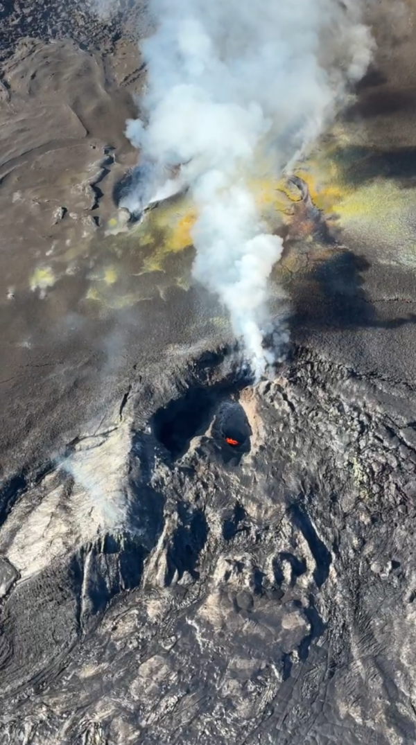
This near-vertical view into the north vent within Halema‘uma‘u crater was captured during a USGS Hawaiian Volcano Observatory UAS (uncrewed aircraft systems) flight on July 17, 2025. The aircraft was about 150 m (500 ft) above the vent, with north oriented to the upper left in this view. No incandescence or lava was visible within the vent.

This near-vertical view into the north vent within Halema‘uma‘u crater was captured during a USGS Hawaiian Volcano Observatory UAS (uncrewed aircraft systems) flight on July 17, 2025. The aircraft was about 150 m (500 ft) above the vent, with north oriented to the upper left in this view. No incandescence or lava was visible within the vent.

Color satellite image of eruption area
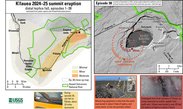
July 17, 2025 — Satellite image of Kīlauea tephra and lava flow deposits from ongoing eruption

Following episode 28 of lava fountaining at the summit of Kīlauea on July 9, this satellite image was acquired on July 11. It shows the tephra deposit extending in the predominant downwind direction to the southwest in the closed area of Hawaiʻi Volcanoes National Park.

Following episode 28 of lava fountaining at the summit of Kīlauea on July 9, this satellite image was acquired on July 11. It shows the tephra deposit extending in the predominant downwind direction to the southwest in the closed area of Hawaiʻi Volcanoes National Park.

Scientists work gather around a volcano monitoring station
July 10, 2025 — USGS field engineers service a volcano monitoring station at the summit of Kīlauea

On July 10, USGS field engineers visited one of the volcanic gas monitoring stations downwind of the summit of Kīlauea, within the closed area of Hawaiʻi Volcanoes National Park. This area has been blanketed with tephra material during recent eruptive episodes within Halemaʻumaʻu. USGS photo by M. Cappos. 

On July 10, USGS field engineers visited one of the volcanic gas monitoring stations downwind of the summit of Kīlauea, within the closed area of Hawaiʻi Volcanoes National Park. This area has been blanketed with tephra material during recent eruptive episodes within Halemaʻumaʻu. USGS photo by M. Cappos. 

Scientist uses power washer to spray off solar panels
July 10, 2025 — Cleaning off solar panels of monitoring equipment at the summit of Kīlauea

Solar panels that power USGS volcano monitoring equipment can be covered with tephra during eruptive episodes at the summit of Kīlauea. These tephra particles can range in size from fine ash to tennis-ball sized and larger.  USGS field engineers visit these stations after eruptive episodes to clean them off and restore power to the stations. USGS photo by M.

Solar panels that power USGS volcano monitoring equipment can be covered with tephra during eruptive episodes at the summit of Kīlauea. These tephra particles can range in size from fine ash to tennis-ball sized and larger.  USGS field engineers visit these stations after eruptive episodes to clean them off and restore power to the stations. USGS photo by M.

Color photograph of scientist walking on new volcanic deposit
July 10, 2025 — Using snowshoes on Kīlauea

USGS Hawaiian Volcano Observatory field engineers visited monitoring stations downwind of the Kīlauea summit eruptive vents on July 10. They wore snowshoes as the large footprint keeps the field engineers walking on top of the frothy pumice everywhere, rather than through it. USGS photo by M. Warren. 

USGS Hawaiian Volcano Observatory field engineers visited monitoring stations downwind of the Kīlauea summit eruptive vents on July 10. They wore snowshoes as the large footprint keeps the field engineers walking on top of the frothy pumice everywhere, rather than through it. USGS photo by M. Warren. 

Color photograph of volcanic eruption
July 9, 2025 — Episode 28 of the Halema‘uma‘u Kīlauea summit eruption

During Kīlauea summit eruption episode 28 on Wednesday, July 9, USGS Hawaiian Volcano Observatory scientists conducted an aerial overflight of Halemaʻumaʻu crater, which included a brief landing on the crater floor to collect lava samples.

During Kīlauea summit eruption episode 28 on Wednesday, July 9, USGS Hawaiian Volcano Observatory scientists conducted an aerial overflight of Halemaʻumaʻu crater, which included a brief landing on the crater floor to collect lava samples.

Color photograph of scientists on crater floor with lava fountain visible in the background
July 9, 2025 — Scientists sample episode 28 of the Halema‘uma‘u Kīlauea summit eruption

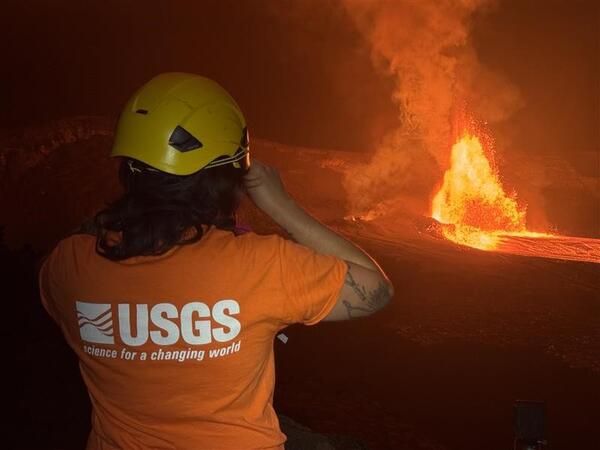
Halemaʻumaʻu crater is the home of Pele, the Native Hawaiian elemental force associated with lava, and numerous eruptions have taken place in the crater. With permission from Hawaiʻi Volcanoes National Park, USGS Hawaiian Volcano Observatory scientists landed briefly on the crater floor on Wednesday, July 9, to collect lava samples of episode 28.

Halemaʻumaʻu crater is the home of Pele, the Native Hawaiian elemental force associated with lava, and numerous eruptions have taken place in the crater. With permission from Hawaiʻi Volcanoes National Park, USGS Hawaiian Volcano Observatory scientists landed briefly on the crater floor on Wednesday, July 9, to collect lava samples of episode 28.

Color photograph of scientists measuring volcanic gas during eruption
July 9, 2025 — Measuring volcanic gas during episode 28 of the Halema‘uma‘u Kīlauea summit eruption

USGS scientists use an FTIR (Fourier transform infrared spectrometer) to measure the chemical composition of volcanic gas during episode 28 of the ongoing Kīlauea summit on July 9, 2025. USGS photo by M. Cappos.

Color photograph of lava fountain
July 9, 2025 — Episode 28 of the Halema‘uma‘u Kīlauea summit eruption

At around 6:30 a.m. HST on July 9, 2025, a fan-shaped lava fountain being erupted during episode 28 was visible from near Kīlauea Overlook within Hawaiʻi Volcanoes National Park. USGS photo by K. Mulliken. 

At around 6:30 a.m. HST on July 9, 2025, a fan-shaped lava fountain being erupted during episode 28 was visible from near Kīlauea Overlook within Hawaiʻi Volcanoes National Park. USGS photo by K. Mulliken. 

Color photograph of volcanic plume from eruption with mountain in the background
Episode 28 lava fountains at Kīlauea, Mauna Loa visible in the background

This photo was taken by a USGS Hawaiian Volcano Observatory monitoring webcam just before 6:00 a.m. HST on July 9, during episode 28 of the ongoing Kīlauea summit eruption. Mauna Loa looms in the background, illuminated by the morning sun. USGS photo.

This photo was taken by a USGS Hawaiian Volcano Observatory monitoring webcam just before 6:00 a.m. HST on July 9, during episode 28 of the ongoing Kīlauea summit eruption. Mauna Loa looms in the background, illuminated by the morning sun. USGS photo.

Color photograph of lava fountain in crater
July 9, 2025 – Aerial view of episode 28 of Halema‘uma‘u Kīlauea summit eruption

In this view from an eruption monitoring helicopter overflight on Wednesday, July 9, new lava flows can be seen traveling across the Halema‘uma‘u crater floor—these appear as fluid forms with a shiny, silvery crust over incandescent red-hot lava. Older lava flows from previous eruptive episodes have a darker or duller appearance.

In this view from an eruption monitoring helicopter overflight on Wednesday, July 9, new lava flows can be seen traveling across the Halema‘uma‘u crater floor—these appear as fluid forms with a shiny, silvery crust over incandescent red-hot lava. Older lava flows from previous eruptive episodes have a darker or duller appearance.

Color photograph of lava fountain
July 9, 2025 — Episode 28 of the Halema‘uma‘u Kīlauea summit eruption

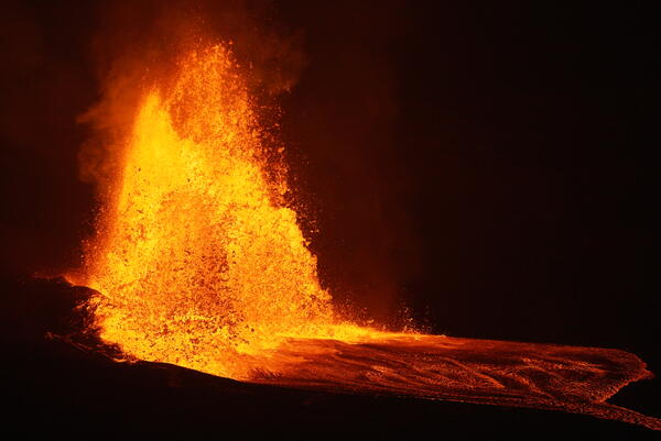
Lava fountaining associated with episode 28 of the ongoing Halemaʻumaʻu eruption began at 4:10 a.m. HST on July 9,  following several days of gas pistoning cycles, some of which produced small lava overflows at the north vent on July 8. USGS photo by L. Gallant. 

Lava fountaining associated with episode 28 of the ongoing Halemaʻumaʻu eruption began at 4:10 a.m. HST on July 9,  following several days of gas pistoning cycles, some of which produced small lava overflows at the north vent on July 8. USGS photo by L. Gallant. 

Color photograph of lava fountain and eruption plume
July 9, 2025 — Episode 28 Halema‘uma‘u lava fountain and eruption plume at Kīlauea summit

Episode 28 of the ongoing Halemaʻumaʻu eruption began just after 4 a.m. HST on July 9, 2025. This photograph was taken from the north rim of the caldera around 6:30 a.m., as Hawaiʻi Volcanoes National Park visitors gathered to view the episode. USGS photo by K. Mulliken.

Episode 28 of the ongoing Halemaʻumaʻu eruption began just after 4 a.m. HST on July 9, 2025. This photograph was taken from the north rim of the caldera around 6:30 a.m., as Hawaiʻi Volcanoes National Park visitors gathered to view the episode. USGS photo by K. Mulliken.

Color panoramic photo of a volcanic caldera with eruption
July 9, 2025 — Panoramic image showing episode 28 of Halema‘uma‘u eruption within Kaluapele

This panoramic image, taken around 6:30 a.m. HST on July 9, 2025, shows episode 28 of the ongoing eruption in Halemaʻumaʻu crater, within Kaluapele (the summit caldera of Kīlauea volcano). This view, from the north rim of the caldera, shows that the ongoing eruption has been occurring in the southwest part of the caldera. USGS photo by K. Mulliken. 

This panoramic image, taken around 6:30 a.m. HST on July 9, 2025, shows episode 28 of the ongoing eruption in Halemaʻumaʻu crater, within Kaluapele (the summit caldera of Kīlauea volcano). This view, from the north rim of the caldera, shows that the ongoing eruption has been occurring in the southwest part of the caldera. USGS photo by K. Mulliken. 

Color photograph of volcanic material deposited on landscape
July 9, 2025 — View of the growing tephra hill after episode 28 at Kīlauea

After episode 28 ended, USGS geologists inspected the tephra deposit southwest of the eruptive vents, in the closed area of Hawai‘i Volcanoes National Park. The tephra continues to accumulate and build up a hill that is more than 80 ft (~25 m) high, covering parts of Crater Rim Drive.

After episode 28 ended, USGS geologists inspected the tephra deposit southwest of the eruptive vents, in the closed area of Hawai‘i Volcanoes National Park. The tephra continues to accumulate and build up a hill that is more than 80 ft (~25 m) high, covering parts of Crater Rim Drive.

Color photograph of lava fountain with flowering tree in foreground
July 9, 2025 — Kīlauea lava fountain and ‘ōhi‘a lehua

Near the Kīlauea Overlook in Hawaiʻi Volcanoes National Park, an ‘ōhi‘a lehua frames the lava fountains of episode 28 on July 9. USGS photo by K. Mulliken. 

Near the Kīlauea Overlook in Hawaiʻi Volcanoes National Park, an ‘ōhi‘a lehua frames the lava fountains of episode 28 on July 9. USGS photo by K. Mulliken. 

Color photograph of scientists setting up monitoring equipment next to lava fountain
July 9, 2025 – Scientists measure gas emissions during episode 28 of the Halema‘uma‘u Kīlauea summit eruption

During episode 28 of lava fountaining during the ongoing Kīlauea summit eruption, USGS scientists approached the caldera rim to measure volcanic gas emissions with permission from Hawai‘i Volcanoes National Park. This lava fountain on the morning of July 9 was approximately 1000 feet tall (300 meters).

Color photograph of lava fountaining within a caldera
July 9, 2025 — Aerial view of lava fountaining at Kīlauea during episode 28

Aerial view taken during a USGS Hawaiian Volcano Observatory helicopter overflight, showing the lava fountain of episode 28 within the summit caldera (Kaluapele) of Kīlauea. These lava fountains reached a maximum of 1150 ft (350 meters) but were mostly lower than this height throughout the fountaining episode.

Aerial view taken during a USGS Hawaiian Volcano Observatory helicopter overflight, showing the lava fountain of episode 28 within the summit caldera (Kaluapele) of Kīlauea. These lava fountains reached a maximum of 1150 ft (350 meters) but were mostly lower than this height throughout the fountaining episode.

Color photograph of lava fountaining
July 9, 2025 — Episode 28 of lava fountaining at Kīlauea summit

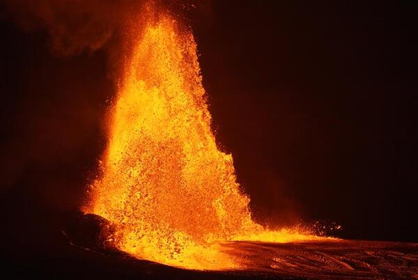
Captured on USGS Hawaiian Volcano Observatory livestreaming V2cam, the north vent produced a fan-shaped fountain during episode 28 on July 9. The south vent was quiet during this episode, giving the north vent the full spotlight. Maximum fountain height in this episode was 321 meters (1053 feet). USGS photo. 

Captured on USGS Hawaiian Volcano Observatory livestreaming V2cam, the north vent produced a fan-shaped fountain during episode 28 on July 9. The south vent was quiet during this episode, giving the north vent the full spotlight. Maximum fountain height in this episode was 321 meters (1053 feet). USGS photo. 

Was this page helpful?