
...to informing restoration efforts in the Florida Everglades
...to tracking storm-related flood conditions through the South Atlantic...
...to investigating coral health in the Florida Keys & Caribbean...
...to assessing environmental contaminants on aquatic life in the Mississippi River Basin...
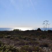
...USGS science spans the South Atlantic, Gulf States and Caribbean
The Southeast Region includes 13 states and two U.S. territories, Puerto Rico and the U.S. Virgin Islands
The Southeast Region includes 13 states and two U.S. territories, Puerto Rico and the U.S. Virgin Islands
Southeast Region
We conduct impartial, multi- and interdisciplinary research and monitoring to address a broad range of natural-resource issues that affect the quality of life of citizens and landscapes in the Southeastern United States and the Caribbean region.
News
AquaDePTH: Merging Aquatic Disease Surveillance Data into One Useful Tool
AquaDePTH: Merging Aquatic Disease Surveillance Data into One Useful Tool
USGS Geologic Mapping Project Supports Critical Mineral Exploration, Enhances Public Safety in the Southeast
USGS Geologic Mapping Project Supports Critical Mineral Exploration, Enhances Public Safety in the Southeast
Ecological Thresholds, Abiotic Stress, and Climate Change: A Conceptual Framework
Ecological Thresholds, Abiotic Stress, and Climate Change: A Conceptual Framework
Publications
Groundwater tracing used to delineate recharge areas and map karst groundwater pathways for subterranean streams at Oregon Caves National Monument and Preserve Groundwater tracing used to delineate recharge areas and map karst groundwater pathways for subterranean streams at Oregon Caves National Monument and Preserve
Oregon Caves National Monument and Preserve in southwestern Oregon is a 4,554-acre area managed by the National Park Service that is home to several cave systems, including Oregon Caves, which is the longest cave in Oregon, with 3.03 miles of mapped passages. Because of the interconnected nature of karst hydrologic systems, it is critical to understand the areas that can influence water...
21st-century mangrove expansion along the southeastern United States 21st-century mangrove expansion along the southeastern United States
Warming winter temperatures are driving range expansion of tropical, cold-sensitive mangroves into temperate ecosystems. Along the Atlantic coast of North America, the mangrove range limit is particularly sensitive to climate variability and historical data demonstrate that the mangrove-salt marsh ecotone on this coast has shifted recurrently during recent centuries. However, a...
Science

Mobile River Basin Study
The Mobile River Basin in Alabama, Georgia, Mississippi, and Tennessee is one of the 59 study units that are part of the U.S. Geological Survey's National Water-Quality Assessment (NAWQA) Program. The long-term goals of this program are to describe the status and trends in the quality of a large, representative part of the Nation's surface- and ground-water resources, and to provide a sound...

Groundwater Monitoring Program for the Brunswick-Glynn County Area, Georgia
In the Brunswick, Georgia area, saltwater has contaminated the Upper Floridan aquifer for nearly 50 years. Saltwater contamination has constrained further development of the Upper Floridan aquifer in the Brunswick area, which has stimulated interest in the development of alternative sources of water supply, primarily from the shallower surficial and Brunswick aquifer systems. USGS is working...
Where land meets sea: USGS science for resilient coastal habitats
USGS coastal science plays a critical role in supporting the effective, science-based management of coastal ecosystems, where the biodiversity of land and sea meet. It provides managers with the information they need to make sound decisions. Through cutting-edge research, predictive modeling, and decision-support tools, USGS empowers resource managers to make informed, science-based choices. From...
By
Core Science Systems Mission Area, Ecosystems Mission Area, Water Resources Mission Area, Cooperative Research Units, Ecosystems Land Change Science Program, Land Management Research Program, Science and Decisions Center, Species Management Research Program, California Water Science Center, Eastern Ecological Science Center, Forest and Rangeland Ecosystem Science Center, Lower Mississippi-Gulf Water Science Center, Pacific Coastal and Marine Science Center, Western Ecological Research Center (WERC), Western Fisheries Research Center, Western Geographic Science Center, Wetland and Aquatic Research Center