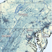
Map of U.S. Geological Survey PFAS study areas. Specific points indicate: 1) Surface water and field studies (teal circles), 2) PFAS in tapwater studies (black circles), 3) PFAS in groundwater studies (orange circles), and 4) Sites where atmospheric samples were collected (yellow triangles).
Brianna Williams
Brianna is a geographer working with the New Jersey Water Science Center Integrated Hydrology Investigation Team
Brianna is a member of the Environmental Health Mission Area’s geospatial Core Technology Team (CTT), and currently resides in Tucson, AZ. Her team utilizes landscape and point source variables to understand what is happening in water bodies and how that might impact the environment and human health. Some of these projects include analyses for endocrine disrupting compounds in the Chesapeake Bay watershed, aquifer contamination nationwide, and Harmful Algal Blooms offshore and in lakes and streams. Brianna began at the USGS in 2011 as a Pathways Intern in the Eastern Geographic Science Center and joined the NJWSC in 2017. Since joining the bureau she has had the opportunity to participate in a variety of projects including field work in Micronesia, stormwater best management practices research, cartographic support for science centers and groups, and outreach to high school students.
Education and Certifications
B.S. in Geography (GIS) from Penn State
M.S. in Geography (Coastal Geomorphology) from Texas A&M.
Science and Products
Understanding the Effects of Stormwater Management Practices on Water Quality and Flow
Geospatial Analyses and Applications Core Technology Team
Current Period Statistics
Data for the Potomac River Watershed Accumulated Wastewater Viewer
Estimated Densities of Residential Septic Tanks across the Conterminous United States for HUC12, NHDV2 Catchment, and Block Group Scales
Streamflow characteristics and trends at 97 continuous-record and 719 partial-record streamflow gaging stations in New Jersey surface water during water years 1903-2017
PFAS Reconnaissance Landscape Data
Geomorphic metrics across four catchments in Clarksburg, Maryland, 2002-19
Stream cross-section, benthic macroinvertebrate and fish taxa counts and abundance, and water chemistry data for the Clarksburg study area in Montgomery County, Maryland, 1992 - 2020
Quality assessed and modified Discharge Monitoring Report (DMR) facility and outfall locations, 2007 - 2019
Estrogen equivalents of surface water and smallmouth bass estrogenic biomarker data in New Jersey, 2016-2017
Land Use Land Cover, 1998 - 2013, Clarksburg (Montgomery County, MD)
Potential contaminant sources and other landscape variables summarized for NHDPlus Version 2.1 catchments within the Chesapeake Bay Watershed (ver. 2.0, June 2021)
Map of U.S. Geological Survey PFAS study areas. Specific points indicate: 1) Surface water and field studies (teal circles), 2) PFAS in tapwater studies (black circles), 3) PFAS in groundwater studies (orange circles), and 4) Sites where atmospheric samples were collected (yellow triangles).
Streamflow characteristics and trends in New Jersey, water years 1903–2017
Per- and polyfluoroalkyl substances (PFAS) in United States tapwater: Comparison of underserved private-well and public-supply exposures and associated health implications
Tracking geomorphic changes after suburban development with a high density of green stormwater infrastructure practices in Montgomery County, Maryland
Lessons learned from 20 y of monitoring suburban development with distributed stormwater management in Clarksburg, Maryland, USA
A review of algal toxin exposures on reserved federal lands and among trust species in the United States
Modeling estrogenic activity in streams throughout the Potomac and Chesapeake Bay watersheds
An initial comparison of pesticides and amphibian pathogens between natural and created wetlands in the New Jersey Pinelands, 2014–16
A carbon balance model for the great dismal swamp ecosystem
Per- and Polyfluoroalkyl Substances (PFAS) in U.S. Tapwater: Comparison of Public-Supply and Underserved Private-Well Exposures and Associated Health Implications
Science and Products
Understanding the Effects of Stormwater Management Practices on Water Quality and Flow
Geospatial Analyses and Applications Core Technology Team
Current Period Statistics
Data for the Potomac River Watershed Accumulated Wastewater Viewer
Estimated Densities of Residential Septic Tanks across the Conterminous United States for HUC12, NHDV2 Catchment, and Block Group Scales
Streamflow characteristics and trends at 97 continuous-record and 719 partial-record streamflow gaging stations in New Jersey surface water during water years 1903-2017
PFAS Reconnaissance Landscape Data
Geomorphic metrics across four catchments in Clarksburg, Maryland, 2002-19
Stream cross-section, benthic macroinvertebrate and fish taxa counts and abundance, and water chemistry data for the Clarksburg study area in Montgomery County, Maryland, 1992 - 2020
Quality assessed and modified Discharge Monitoring Report (DMR) facility and outfall locations, 2007 - 2019
Estrogen equivalents of surface water and smallmouth bass estrogenic biomarker data in New Jersey, 2016-2017
Land Use Land Cover, 1998 - 2013, Clarksburg (Montgomery County, MD)
Potential contaminant sources and other landscape variables summarized for NHDPlus Version 2.1 catchments within the Chesapeake Bay Watershed (ver. 2.0, June 2021)
Map of U.S. Geological Survey PFAS study areas. Specific points indicate: 1) Surface water and field studies (teal circles), 2) PFAS in tapwater studies (black circles), 3) PFAS in groundwater studies (orange circles), and 4) Sites where atmospheric samples were collected (yellow triangles).