San Juan River Above La Plata Creek Looking Downstream
San Juan River Above La Plata Creek Looking DownstreamPicture of San Juan River Above La Plata Creek Looking Downstream, USGS - New Mexico Water Science Center

Official websites use .gov
A .gov website belongs to an official government organization in the United States.
Secure .gov websites use HTTPS
A lock () or https:// means you’ve safely connected to the .gov website. Share sensitive information only on official, secure websites.

Picture of San Juan River Above La Plata Creek Looking Downstream, USGS - New Mexico Water Science Center
Picture of San Juan River Above La Plata Creek Looking Downstream, USGS - New Mexico Water Science Center

Density of oil and gas well pads per km2 in the Colorado Plateau ecoregion (including parts of Utah, Colorado and New Mexico) as counted in 2016. Oil/gas wells are particularly concentrated in this region with ~100,000 abandoned and current wells spanning 60 years of activity. These numbers are dramatically increasing with time.
Density of oil and gas well pads per km2 in the Colorado Plateau ecoregion (including parts of Utah, Colorado and New Mexico) as counted in 2016. Oil/gas wells are particularly concentrated in this region with ~100,000 abandoned and current wells spanning 60 years of activity. These numbers are dramatically increasing with time.

USGS and Department of Interior UAS pilots plan a flight near Canyonland, Utah.
USGS and Department of Interior UAS pilots plan a flight near Canyonland, Utah.

Utah mountain peaks, on average, are the tallest in the country. The average elevation of the tallest peaks in each of Utah’s counties is 11,222 feet–higher than the same average in any other state.
Capital Salt Lake City
Image Source Landsat 8
Population 3,271,616
Utah mountain peaks, on average, are the tallest in the country. The average elevation of the tallest peaks in each of Utah’s counties is 11,222 feet–higher than the same average in any other state.
Capital Salt Lake City
Image Source Landsat 8
Population 3,271,616

RAMPS expands drought adaptation project with national parks in the 4-Corners area. National parks across the desert Southwest are experiencing ecological impacts due to climate change.
RAMPS expands drought adaptation project with national parks in the 4-Corners area. National parks across the desert Southwest are experiencing ecological impacts due to climate change.

Photomicrographs from a Great-Horned Owl showing (A) moderate acute hemorrhage in the right atrial epicardium extending into the myocardium and (B) a focally extensive area of coagulative necrosis of the epidermis and dermis (arrow) consistent with an electrical burn.
Photomicrographs from a Great-Horned Owl showing (A) moderate acute hemorrhage in the right atrial epicardium extending into the myocardium and (B) a focally extensive area of coagulative necrosis of the epidermis and dermis (arrow) consistent with an electrical burn.
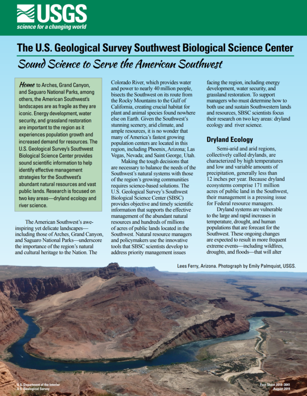
Southwest Biological Science Center fact sheet front cover. Fact Sheet available at FS 2019-3041: Sound Science to Serve the American Southwest (usgs.gov)
Southwest Biological Science Center fact sheet front cover. Fact Sheet available at FS 2019-3041: Sound Science to Serve the American Southwest (usgs.gov)

Lewis flax or Blue flax (Linum lewisii) flower at Canyonlands Research Center, Utah. Photo by Katie Laushman, USGS, SBSC.
Lewis flax or Blue flax (Linum lewisii) flower at Canyonlands Research Center, Utah. Photo by Katie Laushman, USGS, SBSC.

This is a graphic from the USGS National Oil and Gas Assessment Explorer application, which allows user to drill into 70 oil and gas assessment provinces throughout the United States.
This is a graphic from the USGS National Oil and Gas Assessment Explorer application, which allows user to drill into 70 oil and gas assessment provinces throughout the United States.
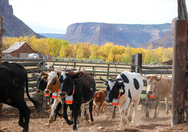
Criollo cattle, a heritage breed of cows, at Canyonlands Research Center, Utah. Photo by Mike Duniway, USGS, SBSC.
Criollo cattle, a heritage breed of cows, at Canyonlands Research Center, Utah. Photo by Mike Duniway, USGS, SBSC.
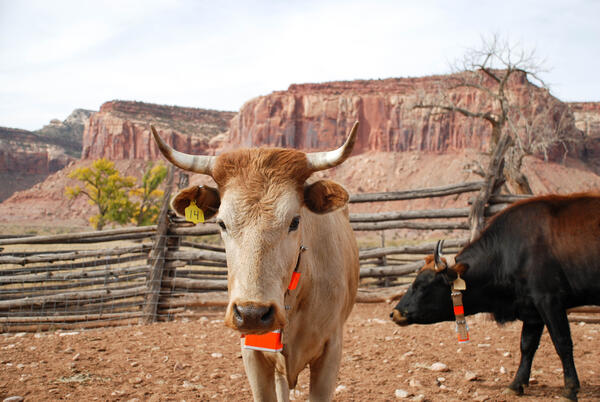
Criollo heritage cattle stand in a corral at Canyonlands Research Center, Utah. Criollo cows are descended from Iberian, or Spanish, stock brought to Mexico hundreds of years ago. They are hardier than Angus cattle and better suited to dry climates.
Criollo heritage cattle stand in a corral at Canyonlands Research Center, Utah. Criollo cows are descended from Iberian, or Spanish, stock brought to Mexico hundreds of years ago. They are hardier than Angus cattle and better suited to dry climates.

The RestoreNet gardens test seedlings of priority restoration species across the Southwest. This is a recently installed garden located in the juniper woodlands of the Colorado Plateau. The experiemental network will support land managers by providing insight into various restoration techniques, including testing seedlings vs seeds.
The RestoreNet gardens test seedlings of priority restoration species across the Southwest. This is a recently installed garden located in the juniper woodlands of the Colorado Plateau. The experiemental network will support land managers by providing insight into various restoration techniques, including testing seedlings vs seeds.

Biocrust survey, Colorado Plateau, Utah, with SBSC staff. Photo courtesy of Erika Geiger, USGS, 2018.
Biocrust survey, Colorado Plateau, Utah, with SBSC staff. Photo courtesy of Erika Geiger, USGS, 2018.

Technicians deploy water-quality instrumentation on Bear Lake platforms
Technicians deploy water-quality instrumentation on Bear Lake platforms

A perennial native warm season grass, Sporobolus cryptandrus (sand dropseed), at a long-term study site that looks at the effects of drought on vegetation and soils in the Utah drylands on the Colorado Plateau.
A perennial native warm season grass, Sporobolus cryptandrus (sand dropseed), at a long-term study site that looks at the effects of drought on vegetation and soils in the Utah drylands on the Colorado Plateau.

Left: RestoreNet outplant trials with greenhouse-grown seedlings planted into the field, Right: RestoreNet direct seeding trials with seeds combined with soil surface modifications including ConMod artificial nurse plants, mulch, and soil pits. Photos by Katie Laushman (USGS).
Left: RestoreNet outplant trials with greenhouse-grown seedlings planted into the field, Right: RestoreNet direct seeding trials with seeds combined with soil surface modifications including ConMod artificial nurse plants, mulch, and soil pits. Photos by Katie Laushman (USGS).

NASA image of Bear Lake with beautiful swirls in blue water showing mixing
NASA image of Bear Lake with beautiful swirls in blue water showing mixing
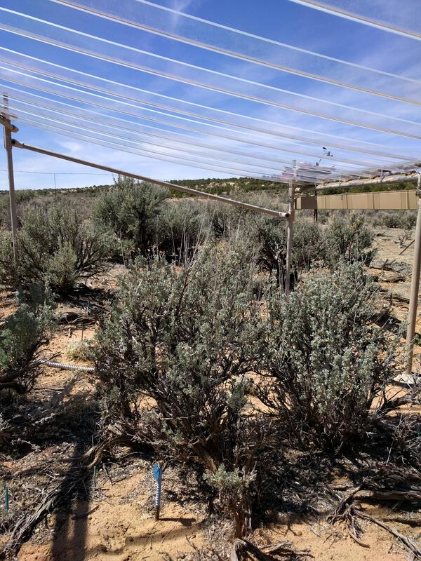
This rainout shelter blcoks about 35% of the natural rainfall, allowing researchers to understand the effects of drought on plants in the southwestern United States.
This rainout shelter blcoks about 35% of the natural rainfall, allowing researchers to understand the effects of drought on plants in the southwestern United States.

Rainout shelters block about 35% of natural rainfall, allowing researchers to study the effects of drought on plants in the arid and semiarid southwestern United States.
Rainout shelters block about 35% of natural rainfall, allowing researchers to study the effects of drought on plants in the arid and semiarid southwestern United States.
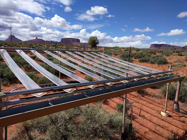
This rainout structure blocks about 35% of the natural rainfall, allowing researchers to study the effects of drought on plants in the southwestern United States.
This rainout structure blocks about 35% of the natural rainfall, allowing researchers to study the effects of drought on plants in the southwestern United States.
Geospatial Analyses and Applications — Salt Lake City, Utah. Attribution of storm-weighted potential contaminant hazard ranks to sampling locations in the Sediment-Bound Contaminant Resiliency and Response (SCoRR) network.
Geospatial Analyses and Applications — Salt Lake City, Utah. Attribution of storm-weighted potential contaminant hazard ranks to sampling locations in the Sediment-Bound Contaminant Resiliency and Response (SCoRR) network.