
U.S. flag

An official website of the United States government

Statistical Analysis

Filter Total Items: 37
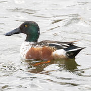
Developing Waterfowl Distribution and Abundance Models to Inform Avian Influenza Transmission Risk

USGS researchers are developing novel methods to improve our understanding of waterfowl distributions and abundance across the United States to inform a variety of ongoing disease studies. Understanding the distribution of wild waterfowl is a critical component to assessing avian influenza transmission risks across the landscape.
Developing Waterfowl Distribution and Abundance Models to Inform Avian Influenza Transmission Risk

Developing Waterfowl Distribution and Abundance Models to Inform Avian Influenza Transmission Risk

USGS researchers are developing novel methods to improve our understanding of waterfowl distributions and abundance across the United States to inform a variety of ongoing disease studies. Understanding the distribution of wild waterfowl is a critical component to assessing avian influenza transmission risks across the landscape.
Learn More

Genomics to Aid Conservation and restoration of the Yellow Lampmussel (Lampsilis cariosa) and Tidewater Mucket (Atlanticoncha ochracea)

Due to the rapid decline in abundance of Yellow Lampmussel ( Lampsilis cariosa) and Tidewater Mucket ( Atlanticoncha ochracea), USGS and partners at the U.S. Fish and Wildlife Service (USFWS) and Central Michigan University (CMU) are conducting an assessment of genetic diversity and population structure to inform appropriate recommendations for conservation and management of each species. These...
Genomics to Aid Conservation and restoration of the Yellow Lampmussel (Lampsilis cariosa) and Tidewater Mucket (Atlanticoncha ochracea)

Genomics to Aid Conservation and restoration of the Yellow Lampmussel (Lampsilis cariosa) and Tidewater Mucket (Atlanticoncha ochracea)

Due to the rapid decline in abundance of Yellow Lampmussel ( Lampsilis cariosa) and Tidewater Mucket ( Atlanticoncha ochracea), USGS and partners at the U.S. Fish and Wildlife Service (USFWS) and Central Michigan University (CMU) are conducting an assessment of genetic diversity and population structure to inform appropriate recommendations for conservation and management of each species. These...
Learn More

Using Telemetry to Understand Overlap in Habitat Use Between Waterfowl and Agricultural Birds in North America

USGS researchers are using telemetry to improve our understanding of how wild birds move throughout their environments and the potential implications for disease transmission within and to domestic poultry.
Using Telemetry to Understand Overlap in Habitat Use Between Waterfowl and Agricultural Birds in North America

Using Telemetry to Understand Overlap in Habitat Use Between Waterfowl and Agricultural Birds in North America

USGS researchers are using telemetry to improve our understanding of how wild birds move throughout their environments and the potential implications for disease transmission within and to domestic poultry.
Learn More

Understanding Avian Influenza Infection and Movement Behavior of Wild Birds

This project focuses on improving our understanding of how current and previous infection with avian influenza viruses impact the movement ecology of wild bird species.
Understanding Avian Influenza Infection and Movement Behavior of Wild Birds

Understanding Avian Influenza Infection and Movement Behavior of Wild Birds

This project focuses on improving our understanding of how current and previous infection with avian influenza viruses impact the movement ecology of wild bird species.
Learn More

Population Monitoring and Removal Strategies for Blue Catfish (Ictalurus furcatus) in Chesapeake Bay

USGS is helping with the design of a population survey and developing mathematical models to assess potential activities to manage the population of invasive blue catfish ( Ictalurus furcatus) in the Chesapeake Bay. This research will help managers determine the cost and feasibility of approaches to control this invasive species.
Population Monitoring and Removal Strategies for Blue Catfish (Ictalurus furcatus) in Chesapeake Bay

Population Monitoring and Removal Strategies for Blue Catfish (Ictalurus furcatus) in Chesapeake Bay

USGS is helping with the design of a population survey and developing mathematical models to assess potential activities to manage the population of invasive blue catfish ( Ictalurus furcatus) in the Chesapeake Bay. This research will help managers determine the cost and feasibility of approaches to control this invasive species.
Learn More

Production, Behavior, and Survival of Juvenile Shad and River Herring

USGS is conducting research to better understand biology, behavior, and survival of juvenile fishes that travel between fresh and saltwater to complete their lifecycles. Migratory fishes as such as herring and shad are vital components in riverine and coastal ecosystems, transporting food and nutrients between fresh rivers and the ocean. They are also an important forage fish for predators in...
Production, Behavior, and Survival of Juvenile Shad and River Herring

Production, Behavior, and Survival of Juvenile Shad and River Herring

USGS is conducting research to better understand biology, behavior, and survival of juvenile fishes that travel between fresh and saltwater to complete their lifecycles. Migratory fishes as such as herring and shad are vital components in riverine and coastal ecosystems, transporting food and nutrients between fresh rivers and the ocean. They are also an important forage fish for predators in...
Learn More

Using Multiple Indicators to Assess Stream Condition in the Chesapeake Bay

USGS is working with federal, state and local partners to develop multiple assessments of stream and river conditions in non-tidal areas of the Chesapeake Bay watershed. These assessments will help managers preserve stream health and improve biological conditions in impaired streams as the human population and climate continue to change in this region.
Using Multiple Indicators to Assess Stream Condition in the Chesapeake Bay

Using Multiple Indicators to Assess Stream Condition in the Chesapeake Bay

USGS is working with federal, state and local partners to develop multiple assessments of stream and river conditions in non-tidal areas of the Chesapeake Bay watershed. These assessments will help managers preserve stream health and improve biological conditions in impaired streams as the human population and climate continue to change in this region.
Learn More

Sustaining Horseshoe Crabs and Supporting Migratory Shorebirds in the Delaware Bay

USGS is developing predictive models to inform sustainable harvest of horseshoe crabs ( Limulus polyphemus) in Delaware Bay to help managers make decisions to support needs of people and shorebirds including rufa red knot ( Calidris canutus rufa).
Sustaining Horseshoe Crabs and Supporting Migratory Shorebirds in the Delaware Bay

Sustaining Horseshoe Crabs and Supporting Migratory Shorebirds in the Delaware Bay

USGS is developing predictive models to inform sustainable harvest of horseshoe crabs ( Limulus polyphemus) in Delaware Bay to help managers make decisions to support needs of people and shorebirds including rufa red knot ( Calidris canutus rufa).
Learn More

Northeast Amphibian Research and Monitoring Initiative

The U.S. Geological Survey’s Eastern Ecological Science Center is home to the Northeast Amphibian Research and Monitoring Initiative (NEARMI), one of 7 ARMI regions across the United States. NEARMI works on public lands in thirteen states from Maine to Virginia, including many National Parks and National Wildlife Refuges.
Northeast Amphibian Research and Monitoring Initiative

Northeast Amphibian Research and Monitoring Initiative

The U.S. Geological Survey’s Eastern Ecological Science Center is home to the Northeast Amphibian Research and Monitoring Initiative (NEARMI), one of 7 ARMI regions across the United States. NEARMI works on public lands in thirteen states from Maine to Virginia, including many National Parks and National Wildlife Refuges.
Learn More

READI-Net: Providing Tools for the Early Detection and Management of Aquatic Invasive Species

The USGS has developed the Rapid environmental (e)DNA Assessment and Deployment Initiative & Network (READI-Net) to accelerate the implementation of environmental DNA (eDNA) analysis as a best practice for the early detection of aquatic biological threats. READI-Net provides tools and a strategy to collect and deliver early detection data for natural resource managers and public health protection...
READI-Net: Providing Tools for the Early Detection and Management of Aquatic Invasive Species

READI-Net: Providing Tools for the Early Detection and Management of Aquatic Invasive Species

The USGS has developed the Rapid environmental (e)DNA Assessment and Deployment Initiative & Network (READI-Net) to accelerate the implementation of environmental DNA (eDNA) analysis as a best practice for the early detection of aquatic biological threats. READI-Net provides tools and a strategy to collect and deliver early detection data for natural resource managers and public health protection...
Learn More

Spatio-Temporal Statistical Models for Forecasting Climate Change Effects on Bird Distribution

Ecological indicators of climate change are needed to measure concurrent changes in ecological systems, inform management decisions, and forecast the consequences of climate change. We seek to develop robust bird-based, climate-change indicators using North American Breeding Bird Survey data.
Spatio-Temporal Statistical Models for Forecasting Climate Change Effects on Bird Distribution

Spatio-Temporal Statistical Models for Forecasting Climate Change Effects on Bird Distribution

Ecological indicators of climate change are needed to measure concurrent changes in ecological systems, inform management decisions, and forecast the consequences of climate change. We seek to develop robust bird-based, climate-change indicators using North American Breeding Bird Survey data.
Learn More

Pre-listing Science Support in the Northeast

We are working closely with multiple partners to provide updated information, model potential outcomes, and identify key uncertainties relevant to amphibian and reptile species proposed for listing in the northeast US. We also provide timely science to partners to assist in recovery of listed species, which may involve field research, data analysis, or decision support.
Pre-listing Science Support in the Northeast

Pre-listing Science Support in the Northeast

We are working closely with multiple partners to provide updated information, model potential outcomes, and identify key uncertainties relevant to amphibian and reptile species proposed for listing in the northeast US. We also provide timely science to partners to assist in recovery of listed species, which may involve field research, data analysis, or decision support.
Learn More
Was this page helpful?