
Annual NLCD science products are available for download on the U.S Geological Survey (USGS repository. All six science products from 1985-2023 for the conterminous United States.
Multimedia
See our Imagery
EROS is home to a wide variety of remotely sensed imagery. Our galleries include some of our best
EROS is home to a wide variety of remotely sensed imagery. Our galleries include some of our best
Before and After
Use our interactive image comparison sliders to see change over time
Use our interactive image comparison sliders to see change over time
Earthshots
See images and read stories about some of the world's most fascinating Earth surface change
See images and read stories about some of the world's most fascinating Earth surface change
We maintain collections of images and videos that are available for download at no charge. Follow the links below to explore our multimedia.
Earth As Art
Earth As Art

In addition to their scientific value, many satellite images are simply intriguing to look at. Satellites capture an incredible variety of views of Earth. See the mesmerizing beauty of river deltas, mountains, and other sandy, salty, and icy landscapes.
Landsat in Action
Landsat in Action
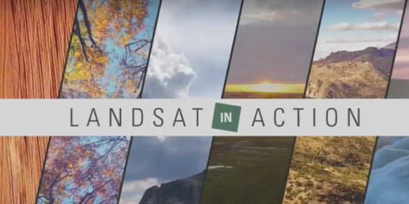
Watch Landsat Science Team members and researchers from around the world talk about the value of remotely sensed imagery to monitoring the health of the planet.
Images

Annual NLCD ScienceBase
Annual NLCD science products are available for download on the U.S Geological Survey (USGS repository. All six science products from 1985-2023 for the conterminous United States.

MRLC Viewer
The Multi-Resolution Land Characteristics (MRLC) Consortium has several different ways to access data, including a web-visualization tool. Users have the ability of several different download methods on the viewer: drawing a rectangle, drawing a polygon, entering GeoJSON information, and uploading a shapefile.
The Multi-Resolution Land Characteristics (MRLC) Consortium has several different ways to access data, including a web-visualization tool. Users have the ability of several different download methods on the viewer: drawing a rectangle, drawing a polygon, entering GeoJSON information, and uploading a shapefile.

Annual NLCD EVA Tool
The Multi-Resolution Land Characteristics (MRLC) Consortium provides users with the Enhanced Visualization and Analysis (EVA) tool, which allows users to interact with Annual NLCD science products at the county level between two different dates. The EVA tool creates landcover analysis and the user has the ability to generate a more detailed report.
The Multi-Resolution Land Characteristics (MRLC) Consortium provides users with the Enhanced Visualization and Analysis (EVA) tool, which allows users to interact with Annual NLCD science products at the county level between two different dates. The EVA tool creates landcover analysis and the user has the ability to generate a more detailed report.

MRLC Data Download site
The Multi-Resolution Land Characteristics (MRLC) consortium hosts land cover and land condition data from various sources, including Annual NLCD. Annual NLCD science products are found under the projects tab and user have the ability to download Annual NLCD CONUS mosaics from 1985-2023.
The Multi-Resolution Land Characteristics (MRLC) consortium hosts land cover and land condition data from various sources, including Annual NLCD. Annual NLCD science products are found under the projects tab and user have the ability to download Annual NLCD CONUS mosaics from 1985-2023.

TimeSync Viewer
Annual NLCD Reference and Validation (R&V) program is in the process of collecting an independent reference dataset of 10,000 plots at the Anderson Level II level. The TimeSync tool is used to record attribute information for each plot. On the interface, the drop in NDVI values are noticeable.
Annual NLCD Reference and Validation (R&V) program is in the process of collecting an independent reference dataset of 10,000 plots at the Anderson Level II level. The TimeSync tool is used to record attribute information for each plot. On the interface, the drop in NDVI values are noticeable.

Annual NLCD Land Cover Confidence Index
Annual NLCD land cover confidence product provides the level of confidence that Annual NLCD land cover class per pixel values that matches the training data.
Annual NLCD land cover confidence product provides the level of confidence that Annual NLCD land cover class per pixel values that matches the training data.
Videos
")
Landsat Captures Mexico's Trending Drought (Image of the Week)
Prolonged drought has lowered water levels in Laguna Bustillos in Chihuahua State, Mexico, killing thousands of fish.
Prolonged drought has lowered water levels in Laguna Bustillos in Chihuahua State, Mexico, killing thousands of fish.

RCMAP Background and Data Access
Rangeland managers need information on the current vegetation condition and how the landscape has changed through time.
Rangeland managers need information on the current vegetation condition and how the landscape has changed through time.
")
Record Wildfire in Texas (Image of the Week)
The Smokehouse Creek Fire started about 1 mile north of Stinnett, Texas on February 26th, 2024. Three days later, the fire had consumed over 1 million acres. With a total area of 1,654 square miles, it became the largest fire on record in Texas. That's larger than New York's Long Island.
The Smokehouse Creek Fire started about 1 mile north of Stinnett, Texas on February 26th, 2024. Three days later, the fire had consumed over 1 million acres. With a total area of 1,654 square miles, it became the largest fire on record in Texas. That's larger than New York's Long Island.

EMIT: Imaging Spectroscopy, Surface Mineralogy, and Greenhouse Gas Products and Resources Available from the LP DAAC
linkThis is a recording of a previous webinar entitled: “EMIT: Imaging Spectroscopy, Surface Mineralogy, and Greenhouse Gas Products and Resources Available from the LP DAAC”. This webinar was recorded on May 30, 2024.

Image of the Week: A Warm February in Northern Minnesota
Like many lakes in northern Minnesota, Mille Lacs near Brainerd experienced an uncommonly warm winter this year, with lower than average snowfall. Natural color Landsat images from the past ten Februarys reveal a stark change in 2024.
Like many lakes in northern Minnesota, Mille Lacs near Brainerd experienced an uncommonly warm winter this year, with lower than average snowfall. Natural color Landsat images from the past ten Februarys reveal a stark change in 2024.
")
Von Karman Vortices in the Atlantic (Image of the Week)
On March 3rd, near South Georgia and the South Sandwich Islands, Landsat 9 captured this dream-like image. This natural color view shows a weather pattern known as a “Von Karman vortex street," caused by prevailing winds from the southeast.
On March 3rd, near South Georgia and the South Sandwich Islands, Landsat 9 captured this dream-like image. This natural color view shows a weather pattern known as a “Von Karman vortex street," caused by prevailing winds from the southeast.
Audio

Eyes on Earth Episode 123 – Bathymetry Mapping
This Eyes on Earth episode is the third in our series on using Landsat for coastal studies. We talk to physical geographer Jeff Danielson about bathymetry and how it is critical for coastal modeling. Bathymetry captures the shape of underwater topography, and satellite-derived bathymetry helps fill in areas where there are data gaps.
This Eyes on Earth episode is the third in our series on using Landsat for coastal studies. We talk to physical geographer Jeff Danielson about bathymetry and how it is critical for coastal modeling. Bathymetry captures the shape of underwater topography, and satellite-derived bathymetry helps fill in areas where there are data gaps.

Eyes on Earth Episode 122 – EROS Interns, 2024
In this episode of Eyes on Earth, we talked with some of the interns who worked at EROS this summer. They shared their experiences learning about the cloud, AI, wildland fire research, terrestrial lidar scanning, and more. The common theme among them was recognizing the value of the EROS mission and noticing the passion their co-workers demonstrated in their work.
In this episode of Eyes on Earth, we talked with some of the interns who worked at EROS this summer. They shared their experiences learning about the cloud, AI, wildland fire research, terrestrial lidar scanning, and more. The common theme among them was recognizing the value of the EROS mission and noticing the passion their co-workers demonstrated in their work.

Eyes on Earth Episode 121 – Mapping the Australia Coastline
This episode of Eyes on Earth is the second in a series about how Landsat is helping researchers study coastal changes. The first one was about mapping changes to beaches in California and using Landsat to create models to predict how the coastline may change in the future because of sea level rise and coastal erosion.
This episode of Eyes on Earth is the second in a series about how Landsat is helping researchers study coastal changes. The first one was about mapping changes to beaches in California and using Landsat to create models to predict how the coastline may change in the future because of sea level rise and coastal erosion.

Eyes on Earth Episode 120 – Mapping the California Coastline
In this episode of Eyes on Earth, we begin a series on Landsat’s usefulness in coastal studies. First, we talk with Sean Vitousek, a USGS research oceanographer, about changes to beaches in California and how he is using Landsat and other data to create models that can predict how the coastline may change in the future because of sea level rise and coastal erosion.
In this episode of Eyes on Earth, we begin a series on Landsat’s usefulness in coastal studies. First, we talk with Sean Vitousek, a USGS research oceanographer, about changes to beaches in California and how he is using Landsat and other data to create models that can predict how the coastline may change in the future because of sea level rise and coastal erosion.

Eyes on Earth Episode 119 – Kristi Kline: EROS Career Reflections
In this episode of Eyes on Earth, we talk with Kristi Kline about the constant changes and innovations that have been needed at EROS to keep up with changes in computer tech and data processing. Kline has been a part of helping to implement these changes over the past 27 years and is now retiring at the end of May 2024.
In this episode of Eyes on Earth, we talk with Kristi Kline about the constant changes and innovations that have been needed at EROS to keep up with changes in computer tech and data processing. Kline has been a part of helping to implement these changes over the past 27 years and is now retiring at the end of May 2024.

Eyes on Earth Episode 118 – Preparing for Landsat Next, Part 2
In this episode of Eyes on Earth, we talk with several people involved with the next Landsat mission, targeted for launch around 2030. While that may seem like a ways into the future, it takes a lot of work to prepare for such a big mission.
In this episode of Eyes on Earth, we talk with several people involved with the next Landsat mission, targeted for launch around 2030. While that may seem like a ways into the future, it takes a lot of work to prepare for such a big mission.