U.S. flag

An official website of the United States government

Remote Sensing Research and Development

EROS has been an integral part of earth-observation science since the launch of the first Landsat satellite in 1972, and is renowned for its experience and proficiency in remote sensing technology. We have been providing technical expertise and services to the USGS and its partners across government, industry, and academia for decades, with a particular emphasis on the capability, r

Filter Total Items: 150

Data Discovery

USGS Earth Resources Observation and Science (EROS) Center provide tools that allow user to view, search, query, download, and utilize onlne interfaces for available remote sensing and geospatial data.
link

Data Discovery

USGS Earth Resources Observation and Science (EROS) Center provide tools that allow user to view, search, query, download, and utilize onlne interfaces for available remote sensing and geospatial data.
Learn More

USGS EROS Archive - Landsat - Landsat Level-3 Fractional Snow Covered Area (fSCA) Science Product

Landsat Collection 1 Level- 3 Fractional Snow Covered Area (fSCA) data contains an acquisition-based per-pixel snow cover fraction, an acquisition-based revised cloud mask for quality assessment, and a product metadata file. NOTE: Landsat Collection 1 data and products are no longer available to download from the USGS as of December 30, 2022. Landsat Collection 2 remains available. Please access...
link

USGS EROS Archive - Landsat - Landsat Level-3 Fractional Snow Covered Area (fSCA) Science Product

Landsat Collection 1 Level- 3 Fractional Snow Covered Area (fSCA) data contains an acquisition-based per-pixel snow cover fraction, an acquisition-based revised cloud mask for quality assessment, and a product metadata file. NOTE: Landsat Collection 1 data and products are no longer available to download from the USGS as of December 30, 2022. Landsat Collection 2 remains available. Please access...
Learn More

USGS EROS Archive - Landsat - Landsat Level-3 Burned Area (BA) Science Product

Landsat Collection 1 Level-3 Burned Area (BA) contains two acquisition-based raster data products that represent burn classification and burn probability. NOTE: Landsat Collection 1 data and products are no longer available to download from the USGS as of December 30, 2022. Landsat Collection 2 remains available. Please access the Landsat Collection 2 webpage below for information about Collection...
link

USGS EROS Archive - Landsat - Landsat Level-3 Burned Area (BA) Science Product

Landsat Collection 1 Level-3 Burned Area (BA) contains two acquisition-based raster data products that represent burn classification and burn probability. NOTE: Landsat Collection 1 data and products are no longer available to download from the USGS as of December 30, 2022. Landsat Collection 2 remains available. Please access the Landsat Collection 2 webpage below for information about Collection...
Learn More

Landsat Science Team

Landsat Science Teams consist of USGS and NASA scientists and engineers, external scientists, engineers, and application specialists, representing industry and university research initiatives. Members contribute technical and scientific input to ensure success and provide science support on issues including data acquisition, product access and format, and science and applications opportunities.
link

Landsat Science Team

Landsat Science Teams consist of USGS and NASA scientists and engineers, external scientists, engineers, and application specialists, representing industry and university research initiatives. Members contribute technical and scientific input to ensure success and provide science support on issues including data acquisition, product access and format, and science and applications opportunities.
Learn More

USGS EROS Archive - Landsat - Landsat Level-3 Dynamic Surface Water Extent (DSWE) Science Product

Landsat Collection 1 Level-3 Dynamic Surface Water Extent (DSWE) contains six acquisition-based raster data products pertaining to the existence and condition of surface water, as well as all intermediate bands used to produce DSWE. NOTE: Landsat Collection 1 data and products are no longer available to download from the USGS as of December 30, 2022. Landsat Collection 2 remains available. Please...
link

USGS EROS Archive - Landsat - Landsat Level-3 Dynamic Surface Water Extent (DSWE) Science Product

Landsat Collection 1 Level-3 Dynamic Surface Water Extent (DSWE) contains six acquisition-based raster data products pertaining to the existence and condition of surface water, as well as all intermediate bands used to produce DSWE. NOTE: Landsat Collection 1 data and products are no longer available to download from the USGS as of December 30, 2022. Landsat Collection 2 remains available. Please...
Learn More

USGS EROS Archive - Data Use and Citation

There are no restrictions on the use of data received from the U.S. Geological Survey's Earth Resources Observation and Science (EROS) Center or NASA's Land Processes Distributed Active Archive Center (LP DAAC), unless expressly identified prior to or at the time of receipt. Depending on the product source, we request that the following statements be used when citing, copying, or reprinting data:
link

USGS EROS Archive - Data Use and Citation

There are no restrictions on the use of data received from the U.S. Geological Survey's Earth Resources Observation and Science (EROS) Center or NASA's Land Processes Distributed Active Archive Center (LP DAAC), unless expressly identified prior to or at the time of receipt. Depending on the product source, we request that the following statements be used when citing, copying, or reprinting data:
Learn More

USGS EROS Archive - Digital Elevation - Shuttle Radar Topography Mission (SRTM) Non-Void Filled

Shuttle Radar Topography Mission data were used to generate digital elevation data with a resolution of 1 arc-second for the United States and 3 arc-seconds for global coverage.
link

USGS EROS Archive - Digital Elevation - Shuttle Radar Topography Mission (SRTM) Non-Void Filled

Shuttle Radar Topography Mission data were used to generate digital elevation data with a resolution of 1 arc-second for the United States and 3 arc-seconds for global coverage.
Learn More

USGS EROS Archive - Digital Elevation - Shuttle Radar Topography Mission (SRTM) 1 Arc-Second Global

SRTM data have been enhanced to fill areas of missing data to provide digital elevation data with a resolution of 1 arc-second for global coverage.
link

USGS EROS Archive - Digital Elevation - Shuttle Radar Topography Mission (SRTM) 1 Arc-Second Global

SRTM data have been enhanced to fill areas of missing data to provide digital elevation data with a resolution of 1 arc-second for global coverage.
Learn More

USGS EROS Archive - Landsat Archives - Landsat Level-2 Provisional Surface Temperature (ST)

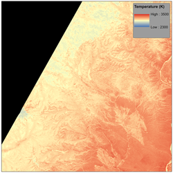
Landsat Level-2 Provisional Surface Temperature (ST) contains nine acquisition-based raster data products that represent the temperature of the Earth’s land surface in Kelvin, as well as quality assessment information. NOTE: Landsat Collection 1 data and products are no longer available to download from the USGS as of December 30, 2022. Landsat Collection 2 remains available. Please access the...
link

USGS EROS Archive - Landsat Archives - Landsat Level-2 Provisional Surface Temperature (ST)

Landsat Level-2 Provisional Surface Temperature (ST) contains nine acquisition-based raster data products that represent the temperature of the Earth’s land surface in Kelvin, as well as quality assessment information. NOTE: Landsat Collection 1 data and products are no longer available to download from the USGS as of December 30, 2022. Landsat Collection 2 remains available. Please access the...
Learn More

USGS EROS Archive - Earth Observing One (EO-1) - Differences Hyperion Data Sets

Differences Between Level 1 and Level 1A Hyperion Data Sets This correspondence tabularizes in Table 1 the difference between the Level 1 and the Level 1A Hyperion output denoted by a .L1 and .L1_A extension respectively. An updated calibration file was released simultaneously with the release of the upgraded processing system. This correspondence also tabularizes the difference between the two...
link

USGS EROS Archive - Earth Observing One (EO-1) - Differences Hyperion Data Sets

Differences Between Level 1 and Level 1A Hyperion Data Sets This correspondence tabularizes in Table 1 the difference between the Level 1 and the Level 1A Hyperion output denoted by a .L1 and .L1_A extension respectively. An updated calibration file was released simultaneously with the release of the upgraded processing system. This correspondence also tabularizes the difference between the two...
Learn More

USGS EROS Archive - Landsat Archives - Landsat 1-5 Multispectral Scanner (MSS) Level-1 Data Products

Multispectral Scanner (MSS) Level-1, collected at 80-meter, multispectral data from Landsats 1 - 5. Data was processed to 60-meter pixel size. (1972-1992). NOTE: Landsat Collection 1 data and products are no longer available to download from the USGS as of December 30, 2022. Landsat Collection 2 remains available. Please access the Landsat Collection 2 webpage below for information about...
link

USGS EROS Archive - Landsat Archives - Landsat 1-5 Multispectral Scanner (MSS) Level-1 Data Products

Multispectral Scanner (MSS) Level-1, collected at 80-meter, multispectral data from Landsats 1 - 5. Data was processed to 60-meter pixel size. (1972-1992). NOTE: Landsat Collection 1 data and products are no longer available to download from the USGS as of December 30, 2022. Landsat Collection 2 remains available. Please access the Landsat Collection 2 webpage below for information about...
Learn More

USGS EROS Archive - ISRO Resourcesat 1 and Resourcesat 2 - LISS-3

The Indian Space Research Organisation’s (ISRO) Indian Remote Sensing (IRS) Resourcesat-1 (2003- present) and Resourcesat-2 (2011-present) satellites provide multispectral images at 24- ( LISS-3 ) and 56- AWiFs) meter resolution.
link

USGS EROS Archive - ISRO Resourcesat 1 and Resourcesat 2 - LISS-3

The Indian Space Research Organisation’s (ISRO) Indian Remote Sensing (IRS) Resourcesat-1 (2003- present) and Resourcesat-2 (2011-present) satellites provide multispectral images at 24- ( LISS-3 ) and 56- AWiFs) meter resolution.
Learn More