
Products and Datasets
Products and Datasets
Filter Total Items: 167

USGS Sagebrush Science: Supporting Public Safety and Economic Decision Making Across the West
The sagebrush biome is one of the largest ecosystems in North America. Encompassing nearly one-third of the continental U.S., it provides critical resources for millions of Americans and a home for hundreds of plants and animal species in the West. Natural resource management in sagebrush ecosystems can be complex, and science can support management decisions by providing knowledge and tools to...
By
Core Science Systems Mission Area, Ecosystems Mission Area, Biological Threats and Invasive Species Research Program, Climate Adaptation Science Centers, Cooperative Research Units, Land Management Research Program, Species Management Research Program, Earth Resources Observation and Science (EROS) Center, Forest and Rangeland Ecosystem Science Center, Fort Collins Science Center, Northern Rocky Mountain Science Center, Southwest Biological Science Center, Western Ecological Research Center (WERC), Wildland Fire Science

EROS Registration System (ERS)
The U.S. Geological Survey (USGS) Earth Resources Observation and Science (EROS) Registration System (ERS) centralizes all existing user profile and authentication for USGS EROS Web services into a single independent application.
EROS Registration System (ERS) Password Expiration
The EROS Registration System (ERS) system requires a login with a username and password. The password may have an expiration date assigned. The documentation will explain the process and how a user can reset their expiration date.

Eyes on Earth Episode 130 – NLCD Accuracy
Providing accuracy metrics for a land cover map takes some work. But there’s poetry and story involved, too.

Eyes on Earth Episode 128 – 2024 EROS Fall Poster Session
Posters covered a wide range of topics as local graduate students and EROS scientists shared their work in the EROS atrium.

Eyes on Earth Episode 126 – Annual NLCD
The next generation of USGS land cover mapping is here. Annual NLCD provides land cover data of the U.S. every year back to 1985.
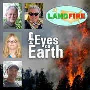
Eyes on Earth Episode 125 – The LANDFIRE Program at 20
LANDFIRE is a diverse product suite with countless uses that go beyond fire management. The program has now been providing this satellite data for 20 years.

USGS EROS Archive - Landsat - Atmospheric Auxiliary Data – GEOS-5 IT C2
Data from Goddard Earth Observing V5 (GEOS-5 IT) are used in the Landsat 8 and Landsat 9 surface temperature algorithm.

USGS EROS Archive - Vegetation Monitoring - eVIIRS Global NDVI
The EROS Visible Infrared Imaging Radiometer Suite (eVIIRS) Global Normalized Difference Vegetation Index (NDVI) collection is based on the Visible Infrared Imaging Radiometer Suite (VIIRS) data acquired by the Joint Polar Satellite System (JPSS), a collaborative program between the National Oceanic and Atmospheric Administration (NOAA) and National Aeronautics and Space Administration (NASA). The...

USGS EROS Archive - Vegetation Monitoring - eVIIRS Global NDWI
The EROS Visible Infrared Imaging Radiometer Suite (eVIIRS) Global Normalized Difference Water Index (NDWI) collection is based on the Visible Infrared Imaging Radiometer Suite (VIIRS) data acquired by the Joint Polar Satellite System (JPSS), a collaborative program between the National Oceanic and Atmospheric Administration (NOAA) and National Aeronautics and Space Administration (NASA). The...

USGS EROS Archive - Landsat Archives - Landsat Collection 2 Digital Elevation Model
Several digital elevation model sources are used in the processing of Landsat Collection 2 Level-1, Level-2, and Level-3 products. These sources, based on specific geographic regions, contribute to improved vertical accuracy in Collection 2 when compared to data processed in the past. Together, these sources are all known as the Landsat Collection 2 Digital Elevation Model (DEM).

Eyes on Earth Episode 83 - ECOSTRESS and Burn Severity
Eyes on Earth is a podcast on remote sensing, Earth observation, land change and science, brought to you by the USGS Earth Resources Observation and Science (EROS) Center. In this episode, we learn about the usefulness of ECOSTRESS data in examining predictors for wildfire burn patterns.