
Remote Sensing
Remote Sensing
Filter Total Items: 178

USGS Sagebrush Science: Supporting Public Safety and Economic Decision Making Across the West
The sagebrush biome is one of the largest ecosystems in North America. Encompassing nearly one-third of the continental U.S., it provides critical resources for millions of Americans and a home for hundreds of plants and animal species in the West. Natural resource management in sagebrush ecosystems can be complex, and science can support management decisions by providing knowledge and tools to...
By
Core Science Systems Mission Area, Ecosystems Mission Area, Biological Threats and Invasive Species Research Program, Climate Adaptation Science Centers, Cooperative Research Units, Land Management Research Program, Species Management Research Program, Earth Resources Observation and Science (EROS) Center, Forest and Rangeland Ecosystem Science Center, Fort Collins Science Center, Northern Rocky Mountain Science Center, Southwest Biological Science Center, Western Ecological Research Center (WERC), Wildland Fire Science
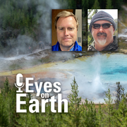
Eyes on Earth Episode 137 – Landsat Takes Yellowstone’s Temperature
How do you keep track of thousands of hot spots in an area the size of Yellowstone National Park? Check out thermal satellite data like Landsat’s!

CIDR Request Data – Imaging Requirements
CIDR Request Data – Imaging Requirements
CIDR Request Data – Spatial Requirements
CIDR Request Data – Spatial Requirements
EROS Registration System (ERS)
The U.S. Geological Survey (USGS) Earth Resources Observation and Science (EROS) Registration System (ERS) centralizes all existing user profile and authentication for USGS EROS Web services into a single independent application.
EROS Registration System (ERS) Password Expiration
The EROS Registration System (ERS) system requires a login with a username and password. The password may have an expiration date assigned. The documentation will explain the process and how a user can reset their expiration date.
CIDR Data Acquisition Request Summary
CIDR Data Acquisition Request Summary displays the entered information from Request Data page.
CIDR User Interface Overview
CIDR User Interface Overview
CIDR Data Acquisition Request (DAR) Process Flow
CIDR Data Acquisition Request (DAR) Process Flow document follows a DAR from beginning to end.
CIDR - Requesting Access
The CIDR Tool is restricted to U.S. Federal Civil agencies and require prior approval to access and request data.
CIDR Request Data – Submit Request
CIDR Request Data – Submit Request

Eyes on Earth Episode 136 – The EROS Test Site
The same as the Landsat satellite, only smaller—that’s a fair description of the field spectrometer used at the EROS test site for validating Landsat’s accuracy.