
The Colorado River near Moab, Utah. The entire Colorado River Basin currently supports 50 million people, and that amount is expected to increase by 23 million between 2000 and 2030. A new USGS study shows more than half of the streamflow in the Upper Colorado River Basin originates as groundwater. Photo by M. Miller.
Images
Here, you'll find images related to research going on at the Fort Collins Science Center. Our team of scientists are working on multiple areas of environmental interest, ranging from land conservation effectiveness to invasive reptiles.
Filter Total Items: 317

Upper Colorado River near Moab, Utah
The Colorado River near Moab, Utah. The entire Colorado River Basin currently supports 50 million people, and that amount is expected to increase by 23 million between 2000 and 2030. A new USGS study shows more than half of the streamflow in the Upper Colorado River Basin originates as groundwater. Photo by M. Miller.

The last sheath-tailed bat photo
This photo of a Pacific sheath-tailed bat is the last good photo of this bat from Aguiguan in existence.
This photo of a Pacific sheath-tailed bat is the last good photo of this bat from Aguiguan in existence.

A brown treesnake in a tree in Guam.
This is an image of a brown treesnake in a tree in Guam, taken in 2009.
This is an image of a brown treesnake in a tree in Guam, taken in 2009.

A brown treesnake in a Streptopelia bitorquata nest
A brown treesnake in a Streptopelia bitorquata nestA brown treesnake in a Streptopelia bitorquata (island collared dove) nest. Yona, Guam, 2009. Photo by James Stanford, USGS.
A brown treesnake in a Streptopelia bitorquata nest
A brown treesnake in a Streptopelia bitorquata nestA brown treesnake in a Streptopelia bitorquata (island collared dove) nest. Yona, Guam, 2009. Photo by James Stanford, USGS.
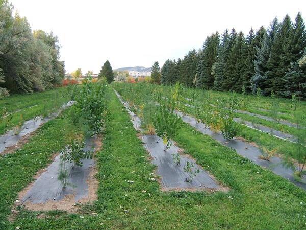
The Cottonwood Common Garden in 2009
A Common Garden at the Colorado State Nursery in Fort Collins, Colorado, established in 2005 to study evolution of phenology of riparian cottonwood and saltcedar. Plants were collected along a latitudinal gradient from Texas to Montana.
A Common Garden at the Colorado State Nursery in Fort Collins, Colorado, established in 2005 to study evolution of phenology of riparian cottonwood and saltcedar. Plants were collected along a latitudinal gradient from Texas to Montana.

A brown treesnake in a tree in Guam.
A brown treesnake in a tree in Guam. Photo by Bob Reed, USGS, 2009.
A brown treesnake in a tree in Guam. Photo by Bob Reed, USGS, 2009.

USGS divers in the Elwha River
USGS divers Steve Rubin and Reg Reisenbichler laying out a survey transect in the Elwha River in northern Washington.
USGS divers Steve Rubin and Reg Reisenbichler laying out a survey transect in the Elwha River in northern Washington.

Rough skinned newt in defensive posture, EPA ponds, Corvallis, OR
Rough skinned newt in defensive posture, EPA ponds, Corvallis, ORRough-skinned newt in defensive posture, EPA ponds, Corvallis, OR. Rough-skinned newts produce a powerful neurotoxin as a defense against predators.
Rough skinned newt in defensive posture, EPA ponds, Corvallis, OR
Rough skinned newt in defensive posture, EPA ponds, Corvallis, ORRough-skinned newt in defensive posture, EPA ponds, Corvallis, OR. Rough-skinned newts produce a powerful neurotoxin as a defense against predators.

Golden aspen, Jemez Mountains, NM.
Golden aspen, Jemez Mountains, NM.

Gunnison Sage-Grouse Habitat
Road intersecting a snowy landscape; Gunnison Sage-Grouse habitat. Photo by Cameron Aldridge.
Road intersecting a snowy landscape; Gunnison Sage-Grouse habitat. Photo by Cameron Aldridge.

Gunnison Sage-grouse habitat 209
Habitat of the Gunnison Sage-grouse, including sagebrush cover. Photo by Cameron Aldridge (USGS).
Habitat of the Gunnison Sage-grouse, including sagebrush cover. Photo by Cameron Aldridge (USGS).

GUSG_Aug_07_Habitat_209.JPG
Dirt road cuts through Gunnison sage grouse habitat. Photo by Cameron Aldridge (USGS).
Dirt road cuts through Gunnison sage grouse habitat. Photo by Cameron Aldridge (USGS).

Wind turbine on farm land next to a dilapidated barn
Wind turbine on farm land next to a dilapidated barnWind turbine next to a dilapidated barn
Wind turbine on farm land next to a dilapidated barn
Wind turbine on farm land next to a dilapidated barnWind turbine next to a dilapidated barn

Big sagebrush landscape in southeast Oregon
Big sagebrush landscape in southeast Oregon, Owyhee Uplands. Photo by Steve Hanser (USGS).
Big sagebrush landscape in southeast Oregon, Owyhee Uplands. Photo by Steve Hanser (USGS).

Tree ring dating
Tamarisk stem cross-section cut 2.8 m below the ground surface showing how sediment deposition is dated using tree rings. Following initial burial of 68 cm in 1969, ring-width decreased, vessel size increased, and annual transitions became less distinct. After a second burial by 41 cm in 1972, annual transitions became indistinguishable.
Tamarisk stem cross-section cut 2.8 m below the ground surface showing how sediment deposition is dated using tree rings. Following initial burial of 68 cm in 1969, ring-width decreased, vessel size increased, and annual transitions became less distinct. After a second burial by 41 cm in 1972, annual transitions became indistinguishable.

Male sharp-tailed grouse during spring breeding season
Male sharp-tailed grouse during spring breeding seasonImage of a Male Sharp-tailed grouse during spring breeding season in North Dakota
Male sharp-tailed grouse during spring breeding season
Male sharp-tailed grouse during spring breeding seasonImage of a Male Sharp-tailed grouse during spring breeding season in North Dakota

Long-legged myotis (Myotis volans) captured in a mist net.
Long-legged myotis (Myotis volans) captured in a mist net.An entangled long-legged myotis (Myotis volans) captured during the course of a mist net survey.
Long-legged myotis (Myotis volans) captured in a mist net.
Long-legged myotis (Myotis volans) captured in a mist net.An entangled long-legged myotis (Myotis volans) captured during the course of a mist net survey.

Cheatgrass in Eastern Nevada
Cheatgrass invasion in sagebrush north of Great Basin National Park in eastern Nevada. Photo by Steve Hanser (USGS)
Cheatgrass invasion in sagebrush north of Great Basin National Park in eastern Nevada. Photo by Steve Hanser (USGS)

A color banded plover in the hand of a scientist.
A color banded plover in the hand of a scientist.
A color banded plover in the hand of a scientist.

Boreal toad (Bufo boreas) mating ball
Boreal toad (Bufo boreas) mating ball, Bridger-Teton National Forest, Wyoming.
Boreal toad (Bufo boreas) mating ball, Bridger-Teton National Forest, Wyoming.

Road-wellsite fragmentation
Road and multiple oil well sites fragmenting sage brush habitat. Photo by Cameron Aldridge (USGS)
Road and multiple oil well sites fragmenting sage brush habitat. Photo by Cameron Aldridge (USGS)