U.S. flag

An official website of the United States government

Fort Collins Science Center

Welcome to the Fort Collins Science Center (FORT) located in Fort Collins, Colorado, just east of the Rocky Mountains. At FORT we develop and disseminate research-based information and tools needed to understand the nation’s biological resources in support of effective decision making.

News

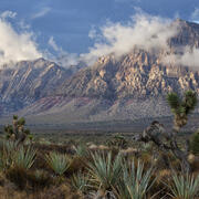
USGS Scientists Facilitate Stakeholder Engagement During Coproduction of BLM National Monument Science Strategies, Red Rock Canyon National Conservation Area

USGS Scientists Facilitate Stakeholder Engagement During Coproduction of BLM National Monument Science Strategies, Red Rock Canyon National Conservation Area

FORT scientists facilitate staff engagement in BLM National Monument Science Strategies, Cotoni-Coast Dairies

FORT scientists facilitate staff engagement in BLM National Monument Science Strategies, Cotoni-Coast Dairies

USGS researchers and collaborators organize two-day webinar series on bat acoustic data analyses for North American Native nations

USGS researchers and collaborators organize two-day webinar series on bat acoustic data analyses for North American Native nations

Publications

Urban tick exposure on Staten Island is higher in pet owners

Over the past decade, Lyme and other tick-borne diseases have expanded into urban areas, including Staten Island, New York. While Lyme disease is often researched with a focus on human risk, domestic pets are also at risk of contracting the disease. The present study aims to describe differences in tick exposure, knowledge, attitude, and practices (KAP) between pet owners and non-owners, and to un
Authors
Noriko Tamari, Kacey C. Ernst, Aaron Joey Enriquez, Maria A. Diuk-Wasser, Maria P. Fernandez, Kevin Berry, Mary H. Hayden

Environmental Flows for Riverine EcoSystem Habitats (E-FRESH) decision support tool user guide

No abstract available.
Authors
Tyler Wible, Christopher Holmquist-Johnson, Heidi Klingel, Ryan R. Morrison, David Merritt, Matthew Korsa

Effects of noise from oil and gas development on raptors and songbirds—A science synthesis to inform National Environmental Policy Act analyses

The U.S. Geological Survey is working with Federal land management agencies to develop a series of science syntheses to support environmental effects analyses that agencies conduct to comply with the National Environmental Policy Act (NEPA). This report synthesizes science information about the potential effects of noise from oil and gas development on North American raptors, songbirds, and other
Authors
Logan M. Maxwell, Tait K. Rutherford, Nathan J. Kleist, Elisabeth C. Teige, Richard J. Lehrter, Megan A. Gilbert, David J.A. Wood, Aaron N. Johnston, John C. Tull, Travis S. Haby, Sarah K. Carter

Science

Developing habitat models for rare plants to inform decision making on multiple-use public lands

Public lands provide important habitat for many rare plants. However, public lands often need to accommodate many other uses, including traditional and renewable energy development, in addition to conservation. We are working with the Bureau of Land Management to coproduce ensemble habitat suitability models that can inform agency planning and permitting decisions that may impact rare plants.
link

Developing habitat models for rare plants to inform decision making on multiple-use public lands

Public lands provide important habitat for many rare plants. However, public lands often need to accommodate many other uses, including traditional and renewable energy development, in addition to conservation. We are working with the Bureau of Land Management to coproduce ensemble habitat suitability models that can inform agency planning and permitting decisions that may impact rare plants.
Learn More

Developing a step-by-step process for assessing cumulative effects in the Bureau of Land Management

The National Environmental Policy Act (NEPA) requires federal agencies to assess potential impacts of proposed actions as part of their decision-making processes. Assessing potential cumulative effects is a challenging component of NEPA analyses. The USGS is working with the Bureau of Land Management to develop a process that public land managers can use to strengthen cumulative effects analyses.
link

Developing a step-by-step process for assessing cumulative effects in the Bureau of Land Management

The National Environmental Policy Act (NEPA) requires federal agencies to assess potential impacts of proposed actions as part of their decision-making processes. Assessing potential cumulative effects is a challenging component of NEPA analyses. The USGS is working with the Bureau of Land Management to develop a process that public land managers can use to strengthen cumulative effects analyses.
Learn More

Modeling chronic wasting disease prevalence through time to investigate mechanisms of spread in deer and elk in Wyoming

Diseases are challenging to manage in wild ungulate populations, particularly when there are many ways the disease can spread. Wildlife management agencies often need to take action to control disease spread, but it is unclear which actions are most effective in constraining disease because the importance of different spread mechanisms is not fully understood. This project will aid state wildlife...
link

Modeling chronic wasting disease prevalence through time to investigate mechanisms of spread in deer and elk in Wyoming

Diseases are challenging to manage in wild ungulate populations, particularly when there are many ways the disease can spread. Wildlife management agencies often need to take action to control disease spread, but it is unclear which actions are most effective in constraining disease because the importance of different spread mechanisms is not fully understood. This project will aid state wildlife...
Learn More

Multimedia

Microscopic view of tree rings, with a scale bar of 0.5 mm
Tree rings
Tree rings
title slide of USGS presentation on satellite observations of lake surface water dynamics Saline Lakes IWAA Fall 2024 Webinar Series: Satellite Observations of Lake Surface Water Dynamics
Saline Lakes IWAA Fall 2024 Webinar Series: Satellite Observations of Lake Surface Water Dynamics
title slide of a presentation on Great Basin terminal lakes waterbird prey availability Saline Lakes IWAA Fall 2024 Webinar Series: Waterbird Prey Availability
Saline Lakes IWAA Fall 2024 Webinar Series: Waterbird Prey Availability
title slide of presentation on USGS Saline Lake Ecosystems Integrated Water Availability Assessment webinar on bird movements Saline Lakes Ecosystems IWAA Fall 2024 Webinar Series: Bird Movements
Saline Lakes Ecosystems IWAA Fall 2024 Webinar Series: Bird Movements
screenshot of title slide for saline lakes water-quality monitoring presentation Saline Lakes Ecosystems IWAA Fall 2024 Webinar Series: Water-Quality Monitoring of Great Basin Terminal Lake Ecosystems
Saline Lakes Ecosystems IWAA Fall 2024 Webinar Series: Water-Quality Monitoring of Great Basin Terminal Lake Ecosystems
screenshot of the title slide of a presentation on saline lake ecosystems water budgets Saline Lake Ecosystems IWAA Fall 2024 Webinar Series: Physical and Chemical Monitoring in Support of Water Budgets of Select Great Basin Saline Lakes
Saline Lake Ecosystems IWAA Fall 2024 Webinar Series: Physical and Chemical Monitoring in Support of Water Budgets of Select Great Basin Saline Lakes
flat, bushy landscape with partly cloudy sunset above
Sagebrush in Seedskadee National Wildlife Refuge
screenshot of title slide of Saline Lake Ecosystems IWAA project overview presentation Saline Lake Ecosystems IWAA Fall 2024 Webinar Series: Project Overview
Saline Lake Ecosystems IWAA Fall 2024 Webinar Series: Project Overview
mountains jut into a partly cloudy ski. Shrubs and succulents in the foreground.
Red Rock Canyon National Conservation Area
Was this page helpful?