Cableway on North Santiam River at Niagara, Oregon
Cableway on North Santiam River at Niagara, OregonCableway on North Santiam River at Niagara, Oregon (Site number 14181500)

Official websites use .gov
A .gov website belongs to an official government organization in the United States.
Secure .gov websites use HTTPS
A lock () or https:// means you’ve safely connected to the .gov website. Share sensitive information only on official, secure websites.
Check out photos of some of the awesome work USGS scientists and field technicians have done over the years.

Cableway on North Santiam River at Niagara, Oregon (Site number 14181500)
Cableway on North Santiam River at Niagara, Oregon (Site number 14181500)

Stream gage on McKenzie River near Vida, Oregon (Site number 14162500)
Stream gage on McKenzie River near Vida, Oregon (Site number 14162500)

Stream gage on Blue River at Blue River, Oregon, (Site number 14162200)
Stream gage on Blue River at Blue River, Oregon, (Site number 14162200)

Stream gage on South Fork McKenzie River near Rainbow, Oregon (Site number 14159500)
Stream gage on South Fork McKenzie River near Rainbow, Oregon (Site number 14159500)

Crater Lake on a bright clear day in August 2020. Crater Lake inspires awe. Native Americans witnessed its formation 7,700 years ago, when a violent eruption triggered the collapse of a tall peak. Scientists marvel at its purity—fed by rain and snow, it’s the deepest lake in the USA and one of the most pristine on Earth.
Crater Lake on a bright clear day in August 2020. Crater Lake inspires awe. Native Americans witnessed its formation 7,700 years ago, when a violent eruption triggered the collapse of a tall peak. Scientists marvel at its purity—fed by rain and snow, it’s the deepest lake in the USA and one of the most pristine on Earth.

Crater Lake inspires awe. Native Americans witnessed its formation 7,700 years ago, when a violent eruption triggered the collapse of a tall peak. Scientists marvel at its purity—fed by rain and snow, it’s the deepest lake in the USA and one of the most pristine on Earth.
Crater Lake inspires awe. Native Americans witnessed its formation 7,700 years ago, when a violent eruption triggered the collapse of a tall peak. Scientists marvel at its purity—fed by rain and snow, it’s the deepest lake in the USA and one of the most pristine on Earth.

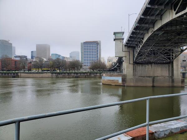
This monitoring station collects water-quality and streamflow data. View data..
This monitoring station collects water-quality and streamflow data. View data..
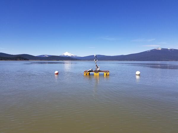
The USGS monitors water-quality parameters on upper Klamath Lake during algae bloom season.
The USGS monitors water-quality parameters on upper Klamath Lake during algae bloom season.
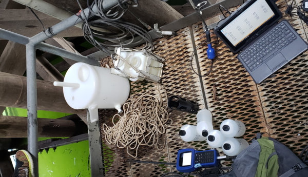
A hydrologic technician snapped a quick photo during routine field work for water-quality monitoring.
A hydrologic technician snapped a quick photo during routine field work for water-quality monitoring.

A RiverPro acoustic doppler current profiler (ADCP) is propped in the snow near the Klamath River in Keno, Oregon. The ADCP is used to measure streamflow.
A RiverPro acoustic doppler current profiler (ADCP) is propped in the snow near the Klamath River in Keno, Oregon. The ADCP is used to measure streamflow.

This is a view of a USGS surface water stream gage that contains equipment to monitor discharge at the Williamson River below the Sprague Ruver in Chiloquin, Oregon. The gage house contains a historic stilling well and a device that records the level of water. It also has a water temerature sensor and a turbidimeter.
This is a view of a USGS surface water stream gage that contains equipment to monitor discharge at the Williamson River below the Sprague Ruver in Chiloquin, Oregon. The gage house contains a historic stilling well and a device that records the level of water. It also has a water temerature sensor and a turbidimeter.

View of lake at Fernhill Natural Treatment Wetlands.
View of lake at Fernhill Natural Treatment Wetlands.

While surveying high water marks in Oakridge, Oregon, bumble bees buzzed around the river banks. The bees often mistake our bright colored equipment and florescent safety gear for tasty yellow flowers.
While surveying high water marks in Oakridge, Oregon, bumble bees buzzed around the river banks. The bees often mistake our bright colored equipment and florescent safety gear for tasty yellow flowers.

While surveying high water marks in Oakridge, Oregon, bumble bees buzzed around the river banks. The bees often mistake our bright colored equipment and florescent safety gear for tasty yellow flowers.
While surveying high water marks in Oakridge, Oregon, bumble bees buzzed around the river banks. The bees often mistake our bright colored equipment and florescent safety gear for tasty yellow flowers.

View of lake at Fernhill Natural Treatment Wetlands.
View of lake at Fernhill Natural Treatment Wetlands.

View of lake at Fernhill Natural Treatment Wetlands.
View of lake at Fernhill Natural Treatment Wetlands.

View of lake at Fernhill Natural Treatment Wetlands.
View of lake at Fernhill Natural Treatment Wetlands.
Technicians lower an aluminum holder to collect river water in medium-sized bottles. The water is then mixed in a churn bucket to evenly suspend any particles. Once thoroughly mixed, smaller sample bottles are filled from the churn’s spigot and transported to the lab for analysis.
Technicians lower an aluminum holder to collect river water in medium-sized bottles. The water is then mixed in a churn bucket to evenly suspend any particles. Once thoroughly mixed, smaller sample bottles are filled from the churn’s spigot and transported to the lab for analysis.

This station monitors streamflow and water-quality on the Link - Keno reach of the Klamath River. View the data.
This station monitors streamflow and water-quality on the Link - Keno reach of the Klamath River. View the data.

View of lake at Fernhill Natural Treatment Wetlands.
View of lake at Fernhill Natural Treatment Wetlands.

View of lake at Fernhill Natural Treatment Wetlands.
View of lake at Fernhill Natural Treatment Wetlands.