Glyphosate is frequently applied to corn and soybeans
Glyphosate is frequently applied to corn and soybeansGlyphosate is frequently applied to corn and soybeans growing areas like these in Iowa.

Official websites use .gov
A .gov website belongs to an official government organization in the United States.
Secure .gov websites use HTTPS
A lock () or https:// means you’ve safely connected to the .gov website. Share sensitive information only on official, secure websites.
Check out photos of some of the awesome work USGS scientists and field technicians have done over the years.

Glyphosate is frequently applied to corn and soybeans growing areas like these in Iowa.
Glyphosate is frequently applied to corn and soybeans growing areas like these in Iowa.

Poster for Tualatin plankton study.
Carpenter, K.D. and Rounds, S.A., 2014, Plankton communities and summertime declines in algal abundance associated with low dissolved oxygen in the Tualatin River, Oregon.
Poster for Tualatin plankton study.
Carpenter, K.D. and Rounds, S.A., 2014, Plankton communities and summertime declines in algal abundance associated with low dissolved oxygen in the Tualatin River, Oregon.

Poster for Wapato Lake Monitoring Project.
Rounds, S.A., 2014, Monitoring streamflow, water levels, and water quality in the Wapato Lake National Wildlife Refuge, Oregon.
Poster for Wapato Lake Monitoring Project.
Rounds, S.A., 2014, Monitoring streamflow, water levels, and water quality in the Wapato Lake National Wildlife Refuge, Oregon.

Over 1 million acres of the Willamette Basin is dedicated to agriculture. This farm rests in the floodplain of the Middle Willamette River near Albany, Oregon.
Over 1 million acres of the Willamette Basin is dedicated to agriculture. This farm rests in the floodplain of the Middle Willamette River near Albany, Oregon.

Poster for organic matter study along Fanno Creek.
Keith, M., Sobieszczyk, S., Rounds, S., and Goldman, J., 2014, Sources, sinks, and transport of organic matter with fine sediment along an urban stream.
Poster for organic matter study along Fanno Creek.
Keith, M., Sobieszczyk, S., Rounds, S., and Goldman, J., 2014, Sources, sinks, and transport of organic matter with fine sediment along an urban stream.

Confluence of Wilson River with tributary Cedar Creek, OR, following heavy storm.
Confluence of Wilson River with tributary Cedar Creek, OR, following heavy storm.

The small house is the monitoring station for Columbia River at The Dalles. The house protects sensitive electronics from the elements.
The small house is the monitoring station for Columbia River at The Dalles. The house protects sensitive electronics from the elements.

A turbid Lost Dog Creek tumbles down steep slopes before feeding Lake Oswego.
A turbid Lost Dog Creek tumbles down steep slopes before feeding Lake Oswego.

Tanner Creek outfall delivers stormwater runoff with insecticides to Tanner Creek, tributary of the Willamette River
Tanner Creek outfall delivers stormwater runoff with insecticides to Tanner Creek, tributary of the Willamette River

Large quantities of sediment released from the water year 2012 Fall Creek Lake, Oregon, streambed drawdown filled the Fall Creek channel just downstream from the dam. Vegetation can be seen growing on the sediment.
Large quantities of sediment released from the water year 2012 Fall Creek Lake, Oregon, streambed drawdown filled the Fall Creek channel just downstream from the dam. Vegetation can be seen growing on the sediment.

USGS Hydrologic Technician Heather Bragg collects suspended-sediment sample from a cableway downstream from Fall Creek Reservoir. Reservoir was drawn down to purge sediment and trapped fish from behind dam in December 2012.
Video available online.
USGS Hydrologic Technician Heather Bragg collects suspended-sediment sample from a cableway downstream from Fall Creek Reservoir. Reservoir was drawn down to purge sediment and trapped fish from behind dam in December 2012.
Video available online.

Algal Bloom in Cougar Reservoir, Oregon
Algal Bloom in Cougar Reservoir, Oregon

View of Clackamas River, OR.


USGS hydrologist surveying channel depth across Fanno Creek, OR
USGS hydrologist surveying channel depth across Fanno Creek, OR
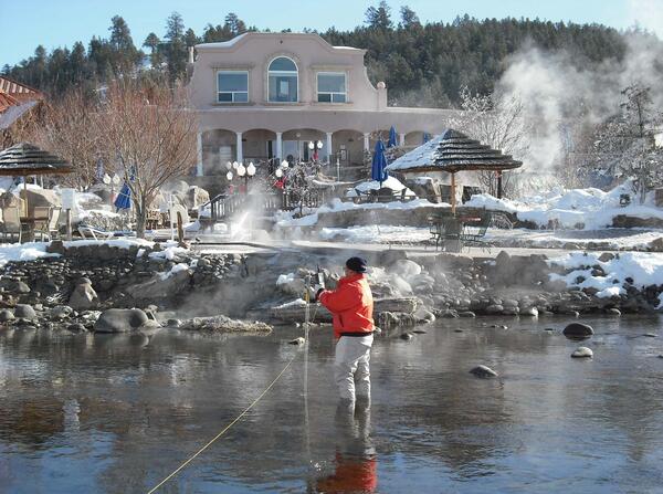
Oregon Water Science Center hydrologic technician, Ann McGowan makes a flow measurement at the hot spring pools along the San Juan River at Pagosa Springs, CO (09342500). This photo was featured in the USGS 2011 stream gaging calendar.
Oregon Water Science Center hydrologic technician, Ann McGowan makes a flow measurement at the hot spring pools along the San Juan River at Pagosa Springs, CO (09342500). This photo was featured in the USGS 2011 stream gaging calendar.

USGS scientist meaures how much light is transmitted into the Wallowa River, near Minam, OR.
USGS scientist meaures how much light is transmitted into the Wallowa River, near Minam, OR.

View of Mount Hood from Pittock Mansion, Portland, OR.
View of Mount Hood from Pittock Mansion, Portland, OR.

Photograph of the Willamette River passing through downtown Portland, OR.
Photograph of the Willamette River passing through downtown Portland, OR.

Aerial view of the Iron Gate Dam and Hatchery along the Klamath River near Hornbrook, California. A series of hydroelectric facilities (JC Boyle, Copco No. 1, Copco No. 2, and Iron Gate) separate the Klamath River into upper and lower basins.
Aerial view of the Iron Gate Dam and Hatchery along the Klamath River near Hornbrook, California. A series of hydroelectric facilities (JC Boyle, Copco No. 1, Copco No. 2, and Iron Gate) separate the Klamath River into upper and lower basins.

Photo taken of the Morrison Bridge from the southwest Portland waterfront. USGS monitors streamflow and water quality at this location.
Photo taken of the Morrison Bridge from the southwest Portland waterfront. USGS monitors streamflow and water quality at this location.