
Glen Canyon Dam Adaptive Management Program (GCDAMP)
The Grand Canyon Monitoring and Research Center (GCMRC) is the science provider for the Glen Canyon Dam Adaptive Management Program (GCDAMP), and its scientists study the effects of Glen Canyon Dam operations on the resources of Grand Canyon. More information can be found at the links below. Neither of these sites are USGS websites, so accessing those sites means you will leave the USGS website.
Bureau of Reclamation, GCDAMP Page

The Bureau of Reclamation's web page for the Glen Canyon Dam Adaptive Management Program contains a wealth of information on Glen Canyon Dam and the Adaptive Management Program (GCDAMP). This will take you to a site not maintained by the USGS.
Glen Canyon Dam Adaptive Management Program (GCDAMP) Wiki Pages

An unofficial, yet valuable resource for all things related to the adaptive management program, including how the adaptive management process works, recent meetings, and more. This site is not maintained by USGS or any other government entity.
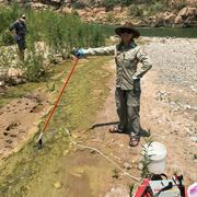
Early detection of aquatic threats: eDNA research in the Colorado River ecosystem & Lake Powell

Lake Powell Research

SBSC: Providing Unbiased Actionable Science & Information to Support Natural Resource Management Needs of the U.S. & Department of the Interior Priorities
Vegetation monitoring: How one square meter can tell the story of 255 river miles along the Colorado River
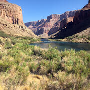
Riparian Vegetation in Grand Canyon: An Overview

Study Uncovers Migration Patterns of Native Fish in the Colorado River

River Sediment Dynamics

Colorado River Basin Science

Humpback Chub in the Colorado River, Grand Canyon

River Geomorphology, Sediment Storage, Sandbar and Campsite Monitoring in Grand Canyon

SBSC Tribal Partnerships
