
U.S. flag

An official website of the United States government

Forecasts and Models

Filter Total Items: 30
Collision Regime

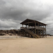
This informational webpage provides an overview to community planners and emergency managers regarding the coastal hazards associated with collision, a regime within the storm impact scale. This page describes the conditions that lead to a collision regime and the risks it poses to local resources. Collision is the second of four storm impact regimes, and the first regime where substantial impacts...
Collision Regime

Collision Regime

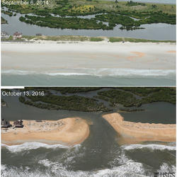
This informational webpage provides an overview to community planners and emergency managers regarding the coastal hazards associated with collision, a regime within the storm impact scale. This page describes the conditions that lead to a collision regime and the risks it poses to local resources. Collision is the second of four storm impact regimes, and the first regime where substantial impacts...
Learn More

Inundation Regime

This informational webpage provides an overview to community planners and emergency managers regarding the coastal hazards associated with inundation, a regime within the storm impact scale. This page describes the conditions that lead to the inundation regime and the risks it poses to the beach and adjacent communities. Inundation is the fourth of four storm-impact regimes and is the most severe...
Inundation Regime

Inundation Regime

This informational webpage provides an overview to community planners and emergency managers regarding the coastal hazards associated with inundation, a regime within the storm impact scale. This page describes the conditions that lead to the inundation regime and the risks it poses to the beach and adjacent communities. Inundation is the fourth of four storm-impact regimes and is the most severe...
Learn More

Overwash Regime

This informational webpage provides an overview to community planners and emergency managers regarding coastal hazards associated with overwash, a regime within the storm impact scale. This page describes the conditions that lead to the overwash regime and the risks it poses to the beach and local community. Overwash is the third of four storm-impact regimes and leads to considerable impacts on...
Overwash Regime

Overwash Regime

This informational webpage provides an overview to community planners and emergency managers regarding coastal hazards associated with overwash, a regime within the storm impact scale. This page describes the conditions that lead to the overwash regime and the risks it poses to the beach and local community. Overwash is the third of four storm-impact regimes and leads to considerable impacts on...
Learn More

Swash Regime

This informational webpage describes the swash regime, including depictions of the beach complex under its influence (Image 1), the conditions that define it, and any risks to the beach complex. Swash is the first of four storm-impact regimes, with minimal to no impacts expected from it.
Swash Regime

Swash Regime

This informational webpage describes the swash regime, including depictions of the beach complex under its influence (Image 1), the conditions that define it, and any risks to the beach complex. Swash is the first of four storm-impact regimes, with minimal to no impacts expected from it.
Learn More

Let's Get Technical: Water Levels

This webpage provides a technical description of how water levels are defined and calculated during a coastal storm event (such as a hurricane). It describes how the USGS team calculates the peak water level against which a reference beach complex is modeled in order to determine risks.
Let's Get Technical: Water Levels

Let's Get Technical: Water Levels

This webpage provides a technical description of how water levels are defined and calculated during a coastal storm event (such as a hurricane). It describes how the USGS team calculates the peak water level against which a reference beach complex is modeled in order to determine risks.
Learn More

Let’s Get Technical: Beach Complex

This webpage expands on the concept of the beach complex introduced on the storm-impact regime homepage. It clarifies the morphological (beach shape) markers used to assess the impact of elevated water levels and relates them to the swash, collision, overwash, and inundation regimes. It also introduces additional terms used by professionals to describe these same features (such as dune toe and...
Let’s Get Technical: Beach Complex

Let’s Get Technical: Beach Complex

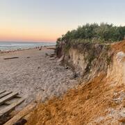
This webpage expands on the concept of the beach complex introduced on the storm-impact regime homepage. It clarifies the morphological (beach shape) markers used to assess the impact of elevated water levels and relates them to the swash, collision, overwash, and inundation regimes. It also introduces additional terms used by professionals to describe these same features (such as dune toe and...
Learn More

Let’s Get Technical: Dunes & Beach Metrics

This webpage provides technical details regarding how the USGS calculates beach metrics related to morphology features; specifically, the dune crest position and elevation, the dune base/toe position and elevation and beach slope. This is a brief overview of that process with links and references to the full source material.
Let’s Get Technical: Dunes & Beach Metrics

Let’s Get Technical: Dunes & Beach Metrics

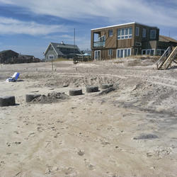
This webpage provides technical details regarding how the USGS calculates beach metrics related to morphology features; specifically, the dune crest position and elevation, the dune base/toe position and elevation and beach slope. This is a brief overview of that process with links and references to the full source material.
Learn More

How Storm-Impact Regimes Affect Beach Complexes: Coastal Hazards

This webpage explains coastal hazards caused by high water at the coast. These high-water levels, called "total water levels," happen when tides, waves, and storms combine and push the ocean higher than normal. This page provides an overview for community planners, emergency managers, and anyone else who wants to understand these risks.
How Storm-Impact Regimes Affect Beach Complexes: Coastal Hazards

How Storm-Impact Regimes Affect Beach Complexes: Coastal Hazards

This webpage explains coastal hazards caused by high water at the coast. These high-water levels, called "total water levels," happen when tides, waves, and storms combine and push the ocean higher than normal. This page provides an overview for community planners, emergency managers, and anyone else who wants to understand these risks.
Learn More

Cultural Heritage at Risk Tool (CHART) Project

Coastal erosion threatens the loss of Native American cultural heritage and archaeological sites located along our coastlines, reducing opportunities to increase knowledge of past communities and environments. This project leverages an advisory team of ancestral Tribes, coastal managers, and archaeologists to strengthen the effectiveness of coastal hazard data, focusing on assessing the...
Cultural Heritage at Risk Tool (CHART) Project

Cultural Heritage at Risk Tool (CHART) Project

Coastal erosion threatens the loss of Native American cultural heritage and archaeological sites located along our coastlines, reducing opportunities to increase knowledge of past communities and environments. This project leverages an advisory team of ancestral Tribes, coastal managers, and archaeologists to strengthen the effectiveness of coastal hazard data, focusing on assessing the...
Learn More

Puerto Rico Natural Hazards: Coastal | Peligros naturales de Puerto Rico: Costas

This page is a collection of USGS coastal hazard research in Puerto Rico, including shoreline changes, coral reef assessments, and coastal flooding. A brief description of highlighted projects can be found below. All coastal hazard publications, data releases, and news for Puerto Rico can be accessed on this page. Esta página es una recopilación de investigaciones del USGS sobre los riesgos...
Puerto Rico Natural Hazards: Coastal | Peligros naturales de Puerto Rico: Costas

Puerto Rico Natural Hazards: Coastal | Peligros naturales de Puerto Rico: Costas

This page is a collection of USGS coastal hazard research in Puerto Rico, including shoreline changes, coral reef assessments, and coastal flooding. A brief description of highlighted projects can be found below. All coastal hazard publications, data releases, and news for Puerto Rico can be accessed on this page. Esta página es una recopilación de investigaciones del USGS sobre los riesgos...
Learn More

Estuarine Shoreline Change Research Project

The goal of the estuarine shoreline change project is to define shoreline positions for historical and modern wetland shorelines and calculate rates of change along the U.S. East and Gulf coasts.
Estuarine Shoreline Change Research Project

Estuarine Shoreline Change Research Project

The goal of the estuarine shoreline change project is to define shoreline positions for historical and modern wetland shorelines and calculate rates of change along the U.S. East and Gulf coasts.
Learn More

USGS DUNEX Operations on the Outer Banks

DUring Nearshore Event eXperiment (DUNEX) is a multi-agency, academic, and non-governmental organization (NGO) collaborative community experiment designed to study nearshore coastal processes during storm events. The experiment began in 2019 and is scheduled for completion in the fall of 2021. USGS participation in DUNEX will contribute new measurements and models that will increase our...
USGS DUNEX Operations on the Outer Banks

USGS DUNEX Operations on the Outer Banks

DUring Nearshore Event eXperiment (DUNEX) is a multi-agency, academic, and non-governmental organization (NGO) collaborative community experiment designed to study nearshore coastal processes during storm events. The experiment began in 2019 and is scheduled for completion in the fall of 2021. USGS participation in DUNEX will contribute new measurements and models that will increase our...
Learn More
Was this page helpful?