
Animated GIF of lava erupting from a fissure at Kīlauea Volcano at night time on December 27, 2020.
Images
Images
Filter Total Items: 9454
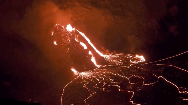
Lava Erupting from a Fissure
Animated GIF of lava erupting from a fissure at Kīlauea Volcano at night time on December 27, 2020.
Lava Erupting from a Fissure
Animated GIF of lava erupting from a fissure at Kīlauea Volcano at night time on December 27, 2020.
Animated GIF of lava erupting from a fissure at Kīlauea Volcano at night time on December 27, 2020.
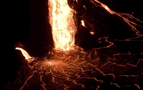
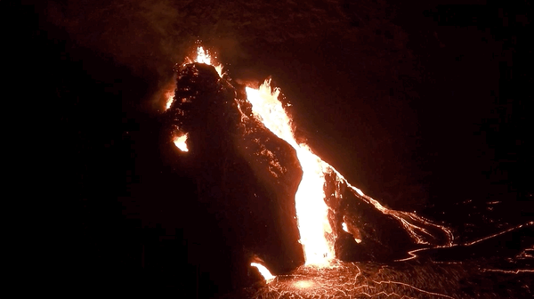
Lava Falls at Kīlauea Volcano (Dec 2020)
An animated GIF of lava falling at the Kīlauea Volcano in Hawaii in 2020 pulled from the Evening Views of the eruption in Halema'uma'u.
An animated GIF of lava falling at the Kīlauea Volcano in Hawaii in 2020 pulled from the Evening Views of the eruption in Halema'uma'u.
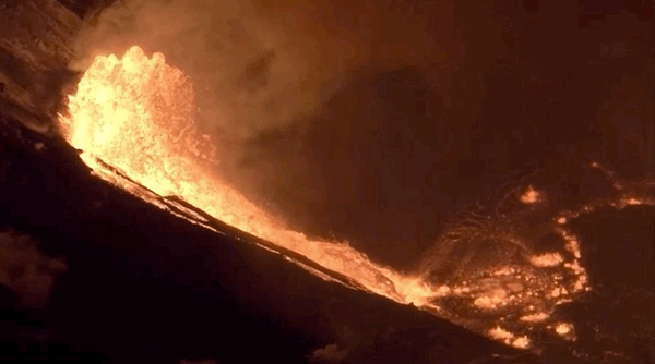
Lava Erupting at Kīlauea (Dec 2020)
This animation shows lava erupting from Kīlauea Volcano on Dec 20, 2020.
This animation shows lava erupting from Kīlauea Volcano on Dec 20, 2020.

Department of the Interior Bison Conservation Initiative 2020
Department of the Interior Bison Conservation Initiative 2020Bison
Since the late 19th century, the Department of the Interior, in collaboration with others, has been a leader in shared conservation stewardship of bison and manages...
Department of the Interior Bison Conservation Initiative 2020
Department of the Interior Bison Conservation Initiative 2020Bison
Since the late 19th century, the Department of the Interior, in collaboration with others, has been a leader in shared conservation stewardship of bison and manages...

Cessna Grand Caravan fixed-wing and an Airbus A350 B3 helicopter
Cessna Grand Caravan fixed-wing and an Airbus A350 B3 helicopterSurvey aircraft include a Cessna Grand Caravan fixed-wing and an Airbus A350 B3 helicopter with magnetometer stinger and towed bird respectively. Photos courtesy of Dewberry Engineers, Inc.
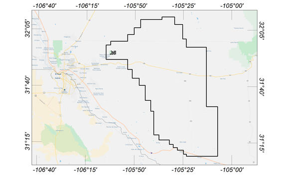
Flight area for Trans-Pecos aeromagnetic and radiometric survey
Flight area for Trans-Pecos aeromagnetic and radiometric surveyMap indicating flight area for Trans-Pecos aeromagnetic and radiometric survey. The survey area includes parts of El Paso and Hudspeth counties, Texas, and Otero County, New Mexico. Flights will begin in November 2020 and are expected to conclude in mid-January 2021.

Scientist holding brown treesnake
A USGS scientist holds an invasive brown treesnake.
A USGS scientist holds an invasive brown treesnake.

USGS Technicians Prepare to Take a Core of the Austin Chalk in Texas
USGS Technicians Prepare to Take a Core of the Austin Chalk in TexasUSGS technicians at the USGS Gulf Coast #4 Bonham borehole in preparation for geophysical logging of the Austin Chalk Group and the Eagle Ford Group mudstones, Fannin County, Texas.

Austin Chalk Core
Bedding features in the core from the USGS Gulf Coast #4 Bonham borehole, in the Eagle Ford Group mudstones from a depth of about 401 feet, Fannin County, Texas. The Eagle Ford Group lies underneath the Austin Chalk and serves as the source rock for much of the Austin Chalk's petroleum.
Bedding features in the core from the USGS Gulf Coast #4 Bonham borehole, in the Eagle Ford Group mudstones from a depth of about 401 feet, Fannin County, Texas. The Eagle Ford Group lies underneath the Austin Chalk and serves as the source rock for much of the Austin Chalk's petroleum.

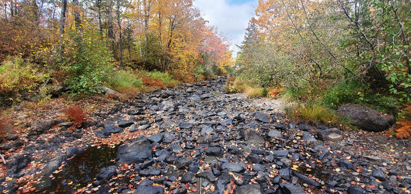
Tingmerkpuk Ridges
Geologists discuss the geology of Jurassic rocks in thurst-faulted structures near the southern limit of Western North Slope.
Geologists discuss the geology of Jurassic rocks in thurst-faulted structures near the southern limit of Western North Slope.

Kukpowruk Redwul
Geologist examines f Faulted and folded petroleum source rocks in Jurassic and Cretaceous rocks (Kingak Shale, pebble shale unit, and gamma-ray zone of Hue Shale) in southern part of Western North Slope. Thermal maturity of these rocks is at the upper limit of oil preservations.
Geologist examines f Faulted and folded petroleum source rocks in Jurassic and Cretaceous rocks (Kingak Shale, pebble shale unit, and gamma-ray zone of Hue Shale) in southern part of Western North Slope. Thermal maturity of these rocks is at the upper limit of oil preservations.

Surprise Creek, Western North Slope of Alaska
Overview of folded Triassic, Jurassic, and Cretaceous rocks in southern part of Western North Slope.
Overview of folded Triassic, Jurassic, and Cretaceous rocks in southern part of Western North Slope.

Kokolik River Oil Sand
Oil-saturated sandstone in the Nanushuk Formation in westernmost National Petroleum Reserve in Alaska (NPR-A). Oil in these rocks likely was generated beneath Western North Slope and migrated northeastward into NPR-A.
Oil-saturated sandstone in the Nanushuk Formation in westernmost National Petroleum Reserve in Alaska (NPR-A). Oil in these rocks likely was generated beneath Western North Slope and migrated northeastward into NPR-A.

Kukpowruk Redwul
Faulted and folded petroleum source rocks in Jurassic and Cretaceous rocks (Kingak Shale, pebble shale unit, and gamma-ray zone of Hue Shale) in southern part of Western North Slope. Thermal maturity of these rocks are at the upper limit of oil preservations.
Faulted and folded petroleum source rocks in Jurassic and Cretaceous rocks (Kingak Shale, pebble shale unit, and gamma-ray zone of Hue Shale) in southern part of Western North Slope. Thermal maturity of these rocks are at the upper limit of oil preservations.

Collecting a red-dye sample in Olathe, Kansas
USGS scientist uses a weighted basket sampler to collect a Time of Travel red-dye sample at WaterOne in Olathe, Kansas.
USGS scientist uses a weighted basket sampler to collect a Time of Travel red-dye sample at WaterOne in Olathe, Kansas.
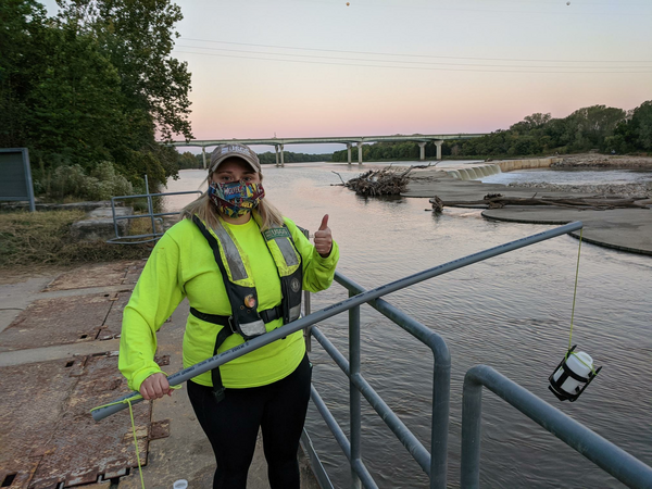
USGS scientist prepares to collect a red-dye sample in Olathe, Kansas
USGS scientist prepares to collect a red-dye sample in Olathe, KansasUSGS scientist Chantelle Davis prepares to collect a red-dye sample, at sunrise, for the Time of Travel study in Olathe, Kansas.
USGS scientist prepares to collect a red-dye sample in Olathe, Kansas
USGS scientist prepares to collect a red-dye sample in Olathe, KansasUSGS scientist Chantelle Davis prepares to collect a red-dye sample, at sunrise, for the Time of Travel study in Olathe, Kansas.
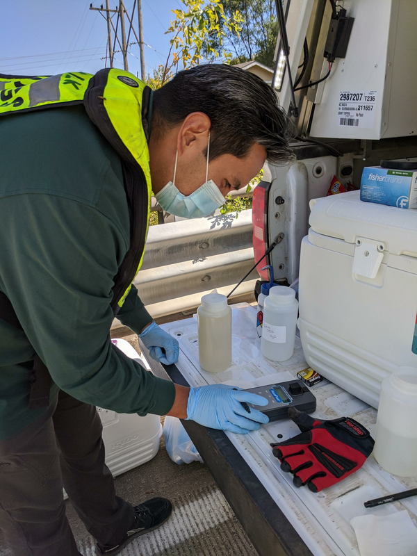
Getting a field fluorometer reading from a red-dye study sample
Getting a field fluorometer reading from a red-dye study sampleUSGS scientist Ian Gambill gets a field fluorometer reading from a recently collected red-dye study sample from the Kansas River in DeSoto, Kansas.
Getting a field fluorometer reading from a red-dye study sample
Getting a field fluorometer reading from a red-dye study sampleUSGS scientist Ian Gambill gets a field fluorometer reading from a recently collected red-dye study sample from the Kansas River in DeSoto, Kansas.

Earth MRI Funds Critical Minerals Projects in West Virginia
Earth MRI Funds Critical Minerals Projects in West VirginiaUSGS map of Earth MRI projects in West Virginia announced in September 2020.
Earth MRI Funds Critical Minerals Projects in West Virginia
Earth MRI Funds Critical Minerals Projects in West VirginiaUSGS map of Earth MRI projects in West Virginia announced in September 2020.
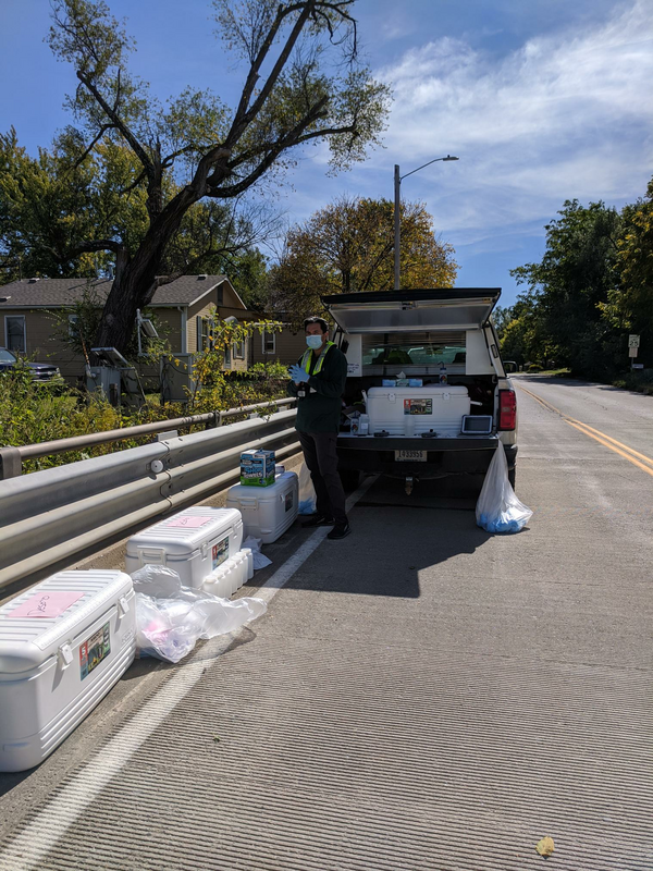
Samples collected during the red-dye study trial run in Desoto, Kansas
Samples collected during the red-dye study trial run in Desoto, KansasUSGS scientist watches over the many samples collected during the red-dye study trial run in Desoto, Kansas while he awaits the next sample.
Samples collected during the red-dye study trial run in Desoto, Kansas
Samples collected during the red-dye study trial run in Desoto, KansasUSGS scientist watches over the many samples collected during the red-dye study trial run in Desoto, Kansas while he awaits the next sample.