
Scientists from the U.S.
Images
Images
Filter Total Items: 9454

USGS Dye Tracing Event

USGS Dye Tracing Event
Scientists from the U.S.

USGS Dye Tracing Event
Scientists from the U.S.

USGS Dye Tracing Event
Scientists from the U.S.

USGS Dye Tracing Event
Scientists from the U.S.

Everglades National Park UVVR
Everglades National Park in South Florida is the largest subtropical wetland ecosystem in North America, consisting of about 1.5 million acres of mangrove forests and other coastal wetlands. Mangroves are salt-tolerant trees that thrive amidst the harsh growing conditions of the coast.
Everglades National Park in South Florida is the largest subtropical wetland ecosystem in North America, consisting of about 1.5 million acres of mangrove forests and other coastal wetlands. Mangroves are salt-tolerant trees that thrive amidst the harsh growing conditions of the coast.

Mississippi River Birdfoot Delta UVVR
In the Mississippi River Birdfoot Delta, there is intense vegetation loss in marshes farthest away from the river, as indicated by high values of UVVR (shown in pink).
In the Mississippi River Birdfoot Delta, there is intense vegetation loss in marshes farthest away from the river, as indicated by high values of UVVR (shown in pink).

Jamaica Bay UVVR
Within the busy boroughs of Brooklyn and Queens, New York City, is Jamaica Bay—a complex urban ecosystem almost the size of Manhattan that consists of salt marsh islands, various waterways, meadowlands and two freshwater ponds.
Within the busy boroughs of Brooklyn and Queens, New York City, is Jamaica Bay—a complex urban ecosystem almost the size of Manhattan that consists of salt marsh islands, various waterways, meadowlands and two freshwater ponds.

Prime Hook National Wildlife Refuge UVVR
The Prime Hook National Wildlife Refuge in Delaware is the site of a \$40 million tidal marsh restoration project—one of the largest restoration projects ever in the eastern U.S. With this project, the U.S.
The Prime Hook National Wildlife Refuge in Delaware is the site of a \$40 million tidal marsh restoration project—one of the largest restoration projects ever in the eastern U.S. With this project, the U.S.

Hurricane deposits in a sediment core
Four close-up images of a longer sediment core (bottom). The light coloring indicates coarser sand that likely occurred from overwash flooding during a previous hurricane. This is one of a few cores collected in northwest Florida by the USGS and partners to help understand past hurricane activity in the Gulf of Mexico and northern Atlantic Ocean.
Four close-up images of a longer sediment core (bottom). The light coloring indicates coarser sand that likely occurred from overwash flooding during a previous hurricane. This is one of a few cores collected in northwest Florida by the USGS and partners to help understand past hurricane activity in the Gulf of Mexico and northern Atlantic Ocean.
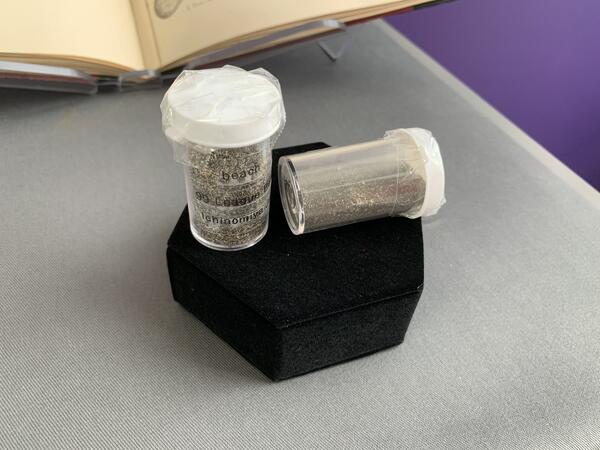
Two samples of beach sediment from Ichinomiya, Japan.
Two samples of beach sediment from Ichinomiya, Japan.Two samples of beach sediment from Ichinomiya, Japan. This beach was the likely source for the sand used in the balloon bombs.
Two samples of beach sediment from Ichinomiya, Japan.
Two samples of beach sediment from Ichinomiya, Japan.Two samples of beach sediment from Ichinomiya, Japan. This beach was the likely source for the sand used in the balloon bombs.
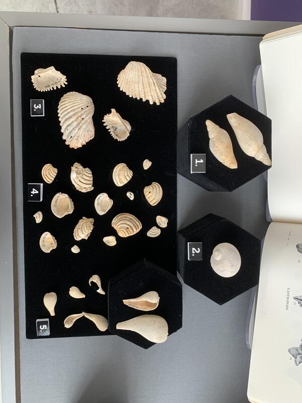
Fossil clams and snails.
Image of fossil clams and snails from the collection of Paleontological Research Institution, Ithaca, New York.
Image of fossil clams and snails from the collection of Paleontological Research Institution, Ithaca, New York.
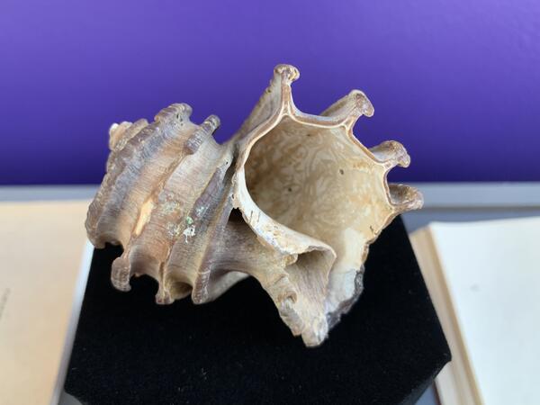
Ecphora gardnerae, a snail shell named in honor of Julia Gardner.
Ecphora gardnerae, a snail shell named in honor of Julia Gardner.Julia Gardner was also immortalized with the naming of Ecphora gardnerae, a snail shell named in her honor. In 1994 the state of Maryland designated it the official state fossil shell.
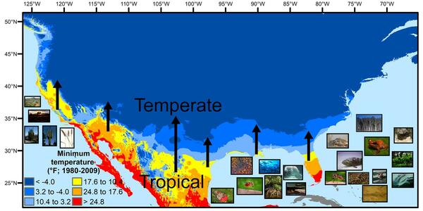
U.S. regions in the tropical-to-temperate transition
U.S. regions in the tropical-to-temperate transitionA map showing North America's tropical-to-temperate transition zone. Red, orange, and yellow depict the more tropical zones, and blues depict the more temperate zones, based on to the coldest recorded temperature for each area between 1980 and 2009.

Cleaning and inspecting water height reference staff at streamgage
Cleaning and inspecting water height reference staff at streamgageUSGS hydrologist Adam Birken cleans and inspects the water height reference staff at the USGS streamgage site on the South Fork of the Ogden River near Hunstville, Utah. This streamgage has been monitoring water levels and flow since March 21, 1921, making it one of 25 centennial gauges in Utah.

Measuring streamflow on the Ogden River near Hunstville, Utah
Measuring streamflow on the Ogden River near Hunstville, UtahUSGS hydrologist Adam Birken prepares to measure streamflow on the South Fork of the Ogden River near Hunstville, Utah. This streamgage has been monitoring water levels and flow since March 21, 1921, making it one of 25 centennial gauges in Utah.

Chart recorder similar to one installed inside a centennial streamgage
Chart recorder similar to one installed inside a centennial streamgageThis is a chart recorder similar to the one installed inside the USGS streamgage on the South Fork of the Ogden River in 1921.
Chart recorder similar to one installed inside a centennial streamgage
Chart recorder similar to one installed inside a centennial streamgageThis is a chart recorder similar to the one installed inside the USGS streamgage on the South Fork of the Ogden River in 1921.

USGS hydrologist conducts equipment maintenance at streamgage
USGS hydrologist conducts equipment maintenance at streamgageUSGS hydrologist Adam Birken conducts equipment maintenance at the USGS streamgage on the South Fork of the Ogden River near Hunstville, Utah. This streamgage has been monitoring water levels and flow since March 21, 1921, making it one of 25 centennial gauges in Utah.

Utah Gauge Celebrates 100 Years of Monitoring Streamflow
Utah Gauge Celebrates 100 Years of Monitoring StreamflowA U.S. Geological Survey streamgage near Hunstville, Utah is celebrating 100 years of monitoring streamflow on the south fork of the Ogden River. The streamgage has been monitoring water levels and flow since March 21, 1921, making it one of 25 centennial gauges in Utah.

Lees Ferry streamgage on the Colorado River, Arizona
Lees Ferry streamgage on the Colorado River, ArizonaLees Ferry streamgage and cableway downstream on the Colorado River, Arizona
Lees Ferry streamgage on the Colorado River, Arizona
Lees Ferry streamgage on the Colorado River, ArizonaLees Ferry streamgage and cableway downstream on the Colorado River, Arizona