A helicopter flight reveals landslides' damage in Utuado municipality
A helicopter flight reveals landslides' damage in Utuado municipalityAn aerial view of landslide damage after Hurricane Maria in Utuado municipality, Puerto Rico.

Official websites use .gov
A .gov website belongs to an official government organization in the United States.
Secure .gov websites use HTTPS
A lock () or https:// means you’ve safely connected to the .gov website. Share sensitive information only on official, secure websites.
Images

An aerial view of landslide damage after Hurricane Maria in Utuado municipality, Puerto Rico.
An aerial view of landslide damage after Hurricane Maria in Utuado municipality, Puerto Rico.

Damage from a major post-wildfire landslide that occurred on 9 January 2018 near Montecito, Santa Barbara County as a result of the 2017 Thomas Fire.
Damage from a major post-wildfire landslide that occurred on 9 January 2018 near Montecito, Santa Barbara County as a result of the 2017 Thomas Fire.

Damage from a major post-wildfire landslide that occurred on 25 December 2003 near Devore, San Bernardino County as a result of the Old/Grand Prix fires that ran through the San Bernardino Mountains.
Damage from a major post-wildfire landslide that occurred on 25 December 2003 near Devore, San Bernardino County as a result of the Old/Grand Prix fires that ran through the San Bernardino Mountains.

USGS marine technicians Alex Nichols (L) and Eric Moore (R) deploy the hydrophone array on a seismic research cruise off the southwest coast of Puerto Rico aboard the R/V Sultana in March 2020.
USGS marine technicians Alex Nichols (L) and Eric Moore (R) deploy the hydrophone array on a seismic research cruise off the southwest coast of Puerto Rico aboard the R/V Sultana in March 2020.

USGS research geologist Jason Chaytor (L) and marine technicians Alex Nichols (center) and Eric Moore (R) deploy the “sparker” sound source on a seismic research cruise off the southwest coast of Puerto Rico aboard the R/V Sultana in March 2020.
USGS research geologist Jason Chaytor (L) and marine technicians Alex Nichols (center) and Eric Moore (R) deploy the “sparker” sound source on a seismic research cruise off the southwest coast of Puerto Rico aboard the R/V Sultana in March 2020.

USGS marine technician Wayne Baldwin prepares to deploy the hydrophone array during a seismic research cruise off the southwest coast of Puerto Rico on board the R/V Sultana in March 2020.
USGS marine technician Wayne Baldwin prepares to deploy the hydrophone array during a seismic research cruise off the southwest coast of Puerto Rico on board the R/V Sultana in March 2020.

The 43rd annual Mineral Commodity Summaries report from the USGS National Minerals Information Center is the earliest comprehensive source of 2019 world mineral production data.
The 43rd annual Mineral Commodity Summaries report from the USGS National Minerals Information Center is the earliest comprehensive source of 2019 world mineral production data.

The sampling mechanism (on blue tarp) is prepared and the Unoccupied Aircraft System (UAS) is inspected just before take off to collect water from the Halema‘uma‘u crater lake. Brightly colored flagging tape tied to a cable attached to the UAS indicated depth as the sampling tool was lowered into the water.
The sampling mechanism (on blue tarp) is prepared and the Unoccupied Aircraft System (UAS) is inspected just before take off to collect water from the Halema‘uma‘u crater lake. Brightly colored flagging tape tied to a cable attached to the UAS indicated depth as the sampling tool was lowered into the water.

El Servicio Geológico de los EE. UU. ha publicado un informe sobre la duración potencial de las réplicas de la secuencia (serie) del terremoto del Suroeste de Puerto Rico en el 2020 que puede ser usado como guía en las decisiones de política pública, otras acciones y ayudar a las personas a mantenerse seguras y cuidarse a sí mismas y a los demás.
El Servicio Geológico de los EE. UU. ha publicado un informe sobre la duración potencial de las réplicas de la secuencia (serie) del terremoto del Suroeste de Puerto Rico en el 2020 que puede ser usado como guía en las decisiones de política pública, otras acciones y ayudar a las personas a mantenerse seguras y cuidarse a sí mismas y a los demás.

The U.S. Geological Survey has released a report on the potential duration of aftershocks of the 2020 Southwest Puerto Rico earthquake sequence (series) to guide public policy decisions, other actions, and help people stay safe and care for themselves and each other.
The U.S. Geological Survey has released a report on the potential duration of aftershocks of the 2020 Southwest Puerto Rico earthquake sequence (series) to guide public policy decisions, other actions, and help people stay safe and care for themselves and each other.

Dianne López-Trujillo with Lynne Carrier, FEMA translator.
The USGS Recognizes Dianne Lopez-Trujillo During Hispanic Heritage Month
What happens when a 6.4 magnitude earthquake strikes Puerto Rico and the public needs critical information? How does a mostly English-speaking science agency reach a mostly Spanish-speaking public?
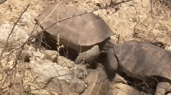
Clip taken from USGS video, "The Heat is On: Desert Tortoises & Survival (Full Length - Part 3 of 4)".
Clip taken from USGS video, "The Heat is On: Desert Tortoises & Survival (Full Length - Part 3 of 4)".

ALASKA CENTRAL NORTH SLOPE
January 2020
One of the most productive areas in the world for oil remains rich in the resource, according to the latest USGS assessment. This assessment is for undiscovered, technically recoverable oil and gas resources in conventional accumulations.
ALASKA CENTRAL NORTH SLOPE
January 2020
One of the most productive areas in the world for oil remains rich in the resource, according to the latest USGS assessment. This assessment is for undiscovered, technically recoverable oil and gas resources in conventional accumulations.

Scientists working to uncover footprints at White Sands National Park field site.
Scientists working to uncover footprints at White Sands National Park field site.

Congressional event following the 6.4 earthquake in Puerto Rico held on Jan. 20, 2020. Dr. Jonathan Godt (USGS) and Dr. Elizabeth A. Vanacore (Red Sismica Puerto Rico) answered questions to congressmen: Yauco's major, Bill Posey, Jenniffer González Colón, Stephanie Murphy, Donna Shalala
Congressional event following the 6.4 earthquake in Puerto Rico held on Jan. 20, 2020. Dr. Jonathan Godt (USGS) and Dr. Elizabeth A. Vanacore (Red Sismica Puerto Rico) answered questions to congressmen: Yauco's major, Bill Posey, Jenniffer González Colón, Stephanie Murphy, Donna Shalala

One of the houses destroyed during the 6.4 earthquake in Puerto Rico.
One of the houses destroyed during the 6.4 earthquake in Puerto Rico.

Overview of the Congressional event following the 6.4 earthquake in Puerto Rico. Bottom of picture: congressmen. Center: Dianne Lopez, Lindsay Davis, Donyelle Davis
Overview of the Congressional event following the 6.4 earthquake in Puerto Rico. Bottom of picture: congressmen. Center: Dianne Lopez, Lindsay Davis, Donyelle Davis

After a sample was collected, HVO team members transferred water from the sampling device to plastic bottles. Team members took notes, measured water pH and evaluated water temperature data for each sample collected.
After a sample was collected, HVO team members transferred water from the sampling device to plastic bottles. Team members took notes, measured water pH and evaluated water temperature data for each sample collected.

Part of the USGS Earthquake Response Team visiting areas affected by the 6.4 earthquake. Place: Guánica Boardwalk. From left to right: Donyelle Davis, Dianne López, Jonathan Godt, Alex Grant
Part of the USGS Earthquake Response Team visiting areas affected by the 6.4 earthquake. Place: Guánica Boardwalk. From left to right: Donyelle Davis, Dianne López, Jonathan Godt, Alex Grant

A close-up view of the Kilauea pond shows the color variations across the surface, and sharp boundaries among zones of different color.
A close-up view of the Kilauea pond shows the color variations across the surface, and sharp boundaries among zones of different color.

Terremotos detectados entre diciembre 28, 2019 hasta enero 16, 2020. Sujeto a actualizaciones.
>300 M3+ terremotos* registrados
desde dic 28, 2019 (dentro de 40km) suficientemente fuerte como para ser sentido
10 M5+ terremotos* registrados
Terremotos detectados entre diciembre 28, 2019 hasta enero 16, 2020. Sujeto a actualizaciones.
>300 M3+ terremotos* registrados
desde dic 28, 2019 (dentro de 40km) suficientemente fuerte como para ser sentido
10 M5+ terremotos* registrados