
Mineral: Garnet Schist
Primary Commodity: Garnet
Primary Commodity Uses: Garnet is mostly used for abrasives, water filtration, and some electronics
Images
Images
Filter Total Items: 9449

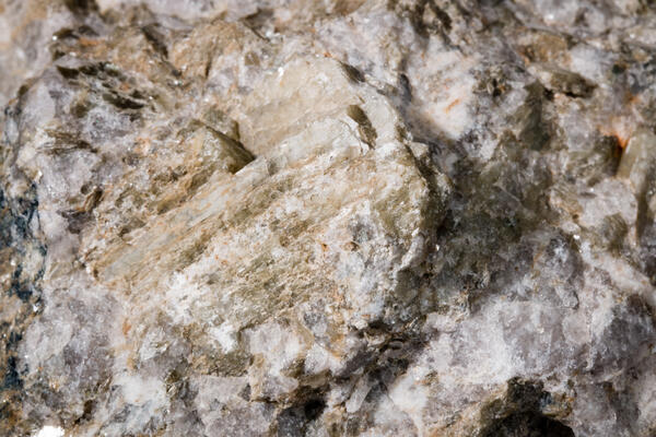
Garnet Schist
Mineral: Garnet Schist
Primary Commodity: Garnet
Primary Commodity Uses: Garnet is mostly used for abrasives, water filtration, and some electronics

Sailfin catfishes discovered in Big Cypress
The sailfin catfish is one of 13 species of nonnative fish that biologists discovered during the Fish Slam in Big Cypress National Preserve, March 23, 2017.
The sailfin catfish is one of 13 species of nonnative fish that biologists discovered during the Fish Slam in Big Cypress National Preserve, March 23, 2017.

Bismuthinite
Primary Commodity: Bismuth
Primary Commodity Uses: Bismuth is the heaviest of the heavy metals and the only non-toxic one at that. As such, it’s seen a lot of use in replacements for lead, as well as in medications and atomic research.
Primary Commodity: Bismuth
Primary Commodity Uses: Bismuth is the heaviest of the heavy metals and the only non-toxic one at that. As such, it’s seen a lot of use in replacements for lead, as well as in medications and atomic research.

Salt, Sodium, Chlorine
Mineral: Halite (NaCl)
Primary mineral Commodity: Salt
Mineral: Halite (NaCl)
Primary mineral Commodity: Salt

Specularite
Mineral: Specularite (a variety of Hematite)
Mineral Origin: Republic Mine, MI
Primary Mineral Commodity: Iron
Commodity Uses: Steelmaking
Mineral: Specularite (a variety of Hematite)
Mineral Origin: Republic Mine, MI
Primary Mineral Commodity: Iron
Commodity Uses: Steelmaking

Stibnite
Stibnite (Sb2S3) is the predominant ore mineral of antimony. Antimony compounds help prevent skin burns, increase battery life, and refine glass used for cellphones. A surprising 83% of antimony consumed stateside is imported—mostly from China—leaving the US susceptible to supply disruption.
Stibnite (Sb2S3) is the predominant ore mineral of antimony. Antimony compounds help prevent skin burns, increase battery life, and refine glass used for cellphones. A surprising 83% of antimony consumed stateside is imported—mostly from China—leaving the US susceptible to supply disruption.

Chalcopyrite
Mineral: Chalcopyrite
Mineral Origin: Bingham Canyon, UT
Primary Commodity: Copper
Primary Commodity Uses: Copper is used primarily in electronics, mostly in building construction and industrial electronics.
Mineral: Chalcopyrite
Mineral Origin: Bingham Canyon, UT
Primary Commodity: Copper
Primary Commodity Uses: Copper is used primarily in electronics, mostly in building construction and industrial electronics.

Bauxite
Mineral: Bauxite
Mineral Origin: Les Baux, France (Sample donated by Gary Kingston)
Primary Commodity: Aluminum and Gallium
Mineral: Bauxite
Mineral Origin: Les Baux, France (Sample donated by Gary Kingston)
Primary Commodity: Aluminum and Gallium

Sphalerite
Sphalerite, zinc sulfide, is and has been the principal ore mineral in the world. Zinc uses range from metal products to rubber and medicines. Zinc alloys readily with other metals and is chemically active. On exposure to air, it develops a thin gray oxide film (patina), which inhibits deeper oxidation (corrosion) of the metal.
Sphalerite, zinc sulfide, is and has been the principal ore mineral in the world. Zinc uses range from metal products to rubber and medicines. Zinc alloys readily with other metals and is chemically active. On exposure to air, it develops a thin gray oxide film (patina), which inhibits deeper oxidation (corrosion) of the metal.

Rutile
Mineral: Rutile
Primary Commodity: Titanium
Primary Commodity Uses: The vast majority of titanium is used in whiteners in the form of titanium oxide. Titanium metal makes up a comparatively small amount of the use for titanium, but as a metal it is used in metal coatings and medical implants.
Mineral: Rutile
Primary Commodity: Titanium
Primary Commodity Uses: The vast majority of titanium is used in whiteners in the form of titanium oxide. Titanium metal makes up a comparatively small amount of the use for titanium, but as a metal it is used in metal coatings and medical implants.

Chalcopyrite, Pentlandite, and Pyrrhotite
Mineral: Chalcopyrite, Pentlandite, Pyrrhotite
Mineral Origin: Creighton Mine, Sudbury, Ontario, Canada (Sample on loan from George J. Coakley)
Primary Commodity: Copper and nickel
Mineral: Chalcopyrite, Pentlandite, Pyrrhotite
Mineral Origin: Creighton Mine, Sudbury, Ontario, Canada (Sample on loan from George J. Coakley)
Primary Commodity: Copper and nickel

Bertrandite
Mineral: Bertrandite (in carbonate clasts that have been largely replaced by fluorite (purple) that contains submicroscopic bertrandite)
Mineral Origin: Spor Mountain, UT
Primary Commodity: Beryllium
Mineral: Bertrandite (in carbonate clasts that have been largely replaced by fluorite (purple) that contains submicroscopic bertrandite)
Mineral Origin: Spor Mountain, UT
Primary Commodity: Beryllium

Lead
Lead is a corrosion-resistant dense metal that is easily molded and shaped. 85% of lead in the US is used for lead-acid batteries, which are used in automobiles, as industrial-type batteries for standby power for computer and telecommunications networks, and for motive power.
Lead is a corrosion-resistant dense metal that is easily molded and shaped. 85% of lead in the US is used for lead-acid batteries, which are used in automobiles, as industrial-type batteries for standby power for computer and telecommunications networks, and for motive power.

Feldspar
Mineral: Feldspar
Primary Commodity: Feldspar
Primary Commodity Uses: Feldspar is one of the most common minerals on the planet and is mostly used for glassmaking and ceramics.
Mineral: Feldspar
Primary Commodity: Feldspar
Primary Commodity Uses: Feldspar is one of the most common minerals on the planet and is mostly used for glassmaking and ceramics.
Spodumene
Mineral origin: Hallman Beam Mine, Cherryville, NC
Primary mineral commodity: Lithium
Uses: batteries for cell phones, laptops, and electric and hybrid vehicles
Mineral origin: Hallman Beam Mine, Cherryville, NC
Primary mineral commodity: Lithium
Uses: batteries for cell phones, laptops, and electric and hybrid vehicles

Expressing lamprey feces
USGS scientist Nick Johnson isn’t afraid to get dirty. Here he is expressing green feces from a parasitic sea lamprey. DNA in the feces may help USGS scientists discover the identity of sea lamprey’s last meal.
USGS scientist Nick Johnson isn’t afraid to get dirty. Here he is expressing green feces from a parasitic sea lamprey. DNA in the feces may help USGS scientists discover the identity of sea lamprey’s last meal.

Long-tailed duck
A long-tailed duck with an underwater speaker in the background. This is part of a study by the USGS and partners to identify the frequencies at which sea ducks can hear underwater. The research can help inform decisions on the use of sound devices to deter ducks from fishing gillnets and other threats. Credit: Jonathan Fiely, USGS. Date: March 2017.
A long-tailed duck with an underwater speaker in the background. This is part of a study by the USGS and partners to identify the frequencies at which sea ducks can hear underwater. The research can help inform decisions on the use of sound devices to deter ducks from fishing gillnets and other threats. Credit: Jonathan Fiely, USGS. Date: March 2017.

A USGS Hydrologic Technician installs a new streamgage
A USGS Hydrologic Technician installs a new streamgageU.S. Geological Survey Hydrologic Technician Patrick Anzman installs a new streamgage February 23 over the Schuylkill River in the Philadelphia neighborhood of Manayunk. Photo by Mason Manis, USGS.

Bogoslof volcano eruption plume
February 19 Bogoslof eruption plume as seen from Unalaska Island, 53 miles ESE of Bogoslof volcano. Photo taken from helicopter during fieldwork by AVO geologists at 5:22PM, approximately 14 minutes after the start of the eruption.
February 19 Bogoslof eruption plume as seen from Unalaska Island, 53 miles ESE of Bogoslof volcano. Photo taken from helicopter during fieldwork by AVO geologists at 5:22PM, approximately 14 minutes after the start of the eruption.

Honey Bees are Valuable Pollinators
Honey bees play a major role in pollinating the world’s plants, including those we eat regularly. However, land-use changes that decrease flower abundance can affect bee health and pollination services.
Honey bees play a major role in pollinating the world’s plants, including those we eat regularly. However, land-use changes that decrease flower abundance can affect bee health and pollination services.

USGS staff gage measuring the height of the water in the Carson River
USGS staff gage measuring the height of the water in the Carson RiverUSGS staff gage (ruler) measuring the height of the water, on the Carson River, near Brunswick Canyon, Nevada.
USGS staff gage measuring the height of the water in the Carson River
USGS staff gage measuring the height of the water in the Carson RiverUSGS staff gage (ruler) measuring the height of the water, on the Carson River, near Brunswick Canyon, Nevada.