
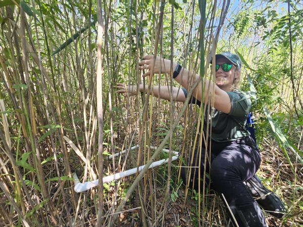
A USGS wetland scientist (GLSC; Ann Arbor, Michigan) counts the number of invasive Phragmites australis stems within a sampling quadrat in an effort to provide information about various control strategies used to manage the plant. Photo credit: Taaja Tucker-Silva, USGS.
Why are wetlands important?
Wetlands provide habitat for thousands of species of aquatic and terrestrial plants and animals. Wetlands are valuable for flood protection, water quality improvement, shoreline erosion control, natural products, recreation, and aesthetics.
Wetlands are among the most productive habitats on earth providing shelter and nursery areas for commercially and recreationally important animals like fish and shellfish, as well as wintering grounds for migrating birds. Coastal marshes are particularly valuable for preventing loss of life and property by moderating extreme floods and buffering the land from storms; they also form natural reservoirs and help maintain desirable water quality.
Learn more: USGS Wetland and Aquatic Research Center
Related

What is the Brown Marsh phenomenon? What is the Brown Marsh phenomenon?
Sudden marsh dieback events are not uncommon and have occurred in coastal marshes from the Gulf of Mexico to Maine. Brown Marsh is a term given to the unusually rapid and extensive browning of Louisiana’s saltwater marsh grass Spartina alterniflora, commonly known as oyster grass or smooth cordgrass. One of the most severe events occurred in 2000, when over 100,000 hectares (ha) of salt marsh were...

What are wetlands? What are wetlands?
Wetlands are transitional areas, sandwiched between permanently flooded deepwater environments and well-drained uplands, where the water table is usually at or near the surface or the land is covered by shallow water. They include mangroves, marshes (salt, brackish, intermediate, and fresh), swamps, forested wetlands, bogs, wet prairies, prairie potholes, and vernal pools. In general terms...

Why is elevation data so important to forecasting hurricane impact? Why is elevation data so important to forecasting hurricane impact?
The fundamental lesson of Hurricane Sandy in 2012 (and prior catastrophic storms and hurricanes) was that storm vulnerability is first and foremost a consequence of elevation. The height at which infrastructure, resources, and communities sit in relation to average tides and water levels, storm waves, surge, and flood waters determines their exposure to overwhelmingly powerful damaging forces...

How would sea level change if all glaciers melted? How would sea level change if all glaciers melted?
There is still some uncertainty about the full volume of glaciers and ice caps on Earth, but if all of them were to melt, global sea level would rise approximately 70 meters (approximately 230 feet), flooding every coastal city on the planet. Learn more: USGS Water Science School: Glaciers and Icecaps National Snow and Ice Data Center: Facts about Glaciers U.S. Global Change Research Program: Sea...
Wetland Scientist
A USGS wetland scientist (GLSC; Ann Arbor, Michigan) counts the number of invasive Phragmites australis stems within a sampling quadrat in an effort to provide information about various control strategies used to manage the plant. Photo credit: Taaja Tucker-Silva, USGS.

Mercury and Rice in the California Delta: Lessons Linking Wetlands to Water to Wildlife
Mercury and Rice in the California Delta: Lessons Linking Wetlands to Water to Wildlife- Wetlands are hotspots for mercury methylation and export of methylmercury to aquatic foodwebs.
- Rice is the most abundant wetland type in California and globally in temperate and tropical latitudes.

Collecting data on coastal wetland on Long Island, NY
Collecting data on coastal wetland on Long Island, NYCollecting data on coastal wetland on Long Island, NY
Collecting data on coastal wetland on Long Island, NY
Collecting data on coastal wetland on Long Island, NYCollecting data on coastal wetland on Long Island, NY

Louisiana's changing coastal wetlands
An aerial view of coastal marshes along Bayou Dufrene, southwest of the town of Dulac in Louisiana's Terrebonne Basin.
An aerial view of coastal marshes along Bayou Dufrene, southwest of the town of Dulac in Louisiana's Terrebonne Basin.

Trumpeter Swans on a Wetland
A family of Trumpeter Swans sits on the earthen berm enclosing a restored wetland unit at the Ottawa National Wildlife Refuge. Photo Credit: USGS.
A family of Trumpeter Swans sits on the earthen berm enclosing a restored wetland unit at the Ottawa National Wildlife Refuge. Photo Credit: USGS.

PubTalk 5/2012 — Restoring the Wild Heart of South San Francisco Bay
PubTalk 5/2012 — Restoring the Wild Heart of South San Francisco Bay--The South Bay Salt Pond Restoration Project
By Laura Valoppi, Lead Scientist
PubTalk 5/2012 — Restoring the Wild Heart of South San Francisco Bay
PubTalk 5/2012 — Restoring the Wild Heart of South San Francisco Bay--The South Bay Salt Pond Restoration Project
By Laura Valoppi, Lead Scientist

Recreating wetland-stream complexes in urban watersheds, Howards Branch, Baltimore, Maryland
Recreating wetland-stream complexes in urban watersheds, Howards Branch, Baltimore, MarylandFaith Fitzpatrick (U.S. Geological Survey), Ronald Bowen (Anne Arundel County Department of Public Works), Kevin Smith (Maryland Department of Natural Resources), and Keith Underwood (Underwood and Assoc.) talk about recreating an Atlantic White Cedar wetland at an old millpond setting along a highly urban section of Howards Branch.

Wade into Wetlands Research
Slideshow of images related to USGS wetlands research.
By
Slideshow of images related to USGS wetlands research.
By

Potential Effects of Elevated CO2 and Climate Change on Coastal Wetlands
Potential Effects of Elevated CO2 and Climate Change on Coastal WetlandsThis video provides an overview of direct and indirect effects of increases in atmospheric CO2 on coastal wetlands using a salt marsh-mangrove community as an example.
By

Sea-Level Rise, Subsidence, and Wetland Loss
This video describes causes of wetland loss in the Mississippi River Delta.
By
This video describes causes of wetland loss in the Mississippi River Delta.
By

Effects of Sea-Level Rise on Coastal Wetlands in the Mississippi Delta
Effects of Sea-Level Rise on Coastal Wetlands in the Mississippi DeltaThis video describes research being conducted by Dr. Karen McKee, USGS Research Ecologist, and her university partner, Dr. Julia Cherry. Their goal is to better understand the effects of sea-level rise and other global change factors on coastal wetlands in the Mississippi River Delta. This region contains over 40% of the U.S.

Coastal Louisiana: Impacts of Hurricanes on Salt Marsh and Mangrove Wetlands
Coastal Louisiana: Impacts of Hurricanes on Salt Marsh and Mangrove WetlandsThis video describes research conducted by Dr. Karen McKee, USGS Research Ecologist, and her university partners, Dr. Irv Mendelssohn (Louisiana State University) and Dr. Mark Hester (University of Louisiana). They are studying the effects of hurricanes on marsh and mangrove wetlands in the Mississippi River Delta, which contains over 40% of the U.S.

White Heron in the Wetlands
White heron wading in the wetlands in Ironia, New Jersey
White heron wading in the wetlands in Ironia, New Jersey

Wetland Revival
USGS scientists deliver a variety of science in the effort to restore wetlands to over 25,000 acres in San Francisco Bay. "Wetland Revival" shows how science is contributing to the transformation of once industrial salt producing ponds into more natural habitat. The program was completed in 2008. USGS General Information Product 61.
By
Related
What is the Brown Marsh phenomenon? What is the Brown Marsh phenomenon?
Sudden marsh dieback events are not uncommon and have occurred in coastal marshes from the Gulf of Mexico to Maine. Brown Marsh is a term given to the unusually rapid and extensive browning of Louisiana’s saltwater marsh grass Spartina alterniflora, commonly known as oyster grass or smooth cordgrass. One of the most severe events occurred in 2000, when over 100,000 hectares (ha) of salt marsh were...
What are wetlands? What are wetlands?
Wetlands are transitional areas, sandwiched between permanently flooded deepwater environments and well-drained uplands, where the water table is usually at or near the surface or the land is covered by shallow water. They include mangroves, marshes (salt, brackish, intermediate, and fresh), swamps, forested wetlands, bogs, wet prairies, prairie potholes, and vernal pools. In general terms...
Why is elevation data so important to forecasting hurricane impact? Why is elevation data so important to forecasting hurricane impact?
The fundamental lesson of Hurricane Sandy in 2012 (and prior catastrophic storms and hurricanes) was that storm vulnerability is first and foremost a consequence of elevation. The height at which infrastructure, resources, and communities sit in relation to average tides and water levels, storm waves, surge, and flood waters determines their exposure to overwhelmingly powerful damaging forces...
How would sea level change if all glaciers melted? How would sea level change if all glaciers melted?
There is still some uncertainty about the full volume of glaciers and ice caps on Earth, but if all of them were to melt, global sea level would rise approximately 70 meters (approximately 230 feet), flooding every coastal city on the planet. Learn more: USGS Water Science School: Glaciers and Icecaps National Snow and Ice Data Center: Facts about Glaciers U.S. Global Change Research Program: Sea...
Wetland Scientist
A USGS wetland scientist (GLSC; Ann Arbor, Michigan) counts the number of invasive Phragmites australis stems within a sampling quadrat in an effort to provide information about various control strategies used to manage the plant. Photo credit: Taaja Tucker-Silva, USGS.
A USGS wetland scientist (GLSC; Ann Arbor, Michigan) counts the number of invasive Phragmites australis stems within a sampling quadrat in an effort to provide information about various control strategies used to manage the plant. Photo credit: Taaja Tucker-Silva, USGS.
Mercury and Rice in the California Delta: Lessons Linking Wetlands to Water to Wildlife
Mercury and Rice in the California Delta: Lessons Linking Wetlands to Water to Wildlife- Wetlands are hotspots for mercury methylation and export of methylmercury to aquatic foodwebs.
- Rice is the most abundant wetland type in California and globally in temperate and tropical latitudes.
Collecting data on coastal wetland on Long Island, NY
Collecting data on coastal wetland on Long Island, NYCollecting data on coastal wetland on Long Island, NY
Collecting data on coastal wetland on Long Island, NY
Collecting data on coastal wetland on Long Island, NYCollecting data on coastal wetland on Long Island, NY
Louisiana's changing coastal wetlands
An aerial view of coastal marshes along Bayou Dufrene, southwest of the town of Dulac in Louisiana's Terrebonne Basin.
An aerial view of coastal marshes along Bayou Dufrene, southwest of the town of Dulac in Louisiana's Terrebonne Basin.
Trumpeter Swans on a Wetland
A family of Trumpeter Swans sits on the earthen berm enclosing a restored wetland unit at the Ottawa National Wildlife Refuge. Photo Credit: USGS.
A family of Trumpeter Swans sits on the earthen berm enclosing a restored wetland unit at the Ottawa National Wildlife Refuge. Photo Credit: USGS.
PubTalk 5/2012 — Restoring the Wild Heart of South San Francisco Bay
PubTalk 5/2012 — Restoring the Wild Heart of South San Francisco Bay--The South Bay Salt Pond Restoration Project
By Laura Valoppi, Lead Scientist
PubTalk 5/2012 — Restoring the Wild Heart of South San Francisco Bay
PubTalk 5/2012 — Restoring the Wild Heart of South San Francisco Bay--The South Bay Salt Pond Restoration Project
By Laura Valoppi, Lead Scientist
Recreating wetland-stream complexes in urban watersheds, Howards Branch, Baltimore, Maryland
Recreating wetland-stream complexes in urban watersheds, Howards Branch, Baltimore, MarylandFaith Fitzpatrick (U.S. Geological Survey), Ronald Bowen (Anne Arundel County Department of Public Works), Kevin Smith (Maryland Department of Natural Resources), and Keith Underwood (Underwood and Assoc.) talk about recreating an Atlantic White Cedar wetland at an old millpond setting along a highly urban section of Howards Branch.
Wade into Wetlands Research
Slideshow of images related to USGS wetlands research.
By
Slideshow of images related to USGS wetlands research.
By
Potential Effects of Elevated CO2 and Climate Change on Coastal Wetlands
Potential Effects of Elevated CO2 and Climate Change on Coastal WetlandsThis video provides an overview of direct and indirect effects of increases in atmospheric CO2 on coastal wetlands using a salt marsh-mangrove community as an example.
By
Sea-Level Rise, Subsidence, and Wetland Loss
This video describes causes of wetland loss in the Mississippi River Delta.
By
This video describes causes of wetland loss in the Mississippi River Delta.
By
Effects of Sea-Level Rise on Coastal Wetlands in the Mississippi Delta
Effects of Sea-Level Rise on Coastal Wetlands in the Mississippi DeltaThis video describes research being conducted by Dr. Karen McKee, USGS Research Ecologist, and her university partner, Dr. Julia Cherry. Their goal is to better understand the effects of sea-level rise and other global change factors on coastal wetlands in the Mississippi River Delta. This region contains over 40% of the U.S.
Coastal Louisiana: Impacts of Hurricanes on Salt Marsh and Mangrove Wetlands
Coastal Louisiana: Impacts of Hurricanes on Salt Marsh and Mangrove WetlandsThis video describes research conducted by Dr. Karen McKee, USGS Research Ecologist, and her university partners, Dr. Irv Mendelssohn (Louisiana State University) and Dr. Mark Hester (University of Louisiana). They are studying the effects of hurricanes on marsh and mangrove wetlands in the Mississippi River Delta, which contains over 40% of the U.S.
White Heron in the Wetlands
White heron wading in the wetlands in Ironia, New Jersey
White heron wading in the wetlands in Ironia, New Jersey
Wetland Revival
USGS scientists deliver a variety of science in the effort to restore wetlands to over 25,000 acres in San Francisco Bay. "Wetland Revival" shows how science is contributing to the transformation of once industrial salt producing ponds into more natural habitat. The program was completed in 2008. USGS General Information Product 61.
By
USGS scientists deliver a variety of science in the effort to restore wetlands to over 25,000 acres in San Francisco Bay. "Wetland Revival" shows how science is contributing to the transformation of once industrial salt producing ponds into more natural habitat. The program was completed in 2008. USGS General Information Product 61.
By
Updated Date: May 21, 2026