An official website of the United States government
Here's how you know
Official websites use .gov
A .gov website belongs to an official government organization in the United States.
Secure .gov websites use HTTPS
A lock () or https:// means you’ve safely connected to the .gov website. Share sensitive information only on official, secure websites.
The U.S. Federal Oceanographic Fleet supports Federal and academic marine activities that address a wide range of national needs. The Fleet is comprised of ships greater than 130 feet (40 meters) in length that are owned and operated or leased by the Federal government. Execution of the USGS mission in data collection, analysis, and interpretation in marine environments relies on Fleet vessels.
USGS marine research addresses a variety of national interests, including natural hazards and disaster preparedness, resource assessment and management, economic development, and national security.
We use the Federal Fleet and commercial vessels to characterize, monitor, and assess hazard and resource potential across U.S. waters and to conduct research on natural and human drivers of environmental change.
The USGS is involved in approximately 8-9 months of activity on Global to Regional class Federal Fleet vessels each year. During this time, USGS scientists serve as both scientific leads and crucial collaborators, working primarily with the National Oceanic and Atmospheric Administration (NOAA), U.S. National Science Foundation (NSF), and Bureau of Ocean Energy Management (BOEM). Studies generally take place over multiple field seasons and the data and samples obtained are used for years after for continued analysis and modeling.
Through robust data collection, we gain crucial insights into marine geohazards like underwater earthquakes, volcanic eruptions, and landslides, enabling us to better forecast and prepare for natural disasters such as tsunamis.
Understanding these hazards and the seafloor's properties is essential for maintaining national security, as it impacts naval operations, offshore infrastructure, and maritime transportation.
Moreover, comprehensive data supports sustainable resource management and conservation efforts, reducing the risk of overexploitation and ecosystem degradation.
Three-dimensional view of central California's Hosgri fault 45 meters below the seafloor, revealing fault strands (black), and potential paths along the fault that fluid could follow (green/blue). The other colors represent different geologic layers.
Examples of USGS activity on U.S. Federal Fleet Vessels
Marine Geohazards: Subduction Zone Hazards
The USGS uses the Federal Fleet to conduct a variety of seismic surveys, high-resolution mapping, and piston-coring efforts to collect geological and geophysical data needed to (1) quantify the probability of marine hazards, such as earthquakes, submarine landslides, tsunamis, and volcanic eruptions; (2) understand the underlying processes of these marine hazards to inform hazard estimations; and (3) develop reliable deterministic and probabilistic estimates of possible hazards and the probability of occurrence to be used by engineers and policymakers.
Gulf of America The USGS studies seafloor landslides and debris flows as part of the marine geohazards focus. USGS surveys conducted in multiple years (2021, 2022, 2024) used USGS equipment systems to acquire high-resolution geophysical images and cores from surface sediment debris flows in the Mississippi River delta front as part of a multi-agency project to characterize hazardous seafloor conditions in this area.
Caribbean The USGS acquires data in offshore active earthquake zones to characterize the risk to coastal communities from seismic and tsunami hazards. To better understand the source area for earthquakes that culminated in the destructive M6.4 quake of January 13, 2020 offshore southwestern Puerto Rico, the USGS sponsored several days of high-resolution multichannel seismic data acquisition in 2023. This was part of a larger NSF-led collaborative project to collect both reflection and refraction data to explore plate boundary and seismogenic fault processes in the Caribbean.
The black lines on this map show the locations where a USGS team collected multichannel seismic reflection profiles during a series of research cruises in March 2020. The dashed purple lines are hypothesized faults, based on the distribution of earthquake epicenters. The red marks are preliminary indications of faults, based on the seismic reflection data gathered during the cruise.
U.S. Pacific Margin (Cascadia and Southeast Alaska) The USGS led a study along the Queen Charlotte Fault offshore Southeast Alaska and British Columbia to study this major transform boundary between the Pacific and North American plates. The primary goal of the study was to gain a better understanding of the earthquake, tsunami, and underwater-landslide hazards throughout southeastern Alaska, as well as gather data to develop geologic models that can be applied to similar plate boundaries around the globe, such as the San Andreas fault system in southern California, the Alpine fault in New Zealand, and the North Anatolian fault in Turkey.
A computed-generated image showing the Queen Charlotte Fault and nearshore area, using bathymetry and lidar data.
Atlantic Ocean The USGS collaborated on proposal formulation and then participated in the 33-day, multichannel seismic and coring cruise focused on the Cape Fear landslide, the largest submarine slide on the U.S. Atlantic margin. For this 2023 cruise, the USGS contributed a portable EK80 imaging capability.
Naturally occurring gas hydrate is an icelike combination of water and (usually) methane gas that forms in sediments below the sea floor and in areas of continuous permafrost when pressure and temperature conditions are appropriate. The USGS Gas Hydrates Project uses the Federal Fleet to study natural gas hydrates in deepwater marine systems. The primary goals are to evaluate methane hydrates as a potential energy source, investigate the interaction between methane hydrate destabilization and climate change at short and long time scales, and study the spatial and temporal connections between submarine slope failures and gas hydrate dynamics.
Atlantic Ocean With support from the Department of Energy (DOE) and BOEM, the USGS collected 2,000 km of high-resolution seismic data and coincident EK80 data in the Mid-Atlantic Bight in 2018 to constrain the distribution of shallow gas and gas hydrates and locate active erosional features on the outermost shelf and upper continental slope. The USGS operated four airguns with a 1-km-long streamer for this research and later developed a machine learning framework to automatically detect the top of gas in marine seismic data. This study built on five previous USGS-led cruises and ongoing collaborative cruises to study marine methane seepage and methane sources, sea-air methane flux, and fate of methane in the water column between Cape Hatteras and the southern New England margin. Many of these cruises have included subseafloor imaging with USGS high-resolution geophysical equipment and seafloor mapping with a portable intermediate depth multibeam sonar.
The Global Marine Mineral Resources project studies deep ocean minerals within the U.S. Exclusive Economic Zone and throughout the Earth’s oceans. Their research concerns the setting, genesis, and metal enrichment processes of mineral deposits, the relationship between marine minerals related and deep-sea biota, and the potential geochemical footprint of any seafloor mining. The project aims to provide stakeholders with the best available science regarding potential resources and environmental impacts associated with accessing those resources. Findings inform stakeholders, including the public, government, industry, academics, and non-governmental organizations, about mineral wealth and its environmental setting within the vast offshore territory of the U.S. and helps them determine which regions and deposits may warrant further research.
Pacific Ocean The USGS is the lead federal agency for scientific studies of critical marine minerals and collaborates with BOEM to identify locations of the deposits and to characterize associated benthic communities. In 2022, the USGS led a 20-day cruise to the Escanaba Trough, the only seafloor spreading center within the U.S. Exclusive Economic Zone, and used a remotely operated vehicle and an autonomous underwater vehicle, a gravity corer, and conductivity, temperature, and depth devices CTDs to acquire samples and measure environmental parameters to understand the extent and composition of the hydrothermal mineral forming system and the associated benthic ecosystem.
The USGS Law of the Sea project helps to determine the outer limits of the extended continental shelf (ECS)—the portion of the continental shelf beyond 200 nautical miles—of the United States. It is an important maritime zone that holds many resources and vital habitats for marine life. Its size may exceed one million square kilometers, twice the area of California. The USGS provides geologic measurements and research to help define the U.S. ECS collaboratively with the Department of State, NOAA, and other federal agencies.
Arctic, Atlantic, Bering Sea, Gulf of America, western Pacific, and Pacific West Coast USGS scientists led or participated in 10 major research expeditions between 2007 and 2016 to support delineation of the U.S. Extended Continental Shelf. During this time, more than 28,000 km of multichannel seismic reflection data were acquired along the U.S. margins. This constitutes the largest offshore mapping effort ever conducted by the United States. In 2023, the geographic coordinates defining the outer limits of the U.S. ECS were released.
The United States has ECS in seven offshore areas (Figure 1): the Arctic, Atlantic (east coast), Bering Sea, Pacific (west coast), Mariana Islands, and two areas in the Gulf of America. The U.S. ECS area is approximately one million square kilometers – an area about twice the size of California.
Exploration and Characterization
The USGS frequently sails its scientists on Federal Oceanographic Fleet vessels for discovery-based research supported by NOAA. Additional support for expeditions involving USGS personnel often comes from BOEM.
Atlantic USGS scientists were leaders in the DEEP SEARCH project that explored Atlantic margin canyons and deep-sea corals to collect critical baseline information about deepwater habitats. DEEP SEARCH discovered the largest coral reef in the deep ocean on the Blake Plateau. USGS, BOEM, and NOAA later returned to the Blake Plateau to better understand the impacts of historic seabed mining equipment testing conducted in the 1970s and collect more detailed seafloor information, including bathymetry and camera imagery.
Brinsingid starfish, cup corals, and a diversity of other corals including both octocorals and stony corals at Pamlico Canyon.
Pacific USGS researchers are key leaders of the Pacific-margin EXPRESS campaign to study benthic habitats, seafloor minerals, and marine geohazards through a BOEM, NOAA, USGS, and Monterey Bay Aquarium Research Institute collaborative.
Atlantic and Pacific USGS scientists have served as co-leads for discovery-based explorations on the Atlantic and Pacific margins. USGS researchers participate heavily in the real-time seafloor exploration via telepresence from the vessel and have published major research findings on benthic ecosystems, deep sea corals, and marine methane seeps.
USGS relies on the Federal Fleet to fulfill its mission to better understand coastal and marine hazards and resources.
By prioritizing data collection and analysis, we provide decision makers with the information they need to enhance our resilience to natural disasters and improve the efficiency of resource management, thereby safeguarding various industries and critical national energy and transportation infrastructure.
Societal Issue: Uncertainty related to rupture extent, slip distribution, and recurrence of past subduction megathrust earthquakes in the Pacific Northwest (northern CA, OR, WA, and southern BC) leads to ambiguity in earthquake and tsunami hazard assessments and hinders our ability to prepare for future events.
Societal Issue: Uncertainty related to rupture extent, slip distribution, and recurrence of past subduction megathrust earthquakes in the Pacific Northwest (northern CA, OR, WA, and southern BC) leads to ambiguity in earthquake and tsunami hazard assessments and hinders our ability to prepare for future events.
The Global Marine Mineral Resources project studies deep ocean minerals that occur within the U.S. Exclusive Economic Zone and areas beyond national jurisdictions. Our research concerns the setting, genesis, and metal enrichment processes of mineral occurrences, the relationship between marine minerals and deep-sea biota, and the potential geochemical footprint of any seafloor mining. We aim to...
The Global Marine Mineral Resources project studies deep ocean minerals that occur within the U.S. Exclusive Economic Zone and areas beyond national jurisdictions. Our research concerns the setting, genesis, and metal enrichment processes of mineral occurrences, the relationship between marine minerals and deep-sea biota, and the potential geochemical footprint of any seafloor mining. We aim to...
Coastal and marine geohazards are sudden and extreme events beneath the ocean that threaten coastal populations. These underwater hazards include earthquakes, volcanic eruptions, landslides, and tsunamis. The tectonically active west coast of the Americas is prone to such hazards, as it lies along the boundaries of major tectonic plates that make up the Earth's crust—the North American, Caribbean...
Coastal and Marine Geohazards of the U.S. West Coast and Alaska
Coastal and marine geohazards are sudden and extreme events beneath the ocean that threaten coastal populations. These underwater hazards include earthquakes, volcanic eruptions, landslides, and tsunamis. The tectonically active west coast of the Americas is prone to such hazards, as it lies along the boundaries of major tectonic plates that make up the Earth's crust—the North American, Caribbean...
Basic research to develop the geologic record of paleotsunamis and improve the ability to interpret that record is needed to mitigate tsunami risk in the U.S.
Tsunami Hazards, Modeling, and the Sedimentary Record
Basic research to develop the geologic record of paleotsunamis and improve the ability to interpret that record is needed to mitigate tsunami risk in the U.S.
EXPRESS is a multi-year, multi-institution cooperative research campaign in deep sea areas of California, Oregon, and Washington, including the continental shelf and slope. EXPRESS data and information are intended to guide wise use of living marine resources and habitats, inform ocean energy and mineral resource decisions, and improve offshore hazard assessments.
EXPRESS: Expanding Pacific Research and Exploration of Submerged Systems
EXPRESS is a multi-year, multi-institution cooperative research campaign in deep sea areas of California, Oregon, and Washington, including the continental shelf and slope. EXPRESS data and information are intended to guide wise use of living marine resources and habitats, inform ocean energy and mineral resource decisions, and improve offshore hazard assessments.
DISCOVRE ( DIversity, Systematics and COnnectivity of Vulnerable Reef Ecosystems) is an integrated, multidisciplinary, international effort investigating the unique and fragile deep-sea coral environments from the microscopic level to the ecosystem level.
DISCOVRE: Diversity, Systematics and Connectivity of Vulnerable Reef Ecosystems
DISCOVRE ( DIversity, Systematics and COnnectivity of Vulnerable Reef Ecosystems) is an integrated, multidisciplinary, international effort investigating the unique and fragile deep-sea coral environments from the microscopic level to the ecosystem level.
The USGS Gas Hydrates Project has been making contributions to advance understanding of US and international gas hydrates science for at least three decades. The research group working on gas hydrates at the USGS is among the largest in the US and has expertise in all the major geoscience disciplines, as well as in the physics and chemistry of gas hydrates, the geotechnical properties of hydrate...
The USGS Gas Hydrates Project has been making contributions to advance understanding of US and international gas hydrates science for at least three decades. The research group working on gas hydrates at the USGS is among the largest in the US and has expertise in all the major geoscience disciplines, as well as in the physics and chemistry of gas hydrates, the geotechnical properties of hydrate...
National Ocean Month: 10 Ocean Field Sites You’ve Got to “Sea” to Believe
The ocean is a beautiful, dynamic, and sometimes dangerous place. Unsurprisingly, this is probably why a lot of USGS researchers spend their entire careers studying it. In celebration of National Ocean Month, we thought it would be a good time to dive in and feature ten ocean field sites you’ve got to “sea” to believe.
The ocean is a beautiful, dynamic, and sometimes dangerous place. Unsurprisingly, this is probably why a lot of USGS researchers spend their entire careers studying it. In celebration of National Ocean Month, we thought it would be a good time to dive in and feature ten ocean field sites you’ve got to “sea” to believe.
Collecting Sediment Cores from the Cascadia Subduction Zone
To better understand the geophysical characteristics and seismic history of the Cascadia Subduction Zone, USGS researchers conduct fieldwork at sea to collect evidence of turbidity currents from underwater landslides likely caused by earthquake shaking.
To better understand the geophysical characteristics and seismic history of the Cascadia Subduction Zone, USGS researchers conduct fieldwork at sea to collect evidence of turbidity currents from underwater landslides likely caused by earthquake shaking.
The familiar saying “good things come in small packages” holds especially true for deep-sea biological communities at hydrothermal vents, including those at Escanaba Trough, a seafloor spreading center located almost 200 miles off the northern California coast.
The familiar saying “good things come in small packages” holds especially true for deep-sea biological communities at hydrothermal vents, including those at Escanaba Trough, a seafloor spreading center located almost 200 miles off the northern California coast.
EXPRESS: Expanding Pacific Research and Exploration of Submerged Systems
Expanding Pacific Research and Exploration of Submerged Systems (EXPRESS) is an inter-agency federal and nonfederal collaborative research effort aimed at gathering new data of the deep ocean, continental shelf and slope offshore of California, Oregon and Washington.
Expanding Pacific Research and Exploration of Submerged Systems (EXPRESS) is an inter-agency federal and nonfederal collaborative research effort aimed at gathering new data of the deep ocean, continental shelf and slope offshore of California, Oregon and Washington.
Seafloor features such as sulfide mounds and chimneys are prominent evidence of hydrothermal activity. These features, whether active or dormant, are just the tip of the iceberg, so to speak; much of the “plumbing” of hydrothermal systems exists beneath the seafloor surface.
Seafloor features such as sulfide mounds and chimneys are prominent evidence of hydrothermal activity. These features, whether active or dormant, are just the tip of the iceberg, so to speak; much of the “plumbing” of hydrothermal systems exists beneath the seafloor surface.
For scientists aboard the Escanaba Trough expedition, obtaining sediment cores or deep-sea biological and geological samples after a Jason dive is only the beginning.
For scientists aboard the Escanaba Trough expedition, obtaining sediment cores or deep-sea biological and geological samples after a Jason dive is only the beginning.
Critical to scientific operations aboard the Escanaba Trough expedition is the submersible robots Sentry and Jason. Owned and operated by the Woods Hole Oceanographic Institute (WHOI), these robots allow researchers to observe seafloor features and collect data from depths seldom visited by humans.
Critical to scientific operations aboard the Escanaba Trough expedition is the submersible robots Sentry and Jason. Owned and operated by the Woods Hole Oceanographic Institute (WHOI), these robots allow researchers to observe seafloor features and collect data from depths seldom visited by humans.
Embarking on a three-week deep-sea research expedition requires a lot of preparation. For this expedition to Escanaba Trough, U.S. Geological Survey scientists and partners spend the first few days in port, building their laboratory space aboard the research vessel Thomas G. Thompson.
Embarking on a three-week deep-sea research expedition requires a lot of preparation. For this expedition to Escanaba Trough, U.S. Geological Survey scientists and partners spend the first few days in port, building their laboratory space aboard the research vessel Thomas G. Thompson.
Climate Science Champions, Season 2: Kira Mizell, Research Oceanographer
Research Oceanographer Kira Mizell studies change in ocean chemistry by collecting marine minerals, looking for insights into past climate conditions and geologic history.
Research Oceanographer Kira Mizell studies change in ocean chemistry by collecting marine minerals, looking for insights into past climate conditions and geologic history.
Web Portal Offers Access to National Marine Seismic Surveys
In a significant stride towards fostering scientific exploration and understanding of the ocean floor and below, the United States Geological Survey...
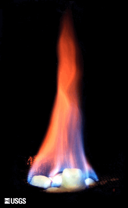
Where Ice Gave Way to Fire: New Study Sheds Light on British Columbia's Deglacial Volcanoes
In a study conducted by the Geological Survey of Canada, USGS, and the University of Alberta, Edmonton, researchers analyzed seismic and sediment data...
Methane Seep Distribution in the Cascadia Subduction Zone
Beneath the seafloor lie vast stores of methane—a potent greenhouse gas—produced by the degradation of organic material, either by the earth’s heat or...
Hawaiian Drowned Reefs Expedition: Coral Cores Provide Glimpse into Climate Past and Future
As climate change and human-induced disruptions threaten coral reefs worldwide, scientists are increasingly turning to the past to better understand...
Societal Issue: Uncertainty related to rupture extent, slip distribution, and recurrence of past subduction megathrust earthquakes in the Pacific Northwest (northern CA, OR, WA, and southern BC) leads to ambiguity in earthquake and tsunami hazard assessments and hinders our ability to prepare for future events.
Societal Issue: Uncertainty related to rupture extent, slip distribution, and recurrence of past subduction megathrust earthquakes in the Pacific Northwest (northern CA, OR, WA, and southern BC) leads to ambiguity in earthquake and tsunami hazard assessments and hinders our ability to prepare for future events.
The Global Marine Mineral Resources project studies deep ocean minerals that occur within the U.S. Exclusive Economic Zone and areas beyond national jurisdictions. Our research concerns the setting, genesis, and metal enrichment processes of mineral occurrences, the relationship between marine minerals and deep-sea biota, and the potential geochemical footprint of any seafloor mining. We aim to...
The Global Marine Mineral Resources project studies deep ocean minerals that occur within the U.S. Exclusive Economic Zone and areas beyond national jurisdictions. Our research concerns the setting, genesis, and metal enrichment processes of mineral occurrences, the relationship between marine minerals and deep-sea biota, and the potential geochemical footprint of any seafloor mining. We aim to...
Coastal and marine geohazards are sudden and extreme events beneath the ocean that threaten coastal populations. These underwater hazards include earthquakes, volcanic eruptions, landslides, and tsunamis. The tectonically active west coast of the Americas is prone to such hazards, as it lies along the boundaries of major tectonic plates that make up the Earth's crust—the North American, Caribbean...
Coastal and Marine Geohazards of the U.S. West Coast and Alaska
Coastal and marine geohazards are sudden and extreme events beneath the ocean that threaten coastal populations. These underwater hazards include earthquakes, volcanic eruptions, landslides, and tsunamis. The tectonically active west coast of the Americas is prone to such hazards, as it lies along the boundaries of major tectonic plates that make up the Earth's crust—the North American, Caribbean...
Basic research to develop the geologic record of paleotsunamis and improve the ability to interpret that record is needed to mitigate tsunami risk in the U.S.
Tsunami Hazards, Modeling, and the Sedimentary Record
Basic research to develop the geologic record of paleotsunamis and improve the ability to interpret that record is needed to mitigate tsunami risk in the U.S.
EXPRESS is a multi-year, multi-institution cooperative research campaign in deep sea areas of California, Oregon, and Washington, including the continental shelf and slope. EXPRESS data and information are intended to guide wise use of living marine resources and habitats, inform ocean energy and mineral resource decisions, and improve offshore hazard assessments.
EXPRESS: Expanding Pacific Research and Exploration of Submerged Systems
EXPRESS is a multi-year, multi-institution cooperative research campaign in deep sea areas of California, Oregon, and Washington, including the continental shelf and slope. EXPRESS data and information are intended to guide wise use of living marine resources and habitats, inform ocean energy and mineral resource decisions, and improve offshore hazard assessments.
DISCOVRE ( DIversity, Systematics and COnnectivity of Vulnerable Reef Ecosystems) is an integrated, multidisciplinary, international effort investigating the unique and fragile deep-sea coral environments from the microscopic level to the ecosystem level.
DISCOVRE: Diversity, Systematics and Connectivity of Vulnerable Reef Ecosystems
DISCOVRE ( DIversity, Systematics and COnnectivity of Vulnerable Reef Ecosystems) is an integrated, multidisciplinary, international effort investigating the unique and fragile deep-sea coral environments from the microscopic level to the ecosystem level.
The USGS Gas Hydrates Project has been making contributions to advance understanding of US and international gas hydrates science for at least three decades. The research group working on gas hydrates at the USGS is among the largest in the US and has expertise in all the major geoscience disciplines, as well as in the physics and chemistry of gas hydrates, the geotechnical properties of hydrate...
The USGS Gas Hydrates Project has been making contributions to advance understanding of US and international gas hydrates science for at least three decades. The research group working on gas hydrates at the USGS is among the largest in the US and has expertise in all the major geoscience disciplines, as well as in the physics and chemistry of gas hydrates, the geotechnical properties of hydrate...
National Ocean Month: 10 Ocean Field Sites You’ve Got to “Sea” to Believe
The ocean is a beautiful, dynamic, and sometimes dangerous place. Unsurprisingly, this is probably why a lot of USGS researchers spend their entire careers studying it. In celebration of National Ocean Month, we thought it would be a good time to dive in and feature ten ocean field sites you’ve got to “sea” to believe.
The ocean is a beautiful, dynamic, and sometimes dangerous place. Unsurprisingly, this is probably why a lot of USGS researchers spend their entire careers studying it. In celebration of National Ocean Month, we thought it would be a good time to dive in and feature ten ocean field sites you’ve got to “sea” to believe.
Collecting Sediment Cores from the Cascadia Subduction Zone
To better understand the geophysical characteristics and seismic history of the Cascadia Subduction Zone, USGS researchers conduct fieldwork at sea to collect evidence of turbidity currents from underwater landslides likely caused by earthquake shaking.
To better understand the geophysical characteristics and seismic history of the Cascadia Subduction Zone, USGS researchers conduct fieldwork at sea to collect evidence of turbidity currents from underwater landslides likely caused by earthquake shaking.
The familiar saying “good things come in small packages” holds especially true for deep-sea biological communities at hydrothermal vents, including those at Escanaba Trough, a seafloor spreading center located almost 200 miles off the northern California coast.
The familiar saying “good things come in small packages” holds especially true for deep-sea biological communities at hydrothermal vents, including those at Escanaba Trough, a seafloor spreading center located almost 200 miles off the northern California coast.
EXPRESS: Expanding Pacific Research and Exploration of Submerged Systems
Expanding Pacific Research and Exploration of Submerged Systems (EXPRESS) is an inter-agency federal and nonfederal collaborative research effort aimed at gathering new data of the deep ocean, continental shelf and slope offshore of California, Oregon and Washington.
Expanding Pacific Research and Exploration of Submerged Systems (EXPRESS) is an inter-agency federal and nonfederal collaborative research effort aimed at gathering new data of the deep ocean, continental shelf and slope offshore of California, Oregon and Washington.
Seafloor features such as sulfide mounds and chimneys are prominent evidence of hydrothermal activity. These features, whether active or dormant, are just the tip of the iceberg, so to speak; much of the “plumbing” of hydrothermal systems exists beneath the seafloor surface.
Seafloor features such as sulfide mounds and chimneys are prominent evidence of hydrothermal activity. These features, whether active or dormant, are just the tip of the iceberg, so to speak; much of the “plumbing” of hydrothermal systems exists beneath the seafloor surface.
For scientists aboard the Escanaba Trough expedition, obtaining sediment cores or deep-sea biological and geological samples after a Jason dive is only the beginning.
For scientists aboard the Escanaba Trough expedition, obtaining sediment cores or deep-sea biological and geological samples after a Jason dive is only the beginning.
Critical to scientific operations aboard the Escanaba Trough expedition is the submersible robots Sentry and Jason. Owned and operated by the Woods Hole Oceanographic Institute (WHOI), these robots allow researchers to observe seafloor features and collect data from depths seldom visited by humans.
Critical to scientific operations aboard the Escanaba Trough expedition is the submersible robots Sentry and Jason. Owned and operated by the Woods Hole Oceanographic Institute (WHOI), these robots allow researchers to observe seafloor features and collect data from depths seldom visited by humans.
Embarking on a three-week deep-sea research expedition requires a lot of preparation. For this expedition to Escanaba Trough, U.S. Geological Survey scientists and partners spend the first few days in port, building their laboratory space aboard the research vessel Thomas G. Thompson.
Embarking on a three-week deep-sea research expedition requires a lot of preparation. For this expedition to Escanaba Trough, U.S. Geological Survey scientists and partners spend the first few days in port, building their laboratory space aboard the research vessel Thomas G. Thompson.
Climate Science Champions, Season 2: Kira Mizell, Research Oceanographer
Research Oceanographer Kira Mizell studies change in ocean chemistry by collecting marine minerals, looking for insights into past climate conditions and geologic history.
Research Oceanographer Kira Mizell studies change in ocean chemistry by collecting marine minerals, looking for insights into past climate conditions and geologic history.
Web Portal Offers Access to National Marine Seismic Surveys
In a significant stride towards fostering scientific exploration and understanding of the ocean floor and below, the United States Geological Survey...
Where Ice Gave Way to Fire: New Study Sheds Light on British Columbia's Deglacial Volcanoes
In a study conducted by the Geological Survey of Canada, USGS, and the University of Alberta, Edmonton, researchers analyzed seismic and sediment data...
Methane Seep Distribution in the Cascadia Subduction Zone
Beneath the seafloor lie vast stores of methane—a potent greenhouse gas—produced by the degradation of organic material, either by the earth’s heat or...
Hawaiian Drowned Reefs Expedition: Coral Cores Provide Glimpse into Climate Past and Future
As climate change and human-induced disruptions threaten coral reefs worldwide, scientists are increasingly turning to the past to better understand...