
Boardwalk leading towards Iguazu Falls viewpoint. Iguazu Falls on the border of Brazil and Argentina. A river in the foreground is bordered by green vegetation, with waterfalls in background.
Images
Below are images associated with the Office of International Programs.
Images appear according to the year they were taken. To search, type a keyword or use filters from the dropdown menu.
Filter Total Items: 101

Iguazu Falls boardwalk
Boardwalk leading towards Iguazu Falls viewpoint. Iguazu Falls on the border of Brazil and Argentina. A river in the foreground is bordered by green vegetation, with waterfalls in background.

Itaipu Binacional Dam spillway
Itaipu Binacional Dam spillway. The binational dam is located on the Parana River on the border of Brazil and Paraguay.
Itaipu Binacional Dam spillway. The binational dam is located on the Parana River on the border of Brazil and Paraguay.

USGS employees inside Itaipu Binational Dam on Parana River bottom
USGS employees inside Itaipu Binational Dam on Parana River bottom(L to R) USGS's Brian McCallum, Joel Groten, and Molly Wood inside Itaipu Binational dam and standing on the original Paraná River bottom on the border of Brazil and Paraguay.

Itaipu Binacional hydroelectric dam
View looking up at Itaipu Binacional hydroelectric dam and sign from below. The binational dam is located on the border of Brazil and Paraguay.
View looking up at Itaipu Binacional hydroelectric dam and sign from below. The binational dam is located on the border of Brazil and Paraguay.

Itaipu Binacional boat used for bathymetric surveys
Itaipu Binacional boat used for bathymetric surveysTwo scientists stand on and on shore near Itaipu Binacional boat used for bathymetric surveys.
Itaipu Binacional boat used for bathymetric surveys
Itaipu Binacional boat used for bathymetric surveysTwo scientists stand on and on shore near Itaipu Binacional boat used for bathymetric surveys.

USGS and Itaipu Binacional staff from Paraguay and Brazil
USGS and Itaipu Binacional staff from Paraguay and BrazilA mix of twenty two USGS and Itaipu Binacional staff from Paraguay and Brazil at a meeting.
USGS and Itaipu Binacional staff from Paraguay and Brazil
USGS and Itaipu Binacional staff from Paraguay and BrazilA mix of twenty two USGS and Itaipu Binacional staff from Paraguay and Brazil at a meeting.

Itaipu Binacional Dam sign in front of spillway
Itaipu Binacional Dam sign in front of spillway. The binational dam is located on the Parana River between Brazil and Paraguay.
Itaipu Binacional Dam sign in front of spillway. The binational dam is located on the Parana River between Brazil and Paraguay.

Itaipu Binacional hydroelectric dam control room
Person in hard hat looks through windows down into the Itaipu Binacional hydroelectric dam control room. The binational dam is located on the border of Brazil and Paraguay on the Parana River.
Person in hard hat looks through windows down into the Itaipu Binacional hydroelectric dam control room. The binational dam is located on the border of Brazil and Paraguay on the Parana River.

UN Water Conference speakers
Speakers at United Nations 2023 Water Conference side event titled, “International and Transboundary Cooperation of Integrated Water Management: From Data Collection to Implementation”. Hydrologist Joel Groten is third from left.
Speakers at United Nations 2023 Water Conference side event titled, “International and Transboundary Cooperation of Integrated Water Management: From Data Collection to Implementation”. Hydrologist Joel Groten is third from left.

Discussion between participants at United Nations 2023 Water Conference
Discussion between participants at United Nations 2023 Water ConferenceDiscussion between participants at United Nations 2023 Water Conference side event titled, “International and Transboundary Cooperation of Integrated Water Management: From Data Collection to Implementation”.

Speakers who presented at United Nations 2023 Water Conference
Speakers who presented at United Nations 2023 Water ConferenceSpeakers who presented at United Nations 2023 Water Conference side event titled, “International and Transboundary Cooperation of Integrated Water Management: From Data Collection to Implementation”.

United Nations General Assembly
View of participants from behind looking forward in the United Nations general assembly at the United Nations 2023 Water Conference.
View of participants from behind looking forward in the United Nations general assembly at the United Nations 2023 Water Conference.

#WATERACTION sign at the United Nations 2023 Water Conference
#WATERACTION sign at the United Nations 2023 Water Conference#WATERACTION sign at the United Nations 2023 Water Conference. Large individual letter sign that states "#wateraction" with New York City skyline in background.
#WATERACTION sign at the United Nations 2023 Water Conference
#WATERACTION sign at the United Nations 2023 Water Conference#WATERACTION sign at the United Nations 2023 Water Conference. Large individual letter sign that states "#wateraction" with New York City skyline in background.

United Nations Headquarters in New York City
United Nations Headquarters in New York City. View looking up at United Nations headquarters building with flags in foreground.
United Nations Headquarters in New York City. View looking up at United Nations headquarters building with flags in foreground.

Erosion and landslides along the Rio Coca in Ecuador
Erosion and landslides along the Rio Coca in EcuadorErosion and landslides along the Rio Coca in Ecuador, February 9, 2023. (Amy East, USGS).
Erosion and landslides along the Rio Coca in Ecuador
Erosion and landslides along the Rio Coca in EcuadorErosion and landslides along the Rio Coca in Ecuador, February 9, 2023. (Amy East, USGS).

USGS meeting with National Agency for Water and Basic Sanitation (ANA) scientists in Brazil
USGS meeting with National Agency for Water and Basic Sanitation (ANA) scientists in BrazilUSGS meeting with National Agency for Water and Basic Sanitation (ANA) scientists in Brazil.
Top (L – R) ANA Scientists Vitor Saback, Brian McCallum, Mauricio Abijaodi
Bottom (L-R) USGS Hydrologists Travis Knight, Joel Groten, Filipe Sampaio
ANA (Agencia Nacional De Aguas E Saneamento Basico)

USGS meeting with National Agency for Water and Basic Sanitation (ANA) scientists in Brazil standing in front of flags
USGS meeting with National Agency for Water and Basic Sanitation (ANA) scientists in Brazil standing in front of flagsUSGS meeting with National Agency for Water and Basic Sanitation (ANA) scientists in Brazil, standing in front of three flags (L-R) American flag, Brazilian Flag, ANA logo flag.
(L-R) Mauricio Abijaodi, Brian McCallum, Filipe Sampaio, Joel Groten, Travis Knight, and Vitor Saback.
ANA (Agencia Nacional De Aguas E Saneamento Basico)

Picture of a dryland stream dam
Picture of a dam in a dry stream bed in Mexico for the aridland water harvesting study.
Picture of a dam in a dry stream bed in Mexico for the aridland water harvesting study.

Gold mining site along the Cuyuni River, Guyana
Permitted small-scale gold mining site along the Cuyuni River in northwestern Guyana, June 2022. The picture depicts two gold mining hydraulic “dredges” in an excavated pit approximately 1 hectare in size. (Pete Chirico, USGS).
Permitted small-scale gold mining site along the Cuyuni River in northwestern Guyana, June 2022. The picture depicts two gold mining hydraulic “dredges” in an excavated pit approximately 1 hectare in size. (Pete Chirico, USGS).

Rock gabion, La Paz, Baja California Sur
Rock gabion installed in arroyo in La Paz, Baja California Sur. (Laura Norman, USGS)
Rock gabion installed in arroyo in La Paz, Baja California Sur. (Laura Norman, USGS)
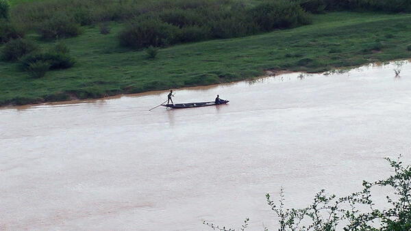
Local boaters on Niger River in Niamey, Niger
Distance photo showing a boat with local fisherfolk on the Niger River in Niamey, Niger.
Distance photo showing a boat with local fisherfolk on the Niger River in Niamey, Niger.