U.S. flag

An official website of the United States government

Videos

Explore USGS Landsat Program videos.

Filter Total Items: 65
Title slide with illustration of satellite above the Earth and text alongside Landsat: Products & Services from the USGS - Webinar, September 2023
Landsat: Products & Services from the USGS - Webinar, September 2023

The USGS Earth Resources Observation and Science (EROS) Center maintains the largest civilian collection of images of the Earth’s land surface. At EROS we study land change and produce land change data products used by researchers, resource managers, and policymakers across the nation and around the world.

The USGS Earth Resources Observation and Science (EROS) Center maintains the largest civilian collection of images of the Earth’s land surface. At EROS we study land change and produce land change data products used by researchers, resource managers, and policymakers across the nation and around the world.

Graphic of Landsat Next Planned Orbits and Swath Coverage Landsat Next Planned Orbits and Swath Coverage
Landsat Next Planned Orbits and Swath Coverage

Landsat Next is the follow on mission to Landsat-9. Landsat Next which will provide data continuity to the decades long data record of the Earth’s land from space. It is still in the planning stages and is targeted for launch around 2030.

Landsat Next is the follow on mission to Landsat-9. Landsat Next which will provide data continuity to the decades long data record of the Earth’s land from space. It is still in the planning stages and is targeted for launch around 2030.

Landsat 1 First Light Image over Dallas, Texas Landsat Records 50 Years of Growth in Dallas-Fort Worth
Landsat Records 50 Years of Growth in Dallas-Fort Worth

Landsat 1 celebrated its 50th anniversary on July 23, 2022!

Landsat 1's first satellite image shared with the world was a view of Dallas-Fort Worth, Texas. Over the course of five decades, Landsat satellites have captured the Dallas-Fort Worth area 2033 times, compiled into individual scenes in the Landsat Archive.

color thumbnail for USGS EROS Image of the Week - Landsat's 10 Millionth Scene Image of the Week - Landsat's 10 Millionth Scene
Image of the Week - Landsat's 10 Millionth Scene

Landsat 7 had the honor of acquiring the satellite program’s 10 millionth scene in November 2021.

The scene captures changes to the Dead Sea, located in Southwest Asia. The Dead Sea is mainly fed by the Jordan River, which enters from the north. However, the water level of the Dead Sea has been falling due to irrigation projects and water use upstream.

A Legacy Continues with Landsat 9 Launch

Landsat 9 is a partnership between NASA and USGS. The satellite will continue the Landsat program’s mission to capture repeat snapshots of Earth to monitor, understand and manage natural resources.

Landsat 9 is a partnership between NASA and USGS. The satellite will continue the Landsat program’s mission to capture repeat snapshots of Earth to monitor, understand and manage natural resources.

Landsat 9 Launch Trajectory Animation

When #Landsat9 is launched from Lompoc, CA, a ULA Atlas V booster will lift it out over the Pacific Ocean, over 2,500 miles away in the first 15 minutes, rising quickly. If all goes as expected, about an hour later Landsat 9 will be in orbit, 438 miles high, falling around the Earth at 16,760 miles per hour, positioned to capture years of imagery.

When #Landsat9 is launched from Lompoc, CA, a ULA Atlas V booster will lift it out over the Pacific Ocean, over 2,500 miles away in the first 15 minutes, rising quickly. If all goes as expected, about an hour later Landsat 9 will be in orbit, 438 miles high, falling around the Earth at 16,760 miles per hour, positioned to capture years of imagery.

Landsat Launches - Looking Back

A short look back at the the history of Landsat launches through the historic articles of the Lompoc Record publication.

View AD version.

A short look back at the the history of Landsat launches through the historic articles of the Lompoc Record publication.

View AD version.

Landsat Launches - Looking Back (AD)

[Audio Descriptions]
A short look back at the the history of Landsat launches through the historic articles of the Lompoc Record publication.

View non-AD version.


[Audio Descriptions]
A short look back at the the history of Landsat launches through the historic articles of the Lompoc Record publication.

View non-AD version.


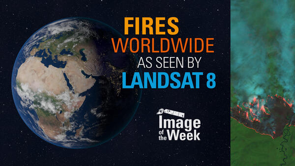
Image of the Week - Fires Worldwide as Seen by Landsat 8

Landsat satellites acquire useful data on wildfires around the world. Their near infrared and shortwave infrared imaging allows for detection and mapping of fire, smoke, and burn scars often in remote areas.

In California: the Dixie Fire near Lake Almanor and the Caldor Fire near Lake Tahoe.

Landsat satellites acquire useful data on wildfires around the world. Their near infrared and shortwave infrared imaging allows for detection and mapping of fire, smoke, and burn scars often in remote areas.
In California: the Dixie Fire near Lake Almanor and the Caldor Fire near Lake Tahoe.

Earth Observation User Case: Speaking a New Language of Landsat

Social scientists at the U.S. Geological Survey (USGS) Fort Collins Science Center – in collaboration with the USGS National Land Imaging Program – conduct Earth observation user case studies using qualitative research methods.

Social scientists at the U.S. Geological Survey (USGS) Fort Collins Science Center – in collaboration with the USGS National Land Imaging Program – conduct Earth observation user case studies using qualitative research methods.

Landsat in the Cloud: COGs and Notebooks

In the past, users spent 80% of their time downloading and preparing Landsat data to be processed. With Landsat in the cloud, you can get direct access to stream the Landsat archive without the need to download large amounts of files, by leveraging the Cloud Optimized Geotiff, or "COG".

In the past, users spent 80% of their time downloading and preparing Landsat data to be processed. With Landsat in the cloud, you can get direct access to stream the Landsat archive without the need to download large amounts of files, by leveraging the Cloud Optimized Geotiff, or "COG".

Landsat in the Cloud: LandsatLook 2.0

With existing USGS tools you can search for scenes, view thumbnail browse images of scenes, and download scene-based data, all derived from the USGS archive of scene-based products. Now that Landsat scene data has been unpacked and stored in the cloud, LandsatLook 2.0 can access that data and present it to users in ways that were not previously possible.

With existing USGS tools you can search for scenes, view thumbnail browse images of scenes, and download scene-based data, all derived from the USGS archive of scene-based products. Now that Landsat scene data has been unpacked and stored in the cloud, LandsatLook 2.0 can access that data and present it to users in ways that were not previously possible.

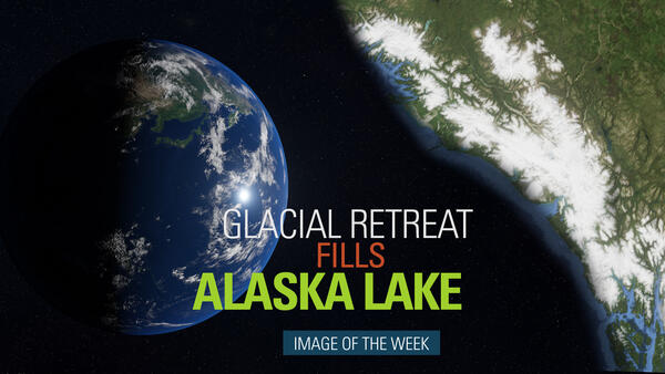
Image of the Week: Glacial Retreat Fills Alaska Lake

The visible impact of climate change on the Earth’s surface is often clearest in the Arctic’s receding glaciers and swelling glacial lakes. Southeastern Alaska’s Harlequin Lake is one of the fastest-growing in North America. These false color Landsat images show the rapidly-retreating Yakutat Glacier, which feeds the lake.

The visible impact of climate change on the Earth’s surface is often clearest in the Arctic’s receding glaciers and swelling glacial lakes. Southeastern Alaska’s Harlequin Lake is one of the fastest-growing in North America. These false color Landsat images show the rapidly-retreating Yakutat Glacier, which feeds the lake.

Earth Observation User Case: Using Landsat to Connect Space to Village

Social scientists at the U.S. Geological Survey (USGS) Fort Collins Science Center – in collaboration with the USGS National Land Imaging Program – conduct Earth observation user case studies using qualitative research methods.

Social scientists at the U.S. Geological Survey (USGS) Fort Collins Science Center – in collaboration with the USGS National Land Imaging Program – conduct Earth observation user case studies using qualitative research methods.

Using Landsat and Machine Learning to Map Urban Change

Social scientists at the U.S. Geological Survey (USGS) Fort Collins Science Center – in collaboration with the USGS National Land Imaging Program – conduct Earth observation user case studies using qualitative research methods.

Social scientists at the U.S. Geological Survey (USGS) Fort Collins Science Center – in collaboration with the USGS National Land Imaging Program – conduct Earth observation user case studies using qualitative research methods.

Earth Observation User Case Study: Ladies of Landsat

Social scientists at the U.S. Geological Survey (USGS) Fort Collins Science Center – in collaboration with the USGS National Land Imaging Program – conduct Earth observation user case studies using qualitative research methods.

Social scientists at the U.S. Geological Survey (USGS) Fort Collins Science Center – in collaboration with the USGS National Land Imaging Program – conduct Earth observation user case studies using qualitative research methods.

Image of the Week - Landsat Archive Hits 9 Million Scenes

The Landsat archive is the world's longest continuously collected record of the Earth's surface. In mid September, it notched another milestone by adding its nine millionth scene. This particular image from north central Paraguay helps tell the kind of story that only a long historical record like Landsat can.

The Landsat archive is the world's longest continuously collected record of the Earth's surface. In mid September, it notched another milestone by adding its nine millionth scene. This particular image from north central Paraguay helps tell the kind of story that only a long historical record like Landsat can.

EROS in Action – Landsat Data Offers Relief to West African Farmers

Data products from the USGS Earth Resources Observation and Science (EROS) Center have long informed the delivery of food aid through a partnership with the Famine Early Warning Systems Network (FEWS NET).

Data products from the USGS Earth Resources Observation and Science (EROS) Center have long informed the delivery of food aid through a partnership with the Famine Early Warning Systems Network (FEWS NET).

Landsat in the Cloud: Will my workflow be supported?

Will my existing workflow still be supported? Landsat downloads will continue to be available via EarthExplorer, LandsatLook, and other familiar USGS tools as they are today, without a noticeable difference to the user. The Landsat record will also remain free and open, with downloads available at no charge to the user.
 

Will my existing workflow still be supported? Landsat downloads will continue to be available via EarthExplorer, LandsatLook, and other familiar USGS tools as they are today, without a noticeable difference to the user. The Landsat record will also remain free and open, with downloads available at no charge to the user.
 

Image of the Week - Virtual Road Trip with Landsat

Summer vacation plans changed for many in 2020. Whatever your plans, Landsat can take you on a virtual road trip. Landsat 8, in its sun-synchronous polar orbit, views every national park in the U.S. every 16 days and gathers more photographic data than the most ambitious of tourists.


Summer vacation plans changed for many in 2020. Whatever your plans, Landsat can take you on a virtual road trip. Landsat 8, in its sun-synchronous polar orbit, views every national park in the U.S. every 16 days and gathers more photographic data than the most ambitious of tourists.