Water is a shared resource between people and wildlife
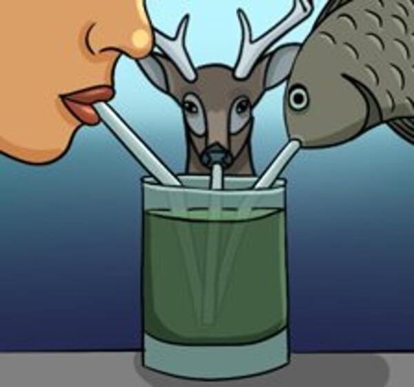
Water is a shared resource between people and wildlifeIllustration showing that drinking water is shared by both humans and wildlife, illustration created by Kathy Lee
An official website of the United States government
Here's how you know
Official websites use .gov
A .gov website belongs to an official government organization in the United States.
Secure .gov websites use HTTPS
A lock () or https:// means you’ve safely connected to the .gov website. Share sensitive information only on official, secure websites.
See our science through the images below.
Illustration showing that drinking water is shared by both humans and wildlife, illustration created by Kathy Lee
A wild rail approaches a speaker playing mating calls at San Elijo lagoon. The light-footed Ridgway’s rail is a handsome but secretive waterbird that lives on tidal marshland fragments in southern California from Santa Barbara County south to Baja California, Mexico.
The United States is developing renewable energy resources, especially solar, at a rapid rate.
Scientist istalling a swallow nest box near Ashumet Pond, Cape Cod Massachusetts as part of a study on the fate and effects of PFAS chemicals.
An environmental DNA (eDNA) sampler discretely placed among the vegetation along a stream on the Flying D Ranch in Montana.
An environmental DNA (eDNA) sampler discretely placed among streamside vegetation at the Flying D Ranch in Montana. An arrow is superimposed on the image to point out the eDNA sampler.
Welcome to the "The I Am A..." series. This is the sixth video in a series of USGS whiteboard animations that highlight USGS careers.
Joe Adams (USGS National Uncrewed Systems Office) pilots and Keith Grabner (USGS Columbia Environmental Research Center) acts as visual observer as a drone equipped with EPA particulate and gas samplers (right) hovers in the plume of a spring prescribed burn at the Konza Prairie Biological Station, Tallgrass Prairie National Preserve, Kansas.
Blackfoot & Jackson Glaciers: 8/1/1914 EC Stebinger, USGS Photographic Library – 9/3/2009 L McKeon, USGS
Since the historic photo was taken, Blackfoot Glacier has retreated and fragmented into two separate glaciers, Blackfoot (foreground) and Jackson (distant) Glaciers.
Blackfoot & Jackson Glaciers: 8/1/1914 EC Stebinger, USGS Photographic Library – 9/3/2009 L McKeon, USGS
Since the historic photo was taken, Blackfoot Glacier has retreated and fragmented into two separate glaciers, Blackfoot (foreground) and Jackson (distant) Glaciers.
Boulder Glacier in 1910 (Elrod photo, GNP Archives) and in 2007 (Fagre/Pederson photo, USGS). Matching the intersection of the peaks in the background helps the repeat photographer locate the photo point. USGS Public domain
Grinnell, Gem & Salamander Glaciers: 8/9/1910 M Elrod, U of M Library – 9/27/2016 L McKeon, USGS
View the full collection at USGS Photographic Library
Grinnell, Gem & Salamander Glaciers: 8/9/1910 M Elrod, U of M Library – 9/27/2016 L McKeon, USGS
View the full collection at USGS Photographic Library
United States map showing modeling results (red) of the probability of arsenic concentrations greater than 5 micrograms per liter. Map of sink and faucet superimposed upon it.
A map showing North America's tropical-to-temperate transition zone. Red, orange, and yellow depict the more tropical zones, and blues depict the more temperate zones, based on to the coldest recorded temperature for each area between 1980 and 2009.
Winter temperature extremes control the distributions of subtropical fishes. Common snook (Centropomus undecimalis), aggregate at a spring in northern Florida during winter. Snook are warm saltwater game fish, common in Florida, that have been moving further northward as extreme cold spells become less frequent and less intense.
Agassiz Glacier: 8/5/1913 WC Alden, USGS Photographic Library - 8/24/2007, D Fagre, USGS
View the full collection at USGS Photographic Library
Agassiz Glacier: 8/5/1913 WC Alden, USGS Photographic Library - 8/24/2007, D Fagre, USGS
View the full collection at USGS Photographic Library
Chaney Glacier: 1911, MR Campbell, USGS Photographic Library – 8/19/2005 Karen Milone, USGS
View the full collection at USGS Photographic Library
Chaney Glacier: 1911, MR Campbell, USGS Photographic Library – 8/19/2005 Karen Milone, USGS
View the full collection at USGS Photographic Library
Karen Holzer and Lisa McKeon rephotograph Shepard Glacier from the slope of Pyramid Peak, Glacier National Park. 1998 USGS photo.
Repeat photo of Harrison Glacier. 8/20/1913 by WC Alden, USGS Photographic Library, 7/30/2009 by Ralph Thornton, USGS.
Boulder Glacier Ice Cave: 1932, TJ Hileman, GNP Archives – 1988, J DeSanto, U of M Library
This photo pair inspired the USGS to document glacier and landscape change using oblique photography.
Boulder Glacier Ice Cave: 1932, TJ Hileman, GNP Archives – 1988, J DeSanto, U of M Library
This photo pair inspired the USGS to document glacier and landscape change using oblique photography.
Sperry Glacier: circa 1930, MJ Elrod, U of M Library – 9/17/2008, L McKeon, USGS
Repeating this photo from the same photo point was impossible since the historic photo was shot from the elevated perspective of the glacier’s surface.
Sperry Glacier: circa 1930, MJ Elrod, U of M Library – 9/17/2008, L McKeon, USGS
Repeating this photo from the same photo point was impossible since the historic photo was shot from the elevated perspective of the glacier’s surface.
Shepard Glacier: 9/6/1913, WC Alden, USGS Photo Library – 8/21/2005, B. Reardon, USGS