
Hazards
Hazards
Ocean hazard events, like tsunamis triggered by earthquakes and landslides, storm surges associated with hurricanes and extreme storms, oil and gas spills, and floods and associated watershed contaminants, affect the health and safety of our Nation's ocean and coastal communities and ecosystems. USGS scientists study the causes, distribution, and hazard potential of these events including
Filter Total Items: 104

COAWST: A Coupled-Ocean-Atmosphere-Wave-Sediment Transport Modeling System
Understanding the processes responsible for coastal change is important for managing both our natural and economic coastal resources. Storms are one of the primary driving forces causing coastal change from a coupling of wave- and wind-driven flows. To better understand storm impacts and their effects on our coastlines, there is an international need to better predict storm paths and intensities...
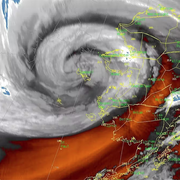
Typhoon Merbok Disaster Recovery Project: Accomplishments
Supported by Title VII of Division N of the Consolidated Appropriations Act, 2023, the Typhoon Merbok Disaster Emergency Recovery Efforts project addresses critical data and capacity gaps in coastal Alaska by generating high resolution environmental datasets, hazard analyses, and monitoring tools needed to quantify erosion, flooding, and permafrost-related risks at the community scale.

Digital Shoreline Analysis System (DSAS)
Software for calculating positional boundary change over time The Digital Shoreline Analysis System (DSAS) version 6 is a standalone application that calculates shoreline or boundary change over time. The GIS of a user’s choice is used to prepare the data for DSAS. Like previous versions, DSAS v.6 enables a user to calculate rate-of-change statistics from multiple historical shoreline positions...

Cultural Heritage at Risk Tool (CHART) Project
Coastal erosion threatens the loss of Native American cultural heritage and archaeological sites located along our coastlines, reducing opportunities to increase knowledge of past communities and environments. This project leverages an advisory team of ancestral Tribes, coastal managers, and archaeologists to strengthen the effectiveness of coastal hazard data, focusing on assessing the...

Post-Fire Sediment Research at the Pacific Coastal and Marine Science Center
The USGS Pacific Coastal and Marine Science Center (PCMSC) in Santa Cruz, California, has been growing our post-fire research contributions since 2017, through studies of post-fire sediment movement that address the Natural Hazards Mission Area objectives for understanding wildfire hazards.

Nutrient Loading and Coral Health at Ofu, American Samoa
Declining water quality poses a significant and persistent threat to coral reefs worldwide, contributing to their widespread degradation. Identifying the specific impacts of water quality stressors is challenging due to the complex interplay of various physical and biological factors affecting reef health. Submarine groundwater discharge (SGD) plays a crucial role in transporting nutrients into...

Developing a USGS Digital Coral Growth Archive using Rotating X-Ray Computerized Tomography - The ACTS Project
The Archival Computed Tomography Scanning Project (ACTS) currently develops the USGS Coral Core Archive, housed at the Pacific and St. Petersburg Coastal and Marine Science Centers, that contains approximately 500 coral reef cores from U.S. jurisdictions worldwide. This archive, is one of the largest coral archives in the world and provides historical context for coral-reef science studies...

Alaska Flood Staffs
The U.S. Geological Survey (USGS) uses observations of flooding in communities to monitor hazard conditions and support research by the USGS and its partners into a variety of hazard processes in Alaska. Local observations of flooding at flood staffs are used to document flood elevations, improve flood models, and support floodplain management decisions.

USGS CoastCams
The U.S. Geological Survey (USGS) uses a nationwide network of coastal observing cameras, or CoastCams, to monitor coastal conditions in near real-time and support research by the USGS and its partners into a variety of coastal processes and hazards. The most recent CoastCam images are made publicly available within minutes of data collection and can be accessed using the links below or by...

USGS Law of the Sea
The USGS Law of the Sea project helps to determine the outer limits of the extended continental shelf (ECS) of the United States. The ECS is that portion of the continental shelf beyond 200 nautical miles. It is an important maritime zone that holds many resources and vital habitats for marine life. Its size may exceed one million square kilometers, encompassing areas in the Arctic, Atlantic...

Remote Sensing Coastal Change
We use remote-sensing technologies—such as aerial photography, satellite imagery, structure-from-motion (SfM) photogrammetry, and lidar (laser-based surveying)—to measure coastal change along U.S. shorelines.

Cascadia Subduction Zone Marine Geohazards
Societal Issue: Uncertainty related to rupture extent, slip distribution, and recurrence of past subduction megathrust earthquakes in the Pacific Northwest (northern CA, OR, WA, and southern BC) leads to ambiguity in earthquake and tsunami hazard assessments and hinders our ability to prepare for future events.
By
Natural Hazards Mission Area, Coastal and Marine Hazards and Resources Program, Pacific Coastal and Marine Science Center, Santa Cruz Core Scanning Laboratory, Santa Cruz Core Laboratories, Santa Cruz Core Splitting Laboratory, Deep Sea Exploration, Mapping and Characterization, Subduction Zone Science