
Mohawk River Ice Jam at Lock 8 in Schenectady, NY near USGS gaging station 01354330
Images
Images below come from a wide variety of USGS science activities in the Northeast Region. Science Center staff showcase what we do, who we are, and where we work conducting science that inform decision makers and addresses societal needs.
Filter Total Items: 2050

Mohawk River Ice Jam at Lock 8 in Schenectady, NY
Mohawk River Ice Jam at Lock 8 in Schenectady, NY near USGS gaging station 01354330

Walls and carts of cores
Core racks filled with split cores in D-tubes in the K.O. Emery Geotechnical Wing walk-in refrigerator
Core racks filled with split cores in D-tubes in the K.O. Emery Geotechnical Wing walk-in refrigerator
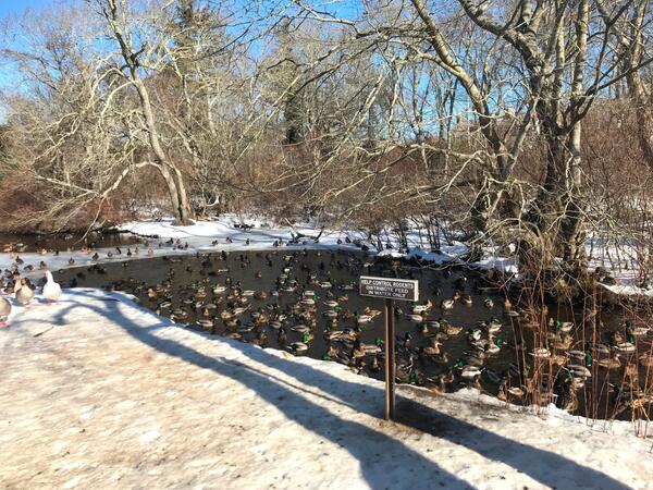
Hook Pond Dreen at Davids Lane, East Hampton, New York
Hook Pond Dreen at Davids Lane, East Hampton, New YorkDucks in Hook Pond Dreen at Davids Lane, East Hampton, New York
Hook Pond Dreen at Davids Lane, East Hampton, New York
Hook Pond Dreen at Davids Lane, East Hampton, New YorkDucks in Hook Pond Dreen at Davids Lane, East Hampton, New York

Erika Lentz is interviewed by WBZ Boston for a sea-level rise segment
Erika Lentz is interviewed by WBZ Boston for a sea-level rise segmentErika Lentz, Woods Hole Coastal and Marine Science Center Research Geologist interviewed by WBZ Boston Meterologist, Danielle Niles fora segment on sea-level rise

Erika Lentz interview by WBZ Meteorologist, Danielle Niles
Erika Lentz interview by WBZ Meteorologist, Danielle NilesResearch geologist, Erika Lentz, interviewed on Trunk River Beach, Falmouth, MA, by WBZ meterologist, Danielle Niles, about the future impacts of sea-level rise
Erika Lentz interview by WBZ Meteorologist, Danielle Niles
Erika Lentz interview by WBZ Meteorologist, Danielle NilesResearch geologist, Erika Lentz, interviewed on Trunk River Beach, Falmouth, MA, by WBZ meterologist, Danielle Niles, about the future impacts of sea-level rise

Licking River at Highway 536 near Alexandria, Kentucky
Licking River at Highway 536 near Alexandria, KentuckyLicking River at Highway 536 near Alexandria, Kentucky gage, looking downstream from the gage location.
Licking River at Highway 536 near Alexandria, Kentucky
Licking River at Highway 536 near Alexandria, KentuckyLicking River at Highway 536 near Alexandria, Kentucky gage, looking downstream from the gage location.

Scouting out high water marks after blizzard
New England WSC Physical Scientist Andy Massey scouting out high water marks associated with the blizzard of January 2018. Houghs Neck Maritime Center, Quincy, MA.
New England WSC Physical Scientist Andy Massey scouting out high water marks associated with the blizzard of January 2018. Houghs Neck Maritime Center, Quincy, MA.

Jonathan Cohl holding a piece of ice at Delaware River
Jonathan Cohl holding a piece of ice at Delaware RiverNortheast Region Photo Contest Winner | March 2019 | People
Jonathan Cohl holding a piece of ice from Delaware River at Frenchtown, NJ
Jonathan Cohl holding a piece of ice at Delaware River
Jonathan Cohl holding a piece of ice at Delaware RiverNortheast Region Photo Contest Winner | March 2019 | People
Jonathan Cohl holding a piece of ice from Delaware River at Frenchtown, NJ

Field Photo Friday Winner for April 2018
Transporting equipment used for maintenance of groundwater well CT2498 in Perrysburg, New York
Transporting equipment used for maintenance of groundwater well CT2498 in Perrysburg, New York

Berm at Jim Foot Key, Florida (2018)
In Photo: The red circle indicates the same position as shown in the April 2014 photo. The mangroves have lost all their leaves and the berm is significantly thinner following the storm.
In Photo: The red circle indicates the same position as shown in the April 2014 photo. The mangroves have lost all their leaves and the berm is significantly thinner following the storm.

Oceanographic equipment deployment at sunrise
Dawn breaks behind one of the bottom landers on deployment day.
Dawn breaks behind one of the bottom landers on deployment day.

Assembly of chains, shackles, and links
Sediment transport team members assemble chain, shackles and pear links that are are attached to the anchor and floats as part of deploying a mooring.
Sediment transport team members assemble chain, shackles and pear links that are are attached to the anchor and floats as part of deploying a mooring.

USGS Team Work!
Sediment transport team members attach a quick-release to the top of a bottom lander prior to deployment
Sediment transport team members attach a quick-release to the top of a bottom lander prior to deployment

Oceanographic Equipment Deployment
An instrumented bottom lander platform is lowered off the stern of the R/V Savannah during deploment
An instrumented bottom lander platform is lowered off the stern of the R/V Savannah during deploment

Meteorological equipment deployment
Sediment transport team members prepare to deploy a buoy instrumented with Meteorological sensors
Sediment transport team members prepare to deploy a buoy instrumented with Meteorological sensors

Buoy, Buoy
The buoy that measures meteorological conditions at the site after deployment.
The buoy that measures meteorological conditions at the site after deployment.

Woods Hole Coastal and Marine Science Center Sediment Transport Team
Woods Hole Coastal and Marine Science Center Sediment Transport TeamSediment transport team members manage tag lines to control the motion of the bottom lander as it is deployed.
Woods Hole Coastal and Marine Science Center Sediment Transport Team
Woods Hole Coastal and Marine Science Center Sediment Transport TeamSediment transport team members manage tag lines to control the motion of the bottom lander as it is deployed.

USGS owned Unmanned Aircraft System
Photograph of USGS Kentucky WSC unmanned aircraft system.
Photograph of USGS Kentucky WSC unmanned aircraft system.

Fish Creek Watershed in the National Petroleum Reserve-Alaska
Fish Creek Watershed in the National Petroleum Reserve-AlaskaFish Creek wanders through the National Petroleum Reserve-Alaska, a 22.8 million acre region managed by the Bureau of Land Management on Alaska's North Slope. USGS has periodically assessed oil and gas resource potential there. These assessments can be found here.

Piping Plovers
An interdisciplinary USGS team is conducting research and developing tools to identify suitable coastal habitats for species of concern, such as the piping plover (Charadrius melodus), under a variety of sea-level rise scenarios.
An interdisciplinary USGS team is conducting research and developing tools to identify suitable coastal habitats for species of concern, such as the piping plover (Charadrius melodus), under a variety of sea-level rise scenarios.

Cenote Bang
Cenote Bang, a component of the Ox Bel Ha cave network study site and model for coastal karst subterranean estuary
Cenote Bang, a component of the Ox Bel Ha cave network study site and model for coastal karst subterranean estuary