
LCMAP Change Stories: Outfitting the Ozarks
The meandering shoreline is the claim to fame for the Midwestern tourist oasis that is Lake of the Ozarks in Central Missouri.
The Missouri Division of Tourism’s website leads its page on the state’s most popular visitor destination by noting that the lake’s 1,100 miles of freshwater coast are more than even California has to offer.
The most populous city on the lake is Osage Beach, surrounded by resorts, golf courses and retail establishments on either side of the lake’s eastern bends. Osage Beach only has around 4,600 permanent residents, but that figure is more than double the 1990 tally.
The USGS Land Change Monitoring, Assessment, and Projection (LCMAP) initiative’s Primary Land Cover product can offer insight into the area’s development from 1985 through 2017.
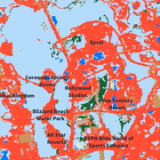
Each pixel in this animation represents a 30-meter square, about the size of a baseball infield. Pixels in red represent developed areas, dark blue pixels are water, gray is barren land, and green colors correspond with tree cover (deciduous forest in Missouri). A small patch of cropland appears in brown the upper right east of the Bagnell Dam, where the Osage River meets the lake.
The red areas expand through all three decades, with four noteworthy spikes. The first comes in 1989, when the Ridge Golf Course appears near the top of the frame. The second major expansion of development also takes the form of a golf course, when the Club at Porto Cima appears in the center of the frame a decade later. Its completion is preceded by the emergence of State Highway MM. The third change starts in 2008, when land is cleared south of the Osage River for a retail hub with big box stores, restaurants and shopping centers. Watch as the gray pixels from 2008-09 are peppered with red as 2017 nears.
The final major expansion comes shortly after the retail work begins. Between 2010 and 2011, the U.S. 54 Expressway is built near the bottom of the frame, its interchange filling in with red in the second year.
Learn more about LCMAP’s Primary and Secondary Land Cover products by watching this video or by visiting the LCMAP Product pages.
Related
Explore more LCMAP Change Stories by following the links below.
LCMAP Change Stories LCMAP Change Stories

LCMAP Change Stories: Where the Forests Fall, the Grasses Grow LCMAP Change Stories: Where the Forests Fall, the Grasses Grow

LCMAP Change Stories: Crops Give Way to Concrete LCMAP Change Stories: Crops Give Way to Concrete

LCMAP Change Stories: Where the Ocean Eats the Land LCMAP Change Stories: Where the Ocean Eats the Land
LCMAP Change Stories: Building a Boomtown, Block by Block

LCMAP Change Stories: Gone in 60 Seconds
LCMAP Change Stories: It's a Sprawl World After All

LCMAP Change Stories: Hurricanes in the Everglades

LCMAP Change Stories: Alabama Tornadoes
Related
Explore more LCMAP Change Stories by following the links below.
LCMAP Change Stories LCMAP Change Stories
LCMAP Change Stories: Where the Forests Fall, the Grasses Grow LCMAP Change Stories: Where the Forests Fall, the Grasses Grow
LCMAP Change Stories: Crops Give Way to Concrete LCMAP Change Stories: Crops Give Way to Concrete
LCMAP Change Stories: Where the Ocean Eats the Land LCMAP Change Stories: Where the Ocean Eats the Land
LCMAP Change Stories: Building a Boomtown, Block by Block
LCMAP Change Stories: Gone in 60 Seconds
LCMAP Change Stories: It's a Sprawl World After All
LCMAP Change Stories: Hurricanes in the Everglades