
On October 16 and 17, Ben Gutierrez visited Tennessee State University (TSU) to give guest lecture in Environmental Science and Water Resource classes taught by Tom Byl of the USGS Lower Mississippi Gulf Water Science Center.
Ben Gutierrez, PhD
Ben Gutierrez is a Geologist with the Coastal Change Project at the Woods Hole Coastal and Marine Science Center.
Science and Products

Coastal Change Hazards
Natural processes such as waves, tides, and weather, continually change coastal landscapes. The integrity of coastal homes, businesses, and infrastructure can be threatened by hazards associated with event-driven changes, such as extreme storms and their impacts on beach and dune erosion, or longer-term, cumulative changes associated with coastal and marine processes, such as sea-level rise...
By
Natural Hazards Mission Area, Coastal and Marine Hazards and Resources Program, Pacific Coastal and Marine Science Center, St. Petersburg Coastal and Marine Science Center, Woods Hole Coastal and Marine Science Center, Supplemental Appropriations for Disaster Recovery Activities, Hurricanes, USGS Science in Long Island Sound and its Watershed

Sea-Level Rise Hazards and Decision Support
The Sea-Level Rise Hazards and Decision-Support project assesses present and future coastal vulnerability to provide actionable information for management of our Nation’s coasts. Through multidisciplinary research and collaborative partnerships with decision-makers, physical, biological, and social factors that describe landscape and habitat changes are incorporated in a probabilistic modeling...

Beach-dependent Shorebirds
Policy-makers, individuals from government agencies, and natural resource managers are under increasing pressure to manage changing coastal areas to meet social, economic, and natural resource demands, particularly under a regime of sea-level rise. Scientific knowledge of coastal processes and habitat-use can support decision-makers as they balance these often-conflicting human and ecological...

Empowering decision-makers: A dynamic web interface for running Bayesian networks
U.S. Geological Survey (USGS) scientists are at the forefront of research that is critical for decision-making, particularly through the development of models (Bayesian networks, or BNs) that forecast coastal change. The utility of these tools outside the scientific community has been limited because they rely on expensive, technical software and a moderate understanding of statistical...

TSU Visit
On October 16 and 17, Ben Gutierrez visited Tennessee State University (TSU) to give guest lecture in Environmental Science and Water Resource classes taught by Tom Byl of the USGS Lower Mississippi Gulf Water Science Center.

TSU Visit
On October 16 and 17, Ben Gutierrez visited Tennessee State University (TSU) to give guest lecture in Environmental Science and Water Resource classes taught by Tom Byl of the USGS Lower Mississippi Gulf Water Science Center.
On October 16 and 17, Ben Gutierrez visited Tennessee State University (TSU) to give guest lecture in Environmental Science and Water Resource classes taught by Tom Byl of the USGS Lower Mississippi Gulf Water Science Center.

Assateague Island Seabeach Amaranth: 2001-2020
Time-series of number of seabeach amaranth observed in end-of-season surveys by NPS biologists. Shaded regions specify years where drought conditions persisted through the amaranth growing season. Vertical lines denote strong storms that occurred during the observation period.
Time-series of number of seabeach amaranth observed in end-of-season surveys by NPS biologists. Shaded regions specify years where drought conditions persisted through the amaranth growing season. Vertical lines denote strong storms that occurred during the observation period.
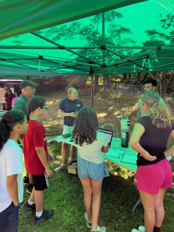
Mashpee Wampanoag Tribe Preserving Our Homeland summer science camp
Mashpee Wampanoag Tribe Preserving Our Homeland summer science campUSGS scientists participated in the Mashpee Wampanoag Tribe Preserving Our Homeland summer science camp in 2023.
Mashpee Wampanoag Tribe Preserving Our Homeland summer science camp
Mashpee Wampanoag Tribe Preserving Our Homeland summer science campUSGS scientists participated in the Mashpee Wampanoag Tribe Preserving Our Homeland summer science camp in 2023.

Mashpee Wampanoag Tribe Preserving Our Homeland summer science camp
Mashpee Wampanoag Tribe Preserving Our Homeland summer science campUSGS scientists participated in the Mashpee Wampanoag Tribe Preserving Our Homeland summer science camp in 2023.
Mashpee Wampanoag Tribe Preserving Our Homeland summer science camp
Mashpee Wampanoag Tribe Preserving Our Homeland summer science campUSGS scientists participated in the Mashpee Wampanoag Tribe Preserving Our Homeland summer science camp in 2023.

Mashpee Wampanoag Tribe Preserving Our Homeland summer science camp
Mashpee Wampanoag Tribe Preserving Our Homeland summer science campUSGS scientists participated in the Mashpee Wampanoag Tribe Preserving Our Homeland summer science camp in 2023.
Mashpee Wampanoag Tribe Preserving Our Homeland summer science camp
Mashpee Wampanoag Tribe Preserving Our Homeland summer science campUSGS scientists participated in the Mashpee Wampanoag Tribe Preserving Our Homeland summer science camp in 2023.
Science and Products
Coastal Change Hazards
Natural processes such as waves, tides, and weather, continually change coastal landscapes. The integrity of coastal homes, businesses, and infrastructure can be threatened by hazards associated with event-driven changes, such as extreme storms and their impacts on beach and dune erosion, or longer-term, cumulative changes associated with coastal and marine processes, such as sea-level rise...
By
Natural Hazards Mission Area, Coastal and Marine Hazards and Resources Program, Pacific Coastal and Marine Science Center, St. Petersburg Coastal and Marine Science Center, Woods Hole Coastal and Marine Science Center, Supplemental Appropriations for Disaster Recovery Activities, Hurricanes, USGS Science in Long Island Sound and its Watershed
Sea-Level Rise Hazards and Decision Support
The Sea-Level Rise Hazards and Decision-Support project assesses present and future coastal vulnerability to provide actionable information for management of our Nation’s coasts. Through multidisciplinary research and collaborative partnerships with decision-makers, physical, biological, and social factors that describe landscape and habitat changes are incorporated in a probabilistic modeling...
Beach-dependent Shorebirds
Policy-makers, individuals from government agencies, and natural resource managers are under increasing pressure to manage changing coastal areas to meet social, economic, and natural resource demands, particularly under a regime of sea-level rise. Scientific knowledge of coastal processes and habitat-use can support decision-makers as they balance these often-conflicting human and ecological...
Empowering decision-makers: A dynamic web interface for running Bayesian networks
U.S. Geological Survey (USGS) scientists are at the forefront of research that is critical for decision-making, particularly through the development of models (Bayesian networks, or BNs) that forecast coastal change. The utility of these tools outside the scientific community has been limited because they rely on expensive, technical software and a moderate understanding of statistical...
TSU Visit
On October 16 and 17, Ben Gutierrez visited Tennessee State University (TSU) to give guest lecture in Environmental Science and Water Resource classes taught by Tom Byl of the USGS Lower Mississippi Gulf Water Science Center.
On October 16 and 17, Ben Gutierrez visited Tennessee State University (TSU) to give guest lecture in Environmental Science and Water Resource classes taught by Tom Byl of the USGS Lower Mississippi Gulf Water Science Center.
Assateague Island Seabeach Amaranth: 2001-2020
Time-series of number of seabeach amaranth observed in end-of-season surveys by NPS biologists. Shaded regions specify years where drought conditions persisted through the amaranth growing season. Vertical lines denote strong storms that occurred during the observation period.
Time-series of number of seabeach amaranth observed in end-of-season surveys by NPS biologists. Shaded regions specify years where drought conditions persisted through the amaranth growing season. Vertical lines denote strong storms that occurred during the observation period.
Mashpee Wampanoag Tribe Preserving Our Homeland summer science camp
Mashpee Wampanoag Tribe Preserving Our Homeland summer science campUSGS scientists participated in the Mashpee Wampanoag Tribe Preserving Our Homeland summer science camp in 2023.
Mashpee Wampanoag Tribe Preserving Our Homeland summer science camp
Mashpee Wampanoag Tribe Preserving Our Homeland summer science campUSGS scientists participated in the Mashpee Wampanoag Tribe Preserving Our Homeland summer science camp in 2023.
Mashpee Wampanoag Tribe Preserving Our Homeland summer science camp
Mashpee Wampanoag Tribe Preserving Our Homeland summer science campUSGS scientists participated in the Mashpee Wampanoag Tribe Preserving Our Homeland summer science camp in 2023.
Mashpee Wampanoag Tribe Preserving Our Homeland summer science camp
Mashpee Wampanoag Tribe Preserving Our Homeland summer science campUSGS scientists participated in the Mashpee Wampanoag Tribe Preserving Our Homeland summer science camp in 2023.
Mashpee Wampanoag Tribe Preserving Our Homeland summer science camp
Mashpee Wampanoag Tribe Preserving Our Homeland summer science campUSGS scientists participated in the Mashpee Wampanoag Tribe Preserving Our Homeland summer science camp in 2023.
Mashpee Wampanoag Tribe Preserving Our Homeland summer science camp
Mashpee Wampanoag Tribe Preserving Our Homeland summer science campUSGS scientists participated in the Mashpee Wampanoag Tribe Preserving Our Homeland summer science camp in 2023.