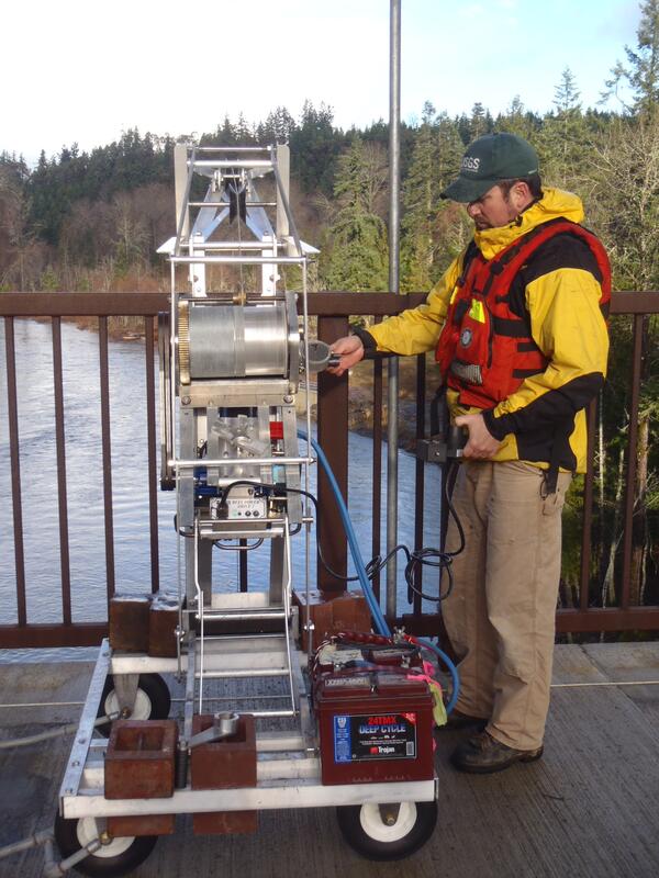
Chris Magirl is a Bureau Approving Official (BAO) in the USGS Office of Science Quality and Integrity, reviewing interpretive science products (that is, written reports, journal articles, book chapters, and other pieces for public release) on behalf of the U.S. Geological Survey to ensure quality and consistency with USGS Fundamental Science Practices.
From 2015–2020, Chris was the Associate Director for Investigations at the USGS Arizona Water Science Center, disseminating high-quality hydrologic data and scientific reports on water resources in Arizona and the Southwest. Chris worked closely with cooperating state, local, and federal agencies, tribes, and academic researchers. From 2000–2015, Chris was a hydrologist, research hydrologist, and project chief at the USGS, working on multiple projects involving fluvial geomorphology throughout the western United States. Chris researched rapids on the Colorado River in Grand Canyon and Cataract Canyon, the Elwha River dam-removal project, sediment production from Mount Rainier and other glaciated stratovolcanoes, and the interactions between geomorphology and aquatic ecology pertaining to salmon. Chris was closely involved with the USGS response to the March 22, 2014, Oso Landslide of Washington State.
Before joining the USGS, Chris was an engineer and R&D project manager with the Hewlett-Packard Company building color inkjet printers. As a youth, Chris was fascinated with fluid mechanics and thermodynamics, thunderstorms, flash floods, airplanes, rockets, and rivers. For over 25 years, Chris has been fortunate to enjoy fluid mechanics and thermodynamics in his professional research and engineering career. Chris is the inventor of 5 patents and has authored or co-authored over 50 peer-reviewed papers and reports on topics ranging from directional solidification, microscopic droplet ejection, landslides, debris flows, extreme rainfall events, extreme floods, to the hydraulics of rapids—it’s all fluid mechanics, just different scales and viscosities.
Professional Experience
US Geological Survey, Tucson, AZ, Studies Chief, 2015–present
US Geological Survey, Tacoma, WA, Research Hydrologist, 2008–2015
US Geological Survey, Tucson, AZ, Hydrologist, 2000–2008
Tetra Tech, Inc, Tucson, AZ, Hydrologist, 2000
Hewlett-Packard Company, San Diego, CA, Project Manager and Engineer, 1992–1999
Education and Certifications
The University of Arizona, PhD, Hydrology (minor in geology) 2006
Purdue University, MS, Mechanical Engineering, 1992
The University of Arizona, BS, Aerospace Engineering, 1990
Science and Products
USGS science supporting the Elwha River Restoration Project
Dam removal: synthesis of ecological and physical responses
Data in support of 5-year sediment budget and morphodynamic analysis of Elwha River following dam removals
Sediment monitoring during Elwha River dam removals: Lessons learned during the Nation’s largest dam removal project
Conceptualizing ecological responses to dam removal: If you remove it, what's to come?
Geomorphic evolution of a gravel‐bed river under sediment‐starved vs. sediment‐rich conditions: River response to the world's largest dam removal
Understanding river response to sediment pulses is a fundamental problem in geomorphic process studies, with myriad implications for river management. However, because large sediment pulses are rare and usually unanticipated, they are seldom studied at field scale. We examine fluvial response to a massive (~20 Mt) sediment pulse released by the largest dam removal globally, on the Elwha River, Was
Effect of river confinement on depth and spatial extent of bed disturbance affecting salmon redds
Science partnership between U.S. Geological Survey and the Lower Elwha Klallam Tribe—Understanding the Elwha River Dam Removal Project
Morphodynamic evolution following sediment release from the world’s largest dam removal
Sediment pulses can cause widespread, complex changes to rivers and coastal regions. Quantifying landscape response to sediment-supply changes is a long-standing problem in geomorphology, but the unanticipated nature of most sediment pulses rarely allows for detailed measurement of associated landscape processes and evolution. The intentional removal of two large dams on the Elwha River (Washingto
The geomorphic legacy of water and erosion control structures in a semiarid rangeland watershed
Streambed scour of salmon spawning habitat in a regulated river influenced by management of peak discharge
Geomorphic responses to dam removal in the United States – a two-decade perspective
Dam removal: Listening in
Geomorphic response of the North Fork Stillaguamish River to the State Route 530 landslide near Oso, Washington
Suspended sediment delivery to Puget Sound from the lower Nisqually River, western Washington, July 2010–November 2011
Science and Products
- Science
USGS science supporting the Elwha River Restoration Project
The Elwha River Restoration Project has reconnected the water, salmon, and sediment of a pristine river and coast of the Olympic Peninsula of Washington.Dam removal: synthesis of ecological and physical responses
Dam decommissioning is rapidly emerging as an important river restoration strategy in the U.S., with several major removals recently completed or in progress. But few studies have evaluated the far-reaching consequences of these significant environmental perturbations, especially those resulting from removals of large (>10-15 m tall) structures during the last decade. In particular, interactions b - Data
Data in support of 5-year sediment budget and morphodynamic analysis of Elwha River following dam removals
Two large dams were removed from the Elwha River in Washington, starting in 2011 and ending in 2014. The Elwha and the Glines Canyon dams were located approximately 7 km and 20 km upstream, respectively, from the Elwha River's mouth on the Strait of Juan de Fuca. The dams trapped over 20 million cubic meters of sediment. Dam removal changed the river's sediment budget and water flow, which affecte - Publications
Filter Total Items: 62
Sediment monitoring during Elwha River dam removals: Lessons learned during the Nation’s largest dam removal project
No abstract available.AuthorsChristopher A. Curran, Christopher S. Magirl, Robert C. HilldaleConceptualizing ecological responses to dam removal: If you remove it, what's to come?
One of the desired outcomes of dam decommissioning and removal is the recovery of aquatic and riparian ecosystems. To investigate this common objective, we synthesized information from empirical studies and ecological theory into conceptual models that depict key physical and biological links driving ecological responses to removing dams. We define models for three distinct spatial domains: upstreAuthorsJ. Ryan Bellmore, George R. Pess, Jeffrey J. Duda, Jim E. O'Connor, Amy E. East, Melissa M. Foley, Andrew C. Wilcox, Jon J. Major, Patrick B. Shafroth, Sarah A. Morley, Christopher S. Magirl, Chauncey W. Anderson, James E. Evans, Christian E. Torgersen, Laura S. CraigByEcosystems Mission Area, Coastal and Marine Hazards and Resources Program, Species Management Research Program, Arizona Water Science Center, Forest and Rangeland Ecosystem Science Center, Fort Collins Science Center, Geology, Minerals, Energy, and Geophysics Science Center, John Wesley Powell Center for Analysis and Synthesis, Oregon Water Science Center, Pacific Coastal and Marine Science Center, Western Fisheries Research CenterGeomorphic evolution of a gravel‐bed river under sediment‐starved vs. sediment‐rich conditions: River response to the world's largest dam removal
Understanding river response to sediment pulses is a fundamental problem in geomorphic process studies, with myriad implications for river management. However, because large sediment pulses are rare and usually unanticipated, they are seldom studied at field scale. We examine fluvial response to a massive (~20 Mt) sediment pulse released by the largest dam removal globally, on the Elwha River, Was
AuthorsAmy E. East, Joshua B. Logan, Mark C. Mastin, Andrew C. Ritchie, Jennifer A. Bountry, Christopher S. Magirl, Joel B. SankeyEffect of river confinement on depth and spatial extent of bed disturbance affecting salmon redds
Human impacts on rivers threaten the natural function of riverine ecosystems. This paper assesses how channel confinement affects the scour depth and spatial extent of bed disturbance and discusses the implications of these results for salmon-redd disturbance in gravel-bedded rivers. Two-dimensional hydrodynamic models of relatively confined and unconfined reaches of the Cedar River in WashingtonAuthorsChristiana R. Czuba, Jonathan A. Czuba, Christopher S. Magirl, Andrew S. Gendaszek, Christopher P. KonradScience partnership between U.S. Geological Survey and the Lower Elwha Klallam Tribe—Understanding the Elwha River Dam Removal Project
After nearly a century of producing power, two large hydroelectric dams on the Elwha River in Washington State were removed during 2011 to 2014 to restore the river ecosystem and recover imperiled salmon populations. Roughly two-thirds of the 21 million cubic meters of sediment—enough to fill nearly 2 million dump trucks—contained behind the dams was released downstream, which restored natural proAuthorsJeffrey J. Duda, Matt M. Beirne, Jonathan A. Warrick, Christopher S. MagirlMorphodynamic evolution following sediment release from the world’s largest dam removal
Sediment pulses can cause widespread, complex changes to rivers and coastal regions. Quantifying landscape response to sediment-supply changes is a long-standing problem in geomorphology, but the unanticipated nature of most sediment pulses rarely allows for detailed measurement of associated landscape processes and evolution. The intentional removal of two large dams on the Elwha River (Washingto
AuthorsAndrew C. Ritchie, Jonathan Warrick, Amy E. East, Christopher S. Magirl, Andrew W. Stevens, Jennifer A. Bountry, Timothy J. Randle, Christopher A. Curran, Robert C. Hilldale, Jeffrey J. Duda, Ian M. Miller, George R. Pess, Emily Eidam, Melissa M. Foley, Randall McCoy, Andrea S. OgstonByEcosystems Mission Area, Natural Hazards Mission Area, Water Resources Mission Area, Coastal and Marine Hazards and Resources Program, Arizona Water Science Center, Pacific Coastal and Marine Science Center, Washington Water Science Center, Western Fisheries Research Center, Sediment Lab Suite and Carbon Analysis LaboratoryThe geomorphic legacy of water and erosion control structures in a semiarid rangeland watershed
Control over water supply and distribution is critical for agriculture in drylands where manipulating surface runoff often serves the dual purpose of erosion control. However, little is known of the geomorphic impacts and legacy effects of rangeland water manipulation infrastructure, especially if not maintained. This study investigated the geomorphic impacts of structures such as earthen berms, wAuthorsMary H. Nichols, Christopher S. Magirl, N.F. Sayre, Jeremy R. ShawStreambed scour of salmon spawning habitat in a regulated river influenced by management of peak discharge
In the Pacific Northwest of the United States, salmon eggs incubating within streambed gravels are susceptible to scour during floods. The threat to egg-to-fry survival by streambed scour is mitigated, in part, by the adaptation of salmon to bury their eggs below the typical depth of scour. In regulated rivers globally, we suggest that water managers consider the effect of dam operations on scourAuthorsAndrew S. Gendaszek, Karl D. Burton, Christopher S. Magirl, Christopher P. KonradGeomorphic responses to dam removal in the United States – a two-decade perspective
Recent decades have seen a marked increase in the number of dams removed in the United States. Investigations following a number of removals are beginning to inform how, and how fast, rivers and their ecosystems respond to released sediment. Though only a few tens of studies detail physical responses to removals, common findings have begun to emerge. They include: (1) Rivers are resilient and respAuthorsJon J. Major, Amy E. East, Jim E. O'Connor, Gordon E. Grant, Andrew C. Wilcox, Christopher S. Magirl, Matthias J. Collins, Desiree D. TullosDam removal: Listening in
Dam removal is widely used as an approach for river restoration in the United States. The increase in dam removals—particularly large dams—and associated dam-removal studies over the last few decades motivated a working group at the USGS John Wesley Powell Center for Analysis and Synthesis to review and synthesize available studies of dam removals and their findings. Based on dam removals thus farAuthorsMelissa M. Foley, James Bellmore, James E. O'Connor, Jeffrey J. Duda, Amy E. East, Gordon G. Grant, Chauncey W. Anderson, Jennifer A. Bountry, Mathias J. Collins, Patrick J. Connolly, Laura S. Craig, James E. Evans, Samantha Greene, Francis J. Magilligan, Christopher S. Magirl, Jon J. Major, George R. Pess, Timothy J. Randle, Patrick B. Shafroth, Christian E. Torgersen, Desiree D. Tullos, Andrew C. WilcoxByEcosystems Mission Area, Natural Hazards Mission Area, Water Resources Mission Area, Volcano Hazards Program, Volcano Science Center, Forest and Rangeland Ecosystem Science Center, John Wesley Powell Center for Analysis and Synthesis, Oregon Water Science Center, Pacific Coastal and Marine Science Center, Western Fisheries Research Center, Columbia River Research Laboratory (CRRL)Geomorphic response of the North Fork Stillaguamish River to the State Route 530 landslide near Oso, Washington
On March 22, 2014, the State Route 530 Landslide near Oso, Washington mobilized 8 million cubic meters of unconsolidated Pleistocene material, creating a valley‑spanning deposit that fully impounded the North Fork Stillaguamish River. The river overtopped the 8-meter high debris impoundment within 25 hours and began steadily incising a new channel through the center of the deposit. Repeat topograpAuthorsScott W. Anderson, Mackenzie K. Keith, Christopher S. Magirl, J. Rose Wallick, Mark C. Mastin, James R. ForemanSuspended sediment delivery to Puget Sound from the lower Nisqually River, western Washington, July 2010–November 2011
On average, the Nisqually River delivers about 100,000 metric tons per year (t/yr) of suspended sediment to Puget Sound, western Washington, a small proportion of the estimated 1,200,000 metric tons (t) of sediment reported to flow in the upper Nisqually River that drains the glaciated, recurrently active Mount Rainier stratovolcano. Most of the upper Nisqually River sediment load is trapped in AlAuthorsChristopher A. Curran, Eric E. Grossman, Christopher S. Magirl, James R. Foreman - News
- Multimedia