Cyprus Tree, Great Dismal Swamp, Lake Drummond, Virginia
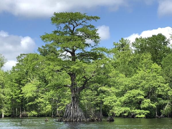
Cyprus Tree, Great Dismal Swamp, Lake Drummond, VirginiaA cyprus tree in Lake Drummond, Great Dismal Swamp National Wildlife Refuge, Virginia

Official websites use .gov
A .gov website belongs to an official government organization in the United States.
Secure .gov websites use HTTPS
A lock () or https:// means you’ve safely connected to the .gov website. Share sensitive information only on official, secure websites.
I am a palynologist (pollen and spores) with expertise in paleoecology and biostratigraphy. My biostratigraphic expertise extends from the Carboniferous to the Holocene, with an emphasis on Euramerica (Paleozoic) and the Northern Hemisphere. My paleoecological expertise includes the late Paleozoic and the Paleogene to Holocene intervals.


A cyprus tree in Lake Drummond, Great Dismal Swamp National Wildlife Refuge, Virginia
A cyprus tree in Lake Drummond, Great Dismal Swamp National Wildlife Refuge, Virginia

Scientists are collecting core samples from the Great Dismal Swamp in Virginia to understand natural conditions before centuries of ditching, draining and harvesting. This is a collaborative project between the USGS and the Great Dismal Swamp National Wildlife Refuge.
Scientists are collecting core samples from the Great Dismal Swamp in Virginia to understand natural conditions before centuries of ditching, draining and harvesting. This is a collaborative project between the USGS and the Great Dismal Swamp National Wildlife Refuge.

Scientists are collecting core samples from the Great Dismal Swamp in Virginia to understand natural conditions before centuries of ditching, draining and harvesting. This is a collaborative project between the USGS and the Great Dismal Swamp National Wildlife Refuge.
Scientists are collecting core samples from the Great Dismal Swamp in Virginia to understand natural conditions before centuries of ditching, draining and harvesting. This is a collaborative project between the USGS and the Great Dismal Swamp National Wildlife Refuge.

Scientists are collecting core samples from the Great Dismal Swamp in Virginia to understand natural conditions before centuries of ditching, draining and harvesting. This is a collaborative project between the USGS and the Great Dismal Swamp National Wildlife Refuge.
Scientists are collecting core samples from the Great Dismal Swamp in Virginia to understand natural conditions before centuries of ditching, draining and harvesting. This is a collaborative project between the USGS and the Great Dismal Swamp National Wildlife Refuge.

Scientists are collecting core samples from the Great Dismal Swamp in Virginia to understand natural conditions before centuries of ditching, draining and harvesting. This is a collaborative project between the USGS and the Great Dismal Swamp National Wildlife Refuge.
Scientists are collecting core samples from the Great Dismal Swamp in Virginia to understand natural conditions before centuries of ditching, draining and harvesting. This is a collaborative project between the USGS and the Great Dismal Swamp National Wildlife Refuge.

Scientists are collecting core samples from the Great Dismal Swamp in Virginia to understand natural conditions before centuries of ditching, draining and harvesting. This is a collaborative project between the USGS and the Great Dismal Swamp National Wildlife Refuge.
Scientists are collecting core samples from the Great Dismal Swamp in Virginia to understand natural conditions before centuries of ditching, draining and harvesting. This is a collaborative project between the USGS and the Great Dismal Swamp National Wildlife Refuge.

Scientists are collecting core samples from the Great Dismal Swamp in Virginia to understand natural conditions before centuries of ditching, draining and harvesting. This is a collaborative project between the USGS and the Great Dismal Swamp National Wildlife Refuge.
Scientists are collecting core samples from the Great Dismal Swamp in Virginia to understand natural conditions before centuries of ditching, draining and harvesting. This is a collaborative project between the USGS and the Great Dismal Swamp National Wildlife Refuge.

Scientists are collecting core samples from the Great Dismal Swamp in Virginia to understand natural conditions before centuries of ditching, draining and harvesting. This is a collaborative project between the USGS and the Great Dismal Swamp National Wildlife Refuge.
Scientists are collecting core samples from the Great Dismal Swamp in Virginia to understand natural conditions before centuries of ditching, draining and harvesting. This is a collaborative project between the USGS and the Great Dismal Swamp National Wildlife Refuge.

Scientists are collecting core samples from the Great Dismal Swamp in Virginia to understand natural conditions before centuries of ditching, draining and harvesting. This is a collaborative project between the USGS and the Great Dismal Swamp National Wildlife Refuge.
Scientists are collecting core samples from the Great Dismal Swamp in Virginia to understand natural conditions before centuries of ditching, draining and harvesting. This is a collaborative project between the USGS and the Great Dismal Swamp National Wildlife Refuge.

Scientists are collecting core samples from the Great Dismal Swamp in Virginia to understand natural conditions before centuries of ditching, draining and harvesting. This is a collaborative project between the USGS and the Great Dismal Swamp National Wildlife Refuge.
Scientists are collecting core samples from the Great Dismal Swamp in Virginia to understand natural conditions before centuries of ditching, draining and harvesting. This is a collaborative project between the USGS and the Great Dismal Swamp National Wildlife Refuge.

Photograph of the Great Dismal Swamp in Virginia.
Photograph of the Great Dismal Swamp in Virginia.

Photograph of the Great Dismal Swamp in Virginia.
Photograph of the Great Dismal Swamp in Virginia.
A cyprus tree in Lake Drummond, Great Dismal Swamp National Wildlife Refuge, Virginia
A cyprus tree in Lake Drummond, Great Dismal Swamp National Wildlife Refuge, Virginia
Scientists are collecting core samples from the Great Dismal Swamp in Virginia to understand natural conditions before centuries of ditching, draining and harvesting. This is a collaborative project between the USGS and the Great Dismal Swamp National Wildlife Refuge.
Scientists are collecting core samples from the Great Dismal Swamp in Virginia to understand natural conditions before centuries of ditching, draining and harvesting. This is a collaborative project between the USGS and the Great Dismal Swamp National Wildlife Refuge.
Scientists are collecting core samples from the Great Dismal Swamp in Virginia to understand natural conditions before centuries of ditching, draining and harvesting. This is a collaborative project between the USGS and the Great Dismal Swamp National Wildlife Refuge.
Scientists are collecting core samples from the Great Dismal Swamp in Virginia to understand natural conditions before centuries of ditching, draining and harvesting. This is a collaborative project between the USGS and the Great Dismal Swamp National Wildlife Refuge.
Scientists are collecting core samples from the Great Dismal Swamp in Virginia to understand natural conditions before centuries of ditching, draining and harvesting. This is a collaborative project between the USGS and the Great Dismal Swamp National Wildlife Refuge.
Scientists are collecting core samples from the Great Dismal Swamp in Virginia to understand natural conditions before centuries of ditching, draining and harvesting. This is a collaborative project between the USGS and the Great Dismal Swamp National Wildlife Refuge.
Scientists are collecting core samples from the Great Dismal Swamp in Virginia to understand natural conditions before centuries of ditching, draining and harvesting. This is a collaborative project between the USGS and the Great Dismal Swamp National Wildlife Refuge.
Scientists are collecting core samples from the Great Dismal Swamp in Virginia to understand natural conditions before centuries of ditching, draining and harvesting. This is a collaborative project between the USGS and the Great Dismal Swamp National Wildlife Refuge.
Scientists are collecting core samples from the Great Dismal Swamp in Virginia to understand natural conditions before centuries of ditching, draining and harvesting. This is a collaborative project between the USGS and the Great Dismal Swamp National Wildlife Refuge.
Scientists are collecting core samples from the Great Dismal Swamp in Virginia to understand natural conditions before centuries of ditching, draining and harvesting. This is a collaborative project between the USGS and the Great Dismal Swamp National Wildlife Refuge.
Scientists are collecting core samples from the Great Dismal Swamp in Virginia to understand natural conditions before centuries of ditching, draining and harvesting. This is a collaborative project between the USGS and the Great Dismal Swamp National Wildlife Refuge.
Scientists are collecting core samples from the Great Dismal Swamp in Virginia to understand natural conditions before centuries of ditching, draining and harvesting. This is a collaborative project between the USGS and the Great Dismal Swamp National Wildlife Refuge.
Scientists are collecting core samples from the Great Dismal Swamp in Virginia to understand natural conditions before centuries of ditching, draining and harvesting. This is a collaborative project between the USGS and the Great Dismal Swamp National Wildlife Refuge.
Scientists are collecting core samples from the Great Dismal Swamp in Virginia to understand natural conditions before centuries of ditching, draining and harvesting. This is a collaborative project between the USGS and the Great Dismal Swamp National Wildlife Refuge.
Scientists are collecting core samples from the Great Dismal Swamp in Virginia to understand natural conditions before centuries of ditching, draining and harvesting. This is a collaborative project between the USGS and the Great Dismal Swamp National Wildlife Refuge.
Scientists are collecting core samples from the Great Dismal Swamp in Virginia to understand natural conditions before centuries of ditching, draining and harvesting. This is a collaborative project between the USGS and the Great Dismal Swamp National Wildlife Refuge.
Scientists are collecting core samples from the Great Dismal Swamp in Virginia to understand natural conditions before centuries of ditching, draining and harvesting. This is a collaborative project between the USGS and the Great Dismal Swamp National Wildlife Refuge.
Scientists are collecting core samples from the Great Dismal Swamp in Virginia to understand natural conditions before centuries of ditching, draining and harvesting. This is a collaborative project between the USGS and the Great Dismal Swamp National Wildlife Refuge.
Photograph of the Great Dismal Swamp in Virginia.
Photograph of the Great Dismal Swamp in Virginia.
Photograph of the Great Dismal Swamp in Virginia.
Photograph of the Great Dismal Swamp in Virginia.
*Disclaimer: Listing outside positions with professional scientific organizations on this Staff Profile are for informational purposes only and do not constitute an endorsement of those professional scientific organizations or their activities by the USGS, Department of the Interior, or U.S. Government