


")
Can these rocks reduce flooding? (Spanish captions)
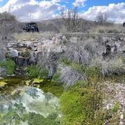
Can these rocks reduce flooding? (Spanish captions)Flooding in the binational cities at Ambos Nogales on the Arizona-Sonora portion of the US-Mexico border has caused damage, ruined livelihoods and taken lives for hundreds of years.


