Geonarrative: Land Motion and Subsidence on the Virginia Coastal Plain
Land Motion and Subsidence on the Virginia Coastal Plain
Groundwater extraction and its consequences on the coast
About this Tool

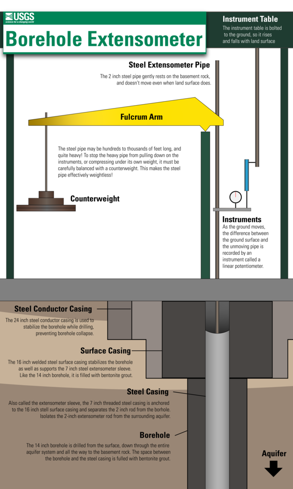
This tool is an interactive narrative that provides introductory information on land motion, specifically land subsidence driven by aquifer compaction, in the Virginia Coastal Plain region. In addition, it describes the methods used by U.S. Geological Survey scientists and our partners to monitor land subsidence, and access to the data being collected by our monitoring network. This work is critical for understanding how exactly groundwater usage might be worsening local sea level rise, which is already endangering both residents and infrastructure in the Virginia Coastal Plain region.
This narrative is intended for both members of the general public who wish to learn more about the below-ground forces acting upon the eastern Virginia region, and for cooperators, partnering agencies, and scientists who are looking to access the data which is being collected by the Land Motion program to assist in decision-making.