
EcoNews - Vol. 7 | Issue 2
Invasive Species
-
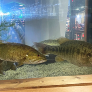
Protecting Tennessee’s Native Bass Heritage Protecting Tennessee’s Native Bass Heritage
USGS researchers at the Tennessee Cooperative Fishery Research Unit (TNCFRU), The Tennessee Wildlife Resources Agency (TWRA), Tennessee Tech University (TTU), and bass anglers are working together to address an emerging conservation challenge: the spread of invasive Alabama bass ( Micropterus henshalli) into Tennessee waters.
-
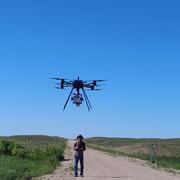
Detecting a Grassland Invader, Above and Below Ground Detecting a Grassland Invader, Above and Below Ground
Invasive plants are rapidly transforming the prairie grasslands of the Southern Great Plains. Researchers supported by the South Central CASC are turning to innovative tools to better detect these species, map their spread, and assess their impacts, both above and below the soil.
-
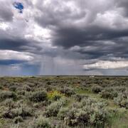
Invasive grass influences on the fire cycle and treatment effectiveness to control their abundance in the Intermountain West, USA Invasive grass influences on the fire cycle and treatment effectiveness to control their abundance in the Intermountain West, USA
Many non-native invasive grass species increase wildfire activity and regenerate more quickly than native species. This invasive grass–fire cycle has severe negative consequences for ecosystems, creating a need to understand how different invasive grass species alter fuel characteristics and fire behavior, as well as effective treatments to control their abundance. To address these needs...
-
Efficacy of increased visual and olfactory cues for luring and trapping invasive tegu lizards Efficacy of increased visual and olfactory cues for luring and trapping invasive tegu lizards
Controlling invasive wildlife species relies on the ability to efficiently remove individuals from the invaded environment. Thus, maximizing capture potential is of high interest, particularly for species that are difficult to capture. For invasive species such as the Argentine black and white tegu lizard (Salvator merianae), increasing attraction to traps could increase the probability...
-
Future aquatic invaders of the Northeast U.S.: How climate change, human vectors, and natural history could bring southern and western species north Future aquatic invaders of the Northeast U.S.: How climate change, human vectors, and natural history could bring southern and western species north
As environmental conditions change, land managers are increasingly concerned about the potential for new aquatic invasive species to move into their jurisdictions. Because managers may have limited resources, detecting invasive species early is important as prevention is more effective and less costly than ongoing mitigation of established populations. Tools built to assist early...
Wildlife Disease & Species Science
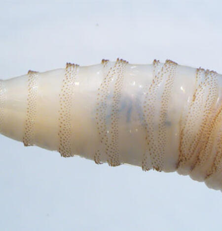
Responding to New World Screwworm in the U.S.
The USGS National Wildlife Health Center (NWHC) is supporting the Department of the Interior’s (DOI) preparedness planning and response for New World screwworm (NWS), a foreign animal disease detected in the U.S. in June 2026 after its northward spread from Central America.
Avian Influenza and Wildlife Health: 2025 Year in Review
Avian influenza, once largely limited to poultry, is now reshaping wildlife health across North America, affecting wild birds, mammals, and even people. This 2025 Year in Review highlights how USGS science is helping track, understand, and respond to this rapidly evolving disease. From large-scale wildlife die-offs to new tools for detecting and monitoring the virus, USGS research supports...

Modeling chronic wasting disease transmission risk in mule deer related to habitat characteristics
Chronic wasting disease (CWD) is a prion disease of cervids that spreads to uninfected individuals through direct transmission (contact with infected individuals), vertical transmission (from mother to offspring), or indirect transmission (exposure to contaminated environments). The risk of indirect transmission is unevenly distributed on the landscape, and risk levels are expected to be
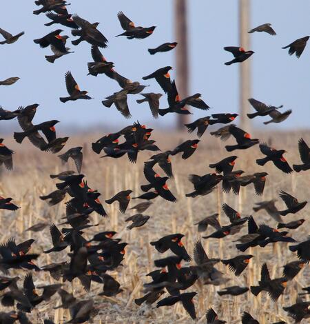
Every Bird Counts – Delivering Gold Standard Science for North America’s Birds
Each spring, as migratory birds span continents, our ability to protect them depends on one simple but powerful force: people paying attention. This World Migratory Bird Day, the theme “Every Bird Counts – Your Observations Matter!” underscores how everyday observers and community scientists provide the essential data that drives bird conservation.
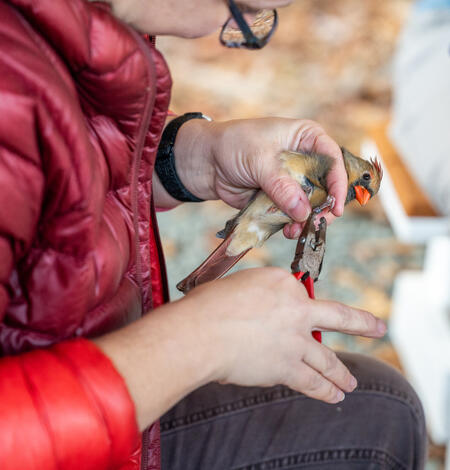
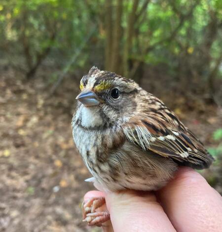
Why We Band Birds
Birds are vital to our economy, ecosystems, and cultural heritage. Investing in bird conservation benefits communities, businesses, and working lands while reinforcing our nation’s legacy of stewardship and biodiversity. By valuing birds, we ensure a richer, healthier, and more vibrant future for all Americans. Bird banding allows for the unique identification of each individual bird. This...
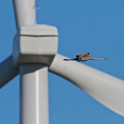
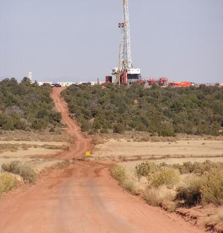
USGS energy and wildlife research update (Sept 2025-March 2026)
Every year, USGS scientists work with partners across the country to better understand how energy development intersects with the natural world. The research summarized here highlights new findings from the first half of FY26, spanning topics from wildlife and habitat responses to oil, gas, wind, solar, and hydropower infrastructure to advances in ecological forecasting, restoration, and species...
-
Estimating GPS-based social aggregation metrics using collar data Estimating GPS-based social aggregation metrics using collar data
Understanding social aggregation patterns in ungulate herds is essential for gaining behavioral insights, optimizing resource use, reducing human-wildlife conflict, and managing disease risk. As chronic wasting disease is the preeminent disease-related threat to cervid populations in North America, knowledge of contact between individuals and spatiotemporal patterns of aggregation...
-
The collective application of shorebird tracking data to conservation The collective application of shorebird tracking data to conservation
Addressing urgent conservation issues, such as the drastic declines of North American migratory birds, requires creative, evidence-based, efficient, and collaborative approaches. The abundance of over 50% of monitored North American shorebird populations has declined by over 50% since 1980. To address these declines, we developed a partnership of scientists and practitioners called the...
-
GPS Tracking Metadata for Caribou (Rangifer tarandus) from the Central Arctic Herd, Alaska, 2015-2021 GPS Tracking Metadata for Caribou (Rangifer tarandus) from the Central Arctic Herd, Alaska, 2015-2021
GPS collar location data were collected as part of a study on migratory, barren-ground caribou (Rangifer tarandus) in the Central Arctic herd of Alaska. Data were collected in collaboration with Alaska Department of Fish and Game (ADFG). Because ADFG has a statute (16.05.815) restricting the public release of specific animal locations for 25 years, we are only providing metadata about...
Sea Otter Survey Data Visualization Tool
Environmental Health
-

The Rusting of Arctic Rivers: Freshwater Ecosystems Respond to Rapidly Uptaking Metals
The water quality of streams and rivers in the Arctic is sensitive to rapid climate change and altered disturbance regimes.
-
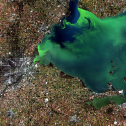
Beyond Microcystins: A New Look at Cyanotoxins in Lake Erie
Cyanobacterial harmful algal blooms (cyanoHABs) in Lake Erie’s western basin have long been associated with microcystins, a well-known group of liver toxins. However, new research shows that these blooms are far more chemically diverse than previously thought. A seven-year study using advanced chemical and genetic tools reveals that cyanobacteria produce a succession of different chemical...
Adaptation Science
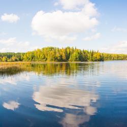
As Lakes Warm and Ice Seasons Shorten, Anglers Are Catching Different Fish Across the Midwest
National CASC-supported research shows that warmwater fish are a growing share of angler catch in the Upper Midwest, but larger, deeper lakes may sustain cool and coldwater fishing opportunities.
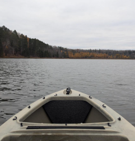
10k Years of Climate Data Retrieved from Minnesota Lake
USGS scientist Dr. Jessica Rodysill was interviewed in a Northern News Now story highlighting how sediment layers collected from Minnesota’s Lake LaSalle reveal what climate conditions looked like thousands of years ago.
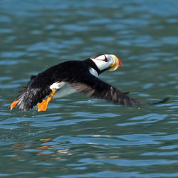
What a Super El Niño could mean for Alaska’s seabirds, salmon, and seas
NOAA has declared an El Niño in June 2026, with a "Super El Niño" expected to peak this winter. USGS researchers are tracking how warming waters threaten Alaska's ecosystems, from seabird die-offs and harmful algal blooms to heat-stressed salmon. USGS science helps reveal the connections between these climate events and the fish and wildlife that Alaskans and ecosystems depend on.
Decision Making
-
AI-driven science synthesis tools for resource managers
The scientific literature is abundant on drought-related topics in the western United States, including areas of the Colorado River Basin and the sagebrush biome. Scientists, resource managers, and decision makers use this science to assess, predict, and respond to the effects of drought on people and the environment. However, it can be difficult to quickly synthesize large amounts of research. To...
-
KWIC Science: Rapid response products to meet resource managers’ priority science needs
Federal public land managers in the US are required by law to use science to inform management decisions. However, managers have limited time to identify science for use in decision making. Literature reviews are one tool to efficiently summarize science for use by managers, but are time-consuming to produce. Keyword in Context (KWIC) text analysis is a straightforward method of locating specific...
Land Management

Enhancing Rangeland Recovery by Forecasting Seed Establishment
This project is synthesizing information about plant establishment and building a tool to deliver forecasts of restoration success, helping to maximize the chances that restoration efforts will be successful.
Supporting energy and mineral development through successful reclamation
Federal lands of the US contain important reserves of oil, gas and other resources important for Unleashing American Energy (SO 3418). After development of these resources is complete, successfully reclaiming disturbed lands is a necessary step towards restoring wildlife habitat, forage production, and maintaining natural resources for future use. To improve reclamation outcomes on these lands...

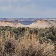
Rangeland Condition Monitoring Assessment and Projection (RCMAP) Fractional Component Time-Series Across Western North America from 1985-2025
The RCMAP (Rangeland Condition Monitoring Assessment and Projection) dataset quantifies the percent cover of rangeland components across western North America using Landsat imagery from 1985-2025. The RCMAP product suite consists of ten fractional components: annual herbaceous, bare ground, herbaceous, litter, non-sagebrush shrub, perennial herbaceous, sagebrush, shrub, tree, and shrub...
Land Treatment
-

Land Treatment Exploration Tool 3.0 Launch Land Treatment Exploration Tool 3.0 Launch
The U.S. Geological Survey launched an updated version of the Land Treatment Exploration Tool that includes many new features for a better user experience.
-
Land Treatment Digital Library Version 2.0 Launch Land Treatment Digital Library Version 2.0 Launch
The U.S. Geological Survey launched an updated version (2.0) of the Land Treatment Digital Library to improve user experience, include additional data, and enhance Bureau of Land Management access.
Wildland Fire
-
Southeast FireMap Burned Area Datasets Southeast FireMap Burned Area Datasets
The Southeast FireMap (SEFM) project is a collaboration between the U.S. Geological Survey (USGS) and Tall Timbers Research Station that aims to improve burned area mapping across the southeastern United States. Tracking prescribed fires and wildfires is essential for effective wildfire risk mitigation, natural resource management, and landscape conservation across both public and...
-
The Landsat Collection 2 Burned Area Products for the conterminous United States (ver. 5.0, April 2026) The Landsat Collection 2 Burned Area Products for the conterminous United States (ver. 5.0, April 2026)
The U.S. Geological Survey (USGS) has developed and implemented an algorithm that identifies burned areas in temporally dense time series of Landsat Analysis Ready Data (ARD) scenes to produce the Landsat Burned Area Products. The algorithm uses predictors derived from individual ARD Landsat scenes, lagged reference conditions, and change metrics between the scene and reference...
-
Contemporary fire history metrics for the conterminous United States (1984-2025)(ver. 5.0, April 2026) Contemporary fire history metrics for the conterminous United States (1984-2025)(ver. 5.0, April 2026)
Fire history metrics enable rapidly increasing amounts of burned area data to be collapsed into a handful of data layers that can be used efficiently by diverse stakeholders. In this effort, the U.S. Geological Survey's Landsat Burned Area product was used to identify burned area across CONUS over a 41-year period (1984-2024). The Landsat BA product was consolidated into a suite of...
-
Millennial-scale climatic and cultural impacts on vegetation and fire at the southern edge of the Rocky Mountains, USA Millennial-scale climatic and cultural impacts on vegetation and fire at the southern edge of the Rocky Mountains, USA
Mountain forests and woodlands in semiarid regions of the world are threatened by climatic change and other human impacts. In the southwestern USA, climate and culturally driven changes to the structure and fire regimes of dry coniferous forests over recent centuries are well documented by tree-ring archives. However, the roles of climate and people as drivers of millennial-scale changes...