
U.S. flag

An official website of the United States government

Surface Water

Surface Water

Filter Total Items: 30

Manning's Roughness Coefficient for New Jersey Streams

Manning’s Roughness Coefficient ( n) is an input to the Manning’s Equation, which can be used for the computation of streamflow during times it is impractical or impossible to make a measurement. ​ Methods and regional equations for determining the value of n have largely been developed in the western United States; New Jersey is comparatively unstudied. New Jersey features a diverse range of...
Manning's Roughness Coefficient for New Jersey Streams

Manning's Roughness Coefficient for New Jersey Streams

Manning’s Roughness Coefficient ( n) is an input to the Manning’s Equation, which can be used for the computation of streamflow during times it is impractical or impossible to make a measurement. ​ Methods and regional equations for determining the value of n have largely been developed in the western United States; New Jersey is comparatively unstudied. New Jersey features a diverse range of...
Learn More

Long-term Water Monitoring Networks in New Jersey

The accurate, long-term monitoring networks of New Jersey Water Science Center provide valuable data in real-time and historical perspective to compare that data to. The longer a monitoring location is in operation, the more valuable it becomes, since more statistical comparisons can be performed. Our field technicians continuously make field measurements and maintain these networks.
Long-term Water Monitoring Networks in New Jersey

Long-term Water Monitoring Networks in New Jersey

The accurate, long-term monitoring networks of New Jersey Water Science Center provide valuable data in real-time and historical perspective to compare that data to. The longer a monitoring location is in operation, the more valuable it becomes, since more statistical comparisons can be performed. Our field technicians continuously make field measurements and maintain these networks.
Learn More

New Jersey Water Science Center Imagery Network

Static webcams have been installed at a number of real-time stream-gaging locations in New Jersey to allow you to view the current river-stage conditions. These webcams provide valuable information to the National Weather Service, emergency managers, and area residents to evaluate real-time conditions in river and coastal environments during storms.
New Jersey Water Science Center Imagery Network

New Jersey Water Science Center Imagery Network

Static webcams have been installed at a number of real-time stream-gaging locations in New Jersey to allow you to view the current river-stage conditions. These webcams provide valuable information to the National Weather Service, emergency managers, and area residents to evaluate real-time conditions in river and coastal environments during storms.
Learn More

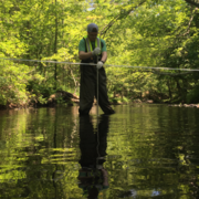
The New Jersey Water Quality Networks

The water quality of New Jersey's water bodies is monitored by the USGS New Jersey Water Science Center to characterize waters, identify trends over time, identify emerging problems, determine whether pollution control programs are working, help direct pollution control efforts to where they are most needed, and respond to emergencies such as floods and spills.
The New Jersey Water Quality Networks

The New Jersey Water Quality Networks

The water quality of New Jersey's water bodies is monitored by the USGS New Jersey Water Science Center to characterize waters, identify trends over time, identify emerging problems, determine whether pollution control programs are working, help direct pollution control efforts to where they are most needed, and respond to emergencies such as floods and spills.
Learn More

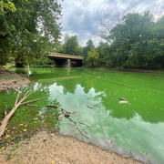
Biological Studies in New Jersey Waters

Biological microbes such as Fecal Indicator Bacteria (FIB)—including Escherichia coli (E. coli)—along with pathogens like Cryptosporidium, and microbial signatures used in Microbial Source Tracking (MST), are receiving heightened attention from the public, environmental agencies, and water-resource managers. These indicators help identify potential contamination sources, assess recreational water...
Biological Studies in New Jersey Waters

Biological Studies in New Jersey Waters

Biological microbes such as Fecal Indicator Bacteria (FIB)—including Escherichia coli (E. coli)—along with pathogens like Cryptosporidium, and microbial signatures used in Microbial Source Tracking (MST), are receiving heightened attention from the public, environmental agencies, and water-resource managers. These indicators help identify potential contamination sources, assess recreational water...
Learn More

Harmful Algal Blooms Studies in New Jersey Waters

Harmful Algal Blooms (HABs) in lakes, ponds, and rivers adversely affect water resources worldwide. Under the right conditions, cyanobacteria can produce cyanotoxins that can pose health risks to both animals and humans which makes them a major environmental and public health concern. More studies to examine the occurrence and persistence of HABs and their potential transport are needed to better...
Harmful Algal Blooms Studies in New Jersey Waters

Harmful Algal Blooms Studies in New Jersey Waters

Harmful Algal Blooms (HABs) in lakes, ponds, and rivers adversely affect water resources worldwide. Under the right conditions, cyanobacteria can produce cyanotoxins that can pose health risks to both animals and humans which makes them a major environmental and public health concern. More studies to examine the occurrence and persistence of HABs and their potential transport are needed to better...
Learn More

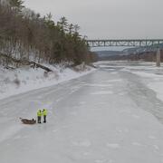
Delaware River at Montague Ice Affected Discharge Measurement

On February 11, 2026, a team of scientists from the New Jersey Water Science Center made a discharge measurement at the USGS 01438500 Delaware River at Montague, New Jersey monitoring site during ice cover conditions. This is the first time since February 1999 that this type of measurement was made at this site. Frigid winter weather conditions made the measurement both necessary and possible.
Delaware River at Montague Ice Affected Discharge Measurement

Delaware River at Montague Ice Affected Discharge Measurement

On February 11, 2026, a team of scientists from the New Jersey Water Science Center made a discharge measurement at the USGS 01438500 Delaware River at Montague, New Jersey monitoring site during ice cover conditions. This is the first time since February 1999 that this type of measurement was made at this site. Frigid winter weather conditions made the measurement both necessary and possible.
Learn More

Estimating Daily Upstream Location of the Freshwater-Saltwater Interface in New Jersey

Frequently, water withdrawals for public supply are made from the freshwater reaches of rivers and streams across New Jersey. Overall, there is a lack of scientific information describing the movement of saltwater upstream into the tributaries discharging into Delaware Bay. This project is collected water-quality data along two selected tributaries in New Jersey to Delaware Bay to develop a...
Estimating Daily Upstream Location of the Freshwater-Saltwater Interface in New Jersey

Estimating Daily Upstream Location of the Freshwater-Saltwater Interface in New Jersey

Frequently, water withdrawals for public supply are made from the freshwater reaches of rivers and streams across New Jersey. Overall, there is a lack of scientific information describing the movement of saltwater upstream into the tributaries discharging into Delaware Bay. This project is collected water-quality data along two selected tributaries in New Jersey to Delaware Bay to develop a...
Learn More

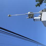
The New Jersey Streamgaging Network

The USGS New Jersey Water Science Center streamgage program is part of the nationwide program that provides streamflow information for a variety of purposes—including the protection of life and property, infrastructure design, recreational usage, and long-term trend assessment. This information is critical to resource managers, farmers, fishermen, kayakers, land-use planners, engineers...
The New Jersey Streamgaging Network

The New Jersey Streamgaging Network

The USGS New Jersey Water Science Center streamgage program is part of the nationwide program that provides streamflow information for a variety of purposes—including the protection of life and property, infrastructure design, recreational usage, and long-term trend assessment. This information is critical to resource managers, farmers, fishermen, kayakers, land-use planners, engineers...
Learn More

New Jersey Precipitation and Weather Networks

The New Jersey Water Science Center provides valuable data augmentation to many locations for: Precipitation, Water and Air Temperature, and even Wind Speed and Direction at some of our coastal sites. Our technicians continuously make field measurements and maintain these networks to ensure the accuracy of these data.
New Jersey Precipitation and Weather Networks

New Jersey Precipitation and Weather Networks

The New Jersey Water Science Center provides valuable data augmentation to many locations for: Precipitation, Water and Air Temperature, and even Wind Speed and Direction at some of our coastal sites. Our technicians continuously make field measurements and maintain these networks to ensure the accuracy of these data.
Learn More

City of Elizabeth Flood Mapping

To better protect the City of Elizabeth’s residents and assets, the U.S. Geological Survey (USGS) and Rutgers University proposed a joint collaboration to develop a reliable flood risk management platform with the cooperation of the City of Elizabeth and the New Jersey Office of Emergency Management. Our understanding is the broader goal for the City of Elizabeth is to accomplish three primary...
City of Elizabeth Flood Mapping

City of Elizabeth Flood Mapping

To better protect the City of Elizabeth’s residents and assets, the U.S. Geological Survey (USGS) and Rutgers University proposed a joint collaboration to develop a reliable flood risk management platform with the cooperation of the City of Elizabeth and the New Jersey Office of Emergency Management. Our understanding is the broader goal for the City of Elizabeth is to accomplish three primary...
Learn More

Flow Photo Explorer (FPE) Project in New Jersey

The Flow Photo Explorer (FPE) is a database, machine learning, and data visualization platform using timelapse images to develop new approaches for collecting hydrologic data in streams and other waterbodies where traditional monitoring methods are not feasible or cost-prohibitive. The Musconetcong River was chosen to participate in the early study, and we are expanding the work to other rivers.
Flow Photo Explorer (FPE) Project in New Jersey

Flow Photo Explorer (FPE) Project in New Jersey

The Flow Photo Explorer (FPE) is a database, machine learning, and data visualization platform using timelapse images to develop new approaches for collecting hydrologic data in streams and other waterbodies where traditional monitoring methods are not feasible or cost-prohibitive. The Musconetcong River was chosen to participate in the early study, and we are expanding the work to other rivers.
Learn More
Was this page helpful?