
Surface Water Team
Surface Water Team
Science related to surface water.
Filter Total Items: 56

Water-quality monitoring during reservoir drawdowns
The USGS is monitoring water-quality above, within, and below Middle Fork Willamette and the South Santiam River dams using field-based and remote-sensing approaches to understand how reservoir drawdowns influence downstream water-quality conditions.

Oregon Water Science Center's Malheur Lake Portfolio
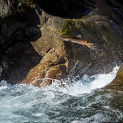
USGS scientists have partnered with local groups to learn about the processes affecting turbidity in Malheur Lake. Located in southeastern Oregon, Malheur Lake and the surrounding refuge provide critical habitat to birds migrating along the Pacific Flyway.
Monitoring tire-derived chemicals in stormwater
The USGS, in partnership with the Oregon Department of Transportation (ODOT) and other state and federal agencies, is studying a contaminant called 6PPD-quinone.

Modeling tire-derived chemicals in stormwater
The USGS and the Environmental Protection Agency are working together using advanced modeling tools to understand how 6PPD-quinone moves through watersheds and how green infrastructure can reduce its impact.

Water Quality in Keno Reach of the Klamath River
The U.S. Geological Survey, U.S. Bureau of Reclamation, and Watercourse Engineering, Inc. are collaborating to develop knowledge and tools to better manage water quality in the Link-Keno reach of the Klamath River and the Lost River.

Harmful Algal Blooms and Drinking Water in Oregon
Harmful algal blooms are a major environmental problem in all 50 states.

City Beavers: Tualatin River Basin Beaver Study
Beavers and their dams are common sights along creeks in the Tualatin River basin. Beaver help create diverse habitats for many other animals, including birds, fish, and amphibians. The USGS studying the affect beaver activity has on the amount and quality of water in local streams, so that agencies in the basin can make strategic management and habitat restoration decisions based on science.

Tualatin River Basin Water Quality Assessment
In 1990, the USGS began assessing water-quality in the Tualatin River. More then 30 years later, we are still monitoring conditions in the basin and conducting investigations to better understand stream processes within the basin.

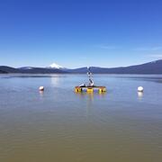
Nutrient and Sediment Loading to Upper Klamath Lake
The U.S. Geological Survey (USGS) computes time-series of total phosphorus (TP) and suspended-sediment concentrations (SSC) and loads entering Upper Klamath Lake using continuous turbidity sensor records, discrete TP and SSC data, and continuously computed streamflow.
Integrating water availability in the Klamath Basin: from drought to dam removal
The USGS Water Resources Mission Area is assessing how much water is available for human and ecological needs in the United States and identifying where and when the Nation may have challenges meeting its demand for water. This information helps decision makers manage and distribute water in ways that balance competing needs. Due to its complex and competing water demands, ecological significance...
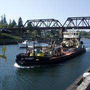
Lake Washington Ship Canal Sustainable Rivers Project
The U.S. Geological Survey (USGS) and the U.S. Army Corps of Engineers (USACE) are refining a water quality model to better understand temperature and salinity dynamics in the Lake Washington Ship Canal. This effort is supported by the Sustainable Rivers Program, a partnership between the USACE and The Nature Conservancy (TNC).

Bridge scour monitoring in Oregon
The U.S. Geological Survey is working with the Oregon Department of Transportation (ODOT) and Federal Highway Administration (FHWA) to revolutionize bridge scour monitoring using real-time sonar data collection and bathymetric surveying to remotely monitor sites, collect long-term data for evaluation, and develop and improve hydraulic models that predict scour.