
Geomorphology Team
Geomorphology Team
Geomorphology Team science.
Filter Total Items: 18
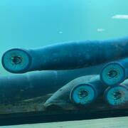
Linkages among pre-contact people, lamprey, and landscapes in the Willamette Valley
The U.S. Geological Survey and Portland State University are working with the Confederated Tribes of Grand Ronde and other partners to link past lamprey harvest locations with hydrogeomorphic conditions as landscape processes and shifting rivers have changed since the pre-contact archaeological period. This research provides a deeper historical context for lamprey conservation and restoration.
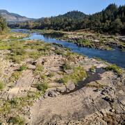
Alluvial reach identification and hydrogeomorphic characterization of Oregon rivers
The USGS, in partnership with the Environmental Protection Agency (EPA), is developing an objective mapping framework to systematically identify alluvial reaches in 13 river basins across Oregon to support EPA and Oregon’s Department of Environmental Quality (DEQ) in their implementation of the Clean Water Act’s water temperature Total Maximum Daily Loads (TMDLs), as well as to support the...

Willamette Focused Investment Partnership Restoration Effectiveness Monitoring Program
The USGS, in collaboration with several Willamette River Basin partners, led a multi-phase program to assess the effectiveness of restoration efforts aimed at improving native fish habitat in the Willamette River. The Willamette Focused Investment Partnership Restoration Effectiveness Monitoring Program evaluates whether restoration projects achieved their targets to improve physical floodplain...

Controls on habitat for native lamprey in the Siletz River Basin
Chinook Salmon and Pacific Lamprey are culturally significant fishes to the Tribal community along the Siletz River, Oregon. The USGS studied how streamflow and bedload conditions may influence mainstem spawning habitats.

Fern Ridge Geomorphology
The USGS, in cooperation with the U.S. Army Corps of Engineers (USACE), is conducting targeted research to better understand geomorphic conditions and processes within the reservoir at Fern Ridge Lake, near Eugene, Oregon, so that managers have the information to support dam operations and other actions that will aid in the preservation and management of cultural sites.

Integrated Water Science Basins: Willamette River
The Willamette River Basin reflects the conflicting water demands between humans and ecosystems—particularly salmon— and the challenge resource managers face throughout the Pacific Northwest.

Upper Klamath Basin Studies and Data Collection
The USGS has been studying the Klamath Basin for decades. The USGS provides unbiased data to Tribal partners and resource managers to aid with complex management and conservation efforts.

Nehalem Bay Sediment Study
Assessment of Sedimentation Changes in the Nehelam Bay, Oregon

Geomorphic Response to Fall Creek Lake Drawdowns
The USGS has been documenting the geomorphic response to the annual Fall Creek Lake drawdown since 2011.

Oregon Geomorphic Studies
Assessing channel change, habitat health, and flood hazards across Oregon rivers and streams.

Vertical Hydraulic Gradient at the Sediment-Water Interface in Upper Klamath Lake
"The goal of this project is to characterize the vertical hydraulic gradient at the sediment-water interface in Upper Klamath Lake."

SPARROW Model Assessments of Nutrients and Suspended Sediment in the Pacific Northwest and California
SPARROW can be used to relate water-quality data to landscape characteristics, such as natural properties and human activities