
Cover of the Coastal Science Navigator Companion Guide. The guide introduces some of the many coastal change hazards-related products available through the USGS. In it, we showcase the products included in the Coastal Science Navigator’s initial publication in July 2023.
Images
St. Petersburg Coastal and Marine Science Center images.
Filter Total Items: 745

Companion Guide Cover
Cover of the Coastal Science Navigator Companion Guide. The guide introduces some of the many coastal change hazards-related products available through the USGS. In it, we showcase the products included in the Coastal Science Navigator’s initial publication in July 2023.

USGS forecasts 44 percent of Florida’s west coast to experience inundation from Helene
USGS forecasts 44 percent of Florida’s west coast to experience inundation from HeleneAn image captured from the U.S. Geological Survey's Coastal Change Hazards portal on Sept. 24, 2024, illustrates how much of Florida's west coast is set to experience erosion, overwash, and inundation. (USGS image).

Coastal Change Hazards Team Forecasted Hurricane Francine Beach Impacts
Coastal Change Hazards Team Forecasted Hurricane Francine Beach ImpactsThe USGS Coastal Change Hazards Portal shows predictions for the coasts of Texas, Louisiana, and Mississippi from Hurricane Francine.
Coastal Change Hazards Team Forecasted Hurricane Francine Beach Impacts
Coastal Change Hazards Team Forecasted Hurricane Francine Beach ImpactsThe USGS Coastal Change Hazards Portal shows predictions for the coasts of Texas, Louisiana, and Mississippi from Hurricane Francine.

Donya Frank-Gilchrist presenting at the International Conference on Coastal Engineering
Donya Frank-Gilchrist presenting at the International Conference on Coastal EngineeringDr. Donya Frank-Gilchrist of the USGS St. Petersburg Coastal and Marine Science Center presented research on sediment transport in coastal regions at the International Conference on Coastal Engineering on 9/8-9/14/2024, in Rome, Italy.

Drs. Donya Frank-Gilchrist and Michael Itzkin giving presentations at ICCE
Drs. Donya Frank-Gilchrist and Michael Itzkin giving presentations at ICCEDrs. Donya Frank-Gilchrist and Michael Itzkin of the USGS St. Petersburg Coastal and Marine Science Center presented research on sediment transport in coastal regions at the International Conference on Coastal Engineering on 9/8-9/14/2024, in Rome, Italy.

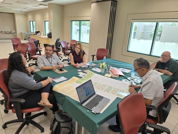
Breakout Table 4 Discussion of the Mayagüez Session of the USGS Workshop in Puerto Rico Titled “Participatory Engagement for Storm Management”
Breakout Table 4 Discussion of the Mayagüez Session of the USGS Workshop in Puerto Rico Titled “Participatory Engagement for Storm Management”Breakout Table 4 Discussion of the Mayagüez Session of the USGS Workshop in Puerto Rico Titled “Participatory Engagement for Storm Management.”

Breakout Table 2 Discussion of the Mayagüez Session of the USGS Workshop in Puerto Rico Titled “Participatory Engagement for Storm Management”
Breakout Table 2 Discussion of the Mayagüez Session of the USGS Workshop in Puerto Rico Titled “Participatory Engagement for Storm Management”Breakout Table 2 Discussion of the Mayagüez Session of the USGS Workshop in Puerto Rico Titled “Participatory Engagement for Storm Management.”

Breakout Table 3 Discussion of the Mayagüez Session of the USGS Workshop in Puerto Rico Titled “Participatory Engagement for Storm Management”
Breakout Table 3 Discussion of the Mayagüez Session of the USGS Workshop in Puerto Rico Titled “Participatory Engagement for Storm Management”Breakout Table 3 Discussion of the Mayagüez Session of the USGS Workshop in Puerto Rico Titled “Participatory Engagement for Storm Management”

Group Photo of the Mayagüez Session of the USGS Workshop in Puerto Rico Titled “Participatory Engagement for Storm Management”
Group Photo of the Mayagüez Session of the USGS Workshop in Puerto Rico Titled “Participatory Engagement for Storm Management”Group Photo of the Mayagüez Session of the USGS Workshop in Puerto Rico Titled “Participatory Engagement for Storm Management”Top row, from left to right: Priscila Vargas-Babilonia, Jaileen López Belén, Jack R. Friedman, Carmen Pérez, Milton Muñoz, Stephen Hughes, Ariam L. Torres-Cordero, Manuel Valdés-Pizzini, Carlos J. Carrero, Tania López, Adlin Melecio.

Group Photo of the Mayagüez Session of the USGS Workshop in Puerto Rico Titled “Participatory Engagement for Storm Management”
Group Photo of the Mayagüez Session of the USGS Workshop in Puerto Rico Titled “Participatory Engagement for Storm Management”Group Photo of the Mayagüez Session of the USGS Workshop in Puerto Rico Titled “Participatory Engagement for Storm Management.” Top row, from left to right: Priscila Vargas-Babilonia, Jaileen López Belén, Jack R. Friedman, Carmen Pérez, Milton Muñoz, Stephen Hughes, Ariam L. Torres-Cordero, Manuel Valdés-Pizzini, Carlos J. Carrero, Tania López, Adlin Melecio.

Breakout Table 1 Discussion of the Mayagüez Session of the USGS Workshop in Puerto Rico Titled “Participatory Engagement for Storm Management”
Breakout Table 1 Discussion of the Mayagüez Session of the USGS Workshop in Puerto Rico Titled “Participatory Engagement for Storm Management”Breakout Table 1 Discussion of the Mayagüez Session of the USGS Workshop in Puerto Rico Titled “Participatory Engagement for Storm Management.”

Breakout Table 1 Discussion of the Río Piedras Session of the USGS Workshop in Puerto Rico Titled “Participatory Engagement for Storm Management”
Breakout Table 1 Discussion of the Río Piedras Session of the USGS Workshop in Puerto Rico Titled “Participatory Engagement for Storm Management”Breakout Table 1 Discussion of the Río Piedras Session of the USGS Workshop in Puerto Rico Titled “Participatory Engagement for Storm Management.”

Morning Group Photo of the Río Piedras Session of the USGS Workshop in Puerto Rico Titled “Participatory Engagement for Storm Management”
Morning Group Photo of the Río Piedras Session of the USGS Workshop in Puerto Rico Titled “Participatory Engagement for Storm Management”Morning Group Photo of the Río Piedras Session of the USGS Workshop in Puerto Rico Titled “Participatory Engagement for Storm Management.” Top row, left to right: Carlos R. Olmedo Álvarez, Francisco “Paco” López, Ernesto Rodríguez, Aurelio “Tito” Castro, Federico Subervi Vélez, Kevian Pérez, Carlos Anselmi-Molina, Aurora Justiniano, Jack R. Friedman.

Breakout Table 2 Discussion of the Río Piedras Session of the USGS Workshop in Puerto Rico Titled “Participatory Engagement for Storm Management”
Breakout Table 2 Discussion of the Río Piedras Session of the USGS Workshop in Puerto Rico Titled “Participatory Engagement for Storm Management”Breakout Table 2 Discussion of the Río Piedras Session of the USGS Workshop in Puerto Rico Titled “Participatory Engagement for Storm Management”

Breakout Table 4 Discussion of the Río Piedras Session of the USGS Workshop in Puerto Rico Titled “Participatory Engagement for Storm Management”
Breakout Table 4 Discussion of the Río Piedras Session of the USGS Workshop in Puerto Rico Titled “Participatory Engagement for Storm Management”Breakout Table 4 Discussion of the Río Piedras Session of the USGS Workshop in Puerto Rico Titled “Participatory Engagement for Storm Management.”

Breakout Table 3 Report Out of the Río Piedras Session of the USGS Workshop in Puerto Rico Titled “Participatory Engagement for Storm Management”
Breakout Table 3 Report Out of the Río Piedras Session of the USGS Workshop in Puerto Rico Titled “Participatory Engagement for Storm Management”Breakout Table 3 Report Out of the Río Piedras Session of the USGS Workshop in Puerto Rico Titled “Participatory Engagement for Storm Management.”

Afternoon Group Photo of the Río Piedras Session of the USGS Workshop in Puerto Rico Titled “Participatory Engagement for Storm Management”
Afternoon Group Photo of the Río Piedras Session of the USGS Workshop in Puerto Rico Titled “Participatory Engagement for Storm Management”Afternoon Group Photo of the Río Piedras Session of the USGS Workshop in Puerto Rico Titled “Participatory Engagement for Storm Management.” Top row, left to right: Héctor Rivera, Carlos Anselmi-Molina, Aurelio “Tito” Castro, Jack R. Friedman, Kevian Pérez. Second row, left to right: Orlando Díaz Flores, Manuel Valdés-Pizzini, Ariam L.
Breakout Table 4 Discussion of the Río Piedras Session of the USGS Workshop in Puerto Rico Titled “Participatory Engagement for Storm Management”
Breakout Table 4 Discussion of the Río Piedras Session of the USGS Workshop in Puerto Rico Titled “Participatory Engagement for Storm Management”Breakout Table 4 Discussion of the Río Piedras Session of the USGS Workshop in Puerto Rico Titled “Participatory Engagement for Storm Management.”

An antibiotic resistance gene (ARG) microarray in the Real-Time PCR (RT-PCR) machine
An antibiotic resistance gene (ARG) microarray in the Real-Time PCR (RT-PCR) machineAn antibiotic resistance gene (ARG) microarray in the Real-Time PCR (RT-PCR) machine.
An antibiotic resistance gene (ARG) microarray in the Real-Time PCR (RT-PCR) machine
An antibiotic resistance gene (ARG) microarray in the Real-Time PCR (RT-PCR) machineAn antibiotic resistance gene (ARG) microarray in the Real-Time PCR (RT-PCR) machine.

Native American shell middens along many coastlines are vulnerable to shoreline erosion
Native American shell middens along many coastlines are vulnerable to shoreline erosionThese shells are what remains of a Native American shell midden that is located along an actively eroding shoreline in Apalachicola Bay.

Estuarine shoreline erosion exposes a Native American shell midden
Estuarine shoreline erosion exposes a Native American shell middenEstuarine shoreline erosion exposes a Native American shell midden beneath the surface of a coastal flatwood forest. Shell middens are the discarded shells and materials from generations of Indigenous people who lived along U.S. coastlines.