
National Water Availability data available now through the Data Companion
Explore, download, and use new datasets related to integrated water availability, supply and use.
Explore, download, and use new datasets related to integrated water availability, supply and use.
USGS releases a comprehensive look at water resources in the United States
New National Water Availability Assessment offers critical insights into water supply, demand, and quality across the Nation.
New National Water Availability Assessment offers critical insights into water supply, demand, and quality across the Nation.
Water Resources Mission Area
Water information is fundamental to national and local economic well-being, protection of life and property, and effective management of the Nation’s water resources. The USGS works with partners to monitor, assess, conduct targeted research, and deliver information on a wide range of water resources and conditions including streamflow, groundwater, water quality, and water use and availability.
Message from the Associate Director
Message from the Associate Director

Learn more about the Mission Area from the Associate Director for Water Resources.
Water Data for the Nation
Water Data for the Nation

Water data collected at approximately 1.9 million sites across all 50 states.
News
The U.S. is producing more food - without increasing nutrient pollution
The U.S. is producing more food - without increasing nutrient pollution
Media Alert: Low-level flights to image geology and aquifers over parts of New Mexico and Texas
Media Alert: Low-level flights to image geology and aquifers over parts of New Mexico and Texas
Sediment contaminants in Puget Sound: Implications for ecosystem health and remediation
Sediment contaminants in Puget Sound: Implications for ecosystem health and remediation
Publications
Development and field testing of a UAS-based-software-defined radar for measuring freshwater bathymetry Development and field testing of a UAS-based-software-defined radar for measuring freshwater bathymetry
We provide an overview of an uncrewed aircraft system (UAS)-based software-defined radar (SDRadar) system for high-resolution geophysical observations. The radar transceiver is implemented on a Radio Frequency System-on-Chip (RFSoC) platform, along with an ultra-wideband Vivaldi antenna that has a starting operating frequency of 150 MHz, enabling the system to be used across different...
Natural source zone depletion of crude oil in the subsurface: Processes controlling mass losses of individual compounds Natural source zone depletion of crude oil in the subsurface: Processes controlling mass losses of individual compounds
At many petroleum hydrocarbon spill sites, residual spilled product forms a long-term source of groundwater contamination. The phrase source zone natural depletion is used to refer to the mass loss rates. Overall mass lost under environmental conditions was analyzed using conservative biomarker concentrations for a 1979 oil spill in northern Minnesota, USA. After 40–41 years, an average...
Toward an efficient framework for remote sensing of river bathymetry: Comparing sensors and algorithms on an inaccessible proglacial river in Alaska Toward an efficient framework for remote sensing of river bathymetry: Comparing sensors and algorithms on an inaccessible proglacial river in Alaska
Remote sensing can provide reliable information on river depths and this approach might be particularly valuable in areas that are difficult to survey via conventional field methods. In this study, we assessed the potential to map the bathymetry of an inaccessible proglacial river in Alaska from both aerial orthophotos and a multispectral satellite image. In addition, we evaluated a...
Science

Alaska Science Center Weekly Findings
Recent findings by USGS Alaska Science Center staff and their collaborators.

The Rusting of Arctic Rivers: Freshwater Ecosystems Respond to Rapidly Uptaking Metals
The water quality of streams and rivers in the Arctic is sensitive to rapid climate change and altered disturbance regimes.
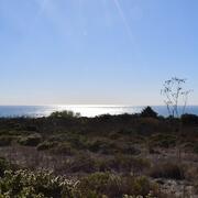
Where land meets sea: USGS science for resilient coastal habitats
USGS coastal science plays a critical role in supporting the effective, science-based management of coastal ecosystems, where the biodiversity of land and sea meet. It provides managers with the information they need to make sound decisions. Through cutting-edge research, predictive modeling, and decision-support tools, USGS empowers resource managers to make informed, science-based choices. From...
By
Core Science Systems Mission Area, Ecosystems Mission Area, Water Resources Mission Area, Cooperative Research Units, Ecosystems Land Change Science Program, Land Management Research Program, Science and Decisions Center, Species Management Research Program, California Water Science Center, Eastern Ecological Science Center, Forest and Rangeland Ecosystem Science Center, Lower Mississippi-Gulf Water Science Center, Pacific Coastal and Marine Science Center, Western Ecological Research Center (WERC), Western Fisheries Research Center, Western Geographic Science Center, Wetland and Aquatic Research Center