



Hydrologic Monitoring Branch
Applied Hydrology Branch
Hydrologic Interpretive Branch
Stay in-the-know with New England Water Science Center’s WaterMarks Newsletter
New England Water Science Center
Welcome to the USGS New England Water Science Center. We provide timely and reliable information to Federal, State, Tribal, and local stakeholders on the water resources of Connecticut, Maine, Massachusetts, New Hampshire, Rhode Island, and Vermont. Our data help safeguard human and wildlife health, public safety, and environmental sustainability.
For assistance, contact us on our Connect page.

News
WaterMarks Newsletter - Fall 2026
WaterMarks Newsletter - Fall 2026
New England WSC Products in the Third Quarter of 2026
New England WSC Products in the Third Quarter of 2026
A Pristine Headwaters Ecosystem as an Outdoor Laboratory for Foundational Science
A Pristine Headwaters Ecosystem as an Outdoor Laboratory for Foundational Science
Publications
Big data for small streams: Leveraging a coarse national model to enhance fine-resolution stream temperature predictions Big data for small streams: Leveraging a coarse national model to enhance fine-resolution stream temperature predictions
Predictive stream temperature models are commonly used to address spatial and temporal gaps in observational data because stream temperature information is essential for environmental management decisions. National models capture broad patterns driven by climate, topography, and seasonality, but often lack the spatial resolution to simulate fine-scale variation in groundwater discharge...
A spatial analysis of the groundwater emergence flood hazard in Long Island, New York, and coastal areas surrounding Long Island Sound in New York, Connecticut, and Rhode Island A spatial analysis of the groundwater emergence flood hazard in Long Island, New York, and coastal areas surrounding Long Island Sound in New York, Connecticut, and Rhode Island
Long Island, New York, and nearby coastal areas surrounding Long Island Sound are densely populated and, like other coastal areas, are susceptible to flooding from several potential sources, including stormwater from precipitation events, tidal flooding and storm surge, and groundwater emergence flooding. Groundwater emergence fooding refers to the intersection of a rising water table...
Science
A Culvert Sizing Tool for Vermont StreamStats
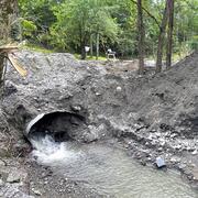
Vermont currently (2025) manages nearly 15,000 culverts, many of which are undersized and classified as being in urgent, critical, or poor condition. After large flooding events, stream crossing structures are frequently replaced in kind with little ability to integrate best available topography and design flows. The USGS, in cooperation with Vermont Agency of Transportation (VTrans), is updating...
Low-Streamflow Statistics for Unregulated Streams in Vermont
Below normal streamflows can intensify competing water demands and affect water quality, drinking-water supplies, and aquatic habitat. Estimating normal low-flow statistics is critical to support natural resource management. The current methods for estimating low-flow statistics at ungaged streams, particularly on small watersheds, are limited in Vermont. The USGS is computing low-flow statistics...

Predicting Cyanobacterial Harmful Algal Blooms at Lake Champlain Beaches
USGS, in cooperation with the Lake Champlain Basin Program, is evaluating machine learning models for predicting blooms of potentially harmful cyanobacteria, a damaging blue-green algae, at Lake Champlain beaches in Vermont and New York. Harmful cyanobacterial algal blooms (cyanoHABs) degrade the water quality of Lake Champlain and can threaten environmental and public health because the lake...