
Wally Brooks records water quality data from a salt marsh creek (Cape Cod, MA)
Images
Images below come from a wide variety of USGS science activities in the Northeast Region. Science Center staff showcase what we do, who we are, and where we work conducting science that inform decision makers and addresses societal needs.
Filter Total Items: 2050

Measuring water quality data, Cape Cod, MA
Wally Brooks records water quality data from a salt marsh creek (Cape Cod, MA)

Gaging station with DCP for groundwater well
Gaging station S-5517 in Suffolk County with DCP for groundwater well collecting real-time data
Gaging station S-5517 in Suffolk County with DCP for groundwater well collecting real-time data

Autumn in New England
Long exposure photo of a river during fall as the leaves are beginning to turn colors.
Long exposure photo of a river during fall as the leaves are beginning to turn colors.

Streamflow measurement in the fall
Hydro Technician, Henry Witt, takes a self portrait while he conducts a discharge measurement in the Houstonic River at Falls Village, CT. One of the many perks of field work year round is the ability to witness the seasons come and go.
Hydro Technician, Henry Witt, takes a self portrait while he conducts a discharge measurement in the Houstonic River at Falls Village, CT. One of the many perks of field work year round is the ability to witness the seasons come and go.

School Branch at Brownsburg IN under the bridge view
School Branch at Brownsburg IN under the bridge viewSchool Branch at Brownsburg IN under the bridge view
School Branch at Brownsburg IN under the bridge view
School Branch at Brownsburg IN under the bridge viewSchool Branch at Brownsburg IN under the bridge view

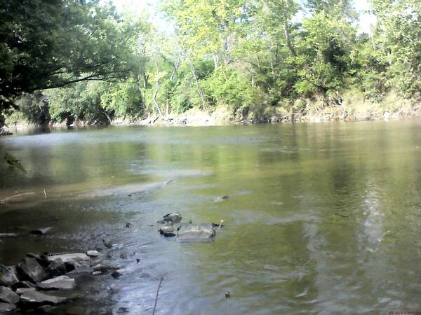
School Branch at Brownsburg IN downstream of gage
School Branch at Brownsburg IN downstream of gage

Shepaug River Peter's Dam gage pool
Autumnal reflection in the Shepaug River Peter's Dam gage pool looking upstream at the dam with the gage in view (site 01202501 at Woodville, CT). The blue sky and Autumn leaves cast a reflection in the gage pool.
Autumnal reflection in the Shepaug River Peter's Dam gage pool looking upstream at the dam with the gage in view (site 01202501 at Woodville, CT). The blue sky and Autumn leaves cast a reflection in the gage pool.

Eagle Creek at Zionsville, IN under the bridge
Eagle Creek at Zionsville, IN under the bridge

Eagle Creek at Zionsville, IN downstream of gage
Eagle Creek at Zionsville, IN downstream of gage

Different Types of Iron Staining on Downhole Samplers
Different Types of Iron Staining on Downhole SamplersUSGS Research Hydrologist Philip Harte describes the different types of different iron staining visible on downhole samplers that were used in passive sampling of groundwater wells.
Different Types of Iron Staining on Downhole Samplers
Different Types of Iron Staining on Downhole SamplersUSGS Research Hydrologist Philip Harte describes the different types of different iron staining visible on downhole samplers that were used in passive sampling of groundwater wells.

Measuring Water-Levels in a Monitoring Well at Homestake Mining Company Superfund Site
Measuring Water-Levels in a Monitoring Well at Homestake Mining Company Superfund SiteResearch Hydrologist Phil Harte takes water-level measurements from a monitoring well that is adjacent to a uranium waste pile (visible in the background of the photograph).

Making a discharge measurement with a flowtracker
USGS hydrologist Amy Simonson making a discharge measurement with a flowtracker in a Long Island stream.
USGS hydrologist Amy Simonson making a discharge measurement with a flowtracker in a Long Island stream.

Field work
USGS scientists doing real time kinematic measurements with a GPS pole on intertidal section of beach.
USGS scientists doing real time kinematic measurements with a GPS pole on intertidal section of beach.

Polar bear lounging on Alaska’s north coast.
Polar bear lounging on Alaska’s north coast.
Polar bear lounging on Alaska’s north coast.

Rain Gage
Rain gage on Long Island
Cuyahoga River at Independence OH - downstream of gage
Cuyahoga River at Independence OH - downstream of gageCuyahoga River at Independence OH - downstream of gage
Cuyahoga River at Independence OH - downstream of gage
Cuyahoga River at Independence OH - downstream of gageCuyahoga River at Independence OH - downstream of gage

City Hall in Gary, Indiana
The City of Gary, Indiana and the Gary Sanitary District are committed to implementing green infrastructure solutions to reduce storm water inputs to their combined sewer system, with the goal of decreasing the volume of storm water to be treated.
The City of Gary, Indiana and the Gary Sanitary District are committed to implementing green infrastructure solutions to reduce storm water inputs to their combined sewer system, with the goal of decreasing the volume of storm water to be treated.

Warning buoy
A buoy warning of the under-bay sewage treatment plant pipeline appears to guide the AUV on its course; confirming that the AUV’s position is accurate. The AUV uses a differential global positioning system (GPS) receiver and bottom-tracking Doppler velocimetry log (DVL) to maintain position.
A buoy warning of the under-bay sewage treatment plant pipeline appears to guide the AUV on its course; confirming that the AUV’s position is accurate. The AUV uses a differential global positioning system (GPS) receiver and bottom-tracking Doppler velocimetry log (DVL) to maintain position.

Retrieval and Results
Retrieval and Results
Processed data are exported to two- and three- dimensional mapping applications to visualize water-quality distributions. Combined with observed water currents and bathymetric contours, this allows for an integrated analysis of the system under investigation.
Retrieval and Results
Processed data are exported to two- and three- dimensional mapping applications to visualize water-quality distributions. Combined with observed water currents and bathymetric contours, this allows for an integrated analysis of the system under investigation.

Wastewater impacts
The AUV travels along the under-bay section of the Bergen Point Sewage Treatment Plant outfall pipe in Babylon, NY. The goal is to see if changes in surrounding water-quality suggest potential leaks in the aging infrastructure.
The AUV travels along the under-bay section of the Bergen Point Sewage Treatment Plant outfall pipe in Babylon, NY. The goal is to see if changes in surrounding water-quality suggest potential leaks in the aging infrastructure.

Mapping the Bay
This autonomous instrument reduces the time and manpower traditionally needed for manned-boat surveys. Because geologic, biologic, hydraulic, and chemical data are collected simultaneously; the datasets allow for a systems-based approach to analysis.
This autonomous instrument reduces the time and manpower traditionally needed for manned-boat surveys. Because geologic, biologic, hydraulic, and chemical data are collected simultaneously; the datasets allow for a systems-based approach to analysis.