



Woods Hole Coastal and Marine Science Center: 2025 Annual Report
This annual report summarizes the work of the U.S. Geological Survey (USGS) Woods Hole Coastal and Marine Science Center and highlights accomplishments from fiscal year 2025—October 1, 2024–December 1, 2025.
Our Mission
Preparing the Nation for coastal and ocean changes.
As coastal populations continue to increase, more people, infrastructure, and ecosystems will be threatened by storms, sea-level rise, and tsunamis. Growing worldwide demand for natural resources will increase our dependence on the goods and services provided by coastal and ocean environments.
The USGS Coastal and Marine Hazards and Resources Program (CMHRP) is the Federal science program dedicated to providing knowledge and science-based tools that lead to safer, more productive coastal communities and improved stewardship of natural resources.
The USGS Woods Hole Coastal and Marine Science Center in Woods Hole, Massachusetts, is one of three centers serving the mission of the USGS CMHRP. The center’s staff of about 100 conducts scientific research across the United States and internationally to understand the persistent processes and extreme events shaping coastal and marine systems, from the deep sea to the continental shelf, beaches, salt marshes, and the Great Lakes. Management decisions that are guided by this research can minimize negative consequences to people, ecosystems, and the economy.
Coastal and Shelf Geology
Marine Geohazards and Resources
Coastal and Estuarine Dynamics
Environmental Geoscience
Information Science
Student and Early Career Mentorships
Coastal and Shelf Geology
Big, impactful events like hurricanes, as well as steady processes like sea-level rise, can cause our coastlines to change. These changes can threaten people’s lives and livelihoods, damage homes and roads, and alter important habitats.
The Coastal and Shelf Geology group is at the forefront of understanding coastal change through robust mapping and computer modeling. By using modern technology such as high-resolution sea-floor mapping and uncrewed aircraft systems (drones), we can characterize the coastal landscape above and below the water. These detailed maps are used to improve forecasts of coastal change and identify areas vulnerable to storms, erosion, and sea-level rise. This work helps coastal managers prepare for these challenges and protect our vital natural resources.
Future Landscape Adaptation and Coastal Change
Aerial Imaging and Mapping
Sea-Floor Mapping
Regional Geologic Framework Studies
Future Landscape Adaptation and Coastal Change
Coastal areas are continuously changing and evolving, causing significant environmental and socioeconomic consequences in our communities. Decision makers rely on coastal change projections to successfully plan for hazards driven by sea-level rise, storms, and other facets of coastal change.
The Future Landscape Adaptation and Coastal Change (FLACC) project provides critical information to coastal planners by integrating their understanding of individual hazards with probabilistic assessments. The project’s predictive modeling also accounts for the interplay between coastal processes and landscape response. These predictions help coastal planners tackle habitat and species management; preserve natural, cultural, and archaeological resources; develop sound infrastructure and design strategies; and bolster community resilience.
Highlights of 2025
End User Engagement
Under a project supported by the USGS Northeast Climate Adaptation Science Center, the FLACC team partnered with user‑engagement specialists to convene a virtual meeting in March 2025. The session introduced the project’s vision to end users and provided an opportunity to better understand their decision-making needs. Participants discussed how landscape‑change projections—particularly enhanced wetland‑change predictions—could offer practical, actionable support for on‑the‑ground management and planning. The Waquoit Bay National Estuarine Research Reserve facilitated the meeting, helping ensure productive dialogue and meaningful engagement.
Geographic Expansion of Coastal Change Products Continue
The U.S. Department of War continued to support expansion of the Coastal Change Likelihood and Coastal Response Likelihood product suite to the Southeast Atlantic coast. The Coastal Change Likelihood assessment determines the future likelihood of coastal change. The Coastal Response Likelihood assessment predicts coastal response to sea-level rise under a range of future scenarios. These assessments are critical to understanding future coastal landscape change that could impact military installations, sites, and infrastructure along the U.S. Atlantic and Gulf Coasts.
Presentations Highlighted Coastal Change Products
The FLACC team discussed the coastal landscape change product suite at various workshops and webinars, including:
- An invited workshop on USGS tools hosted by the USGS Long Island Sound Study;
- An invited webinar hosted by the Department of Defense’s Extreme Weather Working Group;
- An invited webinar hosted by the U.S. Army Environmental Command’s Natural Resources Community of Practice;
- The 2024 American Geophysical Union Fall Meeting; and
- The Atlantic Coastal Piping Plover and Least Tern workshop hosted by the U.S. Fish and Wildlife Service, with focus on USGS science supporting piping plover management.

Journal Articles
-
Projecting management-relevant change of undeveloped coastal barriers with the Mesoscale Explicit Ecogeomorphic Barrier model (MEEB) v1.0 Projecting management-relevant change of undeveloped coastal barriers with the Mesoscale Explicit Ecogeomorphic Barrier model (MEEB) v1.0
Models of coastal barrier geomorphic and ecologic change are valuable tools for understanding and predicting when, where, and how barriers evolve and transition between ecogeomorphic states. Few existing models of barrier systems are designed to operate over spatiotemporal scales congruous with effective management practices (i.e., decades/kilometers, referred to herein as “mesoscales”)Assessing decadal-scale coastal change likelihood to define the accuracy and application of scientific information Assessing decadal-scale coastal change likelihood to define the accuracy and application of scientific information
Defining the accuracy and uncertainties of scientific data products is critical to the usability and trustworthiness of scientific information for environmental management and conservation purposes, such as coastal resource prioritization, design, adaptation, and mitigation. The U.S. Geological Survey has a new decadal-scale coastal change assessment product that synthesizes nearly two...Shaping the coast: Accounting for the human wildcard in projections of future change Shaping the coast: Accounting for the human wildcard in projections of future change
Coastal change and evolution are the product of physical drivers (e.g., waves) tightly coupled with human behavior. As climate change impacts intensify, demand is increasing for information on where, when, and how coastal areas may change in the future. Although considerable research investments have been made in understanding the physical drivers and processes that modify and shape...Pragmatically mapping Phragmites with unoccupied aerial systems: A comparison of invasive species land cover classification using RGB and multispectral imagery Pragmatically mapping Phragmites with unoccupied aerial systems: A comparison of invasive species land cover classification using RGB and multispectral imagery
Unoccupied aerial systems (UASs) are increasingly being deployed in coastal environments to rapidly map and monitor changes to geomorphology, vegetation, and infrastructure, particularly in difficult to access areas. UAS data, relative to airplane or satellite data, typically have higher spatial resolution, sensor customization, and increased flexibility in temporal resolution, which...
Data Releases
-
Coastal landscape response to sea-level change for the northeastern United States Coastal landscape response to sea-level change for the northeastern United States
This data release presents an update to the Coastal Response Likelihood (CRL) model (Lentz and others 2015); a spatially explicit, probabilistic model that evaluates coastal response for the Northeastern U.S. under various sea-level scenarios. The model considers the variable nature of the coast and provides outputs at spatial and temporal scales suitable for decision support. Updated...National Shoreline Change—A GIS compilation of vector shorelines and associated shoreline change data from the 1800s to the 2010s for the coast of Long Island Sound, New York and Connecticut National Shoreline Change—A GIS compilation of vector shorelines and associated shoreline change data from the 1800s to the 2010s for the coast of Long Island Sound, New York and Connecticut
The U.S. Geological Survey (USGS) maintains shoreline positions for the United States coasts from various historical sources, such as aerial photographs or topographic surveys, and contemporary sources, such as lidar-point clouds and digital elevation models. Shorelines are compiled in a GIS and analyzed in the USGS Digital Shoreline Analysis System (DSAS) software to calculate rates of...Ground reference geospatial data collected on Fire Island National Seashore, NY, USA, September 16-19, 2024 Ground reference geospatial data collected on Fire Island National Seashore, NY, USA, September 16-19, 2024
Ground reference data in the form of ecogeomorphic evaluations, topographic survey measurements, and geotagged photographs were collected at four areas of interest (AOI) across Fire Island National Seashore (FIIS), NY, USA September 16-19, 2024, that document site conditions. The overall goals of USGS personnel for the data collection were to: (1) collect ground reference data that...
Aerial Imaging and Mapping
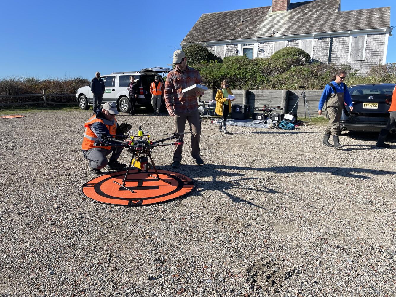
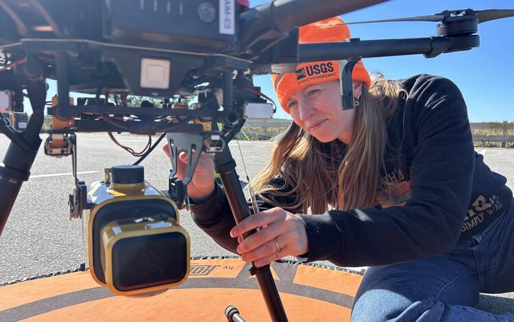
The Aerial Imaging and Mapping Group (AIMG) plays a key role in enhancing our understanding of coastal ecosystems through their innovative fieldwork and mapping techniques. By using uncrewed aircraft system (UAS) technology, the group can quickly map areas of interest and assess both short- and long-term changes. The various data they collect are useful for many different scientific studies. High-resolution imagery, elevation maps, and a range of thermal, gas, and multispectral sensors can be used to monitor landscape change, assess hurricane damage, respond to natural disasters, and provide situational awareness for emergencies.
The AIMG also collaborates with other UAS operators within the U.S. Department of the Interior, U.S. National Park Service, U.S. Fish and Wildlife Service, and the U.S. Environmental Protection Agency, as well as town and municipal stakeholders to explore new technologies and methods for data collection. This work supports the Remote Sensing Coastal Change project, the Coastal Change Hazards programmatic focus, the National Uncrewed Systems Office, and other Bureau-wide remote-sensing projects. Additionally, the AIMG leads the small uncrewed aircraft system (sUAS) capability team for the USGS Northeast Region.
Highlights of 2025
Surveys for Coastal and Wetland Research
The AIMG supported numerous projects by collecting high‑resolution lidar, photogrammetry, multispectral and thermal imagery, and Global Navigation Satellite System survey data using small uncrewed aircraft systems (sUAS). These datasets informed studies of coastal erosion, marsh restoration, sediment transport, and water‑supply modeling, supporting scientific analysis and decision making. The group also coordinated field operations with Tribal, municipal, and other local partners, strengthening collaborative coastal science efforts.
Enhancing Tools, Workflows, and Field Capabilities
To meet diverse project needs, the AIMG developed custom sensor mounts and refined automated processing workflows that improved both efficiency and data consistency. Additionally, integration of next‑generation systems—including the Skydio X10 and Wingtra GEN II lidar platform—expanded AIM’s technical capabilities for coastal mapping, emergency response, and precision elevation modeling.
Training and Capacity Building
The AIMG continued to grow regional capacity in uncrewed systems by leading sUAS training courses and contributing to the Northeast Region sUAS Capability Team. These efforts helped ensure safe, standardized operations while supporting a broad community of new and experienced sUAS users.
Data Releases
-
Topographic data, aerial imagery, and GPS data collected during uncrewed aircraft system (UAS) operations at Lower Darby Creek, Darby Township, Pennsylvania, March to August 2024 Topographic data, aerial imagery, and GPS data collected during uncrewed aircraft system (UAS) operations at Lower Darby Creek, Darby Township, Pennsylvania, March to August 2024
The U.S. Geological Survey deployed small uncrewed aircraft systems (sUAS) to collect aerial remote sensing data across sites within the Lower Darby Creek Superfund Site and the adjacent John Heinz National Wildlife Refuge (JHNWR) ~5 miles outside of Philadelphia, PA in March and August of 2024. March datasets include aerial images from natural color (RGB) and thermal infra-red (TIR)...Lidar and photogrammetry point clouds with supporting imagery and GPS information collected during UAS operations at Great Sippewissett Marsh, Cape Cod, Massachusetts in Fall 2022 Lidar and photogrammetry point clouds with supporting imagery and GPS information collected during UAS operations at Great Sippewissett Marsh, Cape Cod, Massachusetts in Fall 2022
These lidar point clouds and images cover, in high detail, the terrain at Great Sippewissett Marsh, Cape Cod, MA on November 2nd, 2022. USGS researchers tested different sensors that collected lidar and images for photogrammetry point cloud data using Uncrewed Aerial Systems (UAS) to look at differences in coverage and elevation accuracy. The lidar data were acquired with a YellowScan...Topographic data, aerial imagery, and GPS data collected during uncrewed aircraft system (UAS) operations at Sesuit Marsh, Dennis, Massachusetts, August 12, 2024 Topographic data, aerial imagery, and GPS data collected during uncrewed aircraft system (UAS) operations at Sesuit Marsh, Dennis, Massachusetts, August 12, 2024
Small Uncrewed Aircraft Systems (sUAS) were used to collect aerial remote sensing data over Sesuit Marsh in Dennis, MA. Raw data from aerial surveys include aerial images from natural color (RGB) and multispectral cameras and raw lidar data. These datasets were processed to produce high resolution digital elevation models (DEM), image mosaics, and lidar point clouds (LPC) to provide...Topographic, multispectral, and GPS data collected during uncrewed aircraft system (UAS) operations at Marsh Island, New Bedford, Massachusetts (ver. 2.0, May 2026) Topographic, multispectral, and GPS data collected during uncrewed aircraft system (UAS) operations at Marsh Island, New Bedford, Massachusetts (ver. 2.0, May 2026)
Small Uncrewed Aircraft Systems (sUAS) were used to collect aerial remote sensing data over Marsh Island, a salt marsh restoration site along New Bedford Harbor, Massachusetts. Remediation of the site will involve direct hydrological and geochemical monitoring of the system alongside the UAS remote sensing data. Baseline conditions were evaluated in October 2023, and future data...LiDAR, natural color and thermal infrared data collected by uncrewed aircraft system (UAS) for mapping topography and stream temperature along the Vermilion River, Montana, August and October 2023 LiDAR, natural color and thermal infrared data collected by uncrewed aircraft system (UAS) for mapping topography and stream temperature along the Vermilion River, Montana, August and October 2023
The U.S. Geological Survey collected low-altitude airborne LiDAR, natural color and thermal infrared imagery via a multirotor, uncrewed aircraft system (UAS) along with Real Time Kinematic (RTK) GPS survey data along a section of the Vermilion River in Montana in August and October 2023. Natural color and thermal infrared imagery was collected in jpg and tiff format respectively and...Topographic data, imagery, and GPS data collected during uncrewed aircraft system (UAS) operations at Town Neck Beach, Sandwich, Massachusetts - Imagery Dataset Topographic data, imagery, and GPS data collected during uncrewed aircraft system (UAS) operations at Town Neck Beach, Sandwich, Massachusetts - Imagery Dataset
Small Uncrewed Aircraft Systems (sUAS) were used to collect aerial remote sensing data over Town Neck Beach, Massachusetts. The area is a highly trafficked public beach with parking lot, boardwalk, and renourishment and dune stabilization plan. On October 15th, 2024, USGS personnel collected natural (RGB) color images, lidar, ground control points, check points, and a vegetation height...Topographic data, imagery, and GPS data collected during uncrewed aircraft system (UAS) operations at Town Neck Beach, Sandwich, Massachusetts (ver. 2.0, May 2026) Topographic data, imagery, and GPS data collected during uncrewed aircraft system (UAS) operations at Town Neck Beach, Sandwich, Massachusetts (ver. 2.0, May 2026)
Small Uncrewed Aircraft Systems (sUAS) were used to collect aerial remote sensing data over Town Neck Beach, a highly trafficked local beach in Sandwich Massachusetts with parking lot, boardwalk, and state maintained sand and vegetation placement. USGS personnel collected natural (RGB) color images, LiDAR, and ground control points starting in December 2023 to support multiple science...
Sea-Floor Mapping
The Sea Floor Mapping Group (SFMG) maintains a core capability that supports USGS research on coastal and marine geohazards and resources. This multidisciplinary team up of geologists, geographers, ocean engineers, marine electronics technicians, and physical scientists specializes in seafloor and subsurface mapping, with expertise in data acquisition and processing, geologic interpretation, geospatial analysis, technical system development and long-term data stewardship.
Working in environments ranging from inland waters to the deep sea, the group uses acoustic, optic, and sampling technologies to map the water column, seafloor morphology, sediment characteristics, and the underlying geologic structure of the seafloor. These foundational datasets support studies related to energy and mineral resources; sediment transport; earthquake, landslide, and tsunami hazards; coastal change; and more. The SFMG also provides the scientific and technical support and expertise that drives projects forward, from project planning and analysis through to integration of results and publication.
USGS expertise and maps derived from these research efforts help managers, policymakers, and other stakeholders make informed decisions about our coastal and marine geohazards and resources.
Highlights of 2025
Comprehensive Seafloor Mapping in Long Island Sound
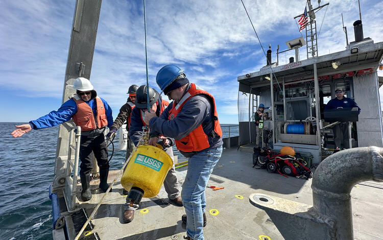
As part of the Long Island Sound Mapping and Research Collaborative, the SFMG completed two 7-day seafloor mapping surveys using the SEABed Observation and Sampling System (SEABOSS) 2.1. They collected seafloor photographs, video, and sediment samples at 149 sites during the fall and spring, generating seasonal datasets that support substrate classification, and benthic habitat studies. Analytical work at our center's Sediment Laboratory will provide grain‑size data to refine ongoing regional assessments. Working closely with research partners from the Connecticut Department of Energy and Environmental Protection, University of Connecticut, University of New Haven, Lamont-Doherty Earth Observatory, and Stony Brook University, the SFMG provides sediment analyses and seafloor imagery that supports the team's multidisciplinary science goals and provides essential baseline information for coastal managers, decisions about habitat protection, resource identification, restoration planning, and long‑term monitoring within Long Island Sound.
Alaska Geohazard and Resource Research
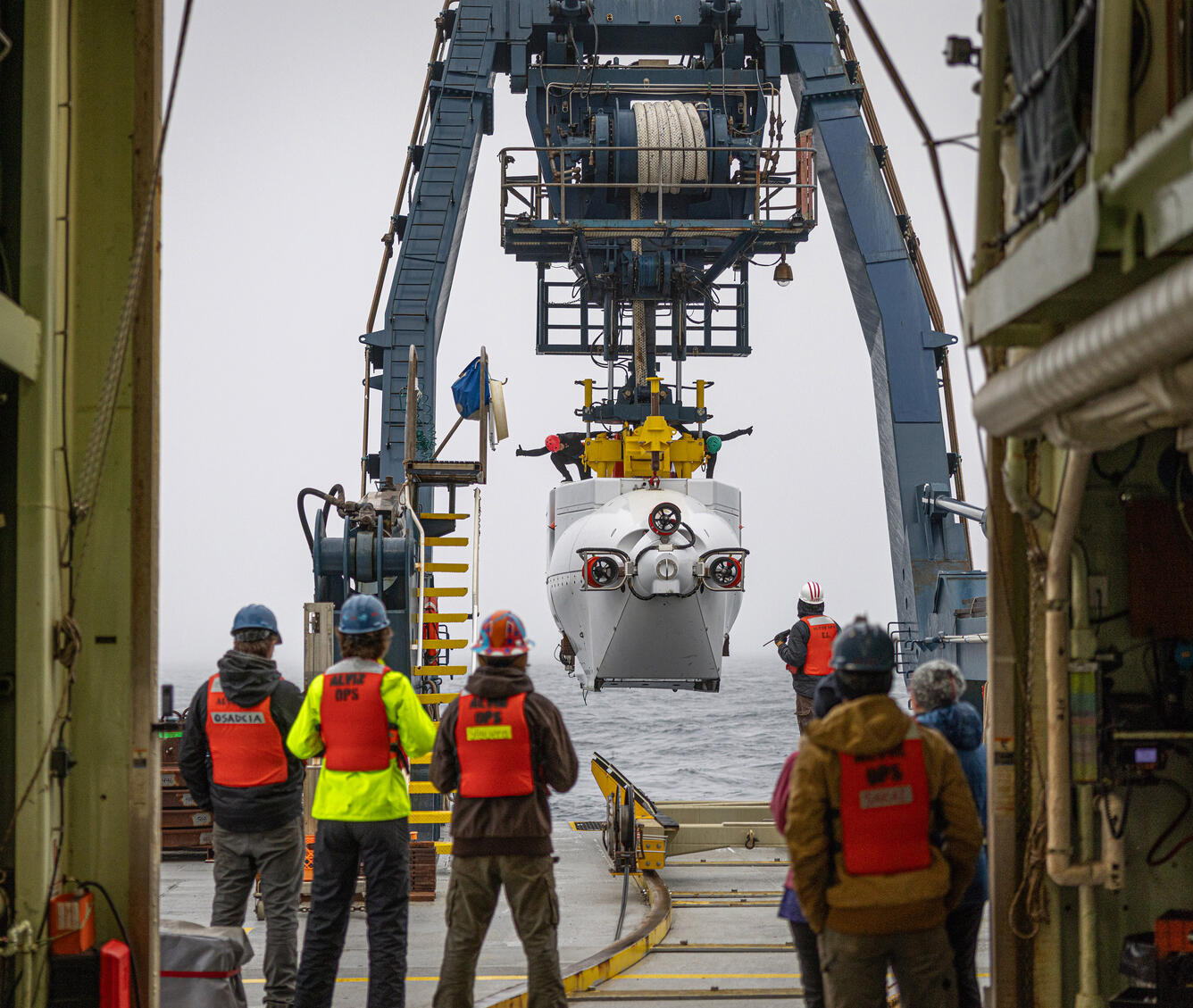
We participated in a USGS-led expedition in the Aleutian Arc with the Bureau of Ocean Energy Management (BOEM), Woods Hole Oceanographic Institution (WHOI), and National Oceanic and Atmospheric Administration (NOAA) to collect critical baseline information on energy resources, underwater earthquakes and other hazards, seafloor habitats, and biological resources, including key fisheries and potential seabed minerals. These datasets support geohazard assessments in this seismically active region, improve understanding of benthic ecosystems, and inform resource evaluation and hazard preparedness efforts.
Surveyed Primary Drinking Water Source for Town of Falmouth
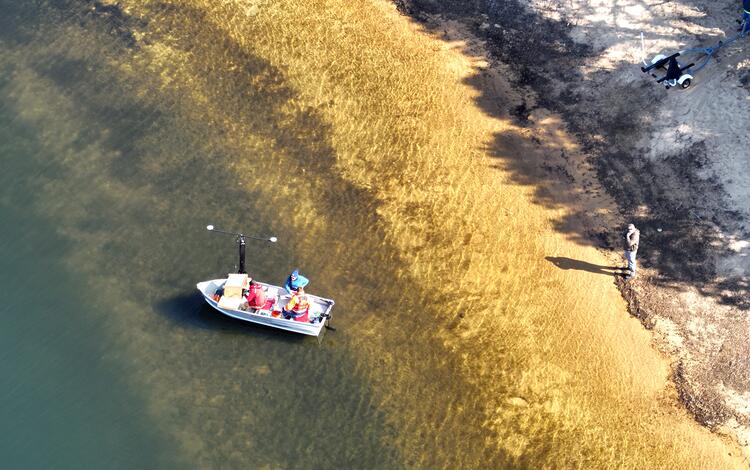
We conducted a mapping survey of Long Pond in Falmouth, Massachusetts at the request of the Town. These data, combined with the center's Aerial Imaging and Mapping Group’s done-based lidar survey of the pond’s shoreline and resulting digital elevation model, allowed us to calculate an updated estimate of Long Pond’s total water volume. This provided town officials with updated and more detailed information for managing Falmouth's primary drinking water source, especially during periods of drought.
Advancing Technology
SFMG staff continued development of SEABOSS 3.0, capable of collecting images, videos, and samples of the seafloor at water depths up to 500 meters. They traveled to the Pacific Coastal and Marine Science Center (PCMSC) in Santa Cruz, California to learn about PCMSC’s Benthic Observation camera Sled (BOBSled). Components from the BOBSled will aid in the design of SEABOSS 3.0. The SFMG also continued field testing and data evaluations of the Edgetech 512e chirp subbottom profiler, replacing the over 25-year system that long supported USGS Coastal and Marine Hazards and Resources Program (CMHRP) research. Instrument development and upgrades are conducted in coordination across CHMRP science centers, helping ensure consistency across the Program, expanding shared technical expertise, and supporting CMHRP’s ability to meet ongoing and future research needs.
Journal Article
-
Evidence for petit-spot volcanism in the Puerto Rico Trench Evidence for petit-spot volcanism in the Puerto Rico Trench
Petit-spot volcanism occurs in intraplate settings along the outer rise of subducting plates. Here we present evidence for petit-spot type of volcanism from multibeam bathymetry and backscatter data from the Puerto Rico Trench (PRT). It is the first report of such volcanism in the Atlantic basin. Up to 34 possible petit-spot volcanic cones are mapped in the eastern section of the PRT...
Data Releases
-
Geospatial data in support of structured decision making for northeast coastal parks Geospatial data in support of structured decision making for northeast coastal parks
Salt marshes provide a range of ecosystem services, including storm protection, recreation, and commercial fishery habitat provision. The National Park Service (NPS) aims to preserve and protect salt marshes in order to achieve multiple objectives which address their mission: to preserve unimpaired the natural and cultural resources and values of their publicly held lands. Ongoing...Chesapeake Bay marsh migration potential under sea-level rise (ver. 2.0, May 2026) Chesapeake Bay marsh migration potential under sea-level rise (ver. 2.0, May 2026)
Marsh migration potential in the Chesapeake Bay (CB) salt marshes is calculated in terms of available migration area for each marsh unit defined by Ackerman and others (2022). The space available for landward migration is based on the NOAA marsh migration predictions under 2.0 feet of local sea-level rise (SLR). The migration space is further divided by National Hydrography Dataset (NHD)...Chirp seismic reflection and navigation data collected in Chesapeake Bay during USGS Field Activity 2022-020-FA Chirp seismic reflection and navigation data collected in Chesapeake Bay during USGS Field Activity 2022-020-FA
In July 2022, the U.S. Geological Survey (USGS) and the University of Maryland's Chesapeake Biological Laboratory conducted a study, USGS Field Activity Number (FAN) 2022-020-FA, in Chesapeake Bay to quantify greenhouse gas fluxes from the largest estuary in the United States. The team investigated the environmental factors that control the distribution and exchange of methane and carbon...
Regional Geologic Framework Studies
We map, interpret, and analyze the seafloor and the geologic structure beneath it. These data provide a foundational understanding of a region’s natural resources—such as minerals, sand, and gravel—and help characterize potential hazards that could affect offshore development and navigation. This work also supports coastal resilience by identifying natural sediment pathways and locating material suitable for shoreline nourishment. We translate these findings into accessible products that inform end user planning, management, and decision‑making.
Highlights of 2025
GeoPackage of Seabed Hazards to Offshore Infrastructure
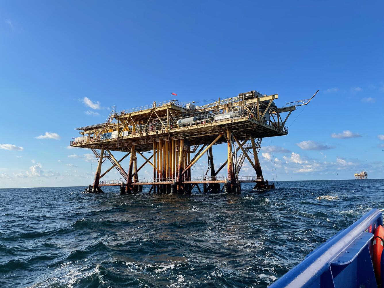
The USGS partnered with the Bureau of Safety and Environmental Enforcement (BSEE) to inventory non-proprietary studies by developers and other researchers to describe the seabed geohazards on the United States’ Atlantic and Pacific continental shelves. From this inventory, we published a GeoPackage where the studies and geohazards can be examined in a spatial context. The data provide insight into the siting and monitoring needs for installing sea-floor cables, pipelines, and other development, as well as characterize the broader geological and environmental conditions of each area.
Development of Next-Generation SEABOSS Underway
The Seabed Observation and Sampling System (SEABOSS) is a long‑used USGS system that collects seafloor images, videos, and sediment samples, supporting research on natural hazards and offshore resources. In partnership with the Bureau of Ocean Energy Management (BOEM), we started developing SEABOSS 3.0—an updated version that modernizes the system and extends capabilities into deeper water (up to 500 meters) through the integration of fiber‑optic technology and upgraded camera systems, improving speed, resolution, and reliability.
Invited Subject Matter Experts
To fill the growing need for trusted marine science, Regional Geologic Studies team members were invited subject matter experts for workshops, working groups, and meetings convened by the Mashpee Wampanoag Tribe, National Science Foundation, BOEM, Commonwealth of Massachusetts, Northeastern Regional Association of Coastal Ocean Observing Systems, and Northeast Regional Ocean Council.
Data Release
-
GeoPackage of Seabed Hazards: A Resource for Safeguarding Offshore Infrastructure GeoPackage of Seabed Hazards: A Resource for Safeguarding Offshore Infrastructure
The USGS and the Bureau of Safety and Environmental Enforcement developed a GeoPackage of seabed hazards for the U.S. Atlantic and Pacific continental shelves. By visualizing hazards in a spatial context, this resource helps users manage and protect essential offshore infrastructure.


Marine Geohazards and Resources
Geologic activity in the ocean can cause dangerous events, such as earthquakes, volcanic eruptions, and submarine landslides, that threaten lives, critical infrastructure, and valuable resources both at sea and on land. Our scientists study the recent history of marine geohazards and evaluate the future potential and probable impacts of these events on a regional basis. We conduct field-based surveys to better understand the processes that cause the hazard and develop reliable deterministic and probabilistic hazard estimates. This information helps decision makers reduce risks to people, the environment, and natural resources.
The United States is increasingly dependent on resources for energy, raw materials for construction, and minerals vital to communication and information technologies. Offshore areas hold enormous potential for energy and mineral resources, including oil, gas, and gas hydrates and deep-sea minerals critical to industry and technological applications. Scientists studying marine resources at the center are part of national and international collaborative efforts to determine where the United States has jurisdiction to manage marine resources and to understand the characterization and distribution of potentially valuable resources. Our scientists map the sea floor and collect and analyze samples to investigate resource potential and learn how and where critical minerals form. Their research and science-based products provide decision makers with information needed to understand offshore resource potential and develop resources safely and sustainably.
Gas Hydrates
Marine Geohazards Sources and Probability
Gas Hydrates
Methane is a natural gas that plays a big role in everyday life, from feeding tiny microbes living deep in the ocean to cooking the food in our kitchens. One of the largest natural sources of methane on Earth is found in gas hydrate, an ice-like solid of water and methane that forms in cold, high-pressure environments, such as beneath permafrost and in deep ocean sediments around the world.
Even a small amount of gas hydrate contains an impressive amount of methane. For instance, a chunk of gas hydrate the size of a golf ball can hold enough methane to fill a basketball. Globally, the amount of methane stored in gas hydrates is enormous—roughly equal to the carbon stored in all the world’s coal, oil, and natural gas combined.
The Gas Hydrate Project brings together dedicated scientists and engineers from across the USGS to understand how methane moves through the environment and whether methane trapped in gas hydrate could be used as an energy resource.
To answer these questions, we develop new tools to determine where methane comes from, and to measure sediment properties associated with gas hydrate. These advanced tools are used in research expeditions both on land and at sea with partners across the U.S. and internationally, helping to generate multidisciplinary science products that are now cited more than 3,000 times each year.
Highlights of 2025
Validated a New Measurement Tool
The project team validated the High Stress Permeameter—a specialized gas hydrate pressure core analysis tool designed and developed in Woods Hole with support from the Department of Energy. The tool is currently being used to analyze core samples from a long-term gas hydrate production test on the Alaskan North Slope.
Expanded Analytical Capability
The team upgraded their patented carbon concentration and isotope measurement system, increasing its analytical capability beyond gas samples to include carbon dissolved in liquid samples. This update enables more comprehensive characterization of carbon pools associated with gas hydrate.
Study Reveals How Methane-Carbon Enters the Deep-Sea Food Web
Drawing from 20 years of data gathered from four research cruises studying methane seeps along the Cascadia Margin in the Pacific Northwest, scientists examined what happens to methane rising from the seafloor. Analysis of these datasets revealed how microbes transform methane into other organic molecules through oxidation—a process that determines how much methane-carbon escapes the sediment and enters the deep ocean. In 2025, a USGS-led publication reported that in seep areas with low sediment organic carbon, microbes allow a greater percentage of methane-carbon to escape out of the sediment, exporting up to 10 teragrams of methane-derived dissolved organic carbon per year to the deep sea. This dissolved organic carbon becomes a significant food source for deep-sea microbial communities.
Expedition Proceedings Support Gas Hydrate Research
In 2023, the USGS provided operational and technical support to a deepwater hydrate coring expedition led by the University of Texas. During the expedition, scientists drilled, cored, and analyzed samples from the seafloor to the base of the gas hydrate stability zone in the Terrebonne Basin, deepwater Gulf of America. In 2025, the research team published the expedition’s proceedings, releasing observations and data to support biological, geochemical, and geomechanical gas hydrate research focused on understanding their role in the carbon cycle and as a potential energy resource. This Department of Energy-funded effort aims to define the geologic controls on gas hydrate occurrence in the Gulf of America and support ongoing assessments of the energy resource potential of gas hydrates across the U.S. offshore Exclusive Economic Zone.

Journal Articles
Proceedings of the UT-GOM2-2 Deepwater Hydrate Coring Expedition
In the summer and fall of 2023, the University of Texas (UT) Deepwater Hydrate Coring Expedition (UT-GOM2-2) drilled, cored, made downhole measurements, and analyzed samples from the seafloor to the base of the gas hydrate stability zone at Site H, in the Walker Ridge Protracted Area Block 313 (Site H, WR313), in the Terrebonne Basin, deepwater Gulf of America (Gulf of Mexico).
Authors: Flemings, P.B., Thomas, C., Phillips, S.C., Collett, T.S. et al.
Expedition UT-GOM2-2 Summary
In the summer and fall of 2023, the University of Texas (UT) Deepwater Hydrate Coring Expedition (UT-GOM2-2) drilled, cored, made downhole measurements, and analyzed samples from the seafloor to the base of the gas hydrate stability zone at Site H, in the Walker Ridge Protracted Area Block 313 (Site H, WR313), in the Terrebonne Basin, deepwater Gulf of America (Gulf of Mexico).
Authors: Flemings, P. B., Thomas, C., Phillips, S. C., Collett, T. S., et al.
Expedition UT-GOM2-2 Methods
This report provides an overview of the methods used during the University of Texas (UT) Deepwater Hydrate Coring Expedition (UT-GOM2-2). Methods include work done onboard the Helix Q4000 in the offshore Gulf of America (Gulf of Mexico), herein “the Gulf”, “dockside” in Salt Lake City, Utah, and some shore-based work in individual laboratories.
Authors: Flemings, P. B., Thomas, C., Phillips, S. C., Collett, T. S., et al.
Expedition UT-GOM2-2 Site H
Pressure and conventional cores were collected at Site H of the Walker Ridge Protracted Area Block 313 in the Terrebonne Basin, deepwater Gulf of America (Gulf of Mexico) during the University of Texas (UT) Deepwater Hydrate Coring Expedition (UT-GOM2-2).
Authors: Flemings, P. B., Thomas, C., Phillips, S. C., Collett, T. S., et al.
Organic Matter Availability and the Production of Methane-Derived Dissolved Organic Carbon at Methane Seeps
Methane seeps located along continental margins and slopes export sedimentary methane and dissolved organic carbon (DOC) into the ocean. The flux of these reduced carbon molecules from the seafloor into the ocean impacts ocean chemistry and supports deep-sea life.
Authors: Lalk, E., J. W. Pohlman, and L. L. Lapham
Data Releases
Compressibility and permeability data for kaolin: a comparison between 1-dimensional oedometers and a high-stress permeameter
To validate measurement results obtained using a custom-built, high-stress permeameter (HSP), consolidation experiments were carried out on kaolin (“Peerless 2” from Vanderbilt Minerals) using both the HSP and industry standard fixed-ring oedometers. From these consolidation tests, the compression index, Cc, and recompression index, Cr, were obtained.
Authors: Garcia, A. V. and Waite, W. F.
Molecular (C1-C5 hydrocarbon, CO2, O2, and N2) and δ13C-CH4 composition of pressure core, void, and hydrate gases from the Terrebonne Basin, Gulf of America (Gulf of Mexico), Walker Ridge Block 313, Site H, Expedition UT-GOM2-2
This dataset contains the gas composition and isotope data from void, hydrate dissociation, and quantitative degassing samples. Void gases were extracted using a stainless-steel puncture sampler that was pushed through the core liner shortly after the core was collected onboard the Helix Q4000.
Authors: Phillips, S. C., Pohlman, J. W., and Casso, M. A.
Rock magnetic measurements of sediment from the Terrebonne Basin, Gulf of America (Gulf of Mexico), Walker Ridge Block 313, Site H, Expedition UT-GOM2-2
These data include magnetic susceptibility measured at high and low frequency, along with calculations of the frequency dependence of magnetic susceptibility, on discrete sediment samples collected from the Terrebonne Basin at UT-GOM2-2 Site H Holes H003 and H002. Magnetic susceptibility values can be a first order indicator of ferrimagnetic iron...
Authors: Phillips, S. C. and Widlansky, S. J.
Marine Geohazards Sources and Probability
The goal of the Marine Geohazards Sources and Probability project is to increase our understanding of various marine hazards, such as earthquakes, landslides, tsunamis, and underwater volcanoes. By learning more about the underlying processes that drive these hazards, the project team can estimate which hazards may occur in specific areas and assess their likelihood. The models and hazard assessments created by the team are used by engineers and policymakers to keep our communities safe and prepared for potential marine hazards.
Highlights of 2025
Seafloor Seismographs Rapidly Deployed Following Major Earthquake
Following the magnitude 7.0 Mendocino earthquake offshore Northern California, we worked with the Woods Hole Oceanographic Institution’s (WHOI) Ocean Bottom Seismic Center to deploy a fleet of rapid response ocean bottom seismographs 11 days after the initial event. This deployment was the first real-world use of the new, smaller instruments designed for rapid deployments during times of increased seismic activity. The instruments and valuable seismic data were recovered after recording hundreds of aftershocks on the seafloor for over 44 days. Combining the ocean bottom seismograph data with data collected on land by the USGS Earthquake Hazards Program will significantly improve aftershock locations and other key measures of earthquake rupture mechanics. These data will be used to determine the size of the main rupture area, image fault zone structure, and model stress changes—all of which will improve the accuracy of seismic hazard models.
Alaska Geohazard Research
In Skilak Lake on the Kenai Peninsula, a team of scientists from the USGS, WHOI, and Earthscope Primary Instrument Center recovered lake‑bottom and land‑based seismographs deployed to measure local variations in ground shaking. This completed a multiyear study that will help evaluate the reliability of geologic seismograph records used to interpret past earthquakes in regions like Cascadia. This work was supported by the center's Sea-Floor Mapping Group.

Journal Article
-
Evidence for petit-spot volcanism in the Puerto Rico Trench Evidence for petit-spot volcanism in the Puerto Rico Trench
Petit-spot volcanism occurs in intraplate settings along the outer rise of subducting plates. Here we present evidence for petit-spot type of volcanism from multibeam bathymetry and backscatter data from the Puerto Rico Trench (PRT). It is the first report of such volcanism in the Atlantic basin. Up to 34 possible petit-spot volcanic cones are mapped in the eastern section of the PRT...


Coastal and Estuarine Dynamics
Coastal systems are constantly changing, shaped by the movement of sediment driven by waves, wind, currents, tides, storms, and rising sea levels. Understanding how these forces affect our coastlines is crucial for increasing coastal resilience and reducing vulnerabilities to hazards, including infrastructure loss, declines in tourism, and effects on important habitats.
The Coastal and Estuarine Dynamics group uses advanced oceanographic tools to observe and measure how sediment moves in coastal waters. These observations are key to creating computer models that help us grasp the past, present, and future of these dynamic ecosystems. Our models vary in scale, from studying local estuaries and barrier islands to analyzing the entire U.S. Atlantic coast.
By combining real-world observations with sophisticated modeling, we enhance hazard and resource assessments— equipping coastal managers with vital information to make informed decisions. This work helps protect people who live on the coast, communities that depend on the coast for their livelihoods and recreational enjoyment, and the health of valuable coastal ecosystems.
Total Water Level and Coastal Change
Cross-Shore and Inlets Processes
Remote Sensing Coastal Change
Estuarine Processes, Hazards, and Ecosystems
Total Water Level and Coastal Change
The Next-Generation Total Water Level and Coastal Change Forecast project is a collaboration between the three USGS Coastal and Marine Science Centers in Santa Cruz, California; St. Petersburg, Florida; and Woods Hole, Massachusetts. At the heart of the project is the Total Water Level and Coastal Change Forecast Viewer, a user-friendly online platform that offers multiday forecasts based on simulations of tides, storm surge, wave conditions, and coastline features. This tool covers nearly 3,000 miles (about 4,700 kilometers) of sandy coastline along the Atlantic and Gulf coasts, with ongoing expansion to the Pacific coast and nonsandy environments. It is the only national-scale, real-time model for coastal change.
The project team is focused on several key goals, including assessing how well the forecasts perform by comparing them to real-world observations, improving accuracy by integrating new data and research, and developing spatially varied and ensemble versions of the model that include certainty estimates. By continually improving forecast accuracy and expanding the geographic and environmental coverage, coastal managers and planners can better prepare for storms and other coastal change hazards, ultimately helping to safeguard our communities.
Highlights of 2025
CoastCam Maintenance and Data Publication
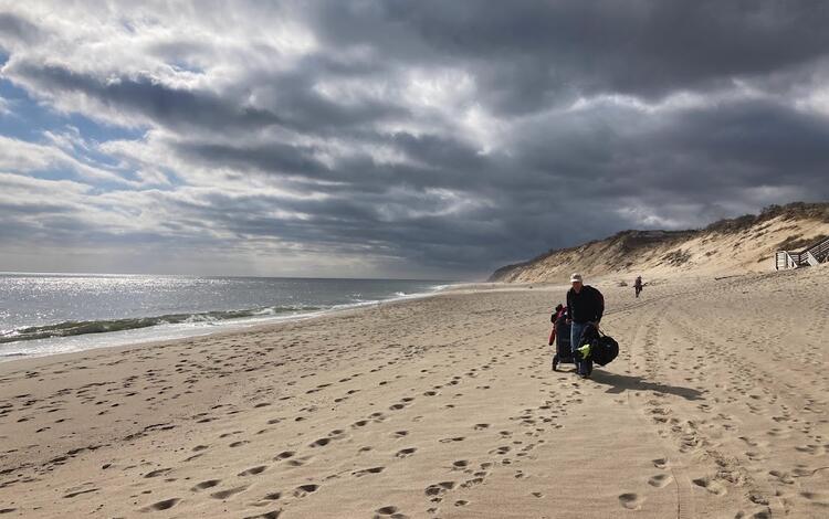
The project team continued to maintain the CoastCam at Marconi Beach on Cape Cod National Seashore in Wellfleet, Massachusetts. Data derived from the camera are used to compare run-up measurements with Total Water Level and Coastal Change forecasts, with the goal of validating and improving the forecast model. Due to significant bluff erosion, the camera at this site was relocated three times. Imagery from the initial site was published and individual images can be browsed and downloaded from the Imagery Data System. The other camera on the Cape Cod National Seashore at Head of the Meadow Beach in Truro, Massachusetts was discontinued and demobilized. Those data are being analyzed for publication.
Mapped Storm Damage at Marconi Beach
The National Park Service stairs leading down to Marconi Beach were destroyed by a storm in September 2024. Using drones equipped with lidar and a small autonomous boat that collects depth data, the Aerial Imaging and Mapping Group mapped the beach and shallow offshore area in front of the Marconi CoastCam by the stairs. These surveys help document how much sand was moved, where erosion occurred, and how the beach is recovering. Researchers also looked at wave runup—the height waves reach as they rush up the beach. Analysis of the runup data suggest that current models for predicting runup may underestimate conditions like those that contributed to the stair’s damage, indicating that new formulas are needed.

Data Releases
-
USGS CoastCam CACO-02 at Marconi Beach, Cape Cod National Seashore, Massachusetts (2021, 2023, 2024): Imagery and Calibration Data USGS CoastCam CACO-02 at Marconi Beach, Cape Cod National Seashore, Massachusetts (2021, 2023, 2024): Imagery and Calibration Data
Two digital video cameras (CACO-02) were installed at Marconi Beach, Cape Cod National Seashore in Massachusetts (MA) as part of a U.S. Geological Survey (USGS) research project to study the beach and nearshore environment. The cameras faced north-east (c1) and east (c2) along the beach and every half hour during daylight hours. They ran daily from March through June 2021, Feburary...Topographic and bathymetric data, aerial imagery, and GPS data collected during UxS operations at Marconi Beach, Cape Cod National Seashore, Massachusetts between September 2024 and March 2025 - Imagery dataset Topographic and bathymetric data, aerial imagery, and GPS data collected during UxS operations at Marconi Beach, Cape Cod National Seashore, Massachusetts between September 2024 and March 2025 - Imagery dataset
Small Uncrewed Aircraft Systems (sUAS) were used to collect aerial remote sensing data over Marconi Beach on Cape Cod National Seashore, Wellfleet, Massachusetts. The USGS has a stationary camera system (CoastCam) and Meterological station overlooking the beach north of the parking lot on the bluff to observe waves and total water levels. The area experienced multiple large erosion...Topographic and bathymetric data, aerial imagery, and GPS data collected during UxS operations at Marconi Beach, Cape Cod National Seashore, Massachusetts between September 2024 and March 2025 Topographic and bathymetric data, aerial imagery, and GPS data collected during UxS operations at Marconi Beach, Cape Cod National Seashore, Massachusetts between September 2024 and March 2025
Surveys with Uncrewed Systems (UxS) were used to collect remote sensing data at Marconi Beach on Cape Cod National Seashore, Wellfleet, Massachusetts after the area experienced multiple erosion events after fall storms in 2024 and the loss of National Park Service beach access stairs. The USGS has a stationary camera system (CoastCam) and meteorological station north of the parking lot...Time-series measurements of oceanographic and seabed response data collected in Cape Cod Bay, Barnstable, MA, March 10 to April 7, 2021 Time-series measurements of oceanographic and seabed response data collected in Cape Cod Bay, Barnstable, MA, March 10 to April 7, 2021
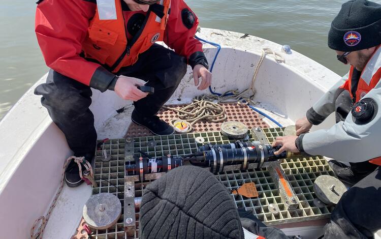
To assess cross-shore sediment transport prediction techniques in coastal models for a wave-dominated sandy coast, the U.S. Geological Survey Woods Hole Coastal and Marine Science Center collected data to measure wave-induced and mean current water velocities near the seabed and the response of the seabed to these forces. A four-legged bottom landing frame (quadpod) containing...
Cross-Shore and Inlets Processes
The Cross-Shore and Inlets Processes (CSI) project is focused on increasing our understanding of the coast, from estuaries to the continental shelf, and our ability to predict its evolving form and shape. A key part of this effort is the development of the COAWST modeling system—a tool that simulates storms realistically by allowing different earth-system models to interact with one another.
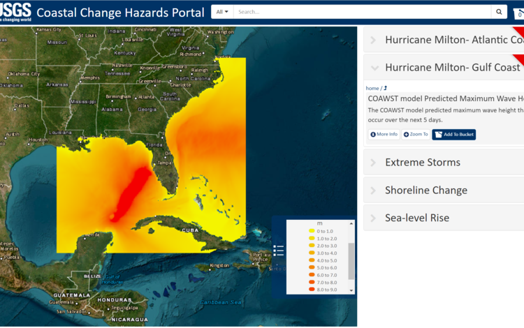
Through the National Oceanographic Partnership Program's (NOPP) Hurricane Coastal Impacts initiative, CSI scientists use the COAWST model to produce five‑day hurricane forecasts and compare them with real‑time observations to strengthen model performance. The team also contributes to several hurricane and Disaster Supplemental efforts aimed at improving coastal hazard forecasting and understanding storm driven landscape change. These activities include advancing urban flood forecasting capabilities, refining storm hindcasts to better capture coastal processes, and strengthening assessments of estuarine responses to extreme events.
Together, this work improves the reliability of coastal storm predictions and supports more informed planning and preparedness.
Highlights of 2025
Compared Model Forecasts to Observations
With the final year of hurricane data collection completed in 2024, the 2025 NOPP effort focused on evaluating forecast skill by comparing COAWST model predictions with observations from Hurricanes Idalia (2023), Helene (2024), and Milton (2024). The team also applied the modeling system to Hurricane Ida (2021) through Disaster Supplemental funding, producing the first flood map of the event for a highly urbanized area in collaboration with WHOI and Stevens Institute—now used by New York City’s Department of Environmental Protection. Additional studies refined understanding of barrier‑island breaching during Hurricane Dorian and advanced research on salt‑intrusion dynamics in shallow embayments, processes critical to freshwater availability and vegetation health.

Journal Articles
-
Pluvial and potential compound flooding in a coupled coastal modeling framework: New York City during post-tropical Cyclone Ida (2021) Pluvial and potential compound flooding in a coupled coastal modeling framework: New York City during post-tropical Cyclone Ida (2021)
Many coastal urban areas are prone to extreme pluvial flooding due to limitations in stormwater system capacity, with the additional potential for flooding compounded by storm surge, tides, and waves. Understanding and simulating these processes can improve prediction and flood risk management. Here, we adapt the Coupled Ocean–Atmosphere–Wave–Sediment Transport modeling framework (COAWST...Compounding of 100-year coastal floods by rainfall in an urban environment Compounding of 100-year coastal floods by rainfall in an urban environment
Coastal and pluvial flooding are both becoming more prevalent and severe due to climate change and urbanization in floodplains. The co-occurrence of these flood drivers is generally assumed to exacerbate the resulting flood impacts, a result referred to as compound flooding. However, few observational or modeling studies have investigated the circumstances under which this occurs. Here...Numerical simulation of sound-side barrier-island inundation and breaching during Hurricane Dorian (2019) Numerical simulation of sound-side barrier-island inundation and breaching during Hurricane Dorian (2019)
Hurricane-induced morphological changes and associated community hazards along sandy, barrier-island coastlines have been studied primarily from the perspective of ocean-side attack by storm-driven ocean surge and large waves. Thus, our understanding of long-term barrier island morphological change focuses on beach erosion, overwash, and inlet formation. In contrast, outwash events with...
Estuarine Exchange Flow in the Albemarle-Pamlico Estuarine System
Estuarine exchange flow controls the salt balance and regulates biogeochemistry in an estuary. The Albemarle-Pamlico estuarine system (APES) is the largest coastal lagoon in the U.S. and historically susceptible to a series of environmental issues including salt water intrusion and eutrophication...
Authors: Yin, D., Harris, C. K., and Warner, J. C.
Investigating Hurricane-Induced Salt Variation Across the Land-Estuary-Ocean Continuum Using a Dynamically Coupled Hydrological-Ocean Model
Salinity variations across the Land-Estuary-Ocean (LEO) continuum are critical for coastal ecosystems and impact the socioeconomic benefits to local communities. However, evaluating these variations is challenging due to the complex interactions of terrestrial and oceanic processes, including river discharge, winds, tides, sea level rise, and storms.
Authors: Xiaochen Zhao, Z. George Xue, Daoyang Bao, John Warner, and Yanda Ou.
Inundation Processes, Barrier Island Breaching, and Structure Impacts During Hurricane Michael (2018)
We demonstrate the increased ability to forecast hurricane impacts with a coupled numerical modeling system by simulating ocean waves, water levels, currents, sediment transport, and structural damage to predict inundation, coastal morphological change, and residential building impacts.
Authors: Warner, J.C., Sherwood, C.R., Carson, M., Olabarrieta, M., Subgranon, A., Klepac, S., Gonzalez, J.M., Zambon, J., He, R., Xue, G., Bao, D., Ou, Y., Hunter, E., Moskaitis, J., Doyle, J. Danielson, J., Amante, C., and Enwright, N.
Data Releases
-
U.S. Geological Survey simulations of hydrodynamics and morphodynamics during Hurricane Michael (2018) U.S. Geological Survey simulations of hydrodynamics and morphodynamics during Hurricane Michael (2018)
The Coupled Ocean-Atmosphere-Wave-Sediment Transport (COAWST v3.8; Warner and others, 2010; Warner and others, 2019) modeling system was used to simulate ocean circulation, water levels, waves, and sediment transport that occurred during Hurricane Michael (2018). Simulations were performed with coupled and concurrent ocean and wave models simulated on a series of refined, cascading grids...U.S. Geological Survey simulations of hydrodynamics and morphodynamics at Core Banks, NC, during Hurricane Dorian (2019) U.S. Geological Survey simulations of hydrodynamics and morphodynamics at Core Banks, NC, during Hurricane Dorian (2019)
The Coupled Ocean-Atmosphere-Wave-Sediment Transport (COAWST v3.8; Warner and others, 2019; Warner and others, 2010) modeling system was used to simulate ocean circulation, water levels, and waves that occurred during Hurricane Dorian (2019) along the US East coast. Simulations were then further downscaled to focus on the resulting inundation, dune overtopping, and barrier island...
Remote Sensing Coastal Change
The Remote Sensing Coastal Change project is a multicenter collaboration to improve how we use remote-sensing techniques to address coastal change challenges. At the Woods Hole center, project scientists are focused on rapidly responding to coastal events like hurricanes and advancing how imagery is processed by use of structure-from-motion photogrammetry—a technique used to create high-resolution digital models of surface elevation. Project scientists also develop USGS Cloud Hosting Solutions that make data more accessible and explore how machine learning can streamline workflows.
By bringing together advanced technology and innovative strategies, the project team aims to better understand our ever-changing coastal landscape, ensuring coastal managers have the information and tools they need to protect coastal communities and ecosystems.
Highlights of 2025
Outwash Impacts Analyzed for Barrier Island
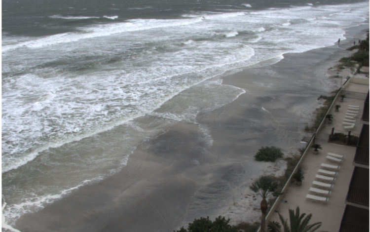
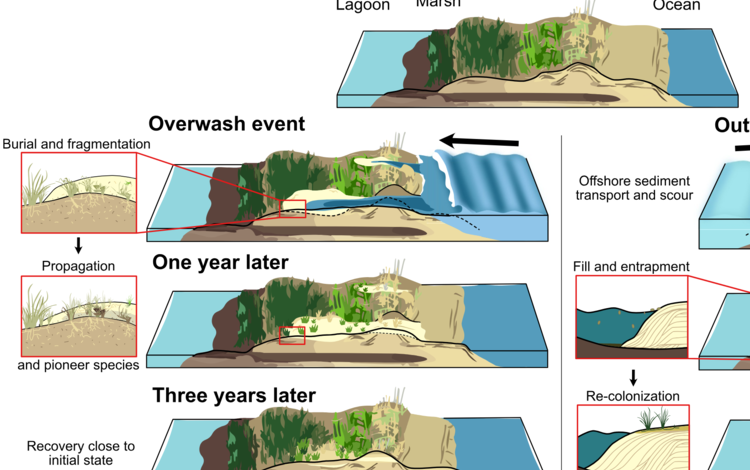
The project team continued to analyze remote-sensing imagery of the Outer Banks of North Carolina and other sites that experienced outwash—the seaward flow of water and erosion associated with high back-barrier water levels. Findings show that areas subjected to washout—rapid erosion caused by intense water flow, typically from heavy rain, storm surge, or high tides—return to prestorm vegetation and geomorphic conditions more slowly than areas subjected to overwash—the landward flow of water and sediment over sand dunes.
Sediment Dynamics Modeled for Outwash Event
Project scientists used a numerical simulation of the Hurricane Dorian (2019) outwash event at North Core Banks in North Carolina to investigate processes not measurable via remote sensing. The model successfully reproduced observed erosion patterns and revealed that washout channels exceeded 4 meters in depth. It also tracked the eroded sediment, showing it was deposited in shallow waters less than 10 meters deep and within 1 kilometer of the shoreline. This suggests that eroded sediment remains nearby and available to naturally rebuild the barrier island after outwash events.

Journal Articles
-
Outwash events inhibit vegetation recovery and prolong coastal vulnerability Outwash events inhibit vegetation recovery and prolong coastal vulnerability
Overwash, when high ocean water levels and waves flood a coastline, is a common phenomenon that can lead to washover deposits and barrier rollover. Outwash, by contrast, involves seaward flow, often driven by high back-barrier water levels, and can produce washout channels and nearshore deposition. Our observations show that washout channels were quickly (days to weeks) filled and...Numerical simulation of sound-side barrier-island inundation and breaching during Hurricane Dorian (2019) Numerical simulation of sound-side barrier-island inundation and breaching during Hurricane Dorian (2019)
Hurricane-induced morphological changes and associated community hazards along sandy, barrier-island coastlines have been studied primarily from the perspective of ocean-side attack by storm-driven ocean surge and large waves. Thus, our understanding of long-term barrier island morphological change focuses on beach erosion, overwash, and inlet formation. In contrast, outwash events with...
Inundation processes and barrier island breaching during Hurricane Michael (2018)
We demonstrate the increased ability to forecast hurricane impacts with a coupled numerical modeling system by simulating ocean waves, water levels, currents, sediment transport, and structural damage to predict inundation, coastal morphological change, and residential building impacts. The Coupled-Ocean-Atmosphere-Waves-Sediment-Transport (COAWST) modeling system is applied to simulate Hurricane Michael...
Authors: John C. Warner, Christopher R. Sherwood, Mark Carson, Emma Manzella, Maitane Olabarrieta, Arthriya Subgranon, Steven Klepac, Joseph B. Zambon, Ruoying He, Z. George Xue, Muhamad Farid Geonova, Elias Hunter, Jonathan Moskaitis, James D. Doyle, Christopher J. Amante, and Nicholas M. Enwright
Data Release
-
U.S. Geological Survey simulations of hydrodynamics and morphodynamics at Core Banks, NC, during Hurricane Dorian (2019) U.S. Geological Survey simulations of hydrodynamics and morphodynamics at Core Banks, NC, during Hurricane Dorian (2019)
The Coupled Ocean-Atmosphere-Wave-Sediment Transport (COAWST v3.8; Warner and others, 2019; Warner and others, 2010) modeling system was used to simulate ocean circulation, water levels, and waves that occurred during Hurricane Dorian (2019) along the US East coast. Simulations were then further downscaled to focus on the resulting inundation, dune overtopping, and barrier island...
Estuarine Processes, Hazards, and Ecosystems
Estuaries are dynamic environments where complex interactions take place between the atmosphere, ocean, watershed, ecosystems, and human infrastructure. They serve as valuable ecological habitat and provide numerous benefits to our society. Unfortunately, estuaries face challenges from natural events and processes like storms and rising sea levels, as well as from human activities.
The Estuarine Processes, Hazards, and Ecosystems project team collects data on how these events, processes, and activities affect estuaries. They use this information to develop models that help us better understand the past, present, and future states of these ecosystems. The team is highly collaborative, working closing with academic institutions and Federal and State agencies to ensure their research and science-based products meet the needs of land and resource managers across the Nation.
Highlights of 2025
UVVR Updated to Provide More Comprehensive Results
The Unvegetated-Vegetated Marsh Ratio (UVVR) is a USGS developed metric that provides a landscape scale assessment of salt marsh vulnerability to sea level rise and other environmental stressors. While the original CONUS-wide UVVR dataset was derived from Landsat 8 spectral data, this year we expanded coverage to include the full Landsat archive from 1985-2023. This update provides more comprehensive results and enables assessment of long-term change of salt marshes across the Nation. The updated datasets can be downloaded from ScienceBase.
Guiding Restoration in Chesapeake Bay
The salt marshes of Chesapeake Bay support a diverse economic engine based on recreation, commercial fisheries, and coastal protection. As part of the Marshes for Tomorrow project, the USGS collaborated with multiple partners to build a decision framework to restore and maintain 25,000 acres of high salt marsh habitat in the Chesapeake Bay. Using models developed by the USGS, Audubon estimated present and future restoration needs across the Bay to identify and prioritize projects.
Updating Spatial Data Viewer
Since 2023 the USGS has been collaborating with the Southeast Region of the U.S. Fish and Wildlife Service to coproduce a spatial data viewer. The current iteration of the viewer spans 57 refuges and integrates present day and historical UVVR, surface elevation change, and refuge boundaries into a single viewer that refuge managers can use. This year we started updating the viewer to include the 1985-2023 UVVR data, additional metrics that track long- and short-term change, and the year of land loss.
Journal Articles
-
Sensitivity analysis of a dynamic vegetation-sediment transport model using equadratures: Exploring inorganic accretion on a marsh platform Sensitivity analysis of a dynamic vegetation-sediment transport model using equadratures: Exploring inorganic accretion on a marsh platform
Salt marsh systems require a net import of inorganic sediment to maintain their structure in response to sea‐level rise. Marshes are affected by physical processes including tides, waves, sediment transport, and the influence of vegetation, and these processes interact in complex ways leading to sediment accretion or erosion. We implement a 3‐D hydrodynamic sediment transport model in an...A simple predictive model for salt marsh internal deterioration under sea-level rise and sediment deficits: Application to Chesapeake Bay A simple predictive model for salt marsh internal deterioration under sea-level rise and sediment deficits: Application to Chesapeake Bay
Salt marshes are dynamic biogeomorphic systems reliant on autochthonous and allochthonous input to maintain their three-dimensional configuration. Sea-level rise, subsidence, and sediment deficits can lead to submergence, open-water expansion, and ultimately loss of the vegetated marsh plain and associated ecosystem services. Widely used management-focused models focus on vegetation...Hydroacoustic observations reveal drivers of mixing and salinization of a karst subterranean estuary during intense precipitation Hydroacoustic observations reveal drivers of mixing and salinization of a karst subterranean estuary during intense precipitation
Karst subterranean estuaries within globally ubiquitous carbonate aquifers are coastal groundwater ecosystems that provide an essential water resource for human populations. To understand the drivers of salinization within a coastal aquifer in the Yucatan Peninsula (Mexico), we employed hydroacoustics in flooded caves to observe how oceanic and atmospheric events facilitate mixing...Multi-model comparison of salt marsh longevity under relative sea-level rise Multi-model comparison of salt marsh longevity under relative sea-level rise
Understanding salt marsh resilience under increasing sea levels can inform for management decisions. We compared temporal projections from various wetland process-based models and a geospatially derived metric (i.e., marsh lifespan) to understand key considerations and uncertainties about salt marsh resilience when using these products for decision-making. The influences of lidar...Ecological thresholds and transformations due to climate change: The role of abiotic stress Ecological thresholds and transformations due to climate change: The role of abiotic stress
An ecological threshold is the point at which a comparatively small environmental change triggers an abrupt and disproportionately large ecological response. In the face of accelerating climate change, there is concern that abrupt ecosystem transformations will become more widespread as critical ecological thresholds are crossed. There has been ongoing debate, however, regarding the...ByEcosystems Mission Area, Coastal and Marine Hazards and Resources Program, California Water Science Center, Eastern Ecological Science Center, Florence Bascom Geoscience Center, Forest and Rangeland Ecosystem Science Center, Pacific Coastal and Marine Science Center, Southwest Biological Science Center, St. Petersburg Coastal and Marine Science Center, Western Ecological Research Center (WERC), Western Geographic Science Center, Wetland and Aquatic Research Center , Woods Hole Coastal and Marine Science CenterDistribution and disturbances of ditches across salt marshes of the Northeast U.S. with implications for management and restoration Distribution and disturbances of ditches across salt marshes of the Northeast U.S. with implications for management and restoration
Effective management of valuable coastal systems, such as salt marshes requires an understanding of the complex stressors influencing their continued threat of drowning. However, efforts to determine the effects of one potential stressor, ditches, have produced diverging results complicating management efforts. Ditches (linear trenches dug to drain salt marshes for agriculture and...Wind pumping dominates landward salt transport in a weakly tidal estuary Wind pumping dominates landward salt transport in a weakly tidal estuary
In tidally energetic estuaries, salinity dynamics vary with tidal forcing as well as factors such as river discharge and bathymetry. However, in weakly tidal estuaries, mechanisms governing salt transport remain poorly understood. Here, we investigate salt transport processes in a weakly tidal estuary, Albemarle Sound on the U.S. East Coast, using a deterministic numerical model. In 2022...
Data Releases
-
Geospatial characterization of Atlantic-facing New Jersey salt marshes Geospatial characterization of Atlantic-facing New Jersey salt marshes
This data release contains coastal wetland synthesis products for the Atlantic-facing New Jersey salt marshes. Metrics for resiliency, including the unvegetated to vegetated ratio (UVVR), marsh elevation, and tidal range, are calculated for smaller units delineated from a digital elevation model, providing the spatial variability of physical factors that influence wetland health. The U.SChesapeake Bay marsh migration potential under sea-level rise (ver. 2.0, May 2026) Chesapeake Bay marsh migration potential under sea-level rise (ver. 2.0, May 2026)
Marsh migration potential in the Chesapeake Bay (CB) salt marshes is calculated in terms of available migration area for each marsh unit defined by Ackerman and others (2022). The space available for landward migration is based on the NOAA marsh migration predictions under 2.0 feet of local sea-level rise (SLR). The migration space is further divided by National Hydrography Dataset (NHD)...Lifespan of marsh units in E.B. Forsythe NWR and Atlantic-facing New Jersey salt marshes Lifespan of marsh units in E.B. Forsythe NWR and Atlantic-facing New Jersey salt marshes
This data release contains the estimated lifespans of salt marshes in E.B. Forsythe National Wildlife Refuge (EBFNWR) and Atlantic-facing New Jersey. The lifespans are calculated based on estimated sediment supply and sea-level rise (SLR) predictions, following the methodology of Ganju and others (2020). The salt marsh delineations are from Ackerman and others (2024) and Defne and Ganju...Projections of vegetated area and vegetated plain elevation in Chesapeake Bay salt marsh units Projections of vegetated area and vegetated plain elevation in Chesapeake Bay salt marsh units
Projections of vegetated area and vegetated plain elevation for salt marsh units within the Chesapeake Bay (CB) salt marsh complex are calculated using geospatial information for conceptual marsh units defined by Ackerman and others (2022) and Defne and others (2023). The projections are based on the UBMorph model, described in Ganju and others (2025), which estimates changes in areal...
Environmental Geoscience
Our coasts are home to diverse environments that provide essential habitat for a wide variety of plants and animals. From lush wetlands to bustling estuaries and dynamic coastal margins, these ecosystems deliver critical benefits and services to our communities.
Research by the Environmental Geosciences group focuses on understanding how these ecosystems function and what causes them to change. Through fieldwork and sample analysis, we gather insights that help model and map the effects of rising sea levels, climate change, and expanding coastal development on these critical ecosystems. This work provides important data and products to Federal, State, and local agencies responsible for managing coastal ecosystems.
Coastal Ecosystem Environmental Chemistry
Analytical Laboratories
Coastal Ecosystem Environmental Chemistry
Coastal wetlands that have been damaged or destroyed can lose their ability to capture carbon dioxide and make the large quantities of carbon stored vulnerable to release into the atmosphere—contributing to climate change. Improved management of salt marshes and mangroves, leading to enhanced conservation and restoration, is therefore a crucial climate change mitigation strategy.
Scientists in the Coastal Ecosystem Environmental Chemistry project are dedicated to understanding carbon cycle processes in coastal wetlands. They study how human modifications to natural water systems affect wetland health and resilience, which are directly linked to a wetland’s ability to store carbon dioxide and protect coastal communities from other coastal hazards like storm surge. They also assess opportunities for ecosystem restoration to provide important benefits such as carbon capture and storage, reduced methane emissions, and increased carbon and alkalinity export to the ocean.
Persistence of these habitats in the 21st century depends on decisions made today regarding ecosystem restoration and other responses by society to sea level rise hazards. Federal, State, and private land management organizations can use information from this project to guide their decisions about wetland restoration and infrastructure development to ensure wetland health and resilience.
Highlights of 2025
New England Wetland Tidal Series: Investigating Drivers of Lateral Carbon Export
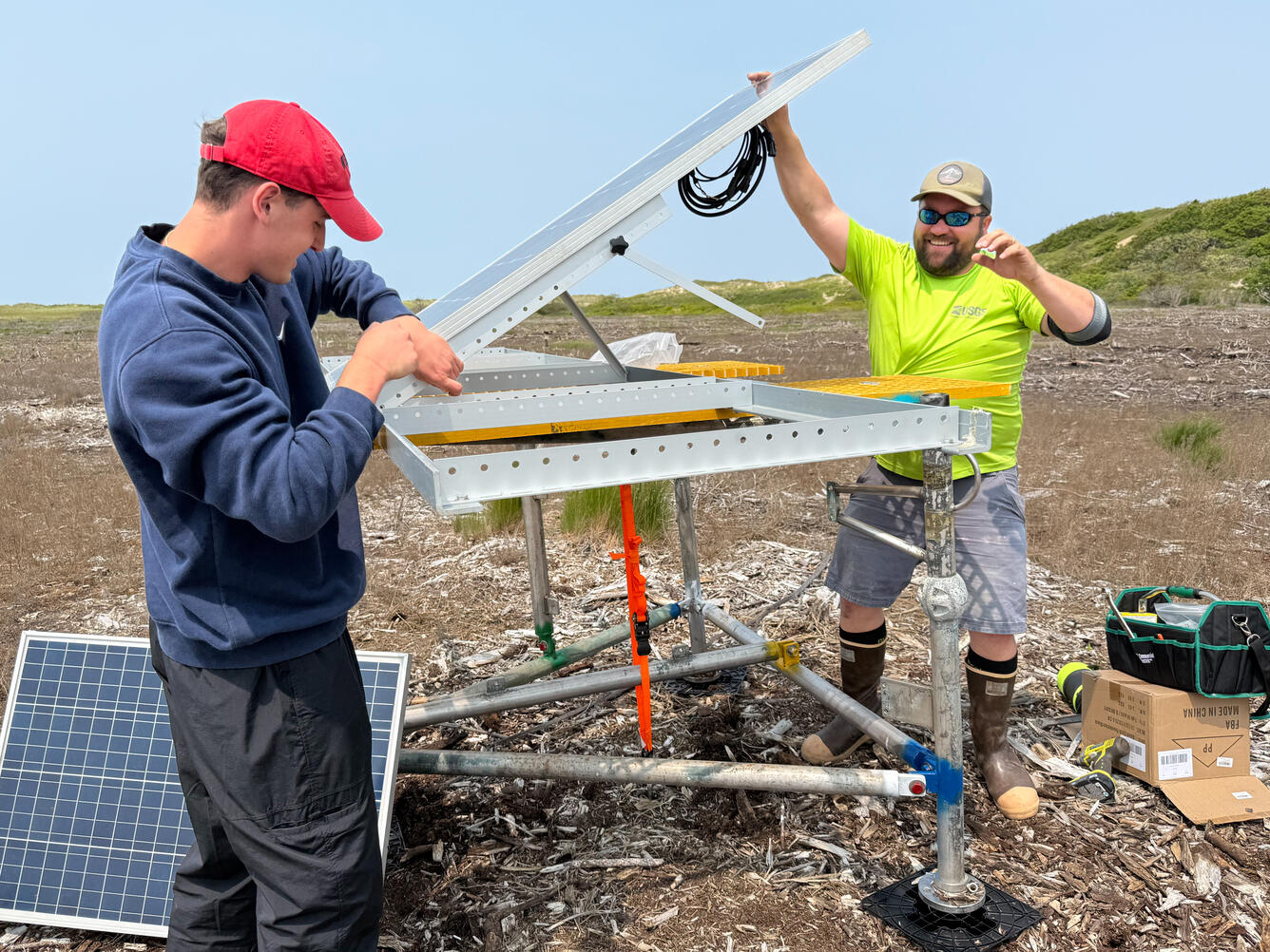
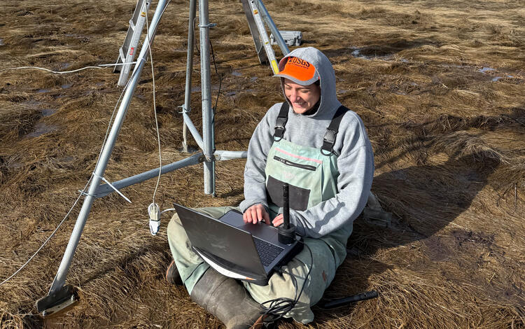
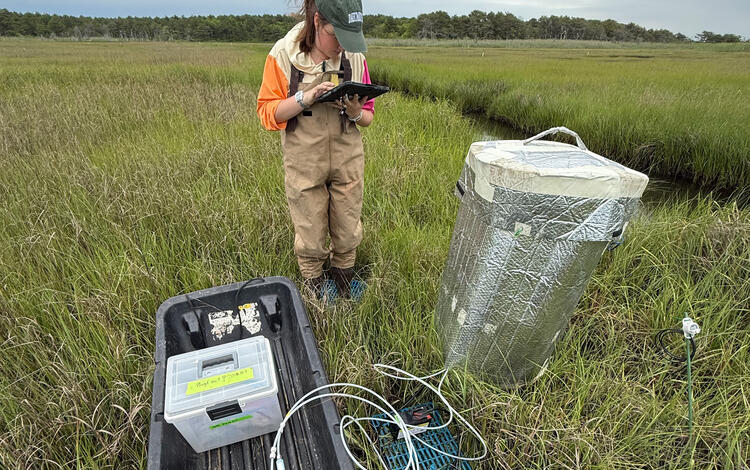
The project team instrumented and sampled two New England marshes situated at different elevations. High‑resolution, time‑series surface water measurements captured spring–neap tidal variation and sporadic flooding events. They also measured carbon exchange between the marsh and atmosphere to determine how much carbon from the marsh may be available for lateral carbon export. These data will improve predictive models of coastal carbon budgets and support broader efforts to characterize how wetlands contribute to climate change mitigation and coastal resilience.
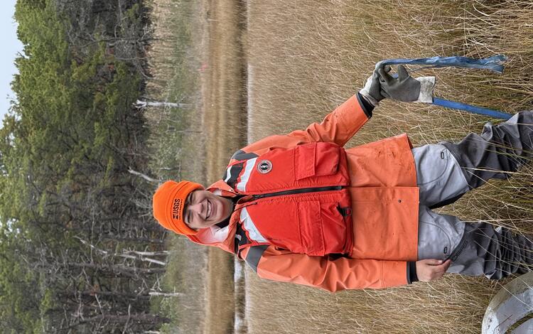
Ecological Changes Monitored at Herring River Restoration Site
Construction on the new Herring River bridge in Wellfleet, Massachusetts, began in January 2023 and has been making steady progress. Because of winter storms in 2024, a large portion of the Herring River Basin flooded with seawater for the first time since the original dike was built in 1909. USGS scientists monitored the rapid ecological changes caused by the seawater flooding. Their work included (1) upgrading or moving infrastructure that supports continuous measurements of carbon dioxide and methane exchange, (2) collecting samples from across the basin to determine geochemical changes, and (3) building a new eddy flux tower to capture the natural regrowth of a salt marsh. Additionally, our summer interns collected new sediment cores to understand how soil chemistry was altered. These data and observations are being used by the U.S. National Park Service Cape Cod National Seashore in adaptive management of the restoration.
Understanding Cold Season Hydrology and Carbon Export in Salt Marshes
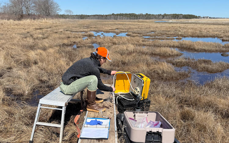
The project team conducted monthly fieldwork at the Wells Reserve at Laudholm in Maine throughout fall, winter, and spring, collecting the data needed to improve our understanding of cold season carbon fluxes and strengthen predictive models of coastal‑carbon cycling.
Quantifying Restoration Impacts on Wetland Health and Carbon Export
The scale of restoration following the Deepwater Horizon spill underscores the need for strong Monitoring and Adaptive Management in coastal Louisiana. Through a five‑year collaboration with Louisiana State University and the University of Southern Mississippi, this project is advancing the Louisiana Trustee Implementation Group’s understanding of ecosystem‑level resilience. Researchers are quantifying net ecosystem carbon balance across pre‑ and post‑spill periods and measuring carbon export from marshes to the Gulf. This year’s work used innovative isotope techniques to track soil‑carbon cycling at two wetland sites, improving estimates of carbon storage and export and strengthening the science needed to evaluate long‑term restoration success.
Journal Articles
-
The δ13C signature of dissolved organic and inorganic carbon reveals complex carbon transformations within a salt marsh The δ13C signature of dissolved organic and inorganic carbon reveals complex carbon transformations within a salt marsh
Coastal wetlands have high rates of atmospheric CO2 uptake, which is subsequently respired back to the atmosphere, stored as organic matter within flooded, anoxic soils, or exported to the coastal ocean. Transformation of fixed carbon occurs through a variety of subsurface aerobic and anaerobic microbial processes, and results in a large inventory of dissolved carbon. Carbon source and...Evidence of mineral alteration in a salt marsh subterranean estuary: Implications for carbon and trace element cycling Evidence of mineral alteration in a salt marsh subterranean estuary: Implications for carbon and trace element cycling
Subterranean estuaries (STE) in salt marshes are biogeochemically active zones where interactions between terrestrial groundwater and seawater drive complex cycling of carbon and trace elements, influenced by mineral dissolution. These systems, characterized by fine-grained organic-rich peat overlying permeable coastal aquifers, play a crucial role as a blue carbon sink, yet their...Decomposing the Tea Bag Index and finding slower organic matter loss rates at higher elevations and deeper soil horizons in a minerogenic salt marsh Decomposing the Tea Bag Index and finding slower organic matter loss rates at higher elevations and deeper soil horizons in a minerogenic salt marsh
Environmental gradients can affect organic matter decay within and across wetlands and contribute to spatial heterogeneity in soil carbon stocks. We tested the sensitivity of decay rates to tidal flooding and soil depth in a minerogenic salt marsh using the Tea Bag Index (TBI). Tea bags were buried at 10 and 50 cm depths across an elevation gradient in a subtropical Spartina alterniflora...
Assessing Coastal Wetland Carbon and Mineral Accumulation Response to Changing Climate, Cape Espenberg, Alaska
The Arctic is experiencing warming and ecological shifts due to climate change and the compounding effects of polar amplification. Arctic Alaskan coastal marsh environments, such as the Cape Espenberg barrier beach system, offer an opportunity to determine the carbon cycle response to changing climate by examining sediment records that have been preserved through time as shoreline-parallel...
Authors: Lindsey Smith, Chris Maio, Nancy Bigelow, and Meagan Eagle
Analytical Laboratories
The Core Laboratories Project is a key service for our center, providing vital support to a variety of projects studying everything from coastal wetlands to deep sea sediment and minerals. The project team delivers high-quality data through advanced analytical techniques and maintains laboratory equipment. Their methods are continually evolving, allowing them to provide new capabilities and meet the ever-changing needs of our projects.
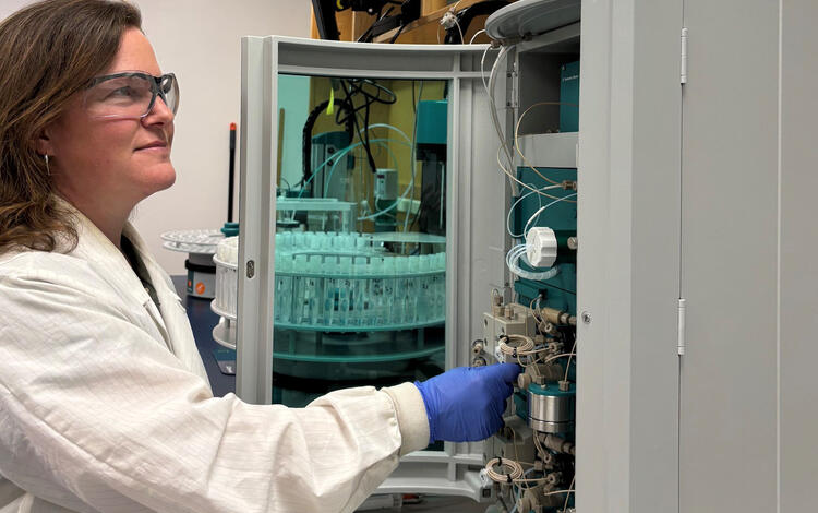
At the Woods Hole center, we have a range of specialized facilities, including the Environmental Geochemistry Laboratory, the Sediment Analysis Laboratory, the Core Processing Laboratory, and the Gas Hydrates Laboratories. Our skilled technicians are well equipped to provide the data, equipment, and techniques needed to drive research forward.
Highlights of 2025
Environmental Geochemistry Laboratory: Analytical Support for Coastal Wetland Focused Projects
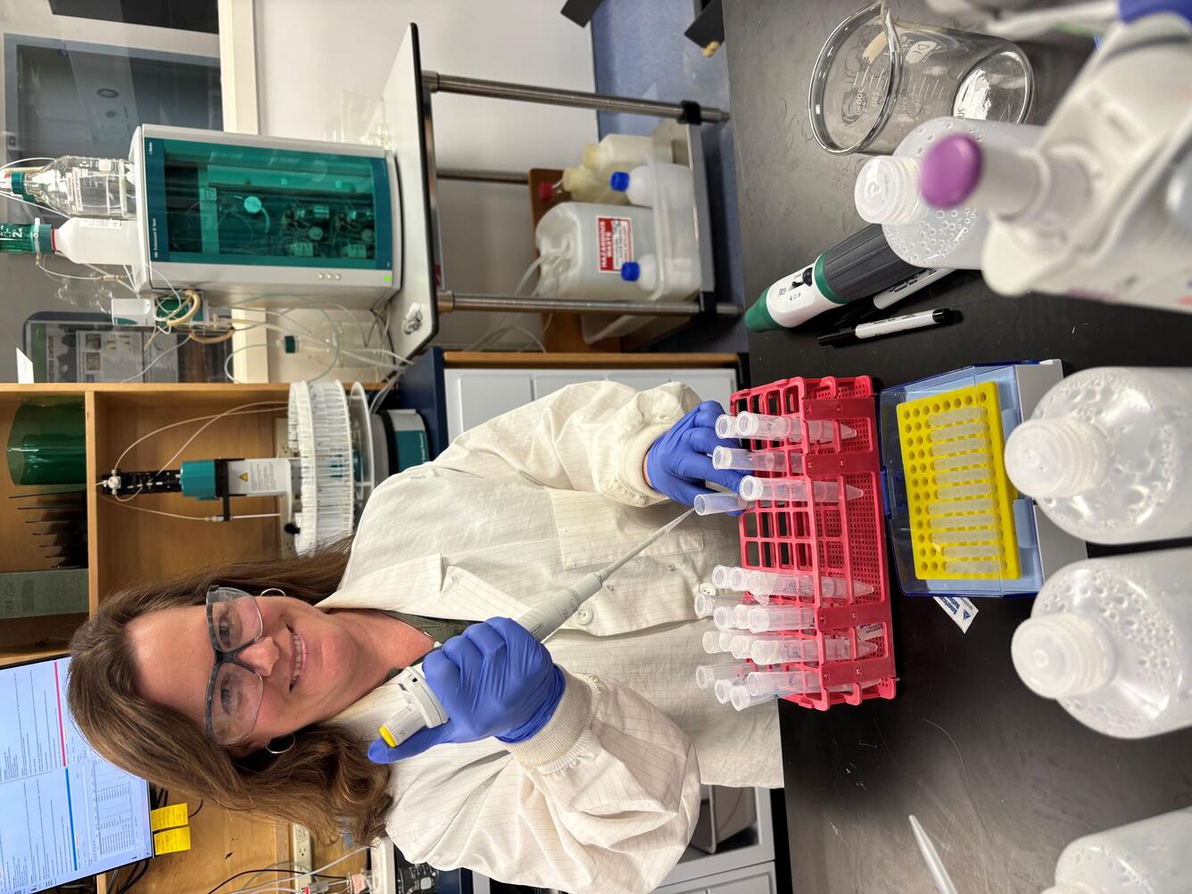
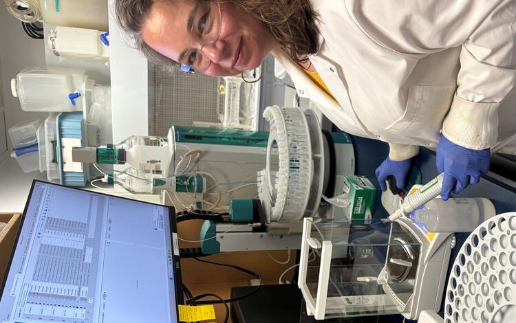
Laboratory personnel continued to provide analytical support for several research efforts focused on ecological change in coastal wetlands. These efforts include monitoring of the ongoing Herring River salt-marsh restoration on Cape Cod, measuring lateral carbon fluxes from several New England coastal wetlands, and understanding winter marsh dynamics. Additionally, the laboratory acquired new equipment, including an instrument capable of measuring both major ions and cations simultaneously from a single water sample, as well as an instrument for automated measurements of total inorganic carbon in water samples.
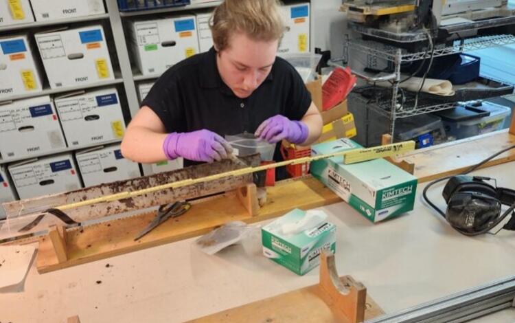
Sediment Analysis Laboratory: Project Support Continued and New Equipment for Sediment Core Analysis
The Sediment Analysis Laboratory continued to support science at the center by providing analytical resources to projects related to marine geohazards, gas hydrates, coastal change hazards, seafloor mapping, and coastal and estuarine dynamics. The laboratory also acquired a new multisensor core logger and began working with the USGS Radiation Safety Committee to establish required safety protocols and permitting for use. Full operation of the core logger is expected in 2026. This instrument will provide a new center-wide capability for rapid, high-resolution sediment core analysis.
Information Science
Our coastal and marine research is in demand by scientists, resource managers, policymakers, and the public. The Information Science group is responsible for managing and maintaining our scientific data, ensuring they are readily available in a variety of formats and online systems. The group also helps stakeholders understand their data needs and guides them to applicable USGS products. In addition to managing our data, the Information Science group shares our research through writing articles and social media posts, crafting eye-catching infographics and deliverables, maintaining the center’s web presence, and organizing and participating in outreach activities.
Data Management and Preservation
Science Communications
Data Management and Preservation
The internationally adopted FAIR data principles—ensuring that USGS data are Findable, Accessible, Interoperable, and Reusable—are central to the operations and services provided by the center’s Information Management group. Through the online discovery portals and services maintained by our data managers and collections specialists, scientists, resource managers, decision makers, and the public can access decades of USGS research, samples, publications, and interpretations. Coordinated efforts across all three Coastal and Marine Science Centers ensure consistent data management practices, interoperable inventory and search capabilities, and a unified Coastal and Marine data resource that is openly available to the public.
Highlights of 2025
Adapting to Change While Maintaining Essential Services
The Information Management group navigated major staffing changes, shifting from five full‑time team members to three. To maintain the level of service required to support USGS science and the communities that depend on it, the remaining team members prioritized core services—including the Data Library, Samples Repository, website content, and publication workflows—and developed new processes and trained across different systems as needed.
Improving Access to USGS Data
Accurate and accessible metadata is critical for helping people find and use USGS scientific information. In 2025, the team created roughly 130 new metadata records for both new and historical datasets and publications. An additional 150 existing records were updated to ensure the most current information was available through the USGS Science Data Catalog. These improvements strengthen long‑term discoverability and support broader reuse of USGS data.
Ensuring Compliance Across the Program
The Information Management group worked closely with Coastal and Marine Hazards and Resources Program (CMHRP) partners to ensure websites and data portals met federal requirements, including updates needed for Secretarial Order 3423 – The Gulf of America. This coordination helps maintain consistent data practices across centers and supports the delivery of reliable, publicly accessible scientific information.

Science Communications
Coastal communities and practitioners need scientific information to support decisions regarding public safety, development, economics, and environmental health. To ensure these stakeholders are aware of the science, data, and tools available through the USGS, effective communications strategies must be deployed to increase their visibility and accessibility.
At the center, a variety of communications methods and platforms are used to share information, including social media, email marketing campaigns, media pitches, science stories and news briefs for USGS web pages and newsletters, videos, handouts for specific events, and other promotional products. Communications, stakeholder engagement, and social science experts from across the USGS also work together to further promote our science, engage with target audiences, and interpret stakeholders’ unique needs so those needs can be incorporated into science planning and products.
Highlights of 2025
Sharing Our Science Widely
The center significantly expanded the reach of its coastal and marine science through articles, newsletters, social media, and strategic media engagement. The Sound Waves newsletter, which shares coastal and marine science from across the USGS, gained 133 subscribers from the previous year, reaching a total of 3,790 subscribers. We also started a center-specific newsletter where we share our science stories, recent publications, fieldwork activities, and more. In 7 months, the newsletter gained 606 subscribers. On social media, the @USGSCoastalandOceanScience Facebook account achieved a 76% increase in followers, totaling 23,309, and received 7.6 million views. Additionally, we engaged with media outlets for further promotion, such as a locally pitched article that earned front-page placement. Collectively, these efforts strengthened public awareness, supported stakeholder decision making, and broadened national engagement with USGS coastal science.
Woods Hole Science Stroll
Every summer, science organizations based in Woods Hole, Massachusetts host the Woods Hole Science Stroll—a free event that celebrates world-class coastal and ocean science. In 2025, our USGS booth was packed with fun activities and interesting displays, including:
- A shake table to demonstrate the power of earthquakes,
- A hands-on seafloor sediment station where we told visitors how we learn about past environments, climate, and geological events from marine microfossils and sediment core samples,
- Uncrewed aircraft system technology (drones) used to map short- and long-term changes in coastal landscapes
- A gas analyzer and respiration chamber to demonstrate the role of salt marshes in carbon sequestration, and
- A geonarrative about modeling hurricanes using the COAWST modeling system.
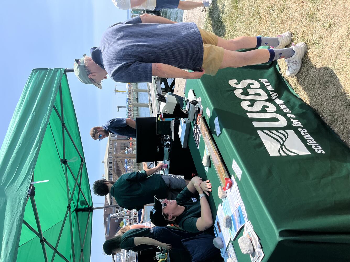
Articles
-
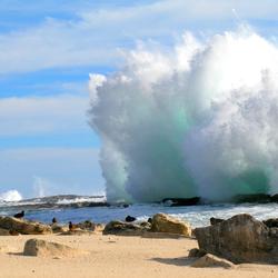
Natural Disaster Preparedness Starts with Science Natural Disaster Preparedness Starts with Science
Whether you get updates about natural disasters from the news, a website, or an app, the accuracy of that information depends on the quality of the science behind it. The USGS provides the trusted scientific foundation that decision makers and communities rely on to prepare for coastal hazards.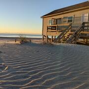
Annual Reports and General Information Product for Woods Hole Coastal and Marine Science Center Annual Reports and General Information Product for Woods Hole Coastal and Marine Science Center
Learn about our research focus areas and yearly accomplishments and progress, while enjoying an array of stunning imagery.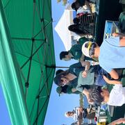
Woods Hole Science Stroll 2025 Woods Hole Science Stroll 2025
On August 9, 2025, the USGS and several other science organizations located in Woods Hole, Massachusetts, hosted hands-on activities and informative displays for the annual Woods Hole Science Stroll.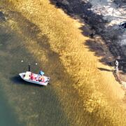
Helping Our Neighbors: USGS Surveys Primary Drinking Water Source for the Town of Falmouth Helping Our Neighbors: USGS Surveys Primary Drinking Water Source for the Town of Falmouth
USGS conducted a mapping survey of Long Pond in Falmouth, Massachusetts, at the request of the Town to determine the total water volume of the reservoir, as well as the water volumes available based on varying water surface elevations. Long Pond is Falmouth’s primary source of drinking water.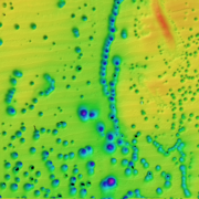
USGS Seafloor Mapping Provides the Scientific Foundation Needed to Address National Priorities USGS Seafloor Mapping Provides the Scientific Foundation Needed to Address National Priorities
Seafloor mapping provides the fundamental data needed to study a wide range of topics. The USGS is actively mapping the seafloor surface and its underlying structure in coastal to deep sea environments to address national priorities.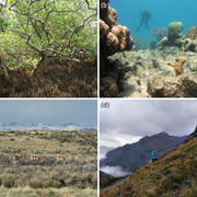
Ecological Thresholds, Abiotic Stress, and Climate Change: A Conceptual Framework Ecological Thresholds, Abiotic Stress, and Climate Change: A Conceptual Framework
As climate change accelerates, the risk of sudden, large-scale shifts in ecosystems is growing. A new USGS study examines the mechanisms behind these abrupt ecological transformations—known as threshold responses—and offers a roadmap for predicting where and when they might occur.ByEcosystems Mission Area, Natural Hazards Mission Area, Coastal and Marine Hazards and Resources Program, Great Lakes Science Center, Pacific Coastal and Marine Science Center, Southwest Biological Science Center, St. Petersburg Coastal and Marine Science Center, Western Ecological Research Center (WERC), Western Geographic Science Center, Wetland and Aquatic Research Center , Woods Hole Coastal and Marine Science Center
USGS Coastal Landscape Change Products Help the U.S. Department of Defense Safeguard Military Infrastructure Along the Coast USGS Coastal Landscape Change Products Help the U.S. Department of Defense Safeguard Military Infrastructure Along the Coast
The U.S. Department of Defense is supporting the geographic expansion of the USGS Coastal Change Likelihood and Coastal Landscape Response assessments. These assessments are critical to understanding future coastal landscape change that could impact military installations, sites, and infrastructure along the U.S. Atlantic and Gulf Coasts.
What are Key Conditions for Marsh Survival Amid Rising Seas? What are Key Conditions for Marsh Survival Amid Rising Seas?
As sea levels continue to rise, coastal marshes face increasing risk of inundation and erosion. These wetlands rely on a steady supply of sediment to keep up with rising waters, but the suite of conditions that control sediment accumulation are difficult to predict.
We Make Treasure Maps: USGS Charts the Seafloor to Help Locate Critical Minerals, Precious Metals, and Other Vital Resources We Make Treasure Maps: USGS Charts the Seafloor to Help Locate Critical Minerals, Precious Metals, and Other Vital Resources
USGS marks the spot! Our science is key to understanding seabed resources. Our maps characterizing the seafloor can help find critical minerals and other resources in high demand worldwide. While advancing scientific knowledge of the seafloor, USGS also leads a national effort to locate the critical minerals needed to drive the U.S. economy and national security. Some of the answer is under water.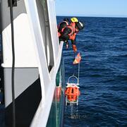
Valuable Data Collected on M7.0 Earthquake Offshore Cape Mendocino, California Valuable Data Collected on M7.0 Earthquake Offshore Cape Mendocino, California
In the first real-world deployment of the new rapid response ocean bottom seismograph fleet, hundreds of aftershocks were successfully recorded on the seafloor offshore Cape Mendocino, California. These data will help seismologists better understand hazards—onshore and offshore—from future earthquakes in the region.
Get Ready to Explore a Little Deeper: SEABOSS 3.0 is Coming Get Ready to Explore a Little Deeper: SEABOSS 3.0 is Coming
The SEABOSS—used to collect images, videos, and samples of the seafloor—is being updated to improve overall capabilities and allow for deep water deployment up to 500 meters. These enhancements are inspired by cross-center knowledge sharing, continuing a long history of collaboration within the USGS Coastal and Marine Hazards and Resources Program to develop new systems and advance capabilities.
USGS St. Petersburg staff attends Geotools 2025 Conference USGS St. Petersburg staff attends Geotools 2025 Conference
USGS scientists from all three Coastal and Marine Hazards and Resources Program Science Centers attended and presented an array of topics at Coastal Geotools conference in Wilmington, NC.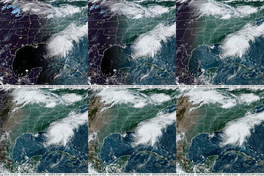
Approaching Storms Approaching Storms
The USGS Coastal and Marine Hazards and Resources Program has various products that report near real-time coastal conditions and forecast an active storm’s path, intensity, and associated coastal change hazards. These tools provide local officials and emergency managers with the scientific information they need to help make life-saving decisions before a storm makes landfall.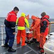
Seafloor Seismographs Rapidly Deployed Following Major Earthquake Offshore Northern California Seafloor Seismographs Rapidly Deployed Following Major Earthquake Offshore Northern California
The rapid response ocean bottom seismograph fleet, jointly developed and maintained by the Woods Hole Oceanographic Institution and USGS, was swiftly deployed after a major earthquake hit Northern California and the Pacific Northwest. The quick deployment of these instruments will enable the collection of the high-value data needed to produce the most accurate and useful hazard assessment.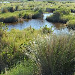
Major Update to Satellite-Based Datasets Used to Assess Salt Marsh Vulnerability Nationwide Major Update to Satellite-Based Datasets Used to Assess Salt Marsh Vulnerability Nationwide
The Unvegetated-Vegetated Marsh Ratio now computes national salt marsh vulnerability using satellite imagery from 1985-2023—a significant increase from the original 2014-2018 dataset.
AGU24 Annual Meeting: Fantastic Scientists and Where to Find Them AGU24 Annual Meeting: Fantastic Scientists and Where to Find Them
AGU24 is the world’s largest annual Earth science meeting, showcasing science that will benefit humanity and ensure a sustainable future for the planet. Join the USGS at booth #912 and attend our presentations to learn more about the role of USGS science in achieving this future.
Engaging the Next Generation of Scientists Engaging the Next Generation of Scientists
USGS geologist Dr. Ben Gutierrez gave a guest lecture in the Environmental Science and Water Resource classes at Tennessee State University in October 2024. He discussed USGS coastal and marine science, as well as the many internship opportunities available through USGS.
Newsletters
-
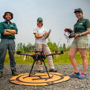
Sound Waves Newsletter: August-November 2025 Sound Waves Newsletter: August-November 2025
In this issue, read stories about natural disaster preparedness, seafloor mapping, coastal modeling, glacial flooding, and much more.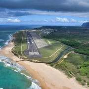
Sound Waves Newsletter: June-July 2025 Sound Waves Newsletter: June-July 2025
This Sound Waves issue includes stories about coastal change, how seafloor mapping addresses national priorities, surveying a drinking water supply, stories related to the USGS-led seafloor mapping expedition on the Aleutian Arc offshore Alaska, and more.
Woods Hole Coastal and Marine Science Center Newsletter: June-July 2025 Woods Hole Coastal and Marine Science Center Newsletter: June-July 2025
Welcome to our newsletter, where we share science stories, popular social media posts, recent publications, fieldwork activities, and more center happenings.-
Sound Waves Newsletter: April-May 2025 Sound Waves Newsletter: April-May 2025
Read stories about using seafloor mapping to better understand offshore natural hazards like earthquakes, landslides, and tsunamis; assessing salt marsh conditions; how coral reefs protect coastlines from storms; and more. 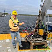
Woods Hole Coastal and Marine Science Center Newsletter: April-May 2025 Woods Hole Coastal and Marine Science Center Newsletter: April-May 2025
Welcome to our newsletter, where we share science stories, popular social media posts, recent publications, fieldwork activities, and more center happenings.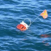
Sound Waves Newsletter: February-March 2025 Sound Waves Newsletter: February-March 2025
Enjoy science stories about a seafloor imaging and sampling system update, assisting in a post-storm seafloor survey following partial collapse of the Santa Cruz wharf, providing a training to the National Weather Service, and more.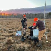
Woods Hole Coastal and Marine Science Center Newsletter: January-March 2025 Woods Hole Coastal and Marine Science Center Newsletter: January-March 2025
Welcome to our new newsletter, sharing science stories, popular social media posts, recent publications, fieldwork activities, and more center happenings.
Sound Waves Newsletter: October 2024-January 2025 Sound Waves Newsletter: October 2024-January 2025
Read stories about responding to natural hazards, a coral reef restoration cost benefit study, marine resources, and much more in this issue of Sound Waves.
Publication
-
Woods Hole Coastal and Marine Science Center—2023 annual report Woods Hole Coastal and Marine Science Center—2023 annual report
The 2023 annual report of the U.S. Geological Survey Woods Hole Coastal and Marine Science Center highlights accomplishments of 2023, includes a list of 2023 publications, and summarizes the work of the center, as well as the work of each of its science groups. This product allows readers to gain a general understanding of the focus areas of the center’s scientific research and learn...
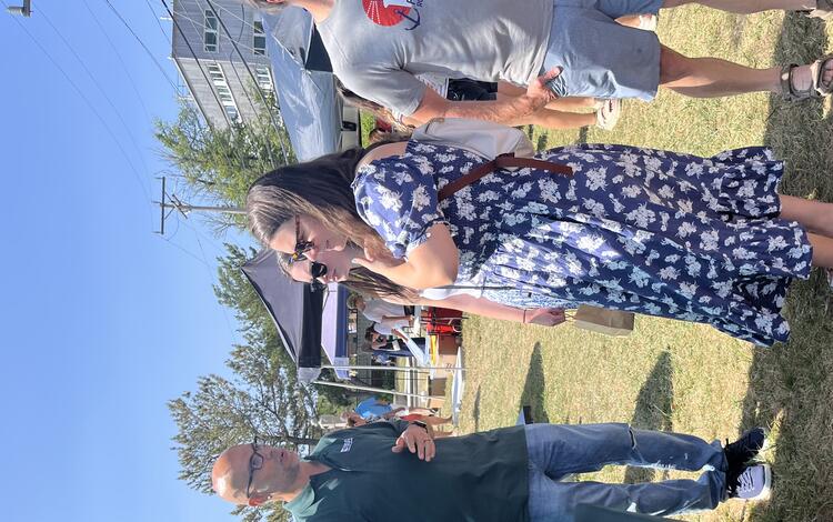
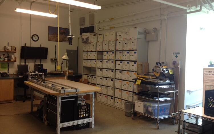
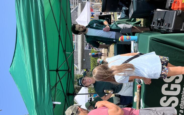
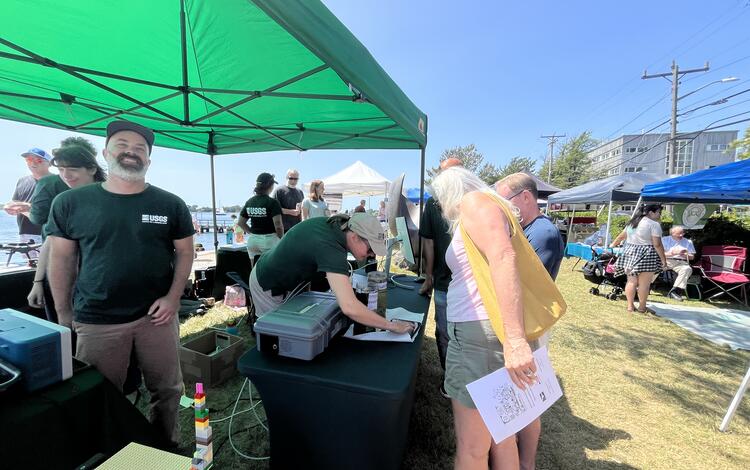
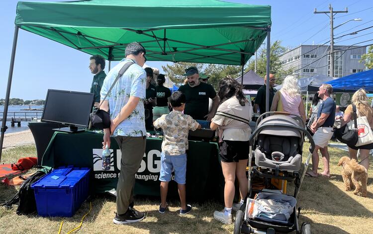
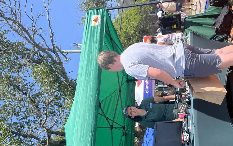
Student and Early Career Mentorships
The internship landscape at USGS changed significantly in 2025 due to funding and new regulations, so the center was unable to hire interns. However, we were still able to host four dedicated students who either volunteered or were funded by their university. Each mentee was mentored by USGS research physical scientist, Meagan Eagle. Meagan is deeply committed to developing the next generation of scientists—she mentors at least one student every year, providing consistent support, guidance, and opportunities for hands‑on research. Her dedication reflects the broader importance of mentorship: building scientific confidence, expanding career pathways, and strengthening a capable future workforce for coastal and marine science.
2025 Interns and Mentors
- Hanna Clark
- Project title: Carbon Dioxide and Methane Greenhouse Gas Fluxes in Coastal Salt Marshes
- Program: Funded by Dartmouth College
- Mentor: Meagan Eagle
- Liam Johnson
- Project title: Salt Marsh Carbon Fluxes: modeling wintertime DOC and DIC at Wells NERR, Maine
- Program: No formal program
- Mentor: Meagan Eagle
- Ryan Simone
- Project title: Comparing Sediment Geochemistry in the Herring River Salt Marsh Before and After the Overwash from the 2021 Duck Harbor Breach
- Program: Funded by Wesleyan University
- Mentor: Meagan Eagle
- Celia Suttles
- Program: Falmouth High School volunteer
- Mentor: Meagan Eagle
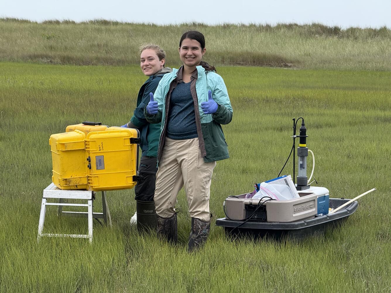
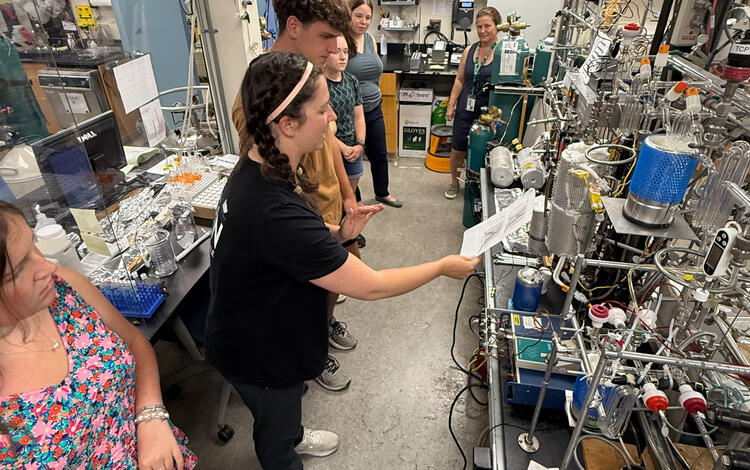
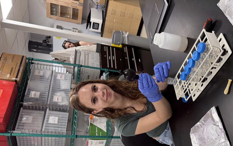
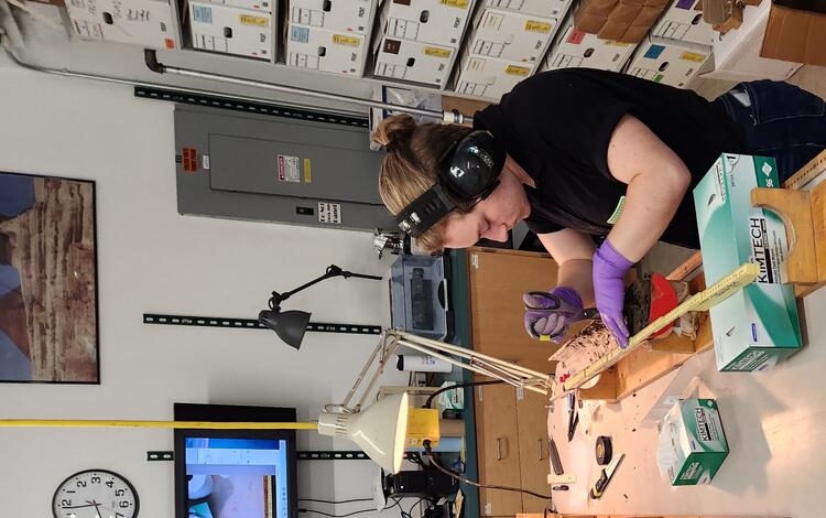
This year’s accomplishments demonstrate the center’s continued commitment to delivering high‑quality coastal and marine science, strengthening partnerships, and expanding the reach of our research. These achievements reflect a strong foundation for future work and position the center to continue providing trusted science that supports resilient coastal communities and informed decision making in the years ahead.