
U.S. flag

An official website of the United States government

Streams and Environmental Change

Climate change and variability, along with adjacent land use, can affect stream conditions and health. The USGS is providing science on changes in stream flows and temperatures on habitats important for fisheries. The findings will help address the Chesapeake Bay Program (CBP) Goals for fisheries, habitat, and water quality.

Filter Total Items: 39
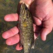
Warmer Temperatures and Disease-Driven Population Declines Can Increase Early Life Growth Rates of Smallmouth Bass

Understanding the factors that affect growth rates of commercially and recreationally important fish species can help fisheries managers make informed stock‑assessment and fishing‑regulation decisions. In this study of smallmouth bass in Pennsylvania rivers, USGS scientists found that warmer temperatures were associated with increased early‑life growth rates, and that growth rates increased...
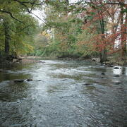
Warmer Temperatures and Disease-Driven Population Declines Can Increase Early Life Growth Rates of Smallmouth Bass

Warmer Temperatures and Disease-Driven Population Declines Can Increase Early Life Growth Rates of Smallmouth Bass

Understanding the factors that affect growth rates of commercially and recreationally important fish species can help fisheries managers make informed stock‑assessment and fishing‑regulation decisions. In this study of smallmouth bass in Pennsylvania rivers, USGS scientists found that warmer temperatures were associated with increased early‑life growth rates, and that growth rates increased...
Learn More

39 Years of Stream Conditions Show Widespread Biological Changes Across the Chesapeake Bay Watershed

USGS scientists predicted stream biological conditions across the Chesapeake Bay watershed from 1985 through 2023, revealing widespread changes but only a ~1% increase in stream length classified as improved. These predicted improvements fell short of the Chesapeake Bay Program’s goal of improving the health of 10% of streams by 2025.
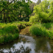
39 Years of Stream Conditions Show Widespread Biological Changes Across the Chesapeake Bay Watershed

39 Years of Stream Conditions Show Widespread Biological Changes Across the Chesapeake Bay Watershed

USGS scientists predicted stream biological conditions across the Chesapeake Bay watershed from 1985 through 2023, revealing widespread changes but only a ~1% increase in stream length classified as improved. These predicted improvements fell short of the Chesapeake Bay Program’s goal of improving the health of 10% of streams by 2025.
Learn More

Chesapeake Stream Team

Connecting Conservation Practices to Local Stream Health in the Chesapeake Bay Watershed
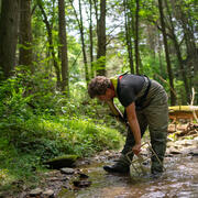
Chesapeake Stream Team

Chesapeake Stream Team

Connecting Conservation Practices to Local Stream Health in the Chesapeake Bay Watershed
Learn More

Evaluating the Effects of Stream-Restoration Practices in an Impaired Agricultural System

Stream-restoration practices are widely used throughout the Chesapeake Bay watershed to improve stream health and function, but research into their effectiveness is limited in agricultural settings. A study in Turtle Creek, Pennsylvania, suggests that stream-restoration practices can significantly reduce streambank erosion and enhance floodplain deposition, changes that can reduce in-stream...
Evaluating the Effects of Stream-Restoration Practices in an Impaired Agricultural System

Evaluating the Effects of Stream-Restoration Practices in an Impaired Agricultural System

Stream-restoration practices are widely used throughout the Chesapeake Bay watershed to improve stream health and function, but research into their effectiveness is limited in agricultural settings. A study in Turtle Creek, Pennsylvania, suggests that stream-restoration practices can significantly reduce streambank erosion and enhance floodplain deposition, changes that can reduce in-stream...
Learn More

500 Years of Extreme Potomac Floods at Washington D.C.

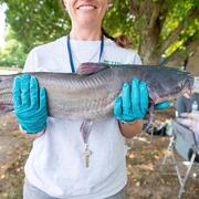
Large floods on the Potomac River in Washington D.C. can be documented as early as 1784, and based on historical data and recent measurements, have occurred with increasing frequency since the mid-19th century. Human modifications to the Potomac estuary since Washington D.C. was established as the Federal capital, as well as increasingly heavy rainfall and land clearance in the watershed, likely...
500 Years of Extreme Potomac Floods at Washington D.C.

500 Years of Extreme Potomac Floods at Washington D.C.

Large floods on the Potomac River in Washington D.C. can be documented as early as 1784, and based on historical data and recent measurements, have occurred with increasing frequency since the mid-19th century. Human modifications to the Potomac estuary since Washington D.C. was established as the Federal capital, as well as increasingly heavy rainfall and land clearance in the watershed, likely...
Learn More

USGS Chesapeake Bay Science Accomplishments for 2025

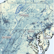
The Chesapeake Bay watershed is home to 18 million people and some of America’s most treasured natural resources – lands, waters, and wildlife that support a strong economy and cherished outdoor traditions, such as hunting and fishing. From local organizations to federal agencies, partners throughout the watershed are working to protect these resources. These partners rely on our unbiased, gold...
USGS Chesapeake Bay Science Accomplishments for 2025

USGS Chesapeake Bay Science Accomplishments for 2025

The Chesapeake Bay watershed is home to 18 million people and some of America’s most treasured natural resources – lands, waters, and wildlife that support a strong economy and cherished outdoor traditions, such as hunting and fishing. From local organizations to federal agencies, partners throughout the watershed are working to protect these resources. These partners rely on our unbiased, gold...
Learn More

Remotely mapping stormwater facility footprints and storage volumes

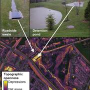
Stormwater management practices are being used throughout the Chesapeake Bay watershed to reduce flood risks and pollutant loads, but consistent and comprehensive maps of these practices are often lacking. Stormwater managers often have incomplete information about the location and storage volume of stormwater facilities within their jurisdiction. Therefore, the USGS is working to develop...
Remotely mapping stormwater facility footprints and storage volumes

Remotely mapping stormwater facility footprints and storage volumes

Stormwater management practices are being used throughout the Chesapeake Bay watershed to reduce flood risks and pollutant loads, but consistent and comprehensive maps of these practices are often lacking. Stormwater managers often have incomplete information about the location and storage volume of stormwater facilities within their jurisdiction. Therefore, the USGS is working to develop...
Learn More

Evaluating the Risks of Tire-Derived Compounds to Fish in the Chesapeake Bay Watershed

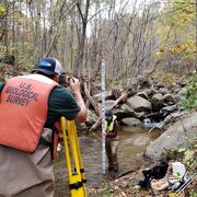
Tires contain a chemical known as 6PPD which prevents them from quickly breaking down. Microscopic tire particles, generated mainly from the friction of tires on roads, release 6PPD-quinone (6PPDQ) when they come into contact with oxygen. During precipitation events, 6PPDQ can be washed off roads, harming fish in nearby waterways. In response to requests from fishery managers, the USGS is studying...
Evaluating the Risks of Tire-Derived Compounds to Fish in the Chesapeake Bay Watershed

Evaluating the Risks of Tire-Derived Compounds to Fish in the Chesapeake Bay Watershed

Tires contain a chemical known as 6PPD which prevents them from quickly breaking down. Microscopic tire particles, generated mainly from the friction of tires on roads, release 6PPD-quinone (6PPDQ) when they come into contact with oxygen. During precipitation events, 6PPDQ can be washed off roads, harming fish in nearby waterways. In response to requests from fishery managers, the USGS is studying...
Learn More

Using monitoring data to measure conditions over time in Chesapeake Bay streams

This study provides a comprehensive assessment of the health of streams throughout the Chesapeake Bay. Monitoring data were used to assess seven key indicators of stream condition, revealing consistent patterns of degradation in urban and agricultural areas. The findings offer critical insights that can inform watershed restoration efforts and improve long-term monitoring strategies.
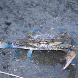
Using monitoring data to measure conditions over time in Chesapeake Bay streams

Using monitoring data to measure conditions over time in Chesapeake Bay streams

This study provides a comprehensive assessment of the health of streams throughout the Chesapeake Bay. Monitoring data were used to assess seven key indicators of stream condition, revealing consistent patterns of degradation in urban and agricultural areas. The findings offer critical insights that can inform watershed restoration efforts and improve long-term monitoring strategies.
Learn More

EESC Makes an Impact: Restoring the Chesapeake Bay Watershed

The Chesapeake Bay provides over $100 billion in annual economic value and is home to 18 million people. The USGS, including scientists from the Eastern Ecological Science Center (EESC), works with Federal, State, local, and academic partners to provide research and monitoring and to communicate results to inform management for the Chesapeake and other important landscapes across the Nation.
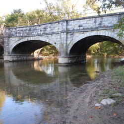
EESC Makes an Impact: Restoring the Chesapeake Bay Watershed

EESC Makes an Impact: Restoring the Chesapeake Bay Watershed

The Chesapeake Bay provides over $100 billion in annual economic value and is home to 18 million people. The USGS, including scientists from the Eastern Ecological Science Center (EESC), works with Federal, State, local, and academic partners to provide research and monitoring and to communicate results to inform management for the Chesapeake and other important landscapes across the Nation.
Learn More

Applying Multiple Tools to Inform Management of Per- and Polyfluoroalkyl Substances (PFAS) in the Potomac River Watershed

The reuse of municipal wastewater provides multiple benefits, including maintaining stream flow, recharging aquifers, and providing public water supply. However, along with the benefits are concerns related to the presence of ‘forever’ chemicals, like per- and polyfluoroalkyl substances (PFAS) in wastewater discharge. Managing PFAS in waterways is challenging because there are many potential PFAS...
Applying Multiple Tools to Inform Management of Per- and Polyfluoroalkyl Substances (PFAS) in the Potomac River Watershed

Applying Multiple Tools to Inform Management of Per- and Polyfluoroalkyl Substances (PFAS) in the Potomac River Watershed

The reuse of municipal wastewater provides multiple benefits, including maintaining stream flow, recharging aquifers, and providing public water supply. However, along with the benefits are concerns related to the presence of ‘forever’ chemicals, like per- and polyfluoroalkyl substances (PFAS) in wastewater discharge. Managing PFAS in waterways is challenging because there are many potential PFAS...
Learn More

Informing Freshwater Management Strategies in the Chesapeake Bay Watershed by Using Observational Data and Expert Knowledge to Identify Influential Stressors

Human activities in the Chesapeake Bay watershed can negatively affect the abundance and diversity of macroinvertebrate communities in freshwater streams, which is a core measure of stream health. For example, urban development and agricultural intensification can degrade habitat and water-quality conditions in streams through sedimentation, nutrient runoff, and changes to instream habitat. A...
Informing Freshwater Management Strategies in the Chesapeake Bay Watershed by Using Observational Data and Expert Knowledge to Identify Influential Stressors

Informing Freshwater Management Strategies in the Chesapeake Bay Watershed by Using Observational Data and Expert Knowledge to Identify Influential Stressors

Human activities in the Chesapeake Bay watershed can negatively affect the abundance and diversity of macroinvertebrate communities in freshwater streams, which is a core measure of stream health. For example, urban development and agricultural intensification can degrade habitat and water-quality conditions in streams through sedimentation, nutrient runoff, and changes to instream habitat. A...
Learn More
Was this page helpful?