
Integrated Land Change Monitoring
Integrated Land Change Monitoring
Phosphate Mining in Central Florida
Satellite images that have been continuously acquired for many decades represent a unique record of our planet’s surface. At EROS, we analyze satellite and other data to determine not only how the Earth’s land cover has changed over time, but also the driving forces behind the changes.
Annual National Land Cover Database
Annual National Land Cover Database

Annual NLCD is generated in cooperation with the Multi-Resolution Land Characteristics Consortium (MRLC) a partnership of Federal agencies working together to produce current, nationally consistent land cover products.
Land Change Monitoring, Assessment, and Projection
Land Change Monitoring, Assessment, and Projection

Land Change Monitoring, Assessment, and Projection (LCMAP) represents a new generation of land cover mapping and change monitoring from the U.S. Geological Survey’s EROS Center.
Filter Total Items: 104
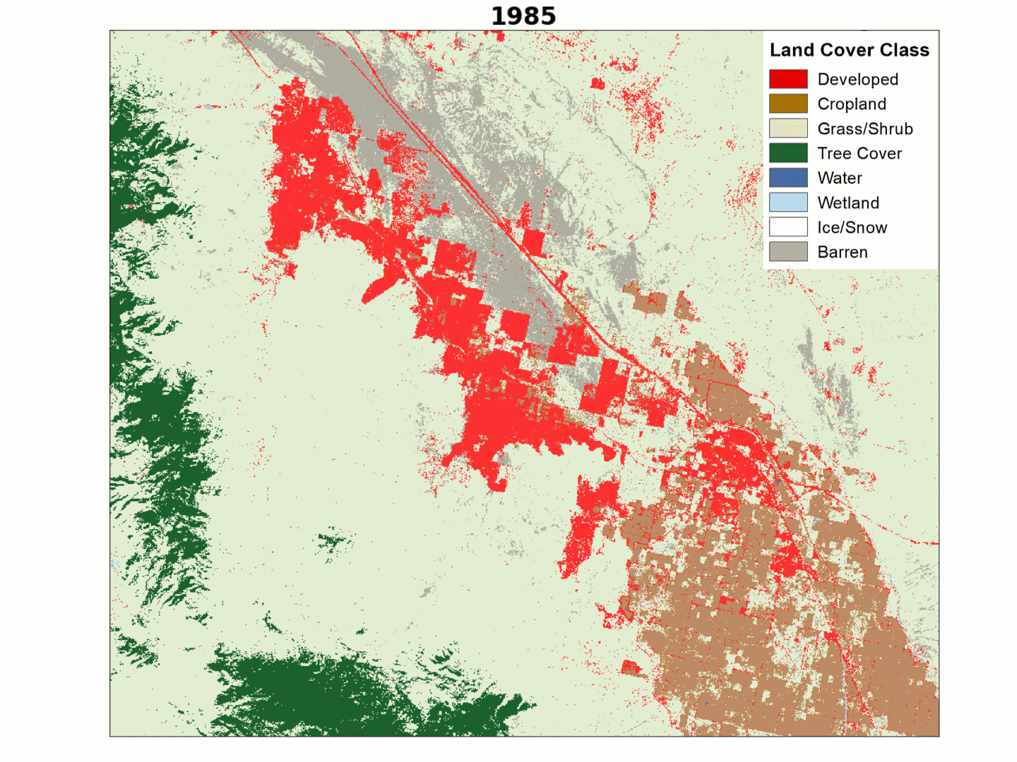
LCMAP Change Stories: Building a Boomtown, Block by Block
The desert outpost of Palm Springs, California and the surrounding Thousand Palms region has experienced explosive population growth over the past four decades, with tract after tract of development filling in previously barren landscapes along Interstate 10.

LCMAP Change Stories: Gone in 60 Seconds
At first glance, the most striking patterns in land cover change over time in this animation of the Oso, Washington area would appear to be forest harvest and regrowth, but a more dramatic change emerged in 2014.
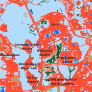
LCMAP Change Stories: It's a Sprawl World After All
The man-made Florida playland of Walt Disney World has grown outward on all sides since the amusement park’s construction commenced in the 1960s. Much of that growth has overtaken the wetlands, tree cover and grassland/shrublands near Orlando.

Ranking Features Based on Magnitude of Change
Each of the polygons in the topographic change inventory has numerous attributes associated with it. These attributes allow a ranking of features based on the magnitude of change, as measured by polygon descriptors (area and volume) and changes in terrain parameters (elevation, relief, slope, aspect). The ability to do such a ranking points out one of the advantages of producing spatially explicit...

1x1-Degree Tiles
Summary statistics were also accumulated on the basis of the 1x1-degree tiles used for data management and processing. A total of 500 tiles contain topographic change polygons (see figure below), which represents over 53 percent of the conterminous United States tiles.

Quadrangle Base Maps
Many resource managers and geospatial data users are familiar with the USGS 7.5-minute quadrangle map series. Also, much of the geospatial data managed by the USGS was originally produced in tiles corresponding to the 7.5-minute maps. The topographic map quadrangles are still commonly used as base maps for outlining data collection strategies and defining project boundaries. Thus, it is useful to...

Regional Geography of Topographic Surface Changes
The spatial distribution of the topographic change polygons across the conterminous United States reveals some notable regional differences and patterns of change. Overall, there is a decided concentration of change polygons in the eastern United States, which can be partially explained by the greater population density as compared to the west.

Proximity of Topographic Change Areas to Other Features
The near-national extent of the topographic change dataset also allows for spatial comparisons, such as proximity of change polygons to roads and urban areas. Such comparisons have been done for the proximity of mines to roads and major cities for the five focus ecoregions. This figure shows the locations of the centroids of mining polygons within the five ecoregions and the locations of cities...

Regional Differences in the Effects of Surface Mining
Because the topographic change inventory has near-national coverage, comparisons can be made among broad regions. This figure shows a set of five Level III ecoregions that were used as a basis for regional comparisons of topographic change.

Visual Impacts
When contrasting the general nature of anthropogenic processes versus other geomorphic agents, the visual impact of human activity generally is greater than that of natural processes.

Hydrologic Effects
Because the shape of the land exerts strong control over the collection and flow of surface water, changes to the topography can have a significant effect on local drainage conditions. The figure below demonstrates how the local surface drainage features have been altered as a result of surface mining operations.

Comparison with Land Cover Status and Trends Data
The topographic changes detected in this study usually have a corresponding land cover change. To examine this relationship more closely, features in the topographic change inventory were compared with data from an ongoing study of the status and trends of land cover in the United States. The status and trends project uses a sampling-based approach in which land cover maps and change products are...