
Research Geologist Leah Morgan working in the USGS Argon Geochronology Laboratory in Denver
Images
Images intro.
Filter Total Items: 316

USGS Argon Geochronology Laboratory in Denver
Research Geologist Leah Morgan working in the USGS Argon Geochronology Laboratory in Denver

Coring on the Juneau Icefield, Alaska
An ideal ice core site is the highest, flattest glacier in a region. In 2016, a transect of 7-9 m ice cores was drilled on the Matthes Glacier, Juneau Icefield to determine if recent fires are affecting the glacier surface. (Photo: Lucas Foglia, used with permission)
An ideal ice core site is the highest, flattest glacier in a region. In 2016, a transect of 7-9 m ice cores was drilled on the Matthes Glacier, Juneau Icefield to determine if recent fires are affecting the glacier surface. (Photo: Lucas Foglia, used with permission)

Natural color image of the Palmyra Atoll National Wildlife Refuge taken from a UAS
Natural color image of the Palmyra Atoll National Wildlife Refuge taken from a UASNatural color image of the Palmyra Atoll National Wildlife Refuge taken from a UAS
Natural color image of the Palmyra Atoll National Wildlife Refuge taken from a UAS
Natural color image of the Palmyra Atoll National Wildlife Refuge taken from a UASNatural color image of the Palmyra Atoll National Wildlife Refuge taken from a UAS

Natural color image of Fall Creek Lake taken from a UAS
Natural color image of Fall Creek Lake taken from a UASNatural color image of Fall Creek Lake taken from a UAS
The NUSO performed UAS-based data collection during the November 2016 drawdown at Fall Creek Lake to help determine the effectiveness of this high-resolution imagery for generating digital elevation models (DEMs) with detailed reservoir bathymetry.

USGS scientist preparing a UAS for launch at the Palmyra Atoll National Wildlife Refuge
USGS scientist preparing a UAS for launch at the Palmyra Atoll National Wildlife RefugeUSGS scientist Joe Adams preparing a UAS for launch at the Palmyra Atoll National Wildlife Refuge
USGS scientist preparing a UAS for launch at the Palmyra Atoll National Wildlife Refuge
USGS scientist preparing a UAS for launch at the Palmyra Atoll National Wildlife RefugeUSGS scientist Joe Adams preparing a UAS for launch at the Palmyra Atoll National Wildlife Refuge

Near-infrared mosaic showing algal blooms at Lake Milford generated from a multispectral sensor mounted on a UAS
Near-infrared mosaic showing algal blooms at Lake Milford generated from a multispectral sensor mounted on a UASNear-infrared mosaic showing algal blooms at Lake Milford generated from a multispectral sensor mounted on a UAS

Image of the Stinking Water Gulch taken from a natural color sensor mounted on a UAS
Image of the Stinking Water Gulch taken from a natural color sensor mounted on a UASImage of the Stinking Water Gulch taken from a natural color sensor mounted on a UAS
Image of the Stinking Water Gulch taken from a natural color sensor mounted on a UAS
Image of the Stinking Water Gulch taken from a natural color sensor mounted on a UASImage of the Stinking Water Gulch taken from a natural color sensor mounted on a UAS

USGS scientist flying a UAS at the Stinking Water Gulch
USGS scientist flying a UAS at the Stinking Water GulchUSGS scientist Joe Adams flying a UAS at the Stinking Water Gulch
To aid in the evaluation of possible impacts of land use on areas of Mancos Shale in Colorado, the NUSO, in cooperation with the Bureau of Land Management (BLM), used UAS in September 2016 to collect data over four 400-acre basins that have been subject to different types of land use.

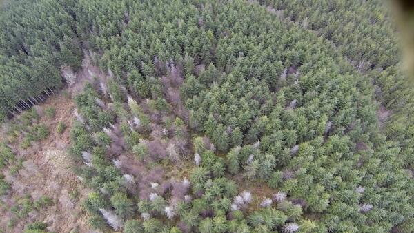
Near infrared image of the Theodore Roosevelt National Park from a multispectral sensor mounted on a UAS
Near infrared image of the Theodore Roosevelt National Park from a multispectral sensor mounted on a UASNear infrared image of the Theodore Roosevelt National Park from a multispectral sensor mounted on a UAS
The NUSO worked with the NPS in July 2016 to evaluate the applicability of UAS data collection to help address specific park resource management needs and provide a basis for future integration of UAS to help manage other NPS resources.

Monitoring riparian vegetation along the Colorado River
Monitoring riparian vegetation along the Colorado RiverMonitoring riparian vegetation along the Colorado River downstream of Glen Canyon Dam
Monitoring riparian vegetation along the Colorado River
Monitoring riparian vegetation along the Colorado RiverMonitoring riparian vegetation along the Colorado River downstream of Glen Canyon Dam

Loveland Pass, Colorado
Panoramic view of snow-covered mountains at Loveland Pass, with ski runs visible in the middle ground.
Panoramic view of snow-covered mountains at Loveland Pass, with ski runs visible in the middle ground.

USGS researchers retrieving a fixed wing UAS after a flight at Borah Peak
USGS researchers retrieving a fixed wing UAS after a flight at Borah PeakUSGS researchers Todd Burton and Joe Adams retrieving a fixed wing UAS after a flight at Borah Peak
USGS researchers retrieving a fixed wing UAS after a flight at Borah Peak
USGS researchers retrieving a fixed wing UAS after a flight at Borah PeakUSGS researchers Todd Burton and Joe Adams retrieving a fixed wing UAS after a flight at Borah Peak
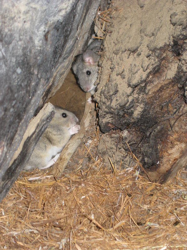
Packrats and Their Midden
Packrats near their midden in the City of Rocks National Reserve. USGS Image (J. Betancourt).
Packrats near their midden in the City of Rocks National Reserve. USGS Image (J. Betancourt).

USGS Luminescence Lab lighting
Photo of the previous USGS Luminescence Laboratory location that gives an idea of the low lighting needed during analyses.
Photo of the previous USGS Luminescence Laboratory location that gives an idea of the low lighting needed during analyses.
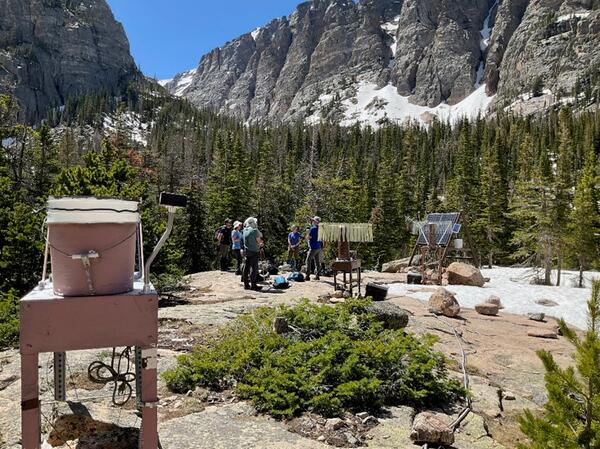
Andrews Meadow research station
USGS researchers gather around their equipment in Rocky Mountain National Park's Andrews Meadow.
USGS researchers gather around their equipment in Rocky Mountain National Park's Andrews Meadow.
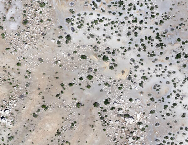
Image of Anaho Island taken at 300 feet from a natural color sensor mounted on a UAS
Image of Anaho Island taken at 300 feet from a natural color sensor mounted on a UASImage of Anaho Island taken at 300 feet from a natural color sensor mounted on a UAS
In May 2015 the NUSO, the U.S. Fish and Wildlife Service (USFWS), the Pyramid Lake Paiute Tribe, and Humboldt State University utilized UAS to conduct population surveys of nesting American White Pelicans at the Anaho Island National Wildlife Refuge (NWR).

Remote pilot monitoring the flight of a UAS at the Sequoyah NWR
Remote pilot monitoring the flight of a UAS at the Sequoyah NWRRemote pilot monitoring the flight of a UAS at the Sequoyah NWR
The NUSO and the USFWS in February 2015 evaluated the use of UAS data collection to improve waterfowl survey accuracy and eliminate pilot/passenger safety risks associated with manned aircraft data collection.

DOI researchers at the UAS mission control station overlooking the Chase Lake National Wildlife Refuge
DOI researchers at the UAS mission control station overlooking the Chase Lake National Wildlife RefugeDOI researchers Mark Feller (NUSO) and Jeff Safron at the UAS mission control station overlooking the Chase Lake National Wildlife Refuge
Natural color image of the Skagit Valley of Washington taken from a sensor mounted on a UAS
Natural color image of the Skagit Valley of Washington taken from a sensor mounted on a UASNatural color image of the Skagit Valley of Washington taken from a sensor mounted on a UAS
Natural color image of the Skagit Valley of Washington taken from a sensor mounted on a UAS
Natural color image of the Skagit Valley of Washington taken from a sensor mounted on a UASNatural color image of the Skagit Valley of Washington taken from a sensor mounted on a UAS
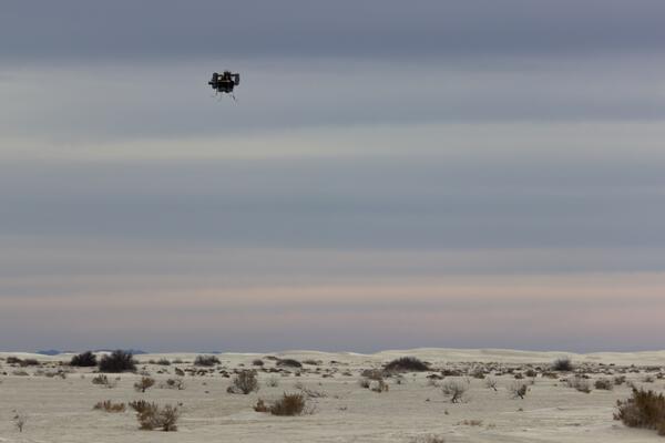
UAS in flight at the White Sands National Monument
UAS in flight at the White Sands National MonumentUAS in flight at the White Sands National Monument
UAS in flight at the White Sands National Monument
UAS in flight at the White Sands National MonumentUAS in flight at the White Sands National Monument

UAS launch site at Tomales Bay in California
UAS launch site at Tomales Bay in California
The U.S. Fish and Wildlife Service (USFWS) partnered with the NUSO in December 2013 at the San Francisco Bay National Wildlife Refuge (NWR) Complex to test the use of UAS technology for surveying waterbird abundance and distribution.
UAS launch site at Tomales Bay in California
The U.S. Fish and Wildlife Service (USFWS) partnered with the NUSO in December 2013 at the San Francisco Bay National Wildlife Refuge (NWR) Complex to test the use of UAS technology for surveying waterbird abundance and distribution.