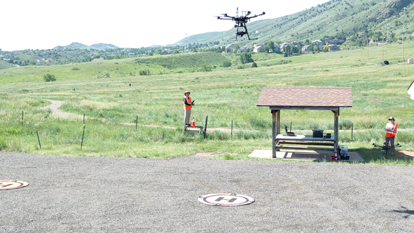
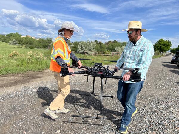
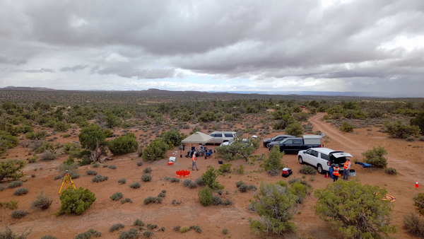
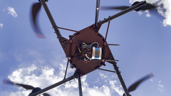
Surficial and bedrock geology in the northern San Juan basin and San Juan volcanic field (Colorado, USA) from the Intermountain West Seamless Geologic Map Explorer (https://apps.usgs.gov/intermountain_west_seamless_geologic_map_explorer/).
Images

Surficial and bedrock geology in the northern San Juan basin and San Juan volcanic field (Colorado, USA) from the Intermountain West Seamless Geologic Map Explorer (https://apps.usgs.gov/intermountain_west_seamless_geologic_map_explorer/).

Map showing locations of snow sampling sites (black circles) within the Upper Colorado River basin, the Colorado River, and the Continental Divide.
Certain minerals, like the red garnets pictured here, are particularly effective at recording the metamorphic history of a rock.
Flowchart of the steps taken to dynamically model wildfire risk, showing inputs (topography, weather, vegetation, and fuels) that are passed to processes (ignition probability and fire spread and behavior). Changes in available fuels are considered each year in the simulations, modifying the inputs.

Exploring the Colorado basement and Proterozoic shear zones. Fresh outcrops like this metagreywacke near Almont, Colorado, and cutting-edge techniques shed light on crustal growth and tectonic processes.
Rock cores from the Hanna basin (Wyoming) penetrate sediments deposited during the Paleocene-Eocene thermal maximum.
Landcover types from the World Terrestrial Ecosystems (WTE) 2020 dataset (Sayre, 2022).
Last Interglacial vegetation changes simulated for 127-119 ka (127,000-119,000 years ago) by BIOME4, an equilibrium vegetation model (Sommers et al. 2021, data from Shafer et al. 2021).

On August 27th Lance Brady (USGS NUSO) attended a "White House Roundtable on Emerging Technologies for Preventing Health Emergencies" convened by the White House Office of Science & Technology Policy (OSTP). Patricia Bright, Senior Science Advisor for the USGS Ecosystems Environmental Health Program, was also in attendance.
Collage of photographs taken during various research missions performed by the National Uncrewed Systems Office (NUSO) representing What We Do
Collage of photographs of the researchers in the National Uncrewed Systems Office (NUSO) showing Who We Are
Top Row:
Mark Bauer, Victoria Scholl, Joe Adams, Jill Cress, and Matt Burgess (left)
Todd Burton (middle)
Victoria Scholl (right)
Collage of photographs of the researchers in the National Uncrewed Systems Office (NUSO) showing Who We Are
Top Row:
Mark Bauer, Victoria Scholl, Joe Adams, Jill Cress, and Matt Burgess (left)
Todd Burton (middle)
Victoria Scholl (right)

Geologist sampling ignimbrites of the Central Death Valley volcanic field for geochronology.
The west side of Lincoln Creek drainage reveals the intricate details of the Grizzly Peak caldera. Dikes cutting the tuff help establish the timing of volcanic activity that shaped this landscape.

NUSO researchers Matt Burgess and Mark Bauer prepare for evaluation flights with the WingtraOne GEN II vertical take-off and landing mapping UAS equipped with the newly released lidar payload.

USGS personnel standing at the overlook to the quarry prior to conducting UAS operations.
Thomas Casadevall (Scientist Emeritus with the Geology, Geophysics, and Geochemistry Science Center), Paco Van Sistine (GECSC), Victoria Scholl (NUSO), Matt Burgess (NUSO)
USGS personnel standing at the overlook to the quarry prior to conducting UAS operations.
Thomas Casadevall (Scientist Emeritus with the Geology, Geophysics, and Geochemistry Science Center), Paco Van Sistine (GECSC), Victoria Scholl (NUSO), Matt Burgess (NUSO)
Group photo captured using a drone. Left to right: Matt Burgess (NUSO), Paco Van Sistine (GECSC), Victoria Scholl (NUSO) standing at the overlook for the Marsh-Felch quarry.
USGS geologists view the informational sign at the quarry upper overlook in July 2024. The sign describes the history of Professor O.C. Marsh and Marshall P. Felch, the namesakes of the quarry, who worked together to excavate and study dinosaur bones. The sign features a photograph by Israel Cook Russel, a USGS Geologist, in July 1888.

Victoria Scholl (NUSO) conducts a Skydio X10 UAS 3D Scan flight at the
Marsh-Felch Quarry site.
Victoria Scholl (NUSO) conducts a Skydio X10 UAS 3D Scan flight at the
Marsh-Felch Quarry site.

Field crew standing at the upper overlook on the Marsh-Felch Quarry site.

Reflectance spectrum for fragments from a shredded road tire showing a strong capacity to absorb solar radiation. The average reflectance over the spectrum is 0.0280. The reflectance of a flat, pure white surface, such as clean snow, is 1.
Investigating a fault mirror formed on a range-bounding fault that offsets Triassic volcaniclastic rocks of the Jackson Mountains